

Colleges
- AAC
- ACC
- Big 12
- Big East
- Big Ten
- Pac-12
- SEC
- Atlantic 10
- Conference USA
- Independents
- Junior College
- Mountain West
- Sun Belt
- MAC
- More
- Navy
- UAB
- Tulsa
- UTSA
- Charlotte
- Florida Atlantic
- Temple
- Rice
- East Carolina
- USF
- SMU
- North Texas
- Tulane
- Memphis
- Miami
- Louisville
- Virginia
- Syracuse
- Wake Forest
- Duke
- Boston College
- Virginia Tech
- Georgia Tech
- Pittsburgh
- North Carolina
- North Carolina State
- Clemson
- Florida State
- Cincinnati
- BYU
- Houston
- Iowa State
- Kansas State
- Kansas
- Texas
- Oklahoma State
- TCU
- Texas Tech
- Baylor
- Oklahoma
- UCF
- West Virginia
- Wisconsin
- Penn State
- Ohio State
- Purdue
- Minnesota
- Iowa
- Nebraska
- Illinois
- Indiana
- Rutgers
- Michigan State
- Maryland
- Michigan
- Northwestern
- Arizona State
- Oregon State
- UCLA
- Colorado
- Stanford
- Oregon
- Arizona
- California
- Washington
- USC
- Utah
- Washington State
- Texas A&M
- Auburn
- Mississippi State
- Kentucky
- South Carolina
- Arkansas
- Florida
- Missouri
- Ole Miss
- Alabama
- LSU
- Georgia
- Vanderbilt
- Tennessee
- Louisiana Tech
- New Mexico State
- Middle Tennessee
- Western Kentucky
- UTEP
- Florida International University
High School
- West
- Midwest
- Northeast
- Southeast
- Other
- Alaska
- Arizona
- California
- Colorado
- Nevada
- New Mexico
- Northern California
- Oregon
- Southern California Preps
- Washington
- Edgy Tim
- Indiana
- Kansas
- Nebraska
- Iowa
- Michigan
- Minnesota
- Missouri
- Oklahoma Varsity
- Texas Basketball
- Texas
- Wisconsin
- Delaware
- Maryland
- New Jersey Basketball
- New Jersey
- New York City Basketball
- Ohio
- Pennsylvania
- Greater Cincinnati
- Virginia
- West Virginia Preps
ADVERTISEMENT
Install the app
How to install the app on iOS
Follow along with the video below to see how to install our site as a web app on your home screen.
Note: This feature may not be available in some browsers.
You are using an out of date browser. It may not display this or other websites correctly.
You should upgrade or use an alternative browser.
You should upgrade or use an alternative browser.
OT: Major winter storm 3/20-21?
- Thread starter RU848789
- Start date
This was last night. I can assume that 537 wasn’t that bad today seeing as how most roads around weren’tHow is 537?

2.5" OTG as of 1:00 pm and 2.0" OTG as of 12:30 pm, so 1" per hour the last half hour - coming down moderately to almost heavily. 32F. Streets getting covered again. Beautiful dendrites - this must be at least 10:1 ratio snow. NWS-Philly still holding fast to forecast, as is NWS-NYC just recently.
3.0" as of 2 pm, which is a 1/2" per hour rate, which is what I would've guessed with 1/2 mile visibility and moderate snow; streets now mostly snow-covered after that hour of decent snowfall rate. 3" seems respectable at this point. It just went from moderate to light though, as we're now in a 15 DBZ zone - but it looks like it's filling in to our east with 20-25 DBZ stuff and heading this way in 5-10 minutes. At this rate, we'd likely get to about 7-8", but I keep hoping we eventually get into one of those 1-2" per hour bands for an hour or two - need that to get to 12". It's freakin' gorgeous outside though.
coastal NJ is dryslotting now but will change later
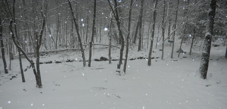
Started snowing between 1 and 130. Not heavy nor is it sticking yet perhaps because it's been in the mid 30s? Strong winds.

Thought this was useful...(assumes no melting and 10:1 ratio snow, I believe)

Is the third row of the visibility (<.03) supposed to say "1 1/2" instead of "1/2"? That's the only one out of order.
Still not much down here in Vineland/Millville. There is a dusting on the grass areas but nothing sticking to roads or sidewalks.
If has been snowing on and off since ~10:00 AM, but it seems to melt as fast as it comes down. Hoping it can stay like this for at least a couple more hours.
If has been snowing on and off since ~10:00 AM, but it seems to melt as fast as it comes down. Hoping it can stay like this for at least a couple more hours.
Here in townhouse in Scotch Plains, roads are thankfully still blacktop, as well as the parking lot and the sidewalks. Shoveled off the deck though, about an hour ago, and it has a coating again already. Was pretty nice outside still, as the winds haven't picked up at all. Mailman and Amazon out and about making deliveries still too. Snow lessened in the last half hour. Light snowfall now.
Talked to someone in Washington Twp Warren County. 2 or 3 inches plow just came by street. I'm guess over 2 since plows don't go out till at least 2.
2-4" at the shore?Euro coming in hot today...note it currently says many of us already have 2-4 to the shore


That band of rain hugging the coast got wider, pushing in on Atlantic City as far west as Egg Harbor City. Hope it stays that way for the move up the coast.
I wonder if the Rider baseball game will be postponed today?
RU hosts Penn St Friday- Sunday.
And some wonder why most of the best HS players go South.
RU hosts Penn St Friday- Sunday.
And some wonder why most of the best HS players go South.
I wonder if the Rider baseball game will be postponed today?
RU hosts Penn St Friday- Sunday.
And some wonder why most of the best HS players go South.
Just use orange balls.

I think the American Weather site just crashed.
yeah had trouble too...not because of the NYC forum which has been dying out must be peeps elsewhere
It was postponed last night.I wonder if the Rider baseball game will be postponed today?
RU hosts Penn St Friday- Sunday.
And some wonder why most of the best HS players go South.
And 3.5" and 31F at 3 pm, so another 1/2" per hour. Nice, but we need the rates and if earthlight/John Homenuk (driving force behind 33andrain and NY Metro Weather and a damn fine and brilliant young man) is correct they're coming; see the link to his tweets below. Would love to get into those 1-2" per hour rates and at least break 10" by the time this is done. Stunningly gorgeous out there. Streets now mostly covered with 1/2-1" of slushy snow. According to the HRRR I still have 6-7" more to come, which would get me to 10"; if the Euro is right, I should get to 12-13".3.0" as of 2 pm, which is a 1/2" per hour rate, which is what I would've guessed with 1/2 mile visibility and moderate snow; streets now mostly snow-covered after that hour of decent snowfall rate. 3" seems respectable at this point. It just went from moderate to light though, as we're now in a 15 DBZ zone - but it looks like it's filling in to our east with 20-25 DBZ stuff and heading this way in 5-10 minutes. At this rate, we'd likely get to about 7-8", but I keep hoping we eventually get into one of those 1-2" per hour bands for an hour or two - need that to get to 12". It's freakin' gorgeous outside though.
https://twitter.com/jhomenuk?ref_src=twsrc%5Etfw...

Lol, Where exactly is this so called 2-4? Here in Hazlet,ZERO so far.2-4" at the shore?
Still blacktop on French Street/Route 27 in NB. Do you think it will be difficult to hit those 8-12 inch or 10-14 inch predictions at this point? I won't be heartbroken about it, just curious.
its possible for the areas that get under banding which is still an unknown, where the CCB sets up,
looks like there will not be a foot on blacktop so thats a good thing. I have probably 3 here taking into consideration compaction and its still not sticking to roads and parking lot has puddles so that will take time to overcome when the heavier rates come down. Sun sets later now so we have a while but I am assuming the timing of the heaviest snow should conincide with sun angle now longer a factor so from 5 to midnight we get our accumulating snows with some lingering snows after that too. So while the big amounts may seem obsence..if we end up with a high end of 10..maybe only 5 or 6 of that is on the road....it could be 8 and only 4 on the pavement.
If the 750 mbar upper level low moves to just off the coast around Toms River, as projected, the heavy snow being seen in E PA (8-12" out there) should come to most of CNJ/NNJ/NYC. If that happens, I could see most folks north of 195 getting to 8" and maybe even to 10" with a shot a foot. If it doesn't happen and people get 1/2" to maybe 1" per hour at times, then plenty of people will finish with 5-8" (I think we finish at 8" if no heavy bands here and 12" if we get the heavy bands). Hard to know for sure we'll get them, but the heavy stuff appears to be on tits way for many/most of us.Still blacktop on French Street/Route 27 in NB. Do you think it will be difficult to hit those 8-12 inch or 10-14 inch predictions at this point? I won't be heartbroken about it, just curious.


If the 750 mbar upper level low moves to just off the coast around Toms River, as projected, the heavy snow being seen in E PA (8-12" out there) should come to most of CNJ/NNJ/NYC. If that happens, I could see most folks north of 195 getting to 8" and maybe even to 10" with a shot a foot. If it doesn't happen and people get 1/2" to maybe 1" per hour at times, then plenty of people will finish with 5-8" (I think we finish at 8" if no heavy bands here and 12" if we get the heavy bands). Hard to know for sure we'll get them, but the heavy stuff appears to be on tits way for many/most of us.
I'm sitting in an Embassy Suites near King of Prussia and we're nowhere near 8" right now. Maybe 5ish.
***3PM Storm Update***
Good afternoon!
Attached is our latest forecast for additional snowfall after 2 PM this afternoon.
This does not include snow that fell before then.

Good afternoon!
Attached is our latest forecast for additional snowfall after 2 PM this afternoon.
This does not include snow that fell before then.
Snow has picked up in SB, all day has been black top but now a coating is on the road/sidewalks. Seems like the other storm where it picked up in the afternoon. Hopefully, not as destructive as that one.
EDIT: Just checked the SBPD nixle and they have similar comments to RU#s that trend is a little dryer and could lead to blowing/drifting snow but fewer downed trees/outages. Hope so.
EDIT: Just checked the SBPD nixle and they have similar comments to RU#s that trend is a little dryer and could lead to blowing/drifting snow but fewer downed trees/outages. Hope so.
Last edited:
Here's the latest NWS snowfall map showing how much snow is expected to fall after 2 pm today. We had 3" at 2 pm and would get about 9" more from this map, which would be 12" total, which is what I predicted. I can live with that. And the 2nd map is the revised NWS-NYC map for snow to fall after 10 am this morning, which essentially is 90% or more of the total, as little had fallen in these counties before 10 am.


If the 750 mbar upper level low moves to just off the coast around Toms River, as projected, the heavy snow being seen in E PA (8-12" out there) should come to most of CNJ/NNJ/NYC. If that happens, I could see most folks north of 195 getting to 8" and maybe even to 10" with a shot a foot. If it doesn't happen and people get 1/2" to maybe 1" per hour at times, then plenty of people will finish with 5-8" (I think we finish at 8" if no heavy bands here and 12" if we get the heavy bands). Hard to know for sure we'll get them, but the heavy stuff appears to be on tits way for many/most of us.
i know you get excited over snow but never heard it described as "on tits way" before:p
Similar threads
- Replies
- 608
- Views
- 17K
- Replies
- 62
- Views
- 2K
- Replies
- 160
- Views
- 3K
- Replies
- 771
- Views
- 20K
ADVERTISEMENT
ADVERTISEMENT