So if none of the snow has stuck between 2 and this moment I can expect less or will it not matter much?


Colleges
- AAC
- ACC
- Big 12
- Big East
- Big Ten
- Pac-12
- SEC
- Atlantic 10
- Conference USA
- Independents
- Junior College
- Mountain West
- Sun Belt
- MAC
- More
- Navy
- UAB
- Tulsa
- UTSA
- Charlotte
- Florida Atlantic
- Temple
- Rice
- East Carolina
- USF
- SMU
- North Texas
- Tulane
- Memphis
- Miami
- Louisville
- Virginia
- Syracuse
- Wake Forest
- Duke
- Boston College
- Virginia Tech
- Georgia Tech
- Pittsburgh
- North Carolina
- North Carolina State
- Clemson
- Florida State
- Cincinnati
- BYU
- Houston
- Iowa State
- Kansas State
- Kansas
- Texas
- Oklahoma State
- TCU
- Texas Tech
- Baylor
- Oklahoma
- UCF
- West Virginia
- Wisconsin
- Penn State
- Ohio State
- Purdue
- Minnesota
- Iowa
- Nebraska
- Illinois
- Indiana
- Rutgers
- Michigan State
- Maryland
- Michigan
- Northwestern
- Arizona State
- Oregon State
- UCLA
- Colorado
- Stanford
- Oregon
- Arizona
- California
- Washington
- USC
- Utah
- Washington State
- Texas A&M
- Auburn
- Mississippi State
- Kentucky
- South Carolina
- Arkansas
- Florida
- Missouri
- Ole Miss
- Alabama
- LSU
- Georgia
- Vanderbilt
- Tennessee
- Louisiana Tech
- New Mexico State
- Middle Tennessee
- Western Kentucky
- UTEP
- Florida International University
High School
- West
- Midwest
- Northeast
- Southeast
- Other
- Alaska
- Arizona
- California
- Colorado
- Nevada
- New Mexico
- Northern California
- Oregon
- Southern California Preps
- Washington
- Edgy Tim
- Indiana
- Kansas
- Nebraska
- Iowa
- Michigan
- Minnesota
- Missouri
- Oklahoma Varsity
- Texas Basketball
- Texas
- Wisconsin
- Delaware
- Maryland
- New Jersey Basketball
- New Jersey
- New York City Basketball
- Ohio
- Pennsylvania
- Greater Cincinnati
- Virginia
- West Virginia Preps
ADVERTISEMENT
Install the app
How to install the app on iOS
Follow along with the video below to see how to install our site as a web app on your home screen.
Note: This feature may not be available in some browsers.
You are using an out of date browser. It may not display this or other websites correctly.
You should upgrade or use an alternative browser.
You should upgrade or use an alternative browser.
OT: Major winter storm 3/20-21?
- Thread starter RU848789
- Start date
some early amounts
NEW JERSEY
...Bergen County...
Ridgewood 3.5 230 PM 3/21 Trained Spotter
Englewood 3.2 215 PM 3/21 Social Media
East Rutherford 2.0 107 PM 3/21 Public
Hasbrouck Heights 1.8 100 PM 3/21 Trained Spotter
Franklin Lakes 1.3 140 PM 3/21 Trained Spotter
...Essex County...
Cedar Grove 2.4 135 PM 3/21 Public
Belleville 1.1 1103 AM 3/21 Trained Spotter
...Hudson County...
Kearny 5.0 150 PM 3/21 Public
Hoboken 3.9 1200 PM 3/21 Social Media
Harrison 3.5 100 PM 3/21 Co-Op Observer
...Passaic County...
Bloomingdale 1.8 1256 PM 3/21 Trained Spotter
...Union County...
Newark Airport 4.3 200 PM 3/21 FAA Observer
Union 2.5 220 PM 3/21 Public
Cranford 0.9 1200 PM 3/21 Trained Spotter
NEW JERSEY
...Atlantic County...
Atlantic City Intl A T 200 PM 3/21 Trace of Snowfall.
Pleasantville T 1210 PM 3/21 Trained Spotter
...Burlington County...
Mount Laurel 3.9 205 PM 3/21 2.4 inches since 7 am.
Mount Holly WFO 3.3 200 PM 3/21 NWS Office
...Camden County...
Lindenwold 2.7 107 PM 3/21 NWS Employee
...Gloucester County...
1 W Deptford 0.5 1110 AM 3/21 Trained Spotter
...Hunterdon County...
Quakertown 6.0 1200 PM 3/21 Social Media
...Mercer County...
Titusville 3.0 112 PM 3/21 Social Media
Lawrenceville 2.5 213 PM 3/21 Trained Spotter
Ewing Twp 2.5 146 PM 3/21 Trained Spotter
West Windsor Twp 1.0 1130 AM 3/21 Social Media
...Middlesex County...
Port Reading 1.7 1225 PM 3/21 Trained Spotter
South Plainfield 1.5 1230 PM 3/21 Social Media
Edison 1.5 1220 PM 3/21 Social Media
...Monmouth County...
1 SE Southard 1.4 156 PM 3/21 CoCoRaHS
Clarksburg 1.0 1230 PM 3/21 Trained Spotter
...Morris County...
Marcella 4.0 227 PM 3/21 Trained Spotter
Budd Lake 3.5 1130 AM 3/21 Social Media
Succasunna 2.0 1145 AM 3/21 Social Media
Rockaway 1.5 1148 AM 3/21 Social Media
Millington 0.8 1200 PM 3/21 Trained Spotter
...Somerset County...
Middlebush 1.8 230 PM 3/21 Trained Spotter
Somerville 1.6 245 PM 3/21 Trained Spotter
Basking Ridge 1.5 235 PM 3/21 Social Media
...Sussex County...
Stockholm 2.0 139 PM 3/21 Trained Spotter
...Warren County...
Stewartsville 4.8 130 PM 3/21 Social Media
Hackettstown 4.0 100 PM 3/21 Social Media
Hope 3.0 140 PM 3/21 Trained Spotter
Marksboro 1.0 1245 PM 3/21 Trained Spotter
2 W Blairstown 0.5 1122 AM 3/21 In last 4.5 hours.
PENNSYLVANIA
...Berks County...
Bechtelsville 8.0 104 PM 3/21 Social Media
Huffs Church 7.3 1230 PM 3/21 Trained Spotter
Sinking Spring 5.5 102 PM 3/21 Public
Kenhorst 5.0 1140 AM 3/21 Social Media
Leesport 5.0 100 PM 3/21 Social Media
Spring Twp 4.8 1230 PM 3/21 Public
West Wyomissing 4.5 1234 PM 3/21 Public
...Bucks County...
West Rockhill Twp 8.0 203 PM 3/21 Social Media
Quakertown 7.0 1210 PM 3/21 Social Media
Springtown 6.9 1220 PM 3/21 Trained Spotter
Kintnersville 6.0 1200 PM 3/21 Social Media
Perkasie 6.0 149 PM 3/21 Social Media
Silverdale 5.0 1151 AM 3/21 Social Media
Lower Makefield Twp 4.8 219 PM 3/21 Social Media
Feasterville 4.0 106 PM 3/21 Social Media
3 NNE Langhorne 2.9 1249 PM 3/21 CoCoRaHS
Langhorne 2.8 1135 AM 3/21 Trained Spotter
Bensalem 2.0 1145 AM 3/21 Social Media
...Carbon County...
Lehighton 5.8 1230 PM 3/21 Social Media
Lower Towamensing Tw 3.3 1250 PM 3/21 Trained Spotter
...Chester County...
West Caln Twp 6.7 158 PM 3/21 Social Media
West Bradford Twp 4.5 100 PM 3/21 Social Media
Valley Forge 4.3 1219 PM 3/21 Social Media
New London 3.5 1134 AM 3/21 Social Media
East Fallowfield Twp 2.8 109 PM 3/21 Social Media
Landenberg 2.5 115 PM 3/21 Trained Spotter
...Delaware County...
Chadds Ford 3.3 1245 PM 3/21 Trained Spotter
Clifton Heights 3.0 150 PM 3/21 Social Media
...Lehigh County...
Coopersburg 9.0 145 PM 3/21 Ship
Zionsville 8.5 111 PM 3/21 Social Media
Orefield 7.5 235 PM 3/21 Public
Salisbury Twp 7.0 130 PM 3/21 Broadcast Media
Emmaus 6.8 1145 AM 3/21 Social Media
2 S Emmaus 6.5 100 PM 3/21 Trained Spotter
Germansville 6.5 1220 PM 3/21 Trained Spotter
Center Valley 6.3 1210 PM 3/21 Trained Spotter
Lehigh Valley Intl A 6.0 200 PM 3/21 ASOS
Slatington 5.0 100 PM 3/21 Trained Spotter
East Texas 5.0 1145 AM 3/21 Trained Spotter
New Tripoli 5.0 1150 AM 3/21 Trained Spotter
Fogelsville 4.7 1145 AM 3/21 Social Media
1 S Allentown 4.5 1110 AM 3/21 Meteorologist
...Monroe County...
Mount Pocono 4.2 238 PM 3/21 storm total
Pocono Summit 2.3 1200 PM 3/21 Trained Spotter
Stroudsburg 1.0 1220 PM 3/21 Social Media
...Montgomery County...
Spring Mount 6.1 124 PM 3/21 Social Media
Pottstown 6.0 1100 AM 3/21 Trained Spotter
Graterford 5.6 100 PM 3/21 Trained Spotter
Norristown 5.2 227 PM 3/21 Trained Spotter
Pennsburg 5.0 1110 AM 3/21 Social Media
Gilbertsville 5.0 1131 AM 3/21 Trained Spotter
Horsham 5.0 210 PM 3/21 Social Media
Eagleville 3.6 115 PM 3/21 Trained Spotter
Skippack 3.5 105 PM 3/21 Social Media
Lansdale 0.3 100 PM 3/21 Public
...Northampton County...
Upper Nazareth Twp 5.5 115 PM 3/21 Trained Spotter
Hellertown 5.0 1215 PM 3/21 Trained Spotter
Martins Creek 2.0 1128 AM 3/21 Trained Spotter
Bangor 2.0 112 PM 3/21 Social Media
...Philadelphia County...
Philadelphia Intl Ai 4.1 200 PM 3/21 ASOS
Philadelphia 2.3 1258 PM 3/21 Emergency Manag
So if none of the snow has stuck between 2 and this moment I can expect less or will it not matter much?
doesnt matter right now....unless you get into those heavy bands for a while you are not getting 12..thats what it will come down to for you...and for those on the coast you are more in the game than some of the western and southwestern areas of NJ
doesnt matter right now....unless you get into those heavy bands for a while you are not getting 12..thats what it will come down to for you...and for those on the coast you are more in the game than some of the western and southwestern areas of NJ
In the game? You mean I finally get picked for a team and it's freekin snow? Not fair man.

down to 31 here and the snow has now suddenly started to stick to pavement and roads...its on...from now until maybe 10-12am our heaviest snow
Now that's funny. 2-3 hours of sleep a night since Friday, tracking this thing and trying to keep up with work/life. It's a little wearing.i know you get excited over snow but never heard it described as "on tits way" before:p
By the way, for everyone else, my apologies if anyone asked a specific question to me, as I've been in work telecons most of the day (work's closed but the damn technology has even more email coming to me since many aren't in meetings) and barely able to step out and measure or check weather sites and here. I'm sure plenty of others here available to answer.
Just now starting to build up a coat on the street/driveway. Grass is now completely white,with no grass/leaves sticking through.
@zappaa - you'll love this post on the weather board: "It ain't over until the best 700mb lift moves out." - Yogi Berra (Found that on the internet, so it's probably a true quote)
https://www.33andrain.com/topic/859...odelsdiscussion/?do=findComment&comment=81992
https://www.33andrain.com/topic/859...odelsdiscussion/?do=findComment&comment=81992
In the game? You mean I finally get picked for a team and it's freekin snow? Not fair man.
there is still time to switch to the red team
Wall and Howell dropped the ball yesterday afternoon. I cut through the airport to Hurley Pond Road to 524. The roads were covered with slush/ice. Saw a car in a ditch near Allaire. Things are better today, but it has been mostly rain.
Yup, yesterday was much worse than earlier today. My wife went to Dills in Freehold to pick up an order of food for the animals and saw two cars facing the wrong direction and one in a ditch. We literally had ice falling from the sky in our area. It got slippery real quick.I almost skidded off the road on Five Points Rd by Colts Neck HS. The road was just garbage.
It's finally starting to stick on the side streets in Howell. Not much but some. Right now 2" on grass and unpaved area's with slush and accumulation starting to occur on roads. But with 8 hrs. left of the heaviest yet to come doesn't look good on us making out like last week. That stuff was gone by mid-day.
Last edited:
To get to the 16" in NYC on this map, we'll have to get, oh, about 16" in my neighborhood.Here's the latest NWS snowfall map showing how much snow is expected to fall after 2 pm today. We had 3" at 2 pm and would get about 9" more from this map, which would be 12" total, which is what I predicted. I can live with that. And the 2nd map is the revised NWS-NYC map for snow to fall after 10 am this morning, which essentially is 90% or more of the total, as little had fallen in these counties before 10 am.


People calling this a bust need to read this and maybe look at these tweets or visit 33andrain. Very good analysis going on there. As isotherm, one of the best, just posted, "the cold conveyor belt will intensify, pivot, and rot, right through 2 am tonight." This storm isn't even half over, for the major snows. Could it not happen like these folks (and the NWS) are saying it should? Possible, but the storm evolution is pretty clear and the radar is responding as predicted. Really picking up here.And 3.5" and 31F at 3 pm, so another 1/2" per hour. Nice, but we need the rates and if earthlight/John Homenuk (driving force behind 33andrain and NY Metro Weather and a damn fine and brilliant young man) is correct they're coming; see the link to his tweets below. Would love to get into those 1-2" per hour rates and at least break 10" by the time this is done. Stunningly gorgeous out there. Streets now mostly covered with 1/2-1" of slushy snow. According to the HRRR I still have 6-7" more to come, which would get me to 10"; if the Euro is right, I should get to 12-13".
https://twitter.com/jhomenuk?ref_src=twsrc%5Etfw...
And with intensifying rates and winds picking up and the sun going down and temps cooling off well below 32F (30F here now), snow will start piling up on roads by 4-5 pm and the pm rush hour could be a mess for those who went to work Hopefully not too many people on the roads to limit that risk.

was in that small green blob in somerset and everything started to stick to pavement but that was short lived and now lower rates...have to get into that green banding to get the sustained accumulations before the sun sets, after that it will be easier to accumulate
I don't think anything new has accumulated today in Brick yet. Had maybe an inch or two of slushy snow yesterday.
Zarrow last snowflakes around daybreak.
i suppose for eastern shore areas but for most of us the accumulating snow is done a bit after midnight
yup, about 5-6" here in Rocktown-Ringoes . So 7-8" more would put us at a foot or just above. At least it is nice powder.It has been sticking in Bucks county since 8 am, the heaviest snow started about half an hour ago. We had about 4 or 5 at two when is shoveled.
Curran ....take half of what you have on grass and this is what will be on pavement to shovel.
People calling this a bust need to read this and maybe look at these tweets or visit 33andrain. Very good analysis going on there. As isotherm, one of the best, just posted, "the cold conveyor belt will intensify, pivot, and rot, right through 2 am tonight." This storm isn't even half over, for the major snows. Could it not happen like these folks (and the NWS) are saying it should? Possible, but the storm evolution is pretty clear and the radar is responding as predicted. Really picking up here.
And with intensifying rates and winds picking up and the sun going down and temps cooling off well below 32F (30F here now), snow will start piling up on roads by 4-5 pm and the pm rush hour could be a mess for those who went to work Hopefully not too many people on the roads to limit that risk.
Thanks #’s. Your posts are very much appreciated by all.
Still not much down here in Vineland/Millville. There is a dusting on the grass areas but nothing sticking to roads or sidewalks.
If has been snowing on and off since ~10:00 AM, but it seems to melt as fast as it comes down. Hoping it can stay like this for at least a couple more hours.
The snow is JUST ABOUT stick on the pavement/sidewalks not. Probably 1-2 inches on the grass (not quite covered, can still see a few blades sticking up here and there).
Snow is coming at a good clip now though, so if it keeps coming for another ~3-6 hours I could see us getting up to ~6 inches or so. I'll have to do some shoveling once I get home unfortunately.
Just shoveled real quick. Easy going. Maybe an inch? Grass has more on it. Sidewalks and street are slushy messesYup, yesterday was much worse than earlier today. My wife went to Dills in Freehold to pick up an order of food for the animals and saw two cars facing the wrong direction and one in a ditch. We literally had ice falling from the sky in our area. It got slippery real quick.
It's finally starting to stick on the side streets in Howell. Not much but some. Right now 2" on grass and unpaved area's with slush and accumulation starting to occur on roads. But with 8 hrs. left of the heaviest yet to come doesn't look good on us making out like last week. That stuff was gone by mid-day.
Just got off the train. Roads and sidewalks are relatively clear. Can we declare this storm a bust yet?
Now it's 4.25" and 30F as of 4 pm, so 3/4" the last hour and the snow is falling moderately and it's clearly much drier now - not quite sure on ratios, as the flakes are smaller than some of the 1/2" size agglomerates we were getting. Some of the small flakes are shaped nicely (dendrites that would layer well), but some are more pellet like, indicating a mixture of growth regimes up there in our favorite place, the DGZ. Guessing we're probably 10:1, but if we could get more uniform drier dendrites, I think we'd get to 13-15:1. Streets completely covered now (not that busy, though).And 3.5" and 31F at 3 pm, so another 1/2" per hour. Nice, but we need the rates and if earthlight/John Homenuk (driving force behind 33andrain and NY Metro Weather and a damn fine and brilliant young man) is correct they're coming; see the link to his tweets below. Would love to get into those 1-2" per hour rates and at least break 10" by the time this is done. Stunningly gorgeous out there. Streets now mostly covered with 1/2-1" of slushy snow. According to the HRRR I still have 6-7" more to come, which would get me to 10"; if the Euro is right, I should get to 12-13".
https://twitter.com/jhomenuk?ref_src=twsrc%5Etfw...
Hope you got the bread and the milk.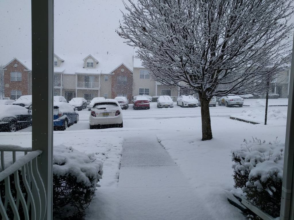
Current look at the snow here in Franklin Park
I think it’s snowed about 6 inches but only about 1/2 -1 inch on the road. A plow truck plowed about an inch maybe at 4:00, never saw they come plowing so early. Do they know something?
Good to live at the Shore. Snow just now starting to stick after all these hours.
I will say I am up to 4.5 inches on grass and now 1 inch on pavement and thats just in the past hour we had inch an hour rates
About 5 inches on my deck in South Brunswick
You may want to put it away before you get frostbite or the neighbors call the cops
People calling this a bust need to read this and maybe look at these tweets or visit 33andrain. Very good analysis going on there. As isotherm, one of the best, just posted, "the cold conveyor belt will intensify, pivot, and rot, right through 2 am tonight." This storm isn't even half over, for the major snows. Could it not happen like these folks (and the NWS) are saying it should? Possible, but the storm evolution is pretty clear and the radar is responding as predicted. Really picking up here.
And with intensifying rates and winds picking up and the sun going down and temps cooling off well below 32F (30F here now), snow will start piling up on roads by 4-5 pm and the pm rush hour could be a mess for those who went to work Hopefully not too many people on the roads to limit that risk.
Well, from a timing perspective, it was definitely off by quite a bit.... whether or not the snow totals eventually hit the target overnight, the amount of snow that had been forecast by midday never really materialized.
The human impact of that 6-8 hour shift in the start was pretty big, with schools and business closing unnecessarily when they could have gotten in half days.
It's the difference between being up 28-0 on an FCS team before halftime and breaking open a close game in the 4th quarter. The margin of victory may end up being the same, but it's still far off from expected performance.
Similar threads
- Replies
- 608
- Views
- 17K
- Replies
- 62
- Views
- 2K
- Replies
- 160
- Views
- 3K
- Replies
- 771
- Views
- 20K
ADVERTISEMENT
ADVERTISEMENT