WTF is up with forcasting the weather 1 day out. On Tues/Wed the forcast for today called for rain heavy at times with an inch of rain with even snow northern NJ. Completely washout I heard. And they were calling this as early as Monday. Now its maybe a shower lol. As a landscaper I have to plan according to the weather reports. This was a complete bust as I now have to rearrange the rest of the work week.


Colleges
- AAC
- ACC
- Big 12
- Big East
- Big Ten
- Pac-12
- SEC
- Atlantic 10
- Conference USA
- Independents
- Junior College
- Mountain West
- Sun Belt
- MAC
- More
- Navy
- UAB
- Tulsa
- UTSA
- Charlotte
- Florida Atlantic
- Temple
- Rice
- East Carolina
- USF
- SMU
- North Texas
- Tulane
- Memphis
- Miami
- Louisville
- Virginia
- Syracuse
- Wake Forest
- Duke
- Boston College
- Virginia Tech
- Georgia Tech
- Pittsburgh
- North Carolina
- North Carolina State
- Clemson
- Florida State
- Cincinnati
- BYU
- Houston
- Iowa State
- Kansas State
- Kansas
- Texas
- Oklahoma State
- TCU
- Texas Tech
- Baylor
- Oklahoma
- UCF
- West Virginia
- Wisconsin
- Penn State
- Ohio State
- Purdue
- Minnesota
- Iowa
- Nebraska
- Illinois
- Indiana
- Rutgers
- Michigan State
- Maryland
- Michigan
- Northwestern
- Arizona State
- Oregon State
- UCLA
- Colorado
- Stanford
- Oregon
- Arizona
- California
- Washington
- USC
- Utah
- Washington State
- Texas A&M
- Auburn
- Mississippi State
- Kentucky
- South Carolina
- Arkansas
- Florida
- Missouri
- Ole Miss
- Alabama
- LSU
- Georgia
- Vanderbilt
- Tennessee
- Louisiana Tech
- New Mexico State
- Middle Tennessee
- Western Kentucky
- UTEP
- Florida International University
High School
- West
- Midwest
- Northeast
- Southeast
- Other
- Alaska
- Arizona
- California
- Colorado
- Nevada
- New Mexico
- Northern California
- Oregon
- Southern California Preps
- Washington
- Edgy Tim
- Indiana
- Kansas
- Nebraska
- Iowa
- Michigan
- Minnesota
- Missouri
- Oklahoma Varsity
- Texas Basketball
- Texas
- Wisconsin
- Delaware
- Maryland
- New Jersey Basketball
- New Jersey
- New York City Basketball
- Ohio
- Pennsylvania
- Greater Cincinnati
- Virginia
- West Virginia Preps
ADVERTISEMENT
Install the app
How to install the app on iOS
Follow along with the video below to see how to install our site as a web app on your home screen.
Note: This feature may not be available in some browsers.
You are using an out of date browser. It may not display this or other websites correctly.
You should upgrade or use an alternative browser.
You should upgrade or use an alternative browser.
OT: Poor forcasting
- Thread starter RocktheRac
- Start date

Haha..not a good look for meteorologists and theyve been busting badly of late on temps and sky conditions especially in mid range
My father always said if you arrange your work according to the weather forecast you'll go broke.
It's got to be rough to manage a business where the weather can have a big impact on operations, because there is still so little confidence in any forecasts.My father always said if you arrange your work according to the weather forecast you'll go broke.
My job planned the week for today to be a washout. Heh.
Luckily we have some contingencies to keep everybody busy.
Luckily we have some contingencies to keep everybody busy.
I figured the Mets game at noon today would get banged, but they might sneak it in. Horrible forecasting. What other profession can you be wrong the majority of the time?
Baseball all you have to do is hit the ball 25 % of the time for a single or betterI figured the Mets game at noon today would get banged, but they might sneak it in. Horrible forecasting. What other profession can you be wrong the majority of the time?
That sucks.WTF is up with forcasting the weather 1 day out. On Tues/Wed the forcast for today called for rain heavy at times with an inch of rain with even snow northern NJ. Completely washout I heard. And they were calling this as early as Monday. Now its maybe a shower lol. As a landscaper I have to plan according to the weather reports. This was a complete bust as I now have to rearrange the rest of the work week.
We had some fairly heavy rain here earlier and showers now. It appears the bulk of the rain is staying east of the Tpke and south of Perth Amboy, heading out to sea.
Way back in grade school in the 1970's remember watching one of those reel to reel videos in "science" class on weather forecasting. The graphic/scene was of a guy boarding up his windows due to a hurricane forecast. He finished boarding his windows only to hear on his transistor radio that the hurricane would not strike. He threw his hammer at the radio.
The old saying ?You can't fool mother nature" still rings true.
Even with improved science and forecasting, with global warming and climate change, weather forecasting has to be even more challenging.
The old saying ?You can't fool mother nature" still rings true.
Even with improved science and forecasting, with global warming and climate change, weather forecasting has to be even more challenging.
To be fair each model run was pushing this north and east for the last several cycles
Its mid and long range models thar are particularly garbage and no one seems to hold them to any accountability
Its mid and long range models thar are particularly garbage and no one seems to hold them to any accountability
Perhaps if OP followed forecasts (instead of forcasts) he'd be better off.
(I had to.. sorry)
(I had to.. sorry)
Economics!I figured the Mets game at noon today would get banged, but they might sneak it in. Horrible forecasting. What other profession can you be wrong the majority of the time?
Perhaps if OP followed forecasts (instead of forcasts) he'd be better off.
(I had to.. sorry QUOTE Don't be sorry. I think that most FOURCASTS are B.S.
It appears to be building back westward a bit as the frontal zone throws up on itself. I understand that spring is just a transition season between winter & summer, and the closed low to our west is getting bounced around due to blocking in the Canadian Maritimes, but this is nothing new. Get it together, NCEP.You must live in the western half of the state. It's pouring from Sussex to Cape May along and just west of the length of the GSP.
Actually, this is completely untrue. Weather forecasting gets better every year. Weather is far too chaotic and uncertain to ever be predicted perfectly, especially beyond a few days, but as per the article below (and the paper it's based on), "today, a five-day forecast is as accurate as a one-day forecast was as recently as 1980. And a 72-hour hurricane warning today is more accurate than a 24-hour warning was 40 years ago. It is also far more accessible."In the last few years weather forecasting has really gotten bad. I now mostly just look at the radar and make my own guess. I fell like I am more accurate than there futurecast.
Deterministic numerical weather prediction will never be able to predict accurately beyond 1-2 weeks, assuming Edward Lorenz's chaos theory remains valid (the "butterfly effect"), but forecasting trends (warm/cold and dry/wet) has improved for periods 2-4 weeks out and analog-based seasonal forecasts have improved for things like tropical storm seasons.
https://phys.org/news/2019-01-geoscientists-insist-weather-accurate.html
Maybe you should follow the NWS more closely. They had significantly reduced rainfall forecasts as early as Wednesday at 4 am, as per below. Having said that, we already have 1/4" here and will likely get 1/2" today.WTF is up with forcasting the weather 1 day out. On Tues/Wed the forcast for today called for rain heavy at times with an inch of rain with even snow northern NJ. Completely washout I heard. And they were calling this as early as Monday. Now its maybe a shower lol. As a landscaper I have to plan according to the weather reports. This was a complete bust as I now have to rearrange the rest of the work week.
National Weather Service Mount Holly NJ
405 AM EDT Wed Apr 14 2021
SHORT TERM /THURSDAY THROUGH FRIDAY NIGHT/...
An upper level closed low will be tracking from the Great Lakes
towards the Mid Atlantic Thursday. Trends in the latest guidance
suggest that the low will likely stay a tad further north and
then will likely lead to more dry air punching into the mid
levels than initially forecast. This will lead to lowered
precipitation totals for the region as the axis of heaviest qpf
will shift northeast over southeastern NY and Connecticut.
With the dry air pushing in, anticipate cloud cover to start
thinning out from the southwest however I dont think we`ll be
seeing any clear skies Thursday. With thinning clouds and less
precip, temps should warm towards the mid 60s from roughly
Trenton southwards across the region with temps in the 50s
further north and east. Given the expected rainfall amounts
will even be less than previously thought, we are not anticipate
any flooding.
Actually, this is completely untrue. Weather forecasting gets better every year. Weather is far too chaotic and uncertain to ever be predicted perfectly, especially beyond a few days, but as per the article below (and the paper it's based on), "today, a five-day forecast is as accurate as a one-day forecast was as recently as 1980. And a 72-hour hurricane warning today is more accurate than a 24-hour warning was 40 years ago. It is also far more accessible."
Deterministic numerical weather prediction will never be able to predict accurately beyond 1-2 weeks, assuming Edward Lorenz's chaos theory remains valid (the "butterfly effect"), but forecasting trends (warm/cold and dry/wet) has improved for periods 2-4 weeks out and analog-based seasonal forecasts have improved for things like tropical storm seasons.
https://phys.org/news/2019-01-geoscientists-insist-weather-accurate.html
I was refering to the futurecast radar on weather.com which only predicts the next 6 hrs., not any of the things you just mentioned.
Actually, this is completely untrue. Weather forecasting gets better every year. Weather is far too chaotic and uncertain to ever be predicted perfectly, especially beyond a few days, but as per the article below (and the paper it's based on), "today, a five-day forecast is as accurate as a one-day forecast was as recently as 1980. And a 72-hour hurricane warning today is more accurate than a 24-hour warning was 40 years ago. It is also far more accessible."
Deterministic numerical weather prediction will never be able to predict accurately beyond 1-2 weeks, assuming Edward Lorenz's chaos theory remains valid (the "butterfly effect"), but forecasting trends (warm/cold and dry/wet) has improved for periods 2-4 weeks out and analog-based seasonal forecasts have improved for things like tropical storm seasons.
https://phys.org/news/2019-01-geoscientists-insist-weather-accurate.html
I do think that in some respects forecasting is attempting to be too specific, too far in advance. In the mid 2000s/ early 2010s there was a good balance where forecasts were broader and generally seemed to lead to greater verification. There also weren't private weather firms like Accuweather and TWC showing a 15 day, highly detailed forecast that completely changes every hour beyond 3 days.
Basically it seems like we are attempting to do what we don't yet have the computational/forecast ability to.
A
anon_ivydyf0amkzay
Guest
Never fail weather report:
Open window,stick out hand
it gets wet means rain
it gets cold :a frost set in
can't see it, means foggy day
gets hot and burns, sunny day
forced to move to one side : windy day ( slaps side of window opening and it's a hurricane approaching
starts pulling you out of the window : tornado warning
Open window,stick out hand
it gets wet means rain
it gets cold :a frost set in
can't see it, means foggy day
gets hot and burns, sunny day
forced to move to one side : windy day ( slaps side of window opening and it's a hurricane approaching
starts pulling you out of the window : tornado warning
I'm certain you're not more accurate than their futurecast.I was refering to the futurecast radar on weather.com which only predicts the next 6 hrs., not any of the things you just mentioned.
I'm certain you're not more accurate than their futurecast.
Go away.
Most of the weather apps out there are not very good, but TWC's in-studio forecasts and expert discussions have improved tremendously over the past few years, especially with the purchase of Weatherundeground - they have some of the best experts in the field now.You really shouldn't listen to Accuweather or TWC. The Fifth RIsk was a good read and covers why.
And he's back, Defending The Faith!Actually, this is completely untrue. Weather forecasting gets better every year. Weather is far too chaotic and uncertain to ever be predicted perfectly, especially beyond a few days, but as per the article below (and the paper it's based on), "today, a five-day forecast is as accurate as a one-day forecast was as recently as 1980. And a 72-hour hurricane warning today is more accurate than a 24-hour warning was 40 years ago. It is also far more accessible."
Deterministic numerical weather prediction will never be able to predict accurately beyond 1-2 weeks, assuming Edward Lorenz's chaos theory remains valid (the "butterfly effect"), but forecasting trends (warm/cold and dry/wet) has improved for periods 2-4 weeks out and analog-based seasonal forecasts have improved for things like tropical storm seasons.
https://phys.org/news/2019-01-geoscientists-insist-weather-accurate.html
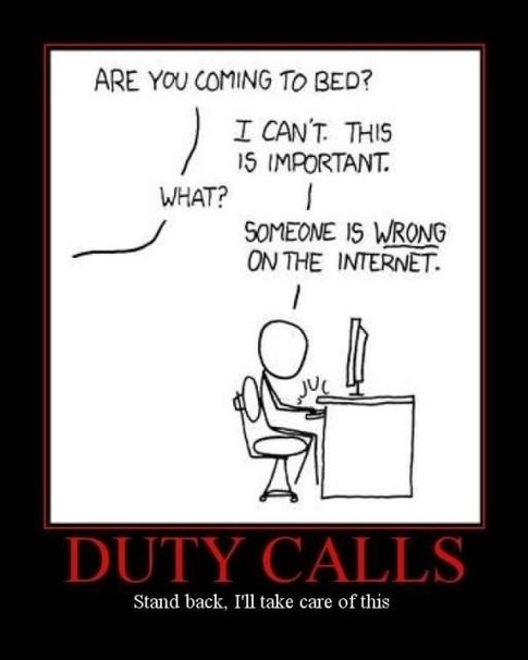
Correcting people on the internet, one post at a time. It's a full-time job. At least.And he's back, Defending The Faith!
Correcting people on the internet, one post at a time. It's a full-time job. At least.
Hillsborough .03
You make some really good points. As educated "weather consumers" we should view the early models as potential scenarios and not absolutes. There are too many on the Internet that view these things as absolutes.I do think that in some respects forecasting is attempting to be too specific, too far in advance. In the mid 2000s/ early 2010s there was a good balance where forecasts were broader and generally seemed to lead to greater verification. There also weren't private weather firms like Accuweather and TWC showing a 15 day, highly detailed forecast that completely changes every hour beyond 3 days.
Basically it seems like we are attempting to do what we don't yet have the computational/forecast ability to.
Correcting people on the internet, one post at a time. It's a full-time job. At least.
Similar threads
- Replies
- 62
- Views
- 1K
- Replies
- 608
- Views
- 17K
- Replies
- 104
- Views
- 2K
ADVERTISEMENT
Latest posts
-
-
 Basketball Former Rutgers Women's Hoops G Erica Lafayette commits to UL-Lafayette
- Latest: Alec Crouthamel
ADVERTISEMENT