Models are all over the place and we're only about 60 hours from the start of the storm (vs. today's 12Z models that initialized at 7 am EST), so I'm not going to go into great detail - this is just more of a heads-up note that something minor to moderate is coming.
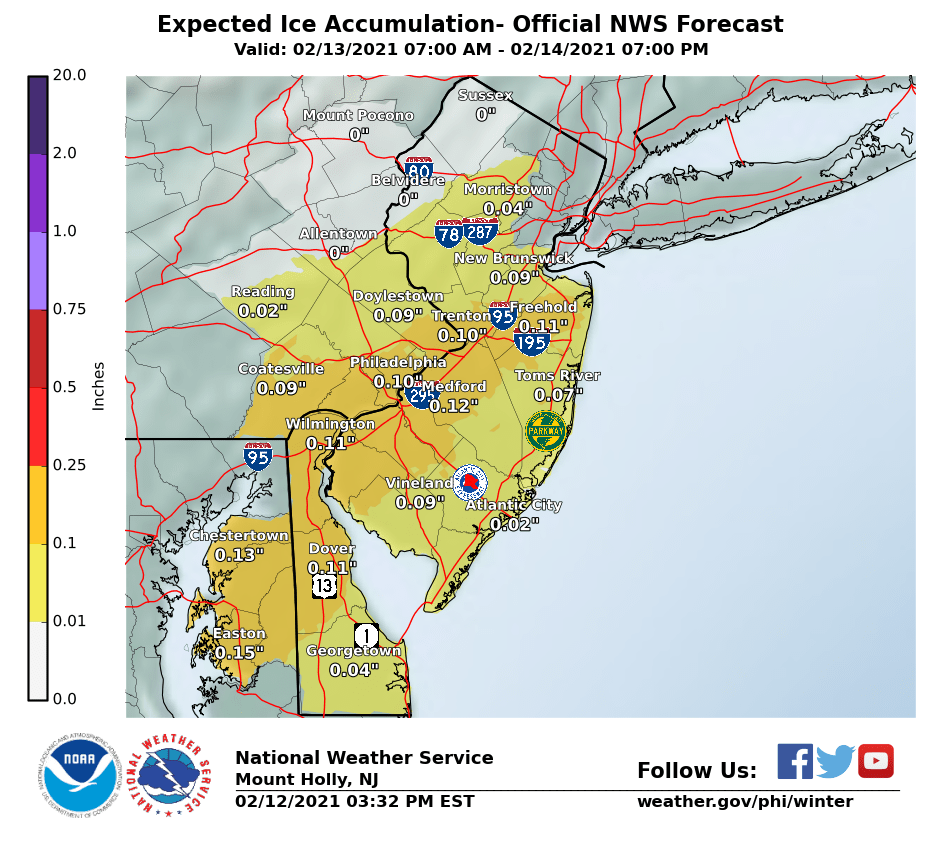
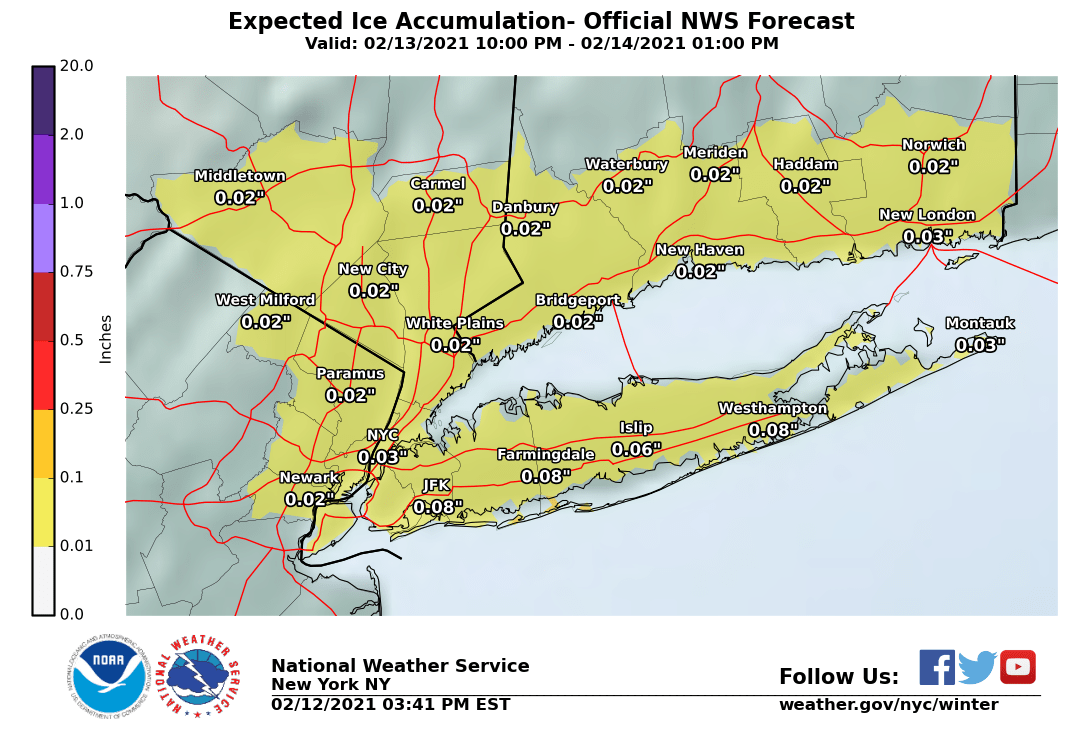
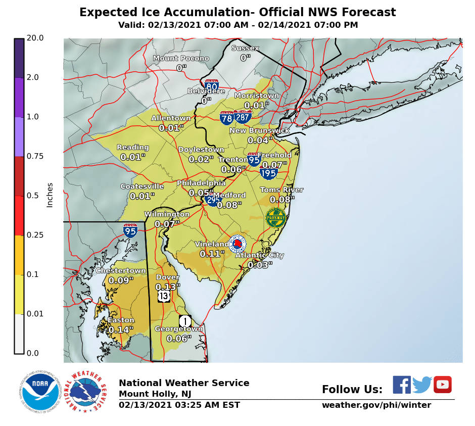
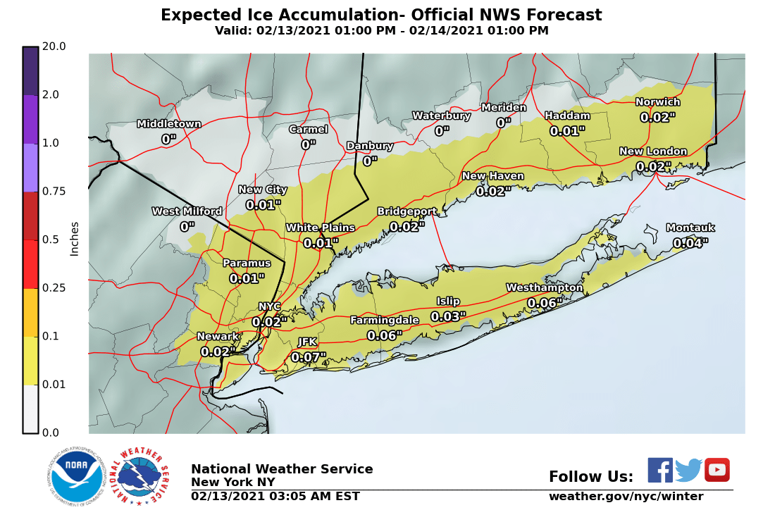
Whatever we get from the coastal low likely to from off of NC and come up the coast is currently not forecast to be heavy (maybe 0.2-0.4" of liquid equivalent, perhaps - which is 2-4" of snow at 10:1 ratios), but the big problem is there's a very strong Canadian high pressure system forecast to be in our area by then with very cold surface temps, but the coastal could be driving enough warm air in at the mid-levels of the atmosphere to lead the snow at the start to quickly change to sleet or maybe freezing rain for many with maybe only far NWNJ/Poconos/Hudson Valley staying as mostly snow.
It's almost impossible to forecast sleet and freezing rain well 12-24 hours out, so it's impossible to forecast them this far out - again, this is more of a heads up. If freezing rain occurs, even a "minor" event becomes significant, as it only takes a glaze of ~0.1" of ice on everything to potentially wreak havoc, as we just saw with the 75+ car pile-up with 5 killed in TX today, from some freezing rain.
https://www.fox4news.com/video/899868
Also, as many may know, the system that is forecast to bring heavy snow, sleet and freezing rain to the Pac NW on Fri/Sat will be hitting the southern Plains (especially TX) on Sat/Sun with bitter cold temps for all of the Plains states (some all-time record lows might be set) and wintry precip possibly all the way to the Gulf Coast (and substantial snow/sleet/ice in parts of the south) - and this is the storm the could bring substantial impacts to this area by late Mon through Tuesday. That will likely require its own thread in a day or so.
https://www.weather.gov/phi/
https://www.33andrain.com/topic/2024-february-10-14-2021-days-of-wintry-waves/page/35/
https://origin.wpc.ncep.noaa.gov/discussions/hpcdiscussions.php?disc=pmdepd