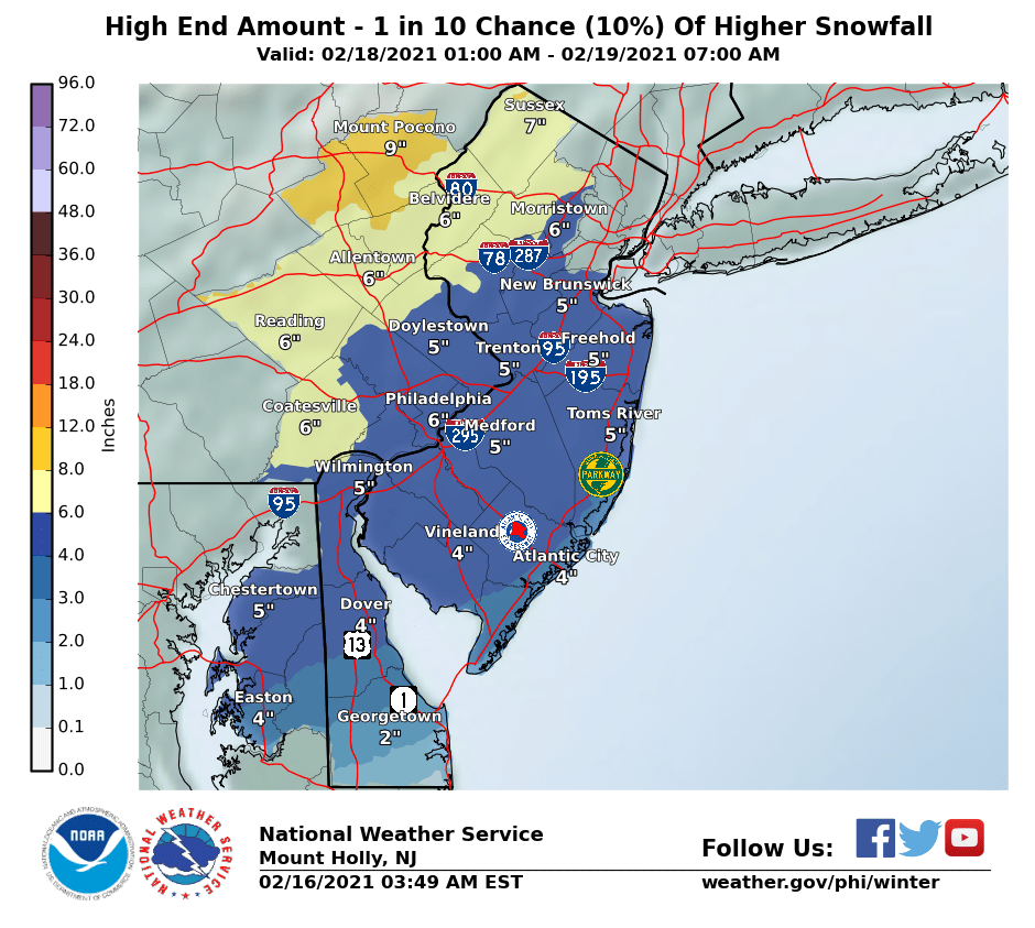
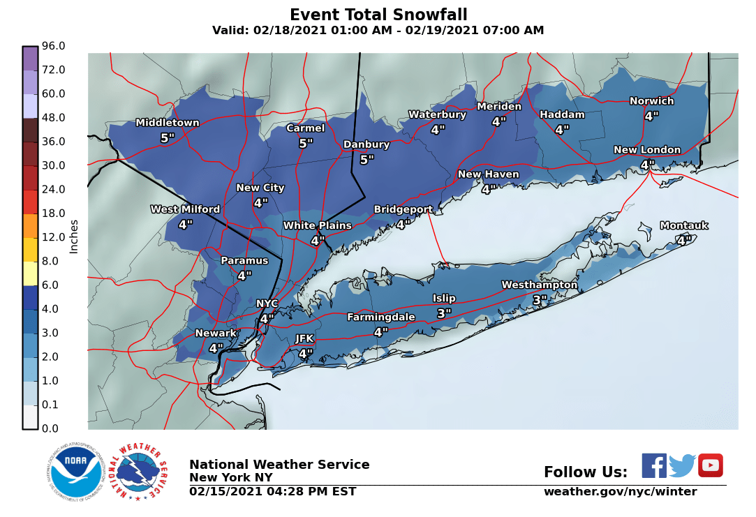
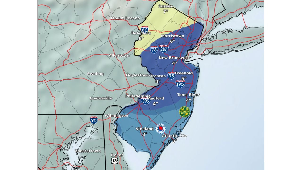
Last gasp for the current cold/snowy pattern? Could be. The Thursday event has been trending snowier on all of the global models for the last 24 hours and for the last 12 hours we've had general global model consensus (Euro, UK, GFS, GFSv16, and CMC) on a significant (3-6/4-8") snowfall for most of the Philly-NJ-NYC area, as this system (the one coming ashore and hammering the Pac NW now and forecast to dive down to the southern US to bring another big round of snow/sleet to the Southern Plains and Ohio Valley and freezing rain to parts of the SE US, following the huge trough across the central US) is now forecast to take a further SE track for us, bringing less warm air in initally.
The storm was originally forecast to cut just inland of our area, bringing mostly rain and warm temps, but today's 12Z (7 am EST data inputs) models are now showing the storm likely staying just offshore keeping the cold air in place for most of the event. Some models still show substantial sleet along and SE of 95 (which would reduce snow depth, but not frozen mass) and rain towards the coast after a dump of snow, but most show mostly frozen precip for the event (the GFS is the outlier showing temps warming up to near 40F with heavy rain after 3-6" of snow, but the GFS is known to have a warm bias).
We're still 45-48 hours from the start of the event very learly Thursday morning (which would go until very early Friday morning), so things can still change somewhat, i.e., the track could go back to being further NW with less snow/more rain or it could move further SE with less precip/snow NW of 95 and mostly/all snow down to the coast. A complete miss is looking very unlikely at this time. Don't have time for model maps; if interested, take a look at the Pivotal site or the 33andrain thread.
https://www.weather.gov/phi/
https://www.pivotalweather.com/model.php?m=ukmet&p=sn10_024h&rh=2021021512&fh=96&r=us_ma&dpdt=&mc=#
https://www.33andrain.com/topic/2024-stretch-to-remember-mid-february-2021-wintry-events/page/102/