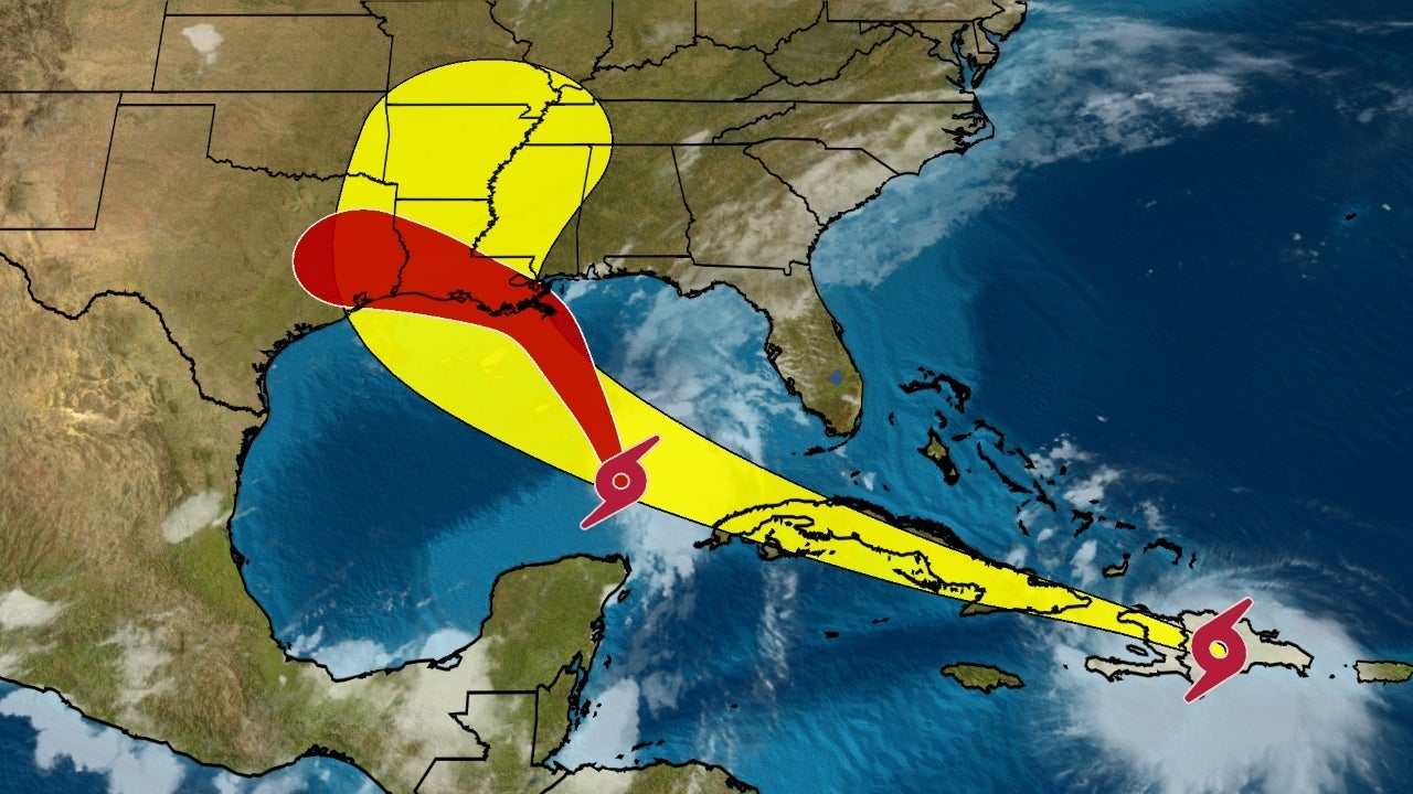
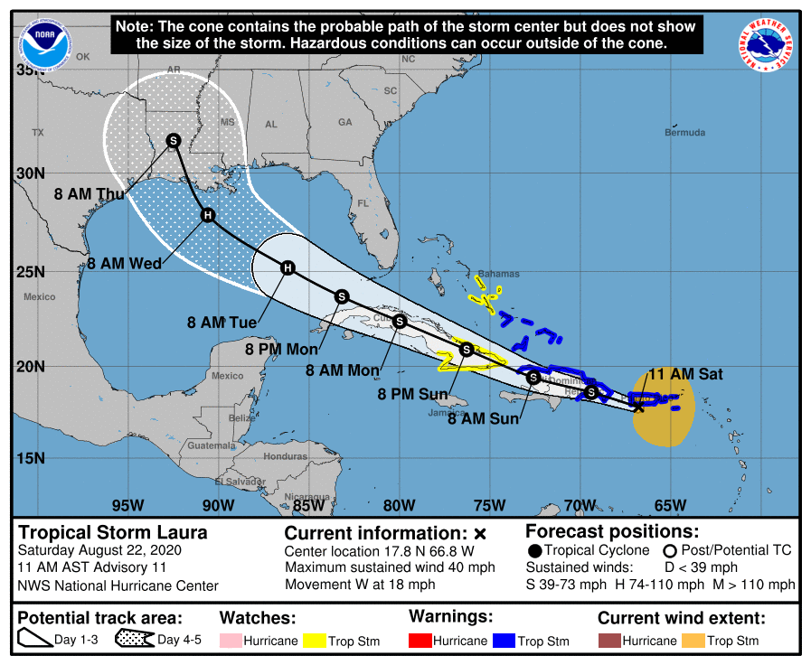
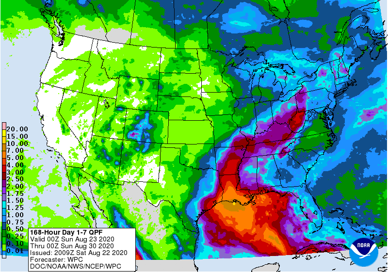
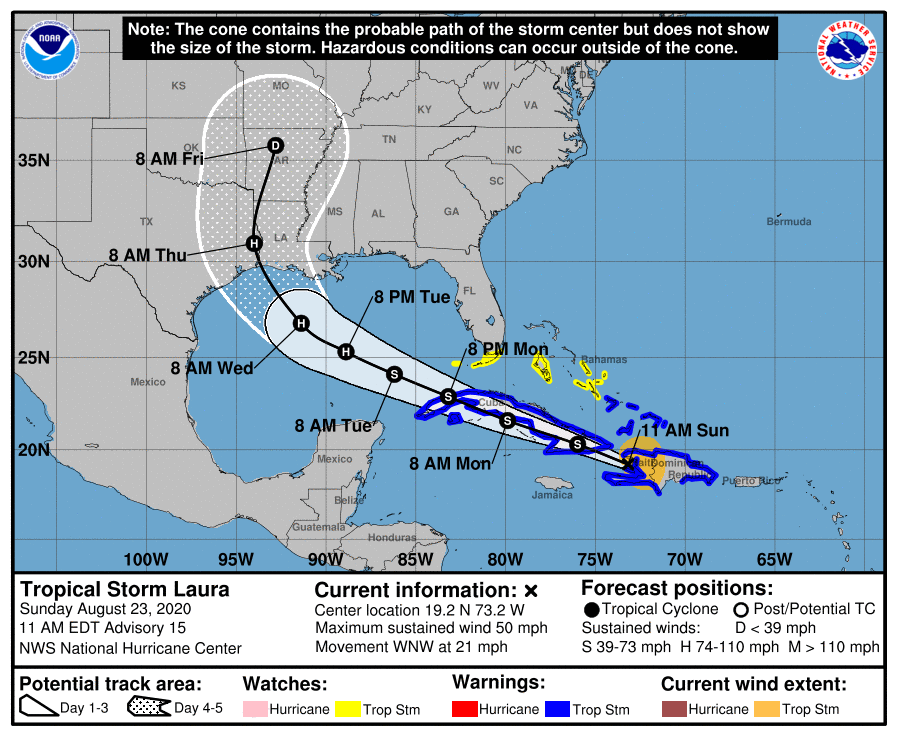
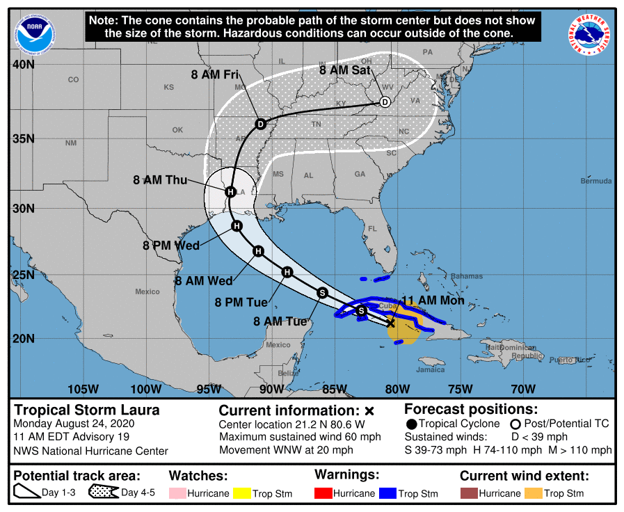
This really busy season is about to get a lot busier if current NHC forecasts hold. Both these systems have been designated as tropical depressions and are both very likely to be named tropical storms shortly, i.e., by tonight. Bare bones discussions below - more to come as the storms develop.
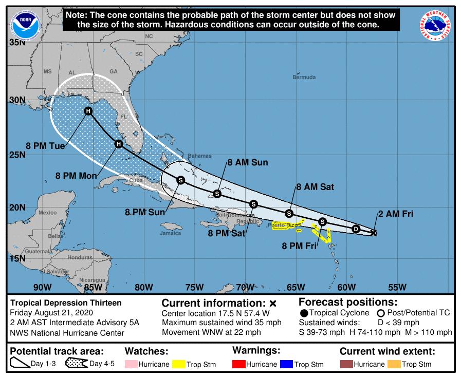
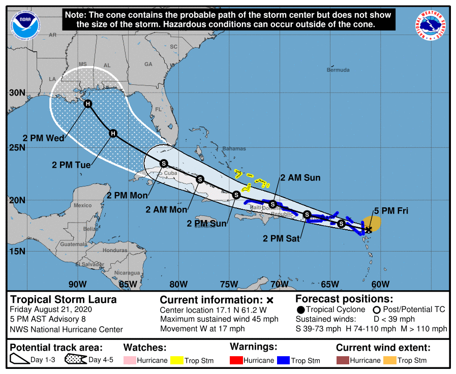
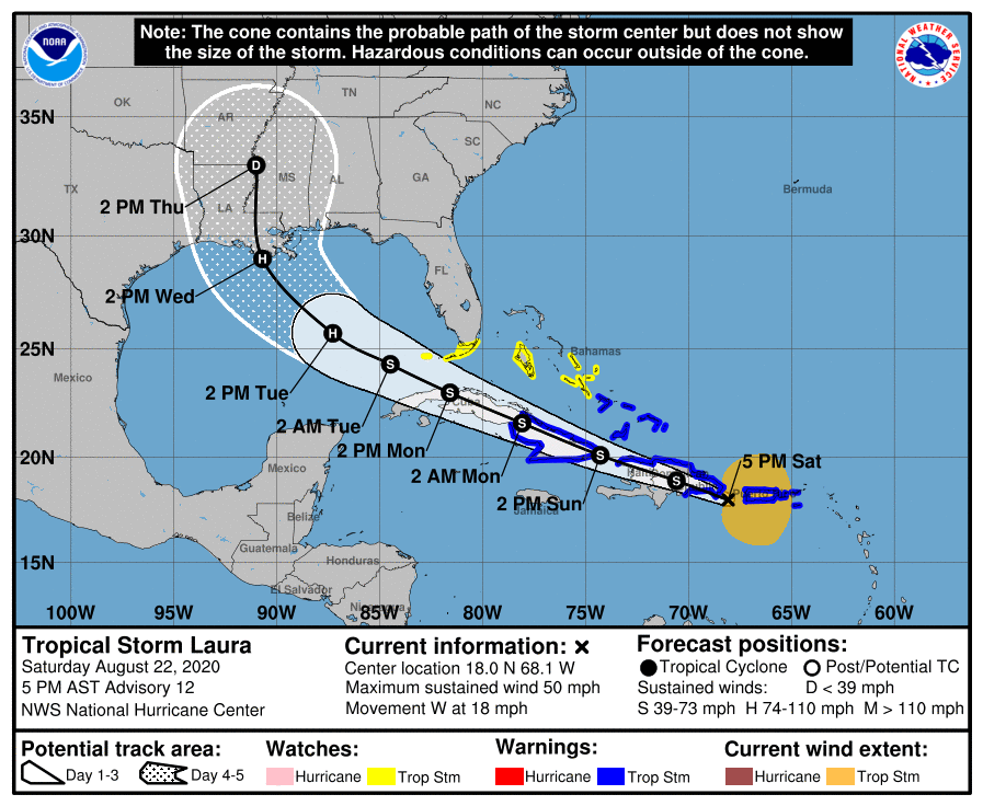
TD-13 is currently in the Atlantic, east of the Caribbean, but is likely to move WNW just north of the Lesser/Greater Antilles (Puerto Rico, Hispaniola and Cuba) and towards the southern Bahamas and South Florida, with the forecast track center going right over the southern tip of FL and the FL Keys sometime around Monday evening; it's also predicted to strengthen into a minimal hurricane by the time it reaches S. FL. Track errors are pretty large 4-5 days out, so it might still miss FL to the south, but it also might move further north up towards the central FL coast and intensity forecasts are always a bit of guesswork, so anyone in the southern half of FL should be paying close attention to this right now. Beyond 5 days, the storm looks like it will head into the Gulf of Mexico and who knows where it will go after that, although longer range models are indicating the northern Gulf Coast in 6-7 days.
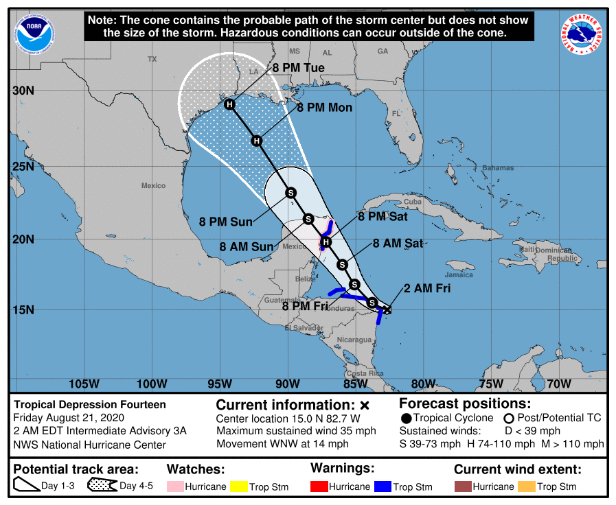
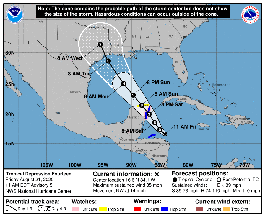
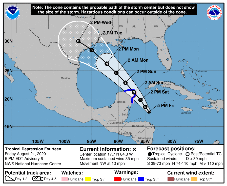
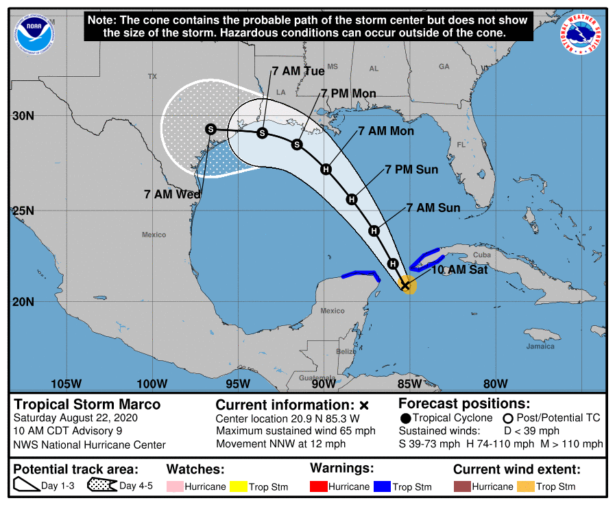
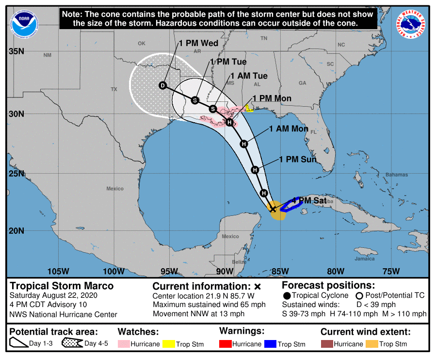
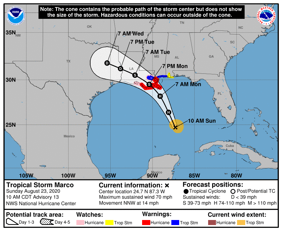
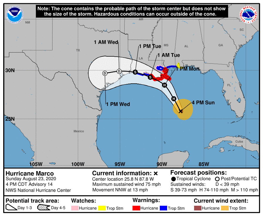
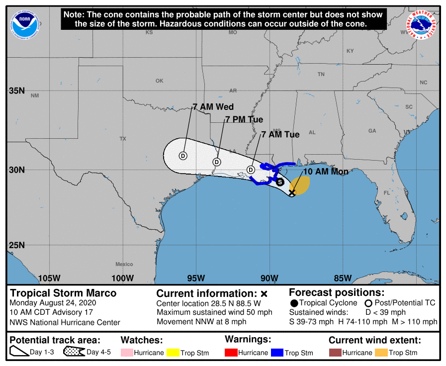
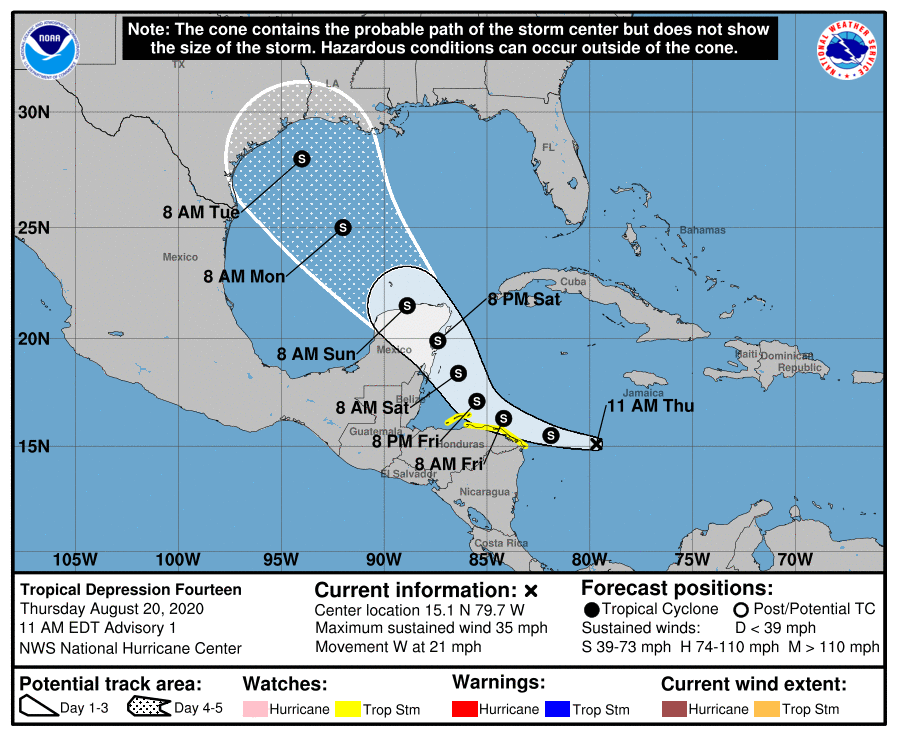
Potential Marco is TD-14 in the Caribbean, near Nicarauga, and is forecast to head NW over the Yucatan Peninsula in 2 days, after which it's still forecast to be a TS and predicted to head towards the central Texas coast, i.e., near Houston by Tuesday morning, still as a strong TS, but the GOM is quite warm, so a hurricane can't be ruled out. Same caveats on track and intensity forecasts as for potential Laura, i.e., hard to know what interaction with the Yucatan will do to the storm and interest from central LA to south TX need to be watching this one closely.
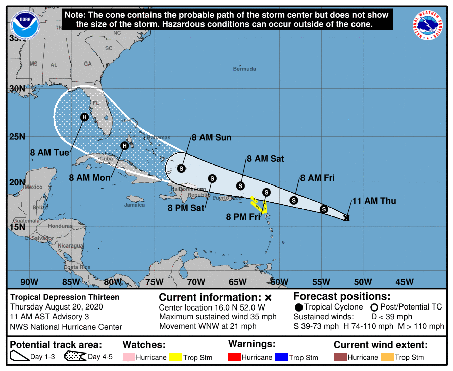
TD-13 is currently in the Atlantic, east of the Caribbean, but is likely to move WNW just north of the Lesser/Greater Antilles (Puerto Rico, Hispaniola and Cuba) and towards the southern Bahamas and South Florida, with the forecast track center going right over the southern tip of FL and the FL Keys sometime around Monday evening; it's also predicted to strengthen into a minimal hurricane by the time it reaches S. FL. Track errors are pretty large 4-5 days out, so it might still miss FL to the south, but it also might move further north up towards the central FL coast and intensity forecasts are always a bit of guesswork, so anyone in the southern half of FL should be paying close attention to this right now. Beyond 5 days, the storm looks like it will head into the Gulf of Mexico and who knows where it will go after that, although longer range models are indicating the northern Gulf Coast in 6-7 days.
Potential Marco is TD-14 in the Caribbean, near Nicarauga, and is forecast to head NW over the Yucatan Peninsula in 2 days, after which it's still forecast to be a TS and predicted to head towards the central Texas coast, i.e., near Houston by Tuesday morning, still as a strong TS, but the GOM is quite warm, so a hurricane can't be ruled out. Same caveats on track and intensity forecasts as for potential Laura, i.e., hard to know what interaction with the Yucatan will do to the storm and interest from central LA to south TX need to be watching this one closely.
TROPICAL STORM JULIA
www.nhc.noaa.gov
POST-TROPICAL CYCLONE KARL
www.nhc.noaa.gov