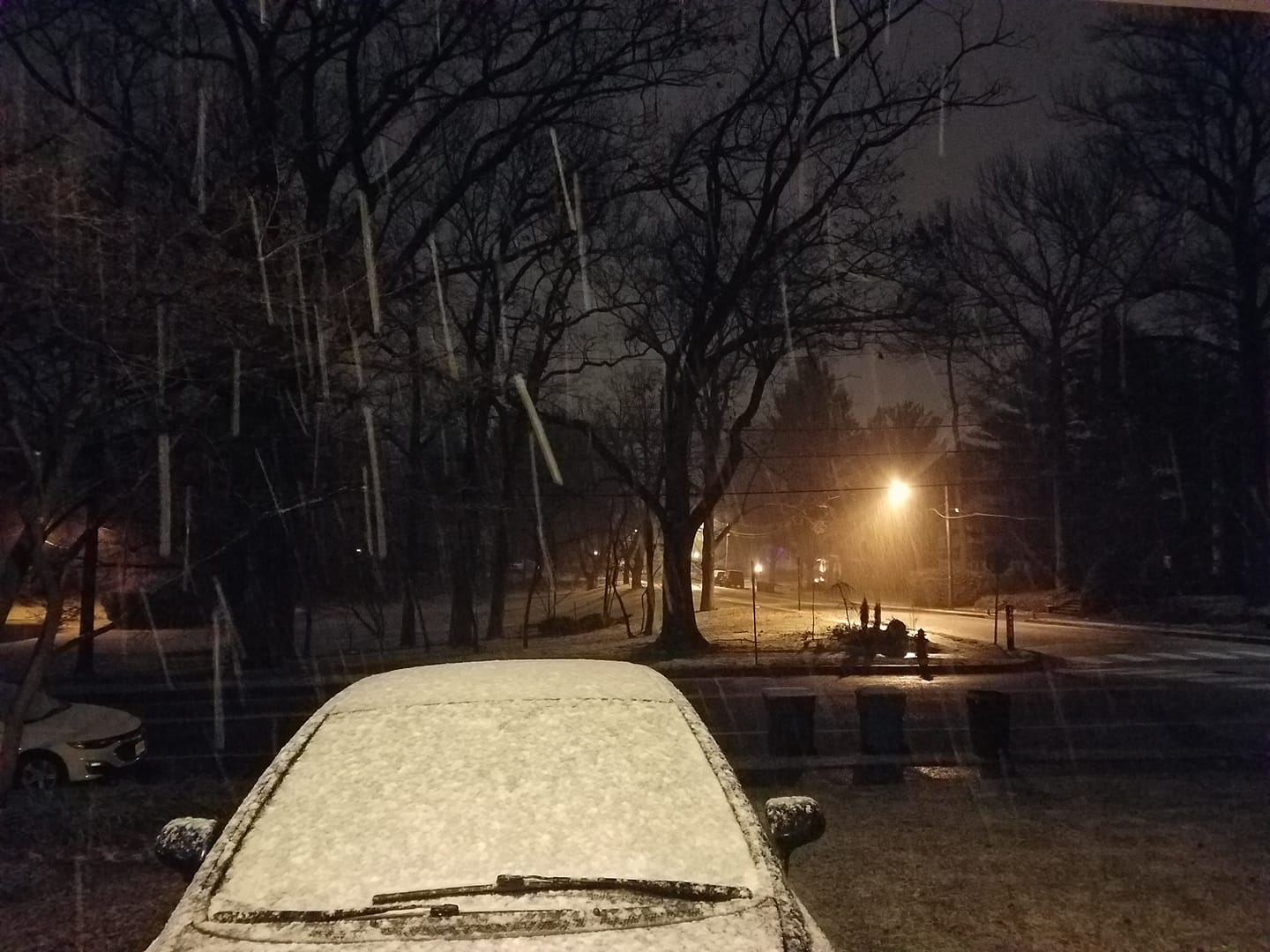
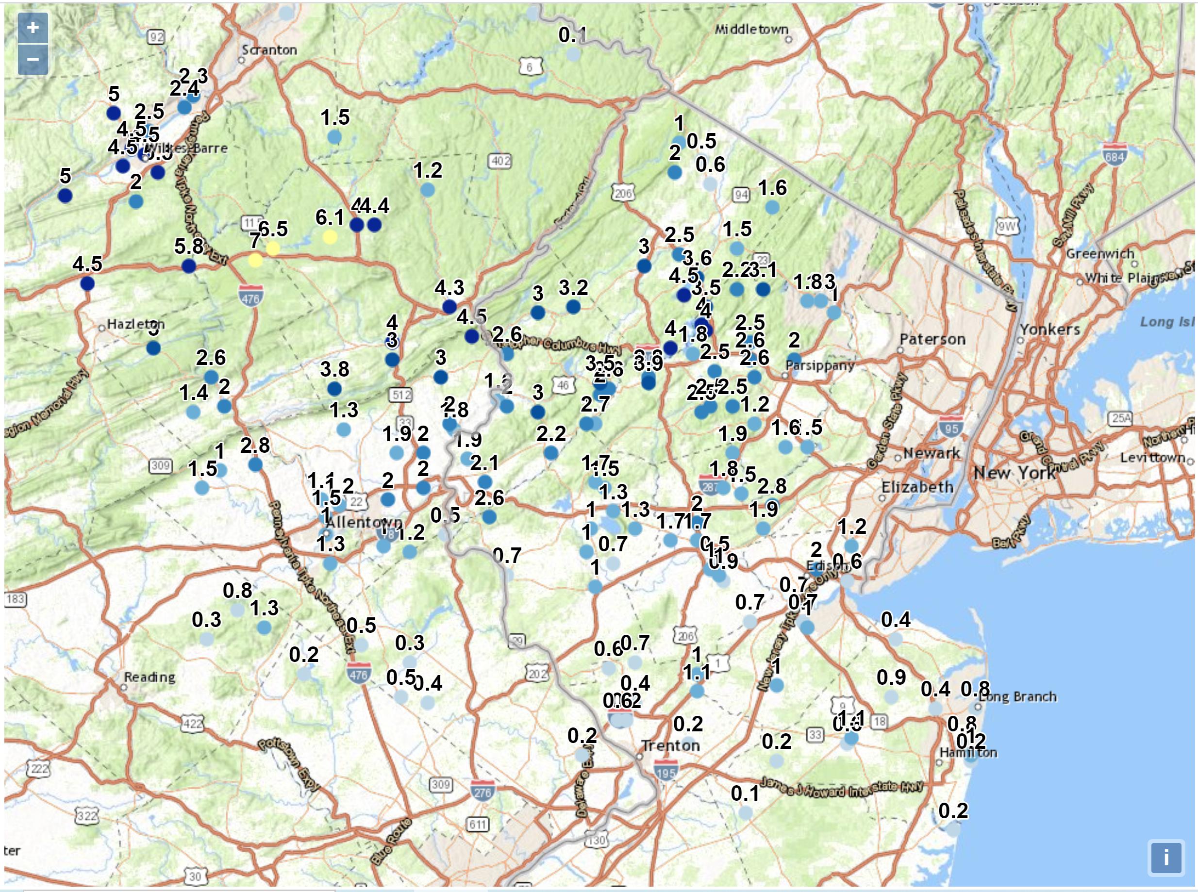
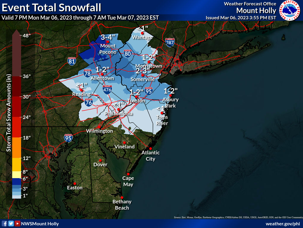
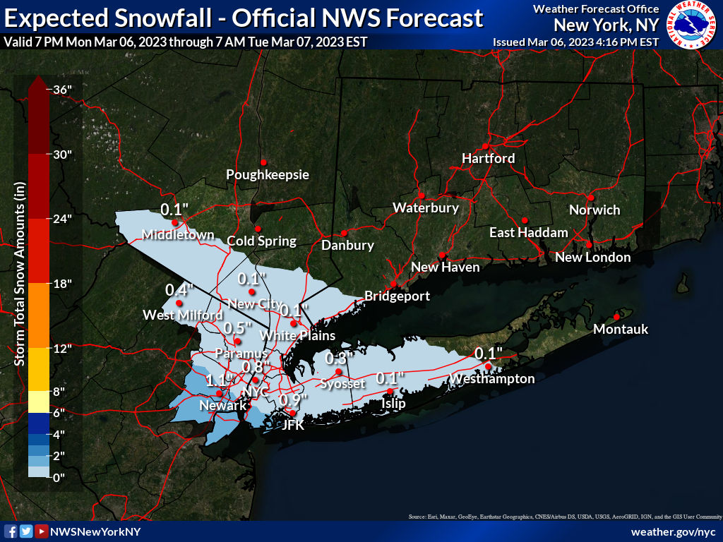
Figured someone else might've started a thread on this, but no, so here you go - it's a pretty minor event, but given how little snow has fallen this winter for most, it's at least noteworthy. Been talking about this clipper for a couple of days in the pattern thread and since last night the models have trended wetter/snowier for much of EPA and NJ between 276/195 and 80, such that now we have advisories up for Carbon/Monroe (Poconos) for 3-5" of snow tonight and for Warren, Hunterdon and Northampton fo 2-4" of snow.
In addition, areas outside of the advisories but between 276/195 and 80 are mostly forecast to get 1-2" and up to 3" is easily possible in these locations, as per the map below. The band of precip is predicted to be pretty narrow, such that areas south of 276/195 are likely to get <1" of snow (or mostly rain) and areas along and N of 80, especially towards and including NYC are likely to also get <1" of snow (which will almost certainly melt on paved surfaces).
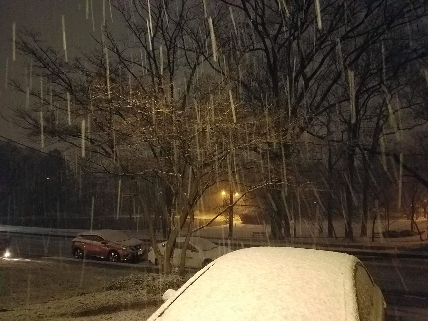
The snow will fall mostly between 10 pm and 4 am and will likely start as rain south of 78, but eventually change to snow, but with temps slightly above freezing (mid-30s) accumulations south of 78 may be limited to grassy/colder surfaces; north of 78 temps should just make it down to 31-32F and the snow should accumulate on all surfaces at night time, meaning those areas may have some slick roads for the morning commute.
https://www.weather.gov/phi/
In addition, areas outside of the advisories but between 276/195 and 80 are mostly forecast to get 1-2" and up to 3" is easily possible in these locations, as per the map below. The band of precip is predicted to be pretty narrow, such that areas south of 276/195 are likely to get <1" of snow (or mostly rain) and areas along and N of 80, especially towards and including NYC are likely to also get <1" of snow (which will almost certainly melt on paved surfaces).
The snow will fall mostly between 10 pm and 4 am and will likely start as rain south of 78, but eventually change to snow, but with temps slightly above freezing (mid-30s) accumulations south of 78 may be limited to grassy/colder surfaces; north of 78 temps should just make it down to 31-32F and the snow should accumulate on all surfaces at night time, meaning those areas may have some slick roads for the morning commute.
https://www.weather.gov/phi/