Its a bust because less than 24 hours before they werent even mentioning rain...every 1-2 day forecast has busted badly this week. We went from just some showers Wednesday night predicted on Monday to 1.25 inches of rain actual
Temperature and sky conditions predictions this week gave also failed
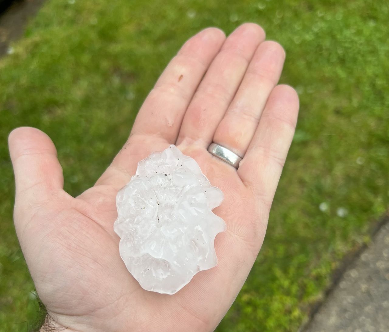
Oh and one of the biggest severe weather threat busts in a decade that incredibly closed schools
Yeah, but the thread wasn't about the forecast 36 hours out, which was certainly poor, as predictions until that point were for "a few spotty showers" on Friday. 24 hours out the models and forecast changed considerably, as per below, and the forecast by yesterday morning was pretty good with decent verification for severe storms, downpours, and at least one tornado. People closing schools for severe t-storms is dumb, but irrelevant with regard to the forecast.
Also, expecting perfect precip predictions on MCS's more than 24 hours out (for the late Weds/early Thurs system) is simply foolish, as the science simply isn't there (and may never be) to predict such high uncertainty mesoscale systems accurately - the QPF was predicted reasonably accurately by Wednesday afternoon, which is about the best one can expect for such systems. I don't think you'll ever understand the limitations of numerical modeling of chaotic, stochastic phenomena, as I've been saying this for years and you keep insisting the forecasts should be better.
Area Forecast Discussion
National Weather Service Mount Holly NJ
343 PM EDT Thu May 19 2022
.NEAR TERM /THROUGH FRIDAY/...
Another
shortwave trough and an associated MCV complex
currently moving east across the central Mississippi and lower
Ohio Valleys are expected to progress toward the region
overnight. The approaching wave will lift a more pronounced warm
front north through the area during the morning hours Friday.
Temperatures, dewpoints, and thus
instability will rise as the
front lifts through the area as the day progresses. Meanwhile,
the broad synoptic ridging will begin quickly building
throughout the day and will continue building through Friday
night.
The latest CAM guidance suite indicates a wide variety of
outcomes related to how the remnant MCV progresses across the
region from the mid-morning and into the afternoon on Friday.
The strengthening
ridge axis across the East Coast and western
Atlantic introduces a complex and low predictability scenario.
It seems that the strengthening
ridge axis may be enough to
weaken/dry out the MCV or even push it north of the local
forecast area (into northeastern Pennsylvania and Upstate New
York). However, if the MCV slows down overnight and passes
across the region after daytime heating has allowed
instability
to build, we could see a few thunderstorms become strong to
locally severe. In any case, the
probability of
convection has
undoubtedly increased enough to warrant a wholesale update and
increase to the
PoP and weather forecast for the daytime period.
Aside from the
convection potential on Friday, skies should
start out
partly cloudy with
scattered clouds expected much of
the day. The cloud cover will be more widespread if the MCV
holds together or restrengthens across the region. Any lingering
fog should mix out fairly quickly by late morning. Southerly
winds will increase to around 10-15 mph. Expect highs about 10
degrees above
normal in the mid to upper 80s in most areas.