ADVERTISEMENT

The OFFICIAL March 13-14 Winter Weather Thread (This is the B1G 1)

Knight Shift

Legend
May 19, 2011
76,838
72,511
113
Jersey Shore
One thread per storm.
NWS Map for Monday-Tuesday. Yellow means hazardous weather outlook.

636247508381103757-NWSNorEaster.jpg


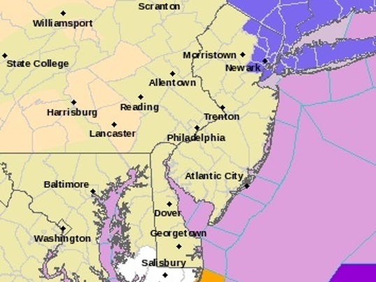
In a hazardous weather outlook Friday afternoon, the National Weather Service's office in Mount Holly predicted that a "significant coastal storm will affect the region beginning Monday night and lasting into early Wednesday." The outlook covered parts of New Jersey and Maryland and all of Delaware.

According to a forecast from Tri-State Stormwatch's Rick Cuttrell, "Computer guidance continues to display a powerful east coast storm" with snow and wind, and "Details will be determined in the coming days but this has the potential to be a high impact weather event."

In a video forecast Friday, Steve DiMartino, owner and lead meteorologist for NY NJ PA Weather, said the storm could juke, but is definitely bearing down on the coast.

"We are still not certain of the exact storm track here, a track further west along the coast will mean basically rain along the coast and significant snowfall along the interior," he said. A track further north and east "would lead to a very impressive snowfall along the coastal plain and not so much along the interior."

"The next storm on the horizon, all model runs for several days now are suggesting a formidable coastal storm come Tuesday, say Monday night into Tuesday. That's subject to some adjustment," Robinson said. "By 'formidable storm,' I mean a nor'easter that will be producing heavy surf, strong winds, and some heavy precipitation. The big question is where, exactly, this will line up and what form the precipitation will be in. But here we are in March, and there is no question that there could be some snow out of this system."
"Best case scenario for the Shore is this storm sets up further north than expected," Robinson said. "The cases where we get our worst coastal flooding and beach erosion is when the storm develops to our south, intensifies as it gets there and is relatively slow-moving.

"The problem with coastal flooding is, often, you get the easterly winds push the water into the bays in the high tide and, as the high tide goes down, the winds are still pushing the water in," Robinson said. "And the next high tide comes along and things haven't gone down as much as they should from the previous high tide."
61127831.jpg
 
  • Like
Reactions: Debtbubble
thank you for the new thread

I like how these guys lay out both sides of what can happen and stress the very uncertain track
 
Just posted this in the other thread - didn't see this thread...

OK, we're 72 hours or so from the start of the storm and the models have moved closer to each other. The Euro and UK are snowmageddon with 12-24" for almost everyone from DC to Boston (less at the immediate coast in far SE NJ). The GFS is further west, changing the heavy snow to sleet then rain for the coast and inland to just about the NJ TPK, with 6-10" for I-95, <6" towards the coast and 10-20" just west of the TPK.

However, the GEFS, the "ensembles" of the GFS, where they do about 20-some runs of the GFS model with perturbations in the initial conditions (since data inputs aren't known well for the systems being sampled), shows a mean much closer to the Euro, indicating that the main operational run may be erroneously too far west. And the CMC came back from its very suppressed previous run to a slightly suppressed run with a general 8-12" for most (more towards the coast).

At this point, a major snowstorm (8" or more) is almost a given for most of the region, i.e., NJ/eastern PA/NYC/LI/CT etc., and an historic snowstorm >12" and up to 20" is now a decent probability and not a wishcast - it's possible with screaming winds that this could end up being an all-out blizzard for anyone near the coast. The odds of a very suppressed solution with only a few inches or an inland solution with mostly rain for at least the I-95 corridor are getting pretty low, but given past busts, we can't say it's not possible.

Generally conservative pros on the weather boards are still saying this is one of the best setups they've ever seen and they are very confident in the very snowy solution. Lest I be accused of wishcasting, below are the maps for the Euro (the best model, particularly in "blocking" setups, which we have here) and the GFS models (3rd best model) - the Euro is the snowiest and the GFS has the mix/changeover for many.

index.php


gfs_asnow_neus_20.png
 
To get myself ready,I watched a tape of Ch.10's coverage of Jonas.

After the storm ended on Saturday night,the station sent a crew to interview the few pedestrians on the street of Manhattan's Upper East Side.

The reporter asked 2 women what they were doing outside.

One of them replied:"Drinking" as she produced a bottle from her purse.

Deep in the eyes of a New York woman.
 
High winds, high tide, full moon.
Yep. Mt. Holly is calling for widespread minor tidal flooding, but leaving the door open for more severe impacts, whereas NWS in NYC is calling for minor to perhaps moderate tidal flooding, as per below. Not to mention the risk of at least gale force winds offshore and along the coast, which would bring blizzard conditions, possibly, to the coast, assuming a mostly/all snow scenario, which is still not a given.

NWS-Phillly: TIDES/COASTAL FLOODING...
A coastal storm is expected to affect our region Tuesday. As a
result, there is a chance for widespread minor coastal flooding,
primarily on the Atlantic shore, during the Tuesday
morning/Tuesday mid day high tide. There is still considerable
uncertainty with the track of this low, and thus still
considerable uncertainty with the threat of coastal flooding and
forecast water levels.

NWS-NYC: TIDES/COASTAL FLOODING...
Main concern is for the Tue late morning/early aft high tide
cycle coming off a full moon on Sunday. Generally 1 1/2 to 2 ft
of surge are needed for minor coastal flooding and around 3 ft
for moderate. Current ensemble means track low pressure
southeast of LI Tue/Tue night...keeping winds veered to the NE/N
and likely limit coastal impacts to minor. But based on model
spread...there is still potential for low pressure to track
closer to the coast...which would result in a stronger and
longer period of easterly flow...and pose a threat for moderate
coastal impacts.
 
The 6Z GFS moved towards the Euro, as expected. Every model, right now is showing at least a foot for 90% of the Philly-NYC corridor (immediate coast still may have mixing issues, especially south of Toms River). And here's why so many pros are convinced we're going to get an all out blizzard. The graphic below is last night's Euro Ensembles output, where they run 51 versions of the Euro in parallel along with the main or "operational" model, as I posted above.

51 versions all have some minor variations in the initial and boundary conditions input to the model, since the uncertainty on those conditions is moderate, given that the data are sparse where one of the main pieces of energy is (off the NW coast still) - given that weather is chaotic in nature, meaning that the errors in inital conditions propagate out in time, making forecasts more and more uncertain in time. Usually 72 hours out, the ensemble spread in outcomes is far larger than what we're seeing here, with the Euro, the best model. It's almost unprecedented how tightly the ensemble members are clustered.

That and the fact that there's pretty good model consensus at this point, is why confidence is unusually high in a major snowstorm at this point. Earthlight, one of the best online pros out there (he runs NY Metro Weather) just said, "This is absolutely incredible. I can't say I have ever seen this before." Strong words. At this point, I'd say prepare for 12-18" (more possible) of snow and blizzard conditions near the coast and if the system doesn't pan out (the new NAM, which is outside its accurate range, is showing a lot of rain inland to about I-95 after 6-10" of snow and less at the coast), which is still possible, but getting less likely, then count your blessings (if you don't like snow).

IMG_2986.thumb.PNG.2f013fd94e0bf86c1fc7cf8abb48fbb6.PNG
 
12z.NAM was warmer and would have serious mixing and changeover issues for some.
Yes it would, but it's outside its useful range. 12Z GFS caved to the Euro on track, shifting maybe 50-75 miles further offshore, and storm evolution, but "only" shows 8-14" of snow for most of us - lots of speculation on convective feedback issues with the model (a numerical modeling issue at times) - it only shows rain in far SE NJ.

Edit: and the Canadian shows 12-18" for everyone, except far SE NJ and the UK just came in like the Canadian. Will be surprised if the Euro doesn't hold serve. And just for giggles, don't forget about the winter storm next weekend...
 
Last edited:
Knightshift, thanks for starting this separate thread, and RU#s, thanks for copying your post on the other thread to this one. I am really hoping for a bust for the NJ suburbs of Philly, but my wife and I are trying to plan the week on the basis that there will be a bad storm. We are hoping the storm does not start before midnight on Monday, but of course that's the hardest thing to predict, as yesterday's storm showed.
 
Knightshift, thanks for starting this separate thread, and RU#s, thanks for copying your post on the other thread to this one. I am really hoping for a bust for the NJ suburbs of Philly, but my wife and I are trying to plan the week on the basis that there will be a bad storm. We are hoping the storm does not start before midnight on Monday, but of course that's the hardest thing to predict, as yesterday's storm showed.

Thanks. This time I looked before starting a separate thread and saw that that rat bastard KS had started one an hour or two earlier. I was going to call my thread the @Knight Shift/@e5dny I Want A New Thread for the Blizzard thread. I really don't think this is going to bust, meaning at least 8-12" looks like a lock. Not going to guarantee more than that, but I think 12-18" is likely.
 
Thanks. This time I looked before starting a separate thread and saw that that rat bastard KS had started one an hour or two earlier. I was going to call my thread the @Knight Shift/@e5dny I Want A New Thread for the Blizzard thread. I really don't think this is going to bust, meaning at least 8-12" looks like a lock. Not going to guarantee more than that, but I think 12-18" is likely.

And along the coast? Same? More? Less? Right now I've seen temps as high as 40.
 
Going to be an interesting next day with the Euro and GFS taking different tracks.

What are we thinking fellas?
 
Thanks. This time I looked before starting a separate thread and saw that that rat bastard KS had started one an hour or two earlier. I was going to call my thread the @Knight Shift/@e5dny I Want A New Thread for the Blizzard thread. I really don't think this is going to bust, meaning at least 8-12" looks like a lock. Not going to guarantee more than that, but I think 12-18" is likely.


60 hours before a storm...you have been around here long enough not to call something a lock...likely yes, lock no and calling for 12-18 is waaaaaaaaay premature especially with your buddy the Euro moving way east
 
Last edited:
Thanks. This time I looked before starting a separate thread and saw that that rat bastard KS had started one an hour or two earlier. I was going to call my thread the @Knight Shift/@e5dny I Want A New Thread for the Blizzard thread. I really don't think this is going to bust, meaning at least 8-12" looks like a lock. Not going to guarantee more than that, but I think 12-18" is likely.

As the latest Euro comes in with a 6" snowfall...
 
  • Like
Reactions: bac2therac
60 hours before a storm...you have been around here long enough not to call something a lock...likely yes, lock no and calling for 12-18 is waaaaaaaaay premature especially with your buddy the Euro moving way east
Yeah - he calls it a lock? Seriously? These things are never a "lock" and predictions more than about 6-12 hours ahead are wrong more often than right from what I've seen.
 
As the latest Euro comes in with a 6" snowfall...
6-10" for most, but yeah, major deviation from what had been an amazingly consistent run for days. Much further east and not nearly as dynamic. Not time to jump ship on the idea of a foot or more of snow, but certainly gives pause. The one thing I always try to remember and don't always say is that it's hard to get huge snowstorms in this area, (especially in mid-March) - that's why they're remembered so well.

So, we have the Euro going east with a general 6-10" for most (4-6" well inland), the NAM going almost inland with 6-10" for I-95 and 12-20" inland (but 2-6" toward the coast with lots of rain), the GFS showing 8-14" and the Canadian/UK with 12-18" for most (except far SE NJ). I still think 8-12" is highly likely, but certainly 12-18" is looking a bit less likely (but nowhere near off the table); problem is this Euro run, to me, brings 3-6" into play if the storm truly ends up going even further east. It's never easy.

Euro ensemble mean is west of the op run, showing a foot or more in most locations, which is a signal that the operational run may have had some numerical errors/convective feedback. Steve D and DT and many others are saying to give this run of the Euro op less credence given this discrepancy. I don't know enough to know if they're right, but they're not dumb guys, so it's at least plausible. Still have a ton of model runs to go...

 
Last edited:
Yeah - he calls it a lock? Seriously? These things are never a "lock" and predictions more than about 6-12 hours ahead are wrong more often than right from what I've seen.
So you crawl out of the woodwork just to make snarky comments on weather threads?
 
  • Like
Reactions: ldwnmas
So you crawl out of the woodwork just to make snarky comments on weather threads?
No - come here to see info from sources that are more balanced - but will call out ridiculous comments when I see them. His "lock" was obviously pretty silly given what has transpired since then.
 
ADVERTISEMENT
ADVERTISEMENT