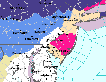
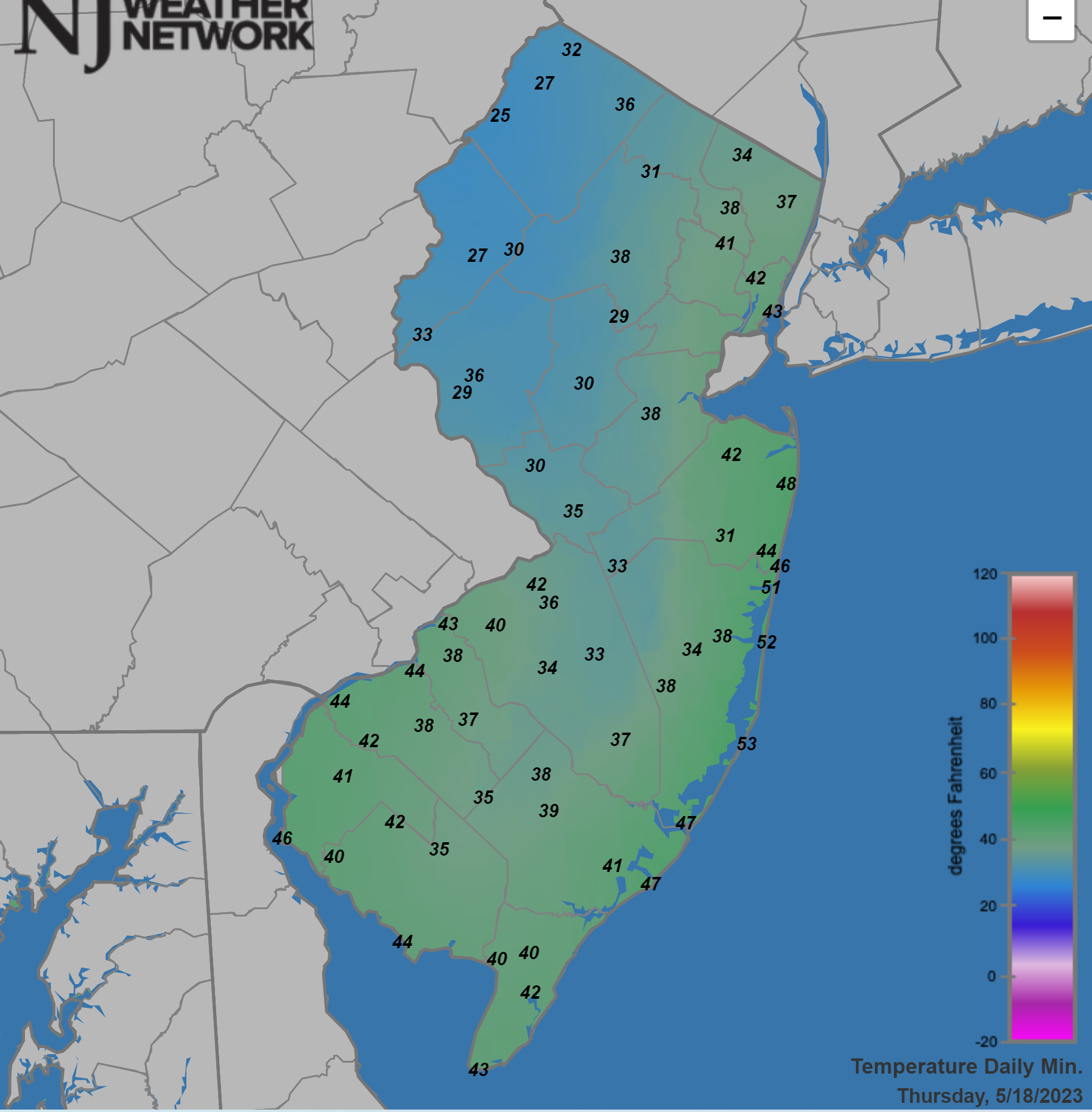
Fairly late-in-the-season cold snap with freeze warnings (dark blue) up for the Poconos, Sussex, W. Passaic and the Hudson Valley N of the Tappan Zee (and almost everywhere N/W of there) and frost advisories (light blue) up for Morris, Hunterdon, Warren, and much of the rest of NE PA. Strong high pressure, clear skies and diminishing winds, allowing for strong radiational cooling will send temps plummeting below 32F in the warning areas and near 32F in the advisory areas. Could also possibly see scattered frost in areas like NW Somerset and N Bergen. Bring in any tender vegetation. Fortunately, the red flag warnings for fire risk for much of SNJ/Pine Barrens come down at 8 pm tonight, as winds die down. Apart from some showers on Saturday, our stretch of fantastic weather looks to continue through the end of next week.