Tonight's 0Z operational model runs still show winter storms in the Saturday timeframe, but mostly not quite for us, as the GFS shows a coastal developing too late for us with a significant winter storm for N of 84 and for New England, the CMC shows a fairly weak storm giving a few inches N of 80 and the UK shows a moderate snowstorm SW of Wilmington, but no coastal for us at all, while the Euro shows a moderate snowfall for our area N of 276/195 (and rain south of there).
But the ensemble run means still show moderate to significant snow for our entire area on Saturday, meaning that the operational runs of these two models are not in good agreement with their ensembles, which often indicates some very high sensitivity of the op runs to some factor that drives a major deviation from the mean and is why most pros generally look more closely at the ensembles this far out (we're still almost 6 days out).
So, again, the bottom line is it's quite possible we could have a moderate to significant winter storm (snow and/or rain) on Saturday, but the uncertainty is very high and we could also have a complete miss or just be on the fringes of a substantial storm. Anyone who thinks they "know" for sure which way this is going to go is probably full of crapola - and definitely not ready for a new thread yet. As an aside, all of the long range models show another potentially significant winter storm for our area on 3/13 into 3/14, but that's way too far out to discuss more than that.
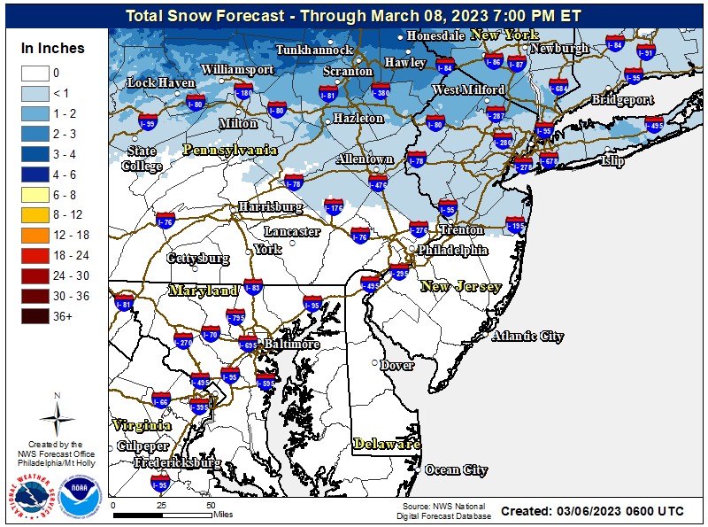
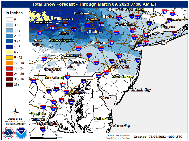
Perhaps the more interesting outcome of tonight's model runs is that the Euro, GFS and NAM (and long range HRRR) all show 2-4/2-4" for a narrow band through CNJ for the clipper for Mon night into early Tuesday (with rain generally south of 195). It's a really marginal setup with temps in the 33-35F range, such that snow may only accumulate on grass/colder surfaces, although it being at night time should keep it from being completely white rain that doesn't accumulate at all (which would likely be the outcome if this occurred during the day in March). The NWS map is below and I think they're discounting the greater amounts seen in the models above for CNJ for now (understandable).