Mentioned this a couple of days ago in the dusting thread. This is about as early as I ever start a possible snow threat thread (5-6 days out), but with every major model is showing a significant winter storm (a classic "Miller B" storm) impacting the mid-Atlantic and the Northeast next Wednesday (and people starting to talk about all over), figured why not. However, the details are highly uncertain right now, with outcomes being quite different across the models which is to be expected this far out. The point isn't to debate what might happen, but just to recognize that a significant winter storm is looking likely for our area, with a wide range of potential wintry outcomes.
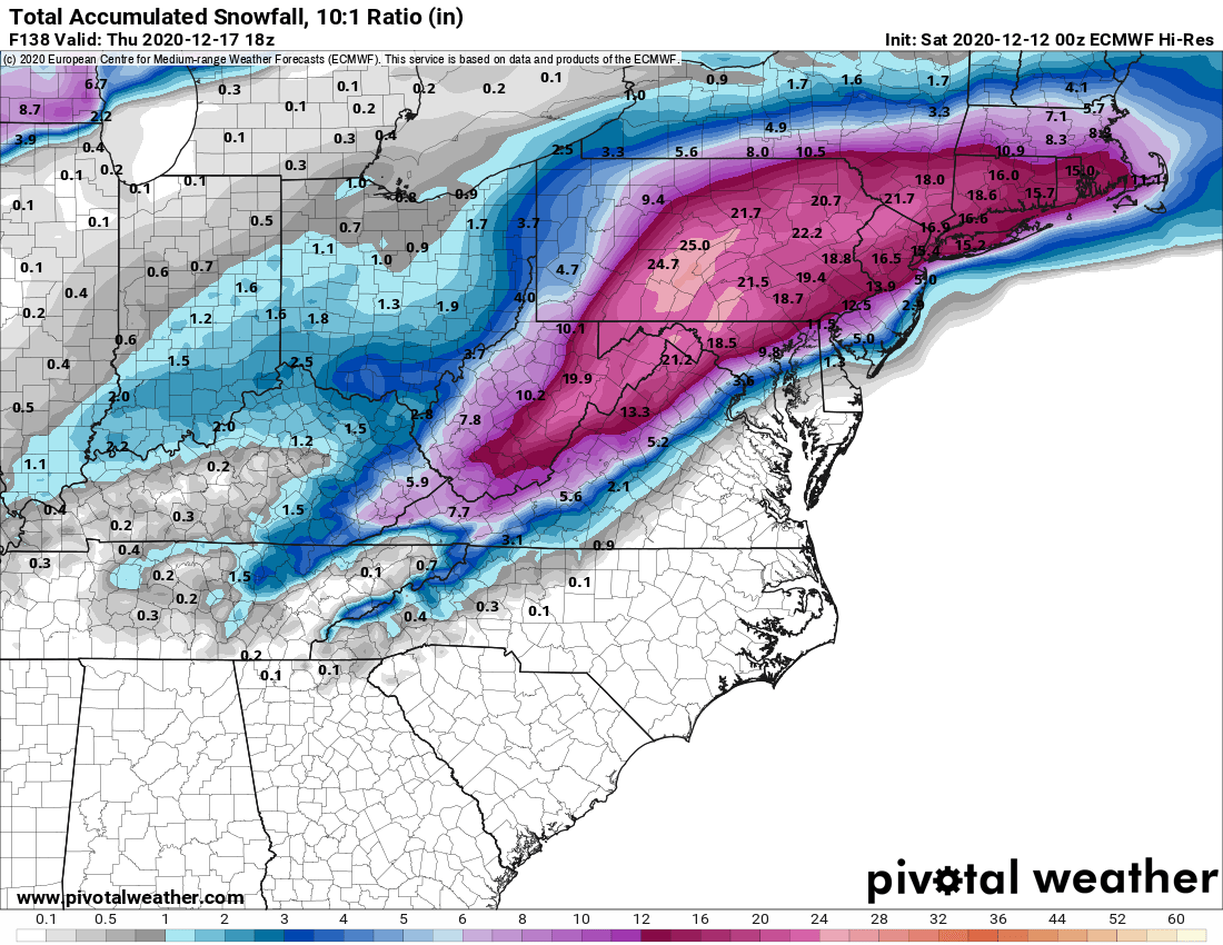
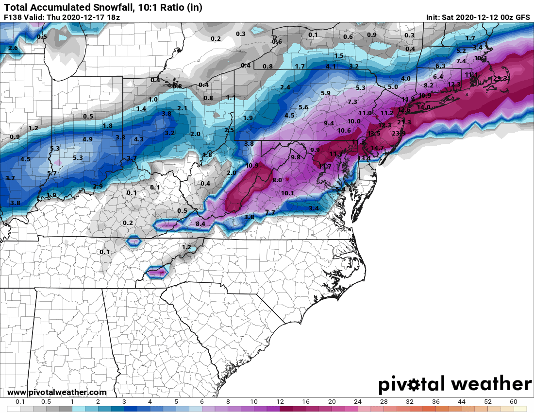
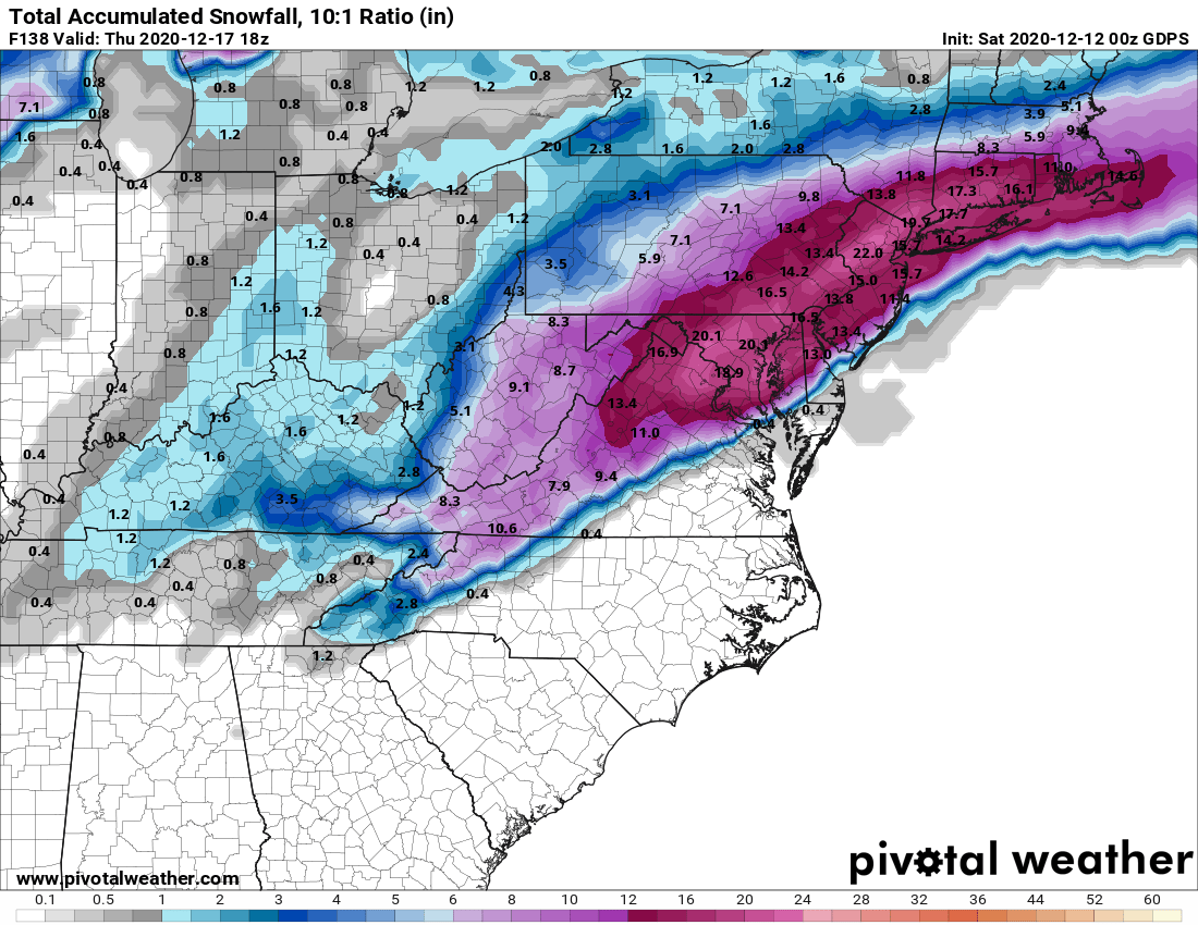
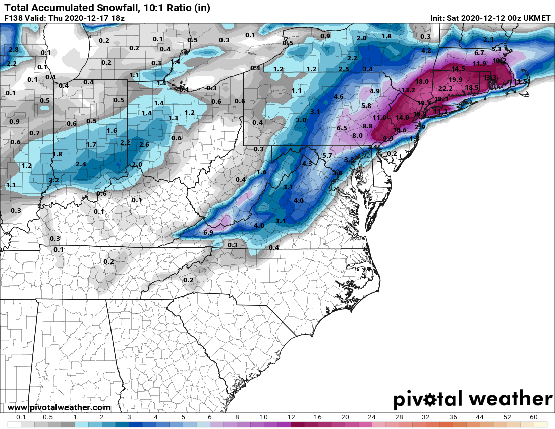
Specifically, the Euro is a major snowstorm NW of 95 (10"+) and a mix/rain along 95 and towards the coast. The Canadian is kind of the opposite, with a major snowstorm S/E of 95 (8"+) and several inches N/W of 95. The GFS shows mostly snow for everyone, but a bit less precip with a general 3-6" snowfall for most of the 95 corridor, with less towards the coast (some rain) and the UK is showing significant snowfall (3-6") only N of about 80 with sleet and mostly rain towards 95 and the coast. Lots more to come, I'm sure.
https://www.americanwx.com/bb/topic...-down-to-near-i80-next-week-14th-18th/page/5/