Was going to start a thread, but looks like Tango already has. No big deal, although it would be great,
@Tango Two if you could update the title as appropriate. Anyway, here's what I had drafted...
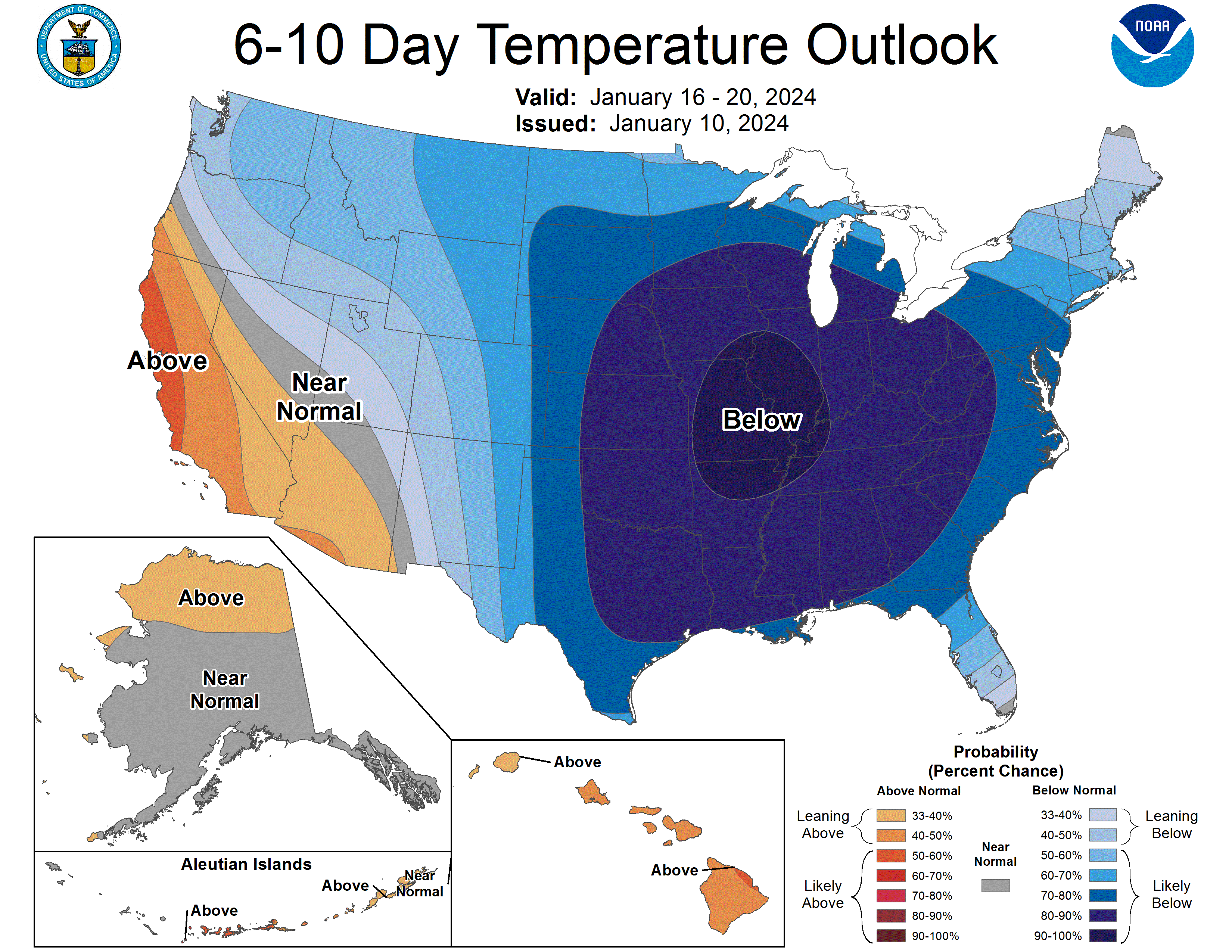
Well, the coming cold has been mentioned numerous times and it's now a lock for this Saturday (pm after the front/rainstorm) through at least next week, with below normal temps (but not the brutal temps they're about to get in the Plains/Midwest); see the CPC graphic below for Days 6-10 (and this continues out to day 14 for the most part). More importantly, for most, is that we now have a pretty strong signal from all of the models for a some snow or mix (or a miss is still possible) next Tuesday, although the details are quite variable as one would expect 5 days out.
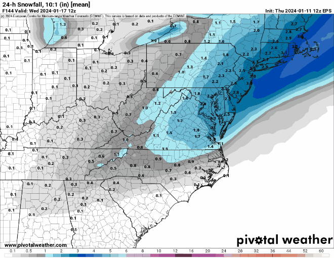
The Euro has consistently been showing a decent snowfall (3-6" or more range) for most of the area on Tuesday, 1/16, including the 95 corridor and the coast, for several model runs, while the other models have been all over the map (with most runs being complete misses or mostly rain), but their ensembles have been signaling a possible snowfall.
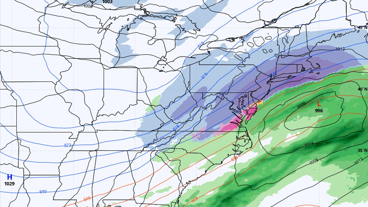
However, today's 12Z Euro shows a much flatter, suppressed whiff with all of the precip well to our SE, whereas the rest of today's 12Z model suite is showing something close to consensus, at least with regard to getting some snow for the whole area, with the GFS looking as snowy as the Euro has been for everyone (4-8" range) and the UK showing a decent snowstorm from 95 and NW, with less towards the coast due to mixing, while the CMC shows 95 being the battleground with good snows NW of 95 and nada just SE of 95 (like last Sat). But it's important to note that the 12Z Euro ensembles still show decent snow for everyone, possibly indicating that the 12Z Op run is a bit of an outlier. And the 18Z GFS is showing a significant snowstorm for everyone (6"+).
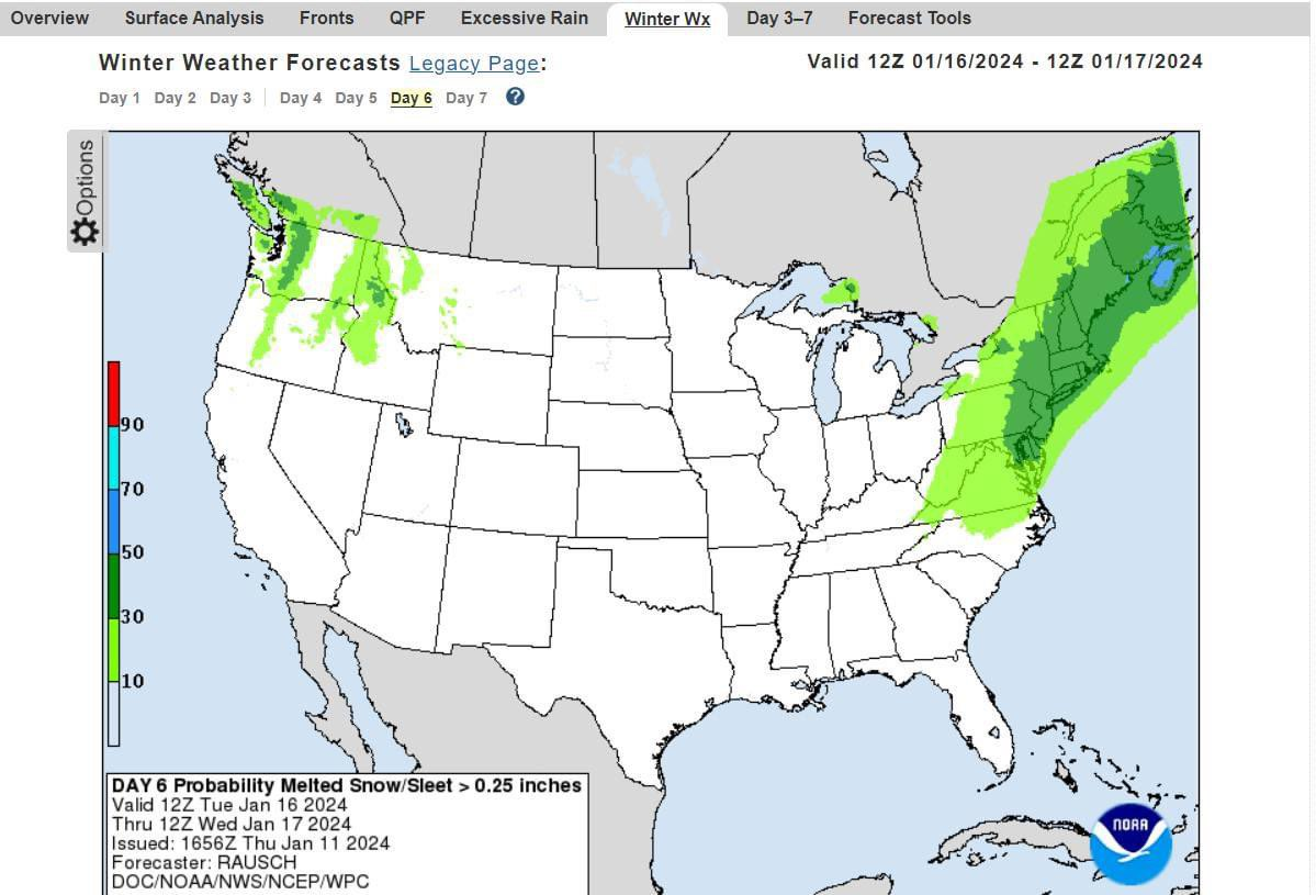
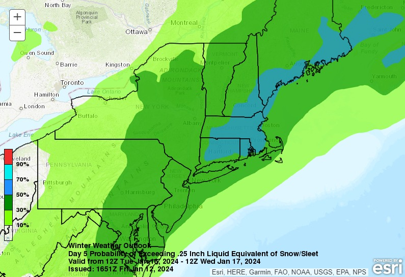
Also, the NWS has been pretty bullish on snow for Tuesday, as per the most recent guidance, below, and the map below showing an unusually high 30-50% probability of more than 2.5" of snow for our area on Tuesday, 5 days out. Still way too early for predictions, but this is the first time we've had a strong signal for cold and precip at the same time for the whole area in maybe 2 years (since 1/29/22). Biggest risk, IMO, is the strong confluence (high P) suppressing the storm to our south and missing or mostly missing us, as the Euro shows. Stay tuned as things will change, as they always do.
Area Forecast Discussion
National Weather Service Mount Holly NJ
429 PM EST Thu Jan 11 2024
High pressure will only briefly be in control as attention then
turns to a potential coastal low that looks to impact the area
sometime early to mid next week. Uncertainty remains with this
system, and model spread has actually increased with today`s 12z
guidance vs the 00z guidance. Although slight timing differences,
the GFS and Canadian are similar and closest to the coast with the
low. However, their ensembles are farther south and east. The latest
ECMWF is a big change from the previous run and shows a much weaker
low well offshore, leaving the area dry. This is the result of a
less amplified upper level trough and any energy out ahead of the
trough staying farther south off the southeast coast. Stuck
relatively close to NBM given the spread across guidance. PoPs are
capped at low end likely for the southern half of the area. Given
the cold air in place, taking a mean track between the ensembles and
deterministic guidance, excluding the ECMWF, precip type looks to be
snow across much of the area, with rain and/or snow across Long
Island. Did no want to jump on the ECMWF outlier yet, but this trend
will have to be monitored. At this time it is too early to talk
specific amounts. Behind this system, brief high pressure looks to
build in.