ADVERTISEMENT

The OFFICIAL March 13-14 Winter Weather Thread (This is the B1G 1)

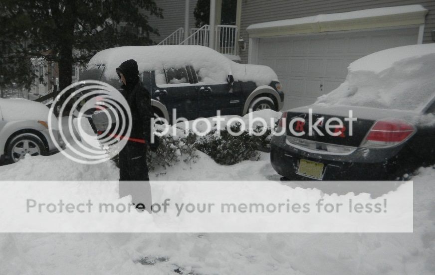
Just got in from 2-2.5 hours of clearing. The wind blown flat places on the driveway measured around 10 inches, with drifting up to 2 feet, so hard to tell just how much we got. had snow/sleet the whole time.

TylerShoveling_zps7wbvvxhq.jpg

You got the most important job done . The R's are clear on the Car !!!
 
Mt Holly new updated snowfall totals


NEW JERSEY

...ATLANTIC COUNTY...
BUENA VISTA TWP 1.1 947 AM 3/14 CO-OP OBSERVER

...BURLINGTON COUNTY...
EDGEWATER PARK 4.2 1038 AM 3/14 NWS EMPLOYEE
COOPERSTOWN 4.2 1044 AM 3/14 NWS EMPLOYEE
FLORENCE 4.0 415 AM 3/14 TRAINED SPOTTER
1 ESE CINNAMINSON TW 3.5 715 AM 3/14 COCORAHS
BURLINGTON 3.3 340 AM 3/14 NWS EMPLOYEE
MOUNT HOLLY WFO 3.3 836 AM 3/14 NWS OFFICE
3 ENE MOUNT LAUREL T 2.8 700 AM 3/14 COCORAHS
MOUNT LAUREL 2.8 700 AM 3/14 RETIRED MET
1 SE MOORESTOWN TWP 2.5 826 AM 3/14 COCORAHS
MOORESTOWN 2.3 808 AM 3/14 TRAINED SPOTTER
CINNAMINSON 2.0 230 AM 3/14 TRAINED SPOTTER
5 WNW TABERNACLE TWP 2.0 830 AM 3/14 COCORAHS
4 S EVESHAM TWP 1.2 700 AM 3/14 COCORAHS

...CAMDEN COUNTY...
COLLINGSWOOD 2.0 310 AM 3/14 SOCIAL MEDIA
1 ESE MERCHANTVILLE 2.0 700 AM 3/14 COCORAHS
2 SW BERLIN 0.8 900 AM 3/14 COCORAHS

...GLOUCESTER COUNTY...
WASHINGTON TWP 2.6 805 AM 3/14 TRAINED SPOTTER
3 W FRANKLIN TWP 1.5 700 AM 3/14 COCORAHS
W PITMAN 1.0 700 AM 3/14 COCORAHS
WEST DEPTFORD TWP 1.0 807 AM 3/14 TRAINED SPOTTER

...HUNTERDON COUNTY...
3 NNE HOLLAND TWP 6.9 830 AM 3/14 COCORAHS
1 S BETHLEHEM TWP 6.0 715 AM 3/14 COCORAHS
TEWKSBURY TWP 6.0 921 AM 3/14 TRAINED SPOTTER
1 NW CALIFON 5.9 845 AM 3/14 COCORAHS
READINGTON 5.3 815 AM 3/14 TRAINED SPOTTER
2 SE READINGTON TWP 5.1 730 AM 3/14 COCORAHS
3 SW LEBANON 5.0 700 AM 3/14 COCORAHS
4 N CLINTON TWP 5.0 800 AM 3/14 COCORAHS
3 N LEBANON 5.0 720 AM 3/14 COCORAHS
FLEMINGTON 4.7 720 AM 3/14 CHANGED OVER TO SLEET
E FLEMINGTON 4.7 630 AM 3/14 COCORAHS
3 NNE GLEN GARDNER 4.5 700 AM 3/14 COCORAHS
2 SE FLEMINGTON 3.8 700 AM 3/14 COCORAHS
1 N FRENCHTOWN 3.5 700 AM 3/14 COCORAHS

...MERCER COUNTY...
WEST WINDSOR TWP 5.5 805 AM 3/14 AMATEUR RADIO
2 S LAWRENCE TWP 5.0 900 AM 3/14 COCORAHS
1 ENE PENNINGTON 5.0 900 AM 3/14 COCORAHS
3 NNW WEST WINDSOR T 4.2 800 AM 3/14 COCORAHS
2 E PRINCETON 4.0 700 AM 3/14 COCORAHS
HAMILTON TWP 4.0 918 AM 3/14 SOCIAL MEDIA
EWING 4.0 605 AM 3/14 TOP 0.5 INCH WAS SLEET
SSW HOPEWELL 4.0 700 AM 3/14 COCORAHS
1 NNE EWING TWP 4.0 730 AM 3/14 COCORAHS
PENNINGTON 3.8 753 AM 3/14 SNOW AND SLEET
2 SSW LAWRENCE TWP 3.5 750 AM 3/14 COCORAHS
2 NW HOPEWELL TWP 3.0 700 AM 3/14 COCORAHS
MERCERVILLE 3.0 730 AM 3/14 CHANGED TO SLEET

...MIDDLESEX COUNTY...
1 W EDISON 7.5 945 AM 3/14 TRAINED SPOTTER
NE NEW BRUNSWICK 6.0 845 AM 3/14 COCORAHS
CRANBURY 5.6 858 AM 3/14 TRAINED SPOTTER
MONROE TWP 5.2 810 AM 3/14 TRAINED SPOTTER
PORT READING 5.0 914 AM 3/14 TRAINED SPOTTER
EAST BRUNSWICK 5.0 808 AM 3/14 TRAINED SPOTTER
1 NNE WOODBRIDGE TWP 4.2 600 AM 3/14 COCORAHS
MONMOUTH JUNCTION 4.0 755 AM 3/14 SNOW AND SLEET
PERTH AMBOY 3.8 808 AM 3/14 TRAINED SPOTTER
2 E NEW BRUNSWICK 3.7 800 AM 3/14 COCORAHS
OLD BRIDGE 3.6 811 AM 3/14 TRAINED SPOTTER
WSW SOUTH RIVER 3.5 700 AM 3/14 COCORAHS
1 ESE WOODBRIDGE TWP 3.1 700 AM 3/14 COCORAHS
5 NE OLD BRIDGE TWP 3.0 700 AM 3/14 COCORAHS
SOUTH BRUNSWICK 2.8 811 AM 3/14 TRAINED SPOTTER

...MONMOUTH COUNTY...
2 NNW COLTS NECK 4.0 823 AM 3/14 PUBLIC
MANALAPAN 2.5 507 AM 3/14 SOCIAL MEDIA
1 W LONG BRANCH 1.5 720 AM 3/14 COCORAHS
4 SSW HOWELL TWP 1.4 700 AM 3/14 COCORAHS

...MORRIS COUNTY...
KINNELON 11.0 945 AM 3/14 PUBLIC
BUTLER 11.0 1000 AM 3/14 TRAINED SPOTTER
GREEN POND 10.0 930 AM 3/14 TRAINED SPOTTER
JEFFERSON TWP 9.5 1032 AM 3/14 TRAINED SPOTTER
2 WSW LONG HILL TWP 9.0 930 AM 3/14 COCORAHS
CHATHAM 9.0 1118 AM 3/14 TRAINED SPOTTER
WHIPPANY 8.5 1105 AM 3/14 TRAINED SPOTTER
1 NE HANOVER TWP 8.0 930 AM 3/14 COCORAHS
1 ENE MINE HILL TWP 7.1 830 AM 3/14 COCORAHS
NE MINE HILL TWP 6.5 800 AM 3/14 COCORAHS
2 W MENDHAM 6.3 845 AM 3/14 COCORAHS
NNW ROCKAWAY 6.2 800 AM 3/14 COCORAHS
WNW FLORHAM PARK 5.6 800 AM 3/14 COCORAHS
1 W RANDOLPH TWP 5.5 758 AM 3/14 COCORAHS
4 W WASHINGTON TWP 5.4 700 AM 3/14 COCORAHS
1 ESE ROXBURY TWP 5.0 900 AM 3/14 COCORAHS
2 NNE DENVILLE TWP 5.0 800 AM 3/14 COCORAHS
2 E RANDOLPH TWP 4.9 800 AM 3/14 COCORAHS
1 NE ROCKAWAY TWP 4.5 745 AM 3/14 COCORAHS
MARCELLA 4.5 804 AM 3/14 TRAINED SPOTTER
1 NW BOONTON 4.3 700 AM 3/14 COCORAHS
2 ESE DENVILLE TWP 4.1 700 AM 3/14 COCORAHS
2 SW RANDOLPH TWP 4.0 700 AM 3/14 COCORAHS
1 NW CHATHAM 3.6 700 AM 3/14 COCORAHS
MADISON 3.5 807 AM 3/14 TRAINED SPOTTER

...OCEAN COUNTY...
BRICK TWP 4.0 811 AM 3/14 TRAINED SPOTTER
JACKSON TWP 3.0 630 AM 3/14 AMATEUR RADIO
6 NE MANCHESTER TWP 1.0 700 AM 3/14 COCORAHS
2 S JACKSON TWP 0.7 700 AM 3/14 COCORAHS

...SALEM COUNTY...
ELMER 0.5 740 AM 3/14 AMATEUR RADIO

...SOMERSET COUNTY...
3 ESE BEDMINSTER TWP 10.0 1045 AM 3/14 COCORAHS
BASKING RIDGE 10.0 910 AM 3/14 TRAINED SPOTTER
4 ENE FRANKLIN TWP 9.2 830 AM 3/14 COCORAHS
3 NW BRIDGEWATER TWP 7.3 900 AM 3/14 COCORAHS
WATCHUNG 6.0 1015 AM 3/14 SNOW AND SLEET
1 NNW BERNARDS TWP 4.9 800 AM 3/14 COCORAHS
4 NNW FRANKLIN TWP 4.7 700 AM 3/14 COCORAHS
3 NE FRANKLIN TWP 4.5 600 AM 3/14 COCORAHS
4 SE HILLSBOROUGH TW 4.5 800 AM 3/14 COCORAHS
5 ESE HILLSBOROUGH T 4.5 700 AM 3/14 COCORAHS
1 ENE BERNARDS TWP 4.5 700 AM 3/14 COCORAHS
2 SE BURNT MILLS 4.0 700 AM 3/14 COCORAHS

...SUSSEX COUNTY...
SUSSEX 17.5 1050 AM 3/14 SOCIAL MEDIA
5 NW WANTAGE 17.0 1057 AM 3/14 TRAINED SPOTTER
MONTAGUE 16.5 1059 AM 3/14 TRAINED SPOTTER
HIGHLAND LAKES 14.5 1025 AM 3/14 TRAINED SPOTTER
STOCKHOLM 13.0 1116 AM 3/14 TRAINED SPOTTER
NEWTON 11.0 944 AM 3/14 TRAINED SPOTTER
WANTAGE 10.8 804 AM 3/14 TRAINED SPOTTER
3 WNW MONTAGUE TWP 8.4 700 AM 3/14 COCORAHS
2 W ANDOVER TWP 7.0 740 AM 3/14 COCORAHS
2 SW WANTAGE TWP 7.0 700 AM 3/14 COCORAHS
3 SE HARDYSTON TWP 6.5 800 AM 3/14 COCORAHS

...WARREN COUNTY...
HACKETTSTOWN 10.0 1020 AM 3/14 TRAINED SPOTTER
WASHINGTON 9.0 948 AM 3/14 TRAINED SPOTTER
2 E BLAIRSTOWN TWP 6.3 755 AM 3/14 COCORAHS
1 ENE WASHINGTON 5.8 800 AM 3/14 COCORAHS
2 WSW LIBERTY TWP 5.4 700 AM 3/14 COCORAHS
RIEGELSVILLE 5.0 812 AM 3/14 TRAINED SPOTTER
2 S GREENWICH TWP 5.0 700 AM 3/14 COCORAHS
STEWARTSVILLE 5.0 700 AM 3/14 SOCIAL MEDIA
1 W HACKETTSTOWN 4.0 700 AM 3/14 COCORAHS

PENNSYLVANIA

...BERKS COUNTY...
HUFFS CHURCH 10.0 1030 AM 3/14 TRAINED SPOTTER
1 NNW HAMBURG 9.5 700 AM 3/14 COCORAHS
4 SW READING 9.0 800 AM 3/14 COCORAHS
5 WSW READING 9.0 700 AM 3/14 COCORAHS
3 SSW MOHNTON 8.7 800 AM 3/14 COCORAHS
4 N READING 8.1 812 AM 3/14 COCORAHS
SPRING TWP 8.0 605 AM 3/14 SOCIAL MEDIA
SINKING SPRING 7.5 615 AM 3/14 SOCIAL MEDIA
WEST LAWN 7.0 445 AM 3/14 EMERGENCY MNGR

...BUCKS COUNTY...
SPINNERSTOWN 9.0 1000 AM 3/14 TRAINED SPOTTER
1 WSW PENNDEL 6.0 700 AM 3/14 COCORAHS
GREENBROOK 5.7 936 AM 3/14 TRAINED SPOTTER
3 NNE LANGHORNE 4.0 630 AM 3/14 COCORAHS
NOTTINGHAM 3.3 1014 AM 3/14 DEOS

...CARBON COUNTY...
ALBRIGHTSVILLE 12.0 1056 AM 3/14 MIXED WITH SLEET.
1 NNE JIM THORPE 10.8 900 AM 3/14 COCORAHS
3 WSW LEHIGHTON 8.9 700 AM 3/14 COCORAHS

...CHESTER COUNTY...
3 W PHOENIXVILLE 6.7 800 AM 3/14 COCORAHS
1 SSW EAST NANTMEAL 6.0 830 AM 3/14 COCORAHS
EXTON 5.6 1036 AM 3/14 TRAINED SPOTTER
WARWICK 5.2 1015 AM 3/14 TRAINED SPOTTER
VALLEY FORGE 5.0 730 AM 3/14 AMATEUR RADIO
6 SSW POTTSTOWN 4.9 700 AM 3/14 COCORAHS
1 WNW BERWYN 4.7 800 AM 3/14 COCORAHS
2 SSE WEST CHESTER 4.5 815 AM 3/14 COCORAHS
PHOENIXVILLE 4.5 705 AM 3/14 AMATEUR RADIO
2 SW NOTTINGHAM 4.0 700 AM 3/14 COCORAHS
NW WICKERTON 4.0 800 AM 3/14 COCORAHS
3 SW CHADDS FORD 4.0 700 AM 3/14 COCORAHS
DEVAULT 3.9 1013 AM 3/14 DEOS
ATGLEN 3.4 1015 AM 3/14 DEOS
WEST CHESTER 3.2 1014 AM 3/14 DEOS

...DELAWARE COUNTY...
CHADDS FORD 5.7 902 AM 3/14 TRAINED SPOTTER
GARNET VALLEY 3.4 700 AM 3/14 COCORAHS
WSW GARNET VALLEY 3.4 700 AM 3/14 COCORAHS

...LEHIGH COUNTY...
LEHIGH VALLEY INTL A 9.6 800 AM 3/14 ASOS
EMMAUS 9.0 1116 AM 3/14 TRAINED SPOTTER
OREFIELD 9.0 435 AM 3/14 PUBLIC
2 ENE SCHNECKSVILLE 8.5 812 AM 3/14 COCORAHS
ALBURTIS 8.0 615 AM 3/14 TRAINED SPOTTER
2 SSE EMMAUS 8.0 940 AM 3/14 TRAINED SPOTTER
ALLENTOWN 7.2 800 AM 3/14 ASOS
1 N ALLENTOWN 7.0 545 AM 3/14 SOCIAL MEDIA

...MONROE COUNTY...
MOUNT POCONO 23.0 1108 AM 3/14 TRAINED SPOTTER
POCONO SUMMIT 14.0 1000 AM 3/14 TRAINED SPOTTER
SWIFTWATER 12.0 700 AM 3/14 SOCIAL MEDIA
1 NNE MONROE LAKE 12.0 1000 AM 3/14 PUBLIC
MARSHALLS CREEK 9.5 911 AM 3/14 SOCIAL MEDIA
4 W SAYLORSBURG 8.6 701 AM 3/14 COCORAHS
3 W SAYLORSBURG 8.1 800 AM 3/14 COCORAHS

...MONTGOMERY COUNTY...
ROYERSFORD 7.5 1045 AM 3/14 TRAINED SPOTTER
GRATERFORD 6.6 1030 AM 3/14 SNOW AND SLEET
1 W LIMERICK 6.3 830 AM 3/14 COCORAHS
1 NNE COLLEGEVILLE 6.1 700 AM 3/14 COCORAHS
LIMERICK TWP 6.0 855 AM 3/14 CURRENTLY HEAVY SLEET
3 SSW KULPSVILLE 6.0 700 AM 3/14 COCORAHS
KING OF PRUSSIA 5.8 1118 AM 3/14 SNOW AND SLEET
1 NW FORT WASHINGTON 5.5 900 AM 3/14 COCORAHS
AMBLER 5.5 943 AM 3/14 TRAINED SPOTTER
2 WSW SCHWENKSVILLE 5.3 800 AM 3/14 COCORAHS
4 WNW HARLEYSVILLE 5.2 700 AM 3/14 COCORAHS
JEFFERSONVILLE 5.0 730 AM 3/14 AMATEUR RADIO
PENN WYNNE 5.0 915 AM 3/14 SNOW AND SLEET
3 SW LANSDALE 4.5 830 AM 3/14 COCORAHS
NORRISTOWN 4.5 1031 AM 3/14 CO-OP OBSERVER
1 S GILBERTSVILLE 4.1 800 AM 3/14 COCORAHS
2 SW HARLEYSVILLE 4.0 700 AM 3/14 COCORAHS
LANSDALE 4.0 730 AM 3/14 AMATEUR RADIO
1 WSW NORTH WALES 3.5 700 AM 3/14 COCORAHS
2 NW BLUE BELL 3.0 905 AM 3/14 COCORAHS
WYNNEWOOD 2.0 200 AM 3/14 TRAINED SPOTTER

...NORTHAMPTON COUNTY...
2 SSE TATAMY 12.9 1100 AM 3/14 SNOW AND SLEET
NAZARETH 12.5 945 AM 3/14 PUBLIC
BUSHKILL TWP 11.2 1054 AM 3/14 TRAINED SPOTTER
1 NNW NORTHAMPTON HE 10.0 943 AM 3/14 PUBLIC
HELLERTOWN 8.8 1030 AM 3/14 SNOW AND SLEET
MARTINS CREEK 7.7 913 AM 3/14 SOCIAL MEDIA
1 W NAZARETH 7.0 1000 AM 3/14 COCORAHS
4 S ACKERMANVILLE 6.2 811 AM 3/14 1/4SM VIS
3 WNW PORTLAND 6.1 700 AM 3/14 COCORAHS
E MARTINS CREEK 5.7 700 AM 3/14 COCORAHS

...PHILADELPHIA COUNTY...
PHILADELPHIA FIRE 66 5.0 1023 AM 3/14 FIRE DEPT/RESCUE
PHILADELPHIA INTL AI 3.9 800 AM 3/14 ASOS
PHILADELPHIA OEM 3.9 711 AM 3/14 EMERGENCY MNGR
PHILADELPHIA FIRE 54 3.0 255 AM 3/14 FIRE DEPT/RESCUE
5 NE PHILADELPHIA 3.0 700 AM 3/14 COCORAHS
PHILADELPHIA FIRE 73 2.5 405 AM 3/14 FIRE DEPT/RESCUE


***********************STORM TOTAL ICE***********************

LOCATION STORM TOTAL TIME/DATE COMMENTS
ICE OF
/INCHES/ MEASUREMENT

DELAWARE

...NEW CASTLE COUNTY...
GLASGOW 0.30 1054 AM 3/14 TRAINED SPOTTER
NEWARK 0.20 645 AM 3/14 SOCIAL MEDIA
NEW CASTLE COUNTY AI 0.18 909 AM 3/14 ASOS

NEW JERSEY

...BURLINGTON COUNTY...
MOUNT HOLLY WFO 0.25 1009 AM 3/14 RADIAL ON TREE BRANCHES
MOUNT LAUREL T 700 AM 3/14 RETIRED MET

...CAMDEN COUNTY...
CHESILHURST 0.40 1036 AM 3/14 PUBLIC

...MERCER COUNTY...
TRENTON AIRPORT T 934 AM 3/14 ASOS

...MIDDLESEX COUNTY...
OUTCALT T 445 AM 3/14 PUBLIC
HIGHLAND PARK T 857 AM 3/14 TRAINED SPOTTER

PENNSYLVANIA

...CHESTER COUNTY...
2 ENE LANDENBERG 0.20 845 AM 3/14 2-HR ACCRETION AMOUNT

...MONTGOMERY COUNTY...
ROYERSFORD 0.10 1045 AM 3/14 TRAINED SPOTTER

...NORTHAMPTON COUNTY...
1 NNW NORTHAMPTON HE 0.10 943 AM 3/14 PUBLIC
NAZARETH T 941 AM 3/14 PUBLIC

...PHILADELPHIA COUNTY...
PHILADELPHIA INTL AI 0.14 939 AM 3/14 ASOS
NE PHILADELPHIA AIRP 0.01 938 AM 3/14 ASOS

Bac, where can I go to update these numbers?
 
Snowing again in northern bergen county, gonna fire up the snowblower after an early dinner.
 
Last edited:
It's snowing fairly heavy here in Wayne right now - I just got up, had to crash for an hour or so after moving that heavy crap. Glad i wore my belt while doing it. Looks like we'll have a few more inches to move when we go out around 6-7.
 
I wouldn't call it a bust. Some areas got pounded . Some areas didn't. It's not like the storm didn't show.
When many areas were supposed to get 18in and didn't come close yes thats a bust. When two NJ counties that were first to get the blizzard warning and inly got rain. Thats a bust. Mt Pocono is the only place that got 2ft when much more were supposed to get that and barley got 1/2 , than yes that os a bust. Small, low populated areas got what was forcast.
 
  • Like
Reactions: T2Kplus10
As a small aside, TWC did pretty well on both of these busted storms - much better than anyone else. However, I still see tons of disparaging remarks about them on the weather boards. They went down the tubes many years ago, but they've hired some top notch talent over the past 5 years and really do a very nice job, especially with their experts and the Wunderground show.
Interesting. I gave up on them many years ago when they turned their broadcasts into a weather version of the Today Show and didn't look back. I tuned in last night as people (including you I think) noted they weren't as bullish as the local mets. And they were actually focused on the weather happening now, not storm stories or some other fluff. I'll have to give them another chance.
 
  • Like
Reactions: RU848789
The third consecutive complete bust here in Delaware. The predicted 6-12 late last night turned into 2 inch of sleet. Its gotta be nice to be consistently wrong and remain employed. We don't need trained meteorologists to regurgitate model results..
 
The third consecutive complete bust here in Delaware. The predicted 6-12 late last night turned into 2 inch of sleet. Its gotta be nice to be consistently wrong and remain employed. We don't need trained meteorologists to regurgitate model results..
In Major League Baseball they have a name for somebody who does that about 70% of the time...All-Star. :stuck_out_tongue_winking_eye:
 
The third consecutive complete bust here in Delaware. The predicted 6-12 late last night turned into 2 inch of sleet. Its gotta be nice to be consistently wrong and remain employed. We don't need trained meteorologists to regurgitate model results..
Well, I guess the 2 inches of sleet would have been 6 inches of snow or close to it
 
Well we just cleared another 3 inches of concrete off the driveway. That finishes it.
 
because there seems to be no accountability in weather forecasting anymore. They do not do the hard work. Was that Curren or another guy? I find News 12 to be pretty awful

and Nick Gregory doubled down on 12-20 last night as he went off the air, he said he said he saw new data (presumably the NAM/RGEM) and he was going to hold firm with his forecast.

I will give some credit to Lee Goldberg who was mentioning the mix possibility up to NYC and hedging on the big amounts and Bill Evans was the first met to step to the plate and bring NYC totals down to 3-6 this morning
FWIW, Monday evening Bill Evans was mentioning warmer than normal ocean waters in the area and that could effect possible mixing precip, especially if the storm kept tracking closer to shore. Get that man a cigar.
 
I don't do many good deeds so I need to do a few but anything around 18-24 inches will require me to do my driveway 2-3 times since my snowblower isn't the greatest. I guess I just need to take my time.
I'm 65 in Albany NY area and we've gotten hammered...I've been shoveling all day to keep up but if you have strength you've been blessed...share it with the lamb and you'll be compensated 10 fold in your mind and by God...I hate having to shovel but thankful I'm strong and able...I'll be up at 5am again doing it as the plows will pile my driveway back in again...you sound like the good neighbor and Samaritan we all should be...my mom's 84 and I hope someone would spare her...God bless...we have 22 inches and still coming...
 
  • Like
Reactions: Abro1975
I'm 65 in Albany NY area and we've gotten hammered...I've been shoveling all day to keep up but if you have strength you've been blessed...share it with the lamb and you'll be compensated 10 fold in your mind and by God...I hate having to shovel but thankful I'm strong and able...I'll be up at 5am again doing it as the plows will pile my driveway back in again...you sound like the good neighbor and Samaritan we all should be...my mom's 84 and I hope someone would spare her...God bless...we have 22 inches and still coming...
 
  • Like
Reactions: NickyNewark51
How much did you get? I thought about going up to ski hunter but heard the Catskills were going to get hammered. My SUV broke down so didn't want to chance getting stuck going up in the Accord.
 
  • Like
Reactions: NickyNewark51
My question to the knowledge weather geeks.
I understand a cold shot of air for a day or two, that happens in April as well, but usually you get a nice look at spring temps shortly thereafter.
From what I'm seeing, ten days out from today is still way, way below normal...what's up and when do we hit 60 again?
 
How much did you get? I thought about going up to ski hunter but heard the Catskills were going to get hammered. My SUV broke down so didn't want to chance getting stuck going up in the Accord.
Should end up 23 to 27 inches? At least 18/20 and still coming until midmorning in bands...everything was closed...good thing you didn't come today..it would've been a disaster...trucks are temporarily BANNED on the throughway....
 
Should end up 23 to 27 inches? At least 18/20 and still coming until midmorning in bands...everything was closed...good thing you didn't come today..it would've been a disaster...trucks are temporarily BANNED on the throughway....
Now I feel better. Was pissed I didn't go up when hunter website said 30 inches today, but I had to get back to work by 11:00 tomorrow in central jersey.
 
  • Like
Reactions: NickyNewark51
My question to the knowledge weather geeks.
I understand a cold shot of air for a day or two, that happens in April as well, but usually you get a nice look at spring temps shortly thereafter.
From what I'm seeing, ten days out from today is still way, way below normal...what's up and when do we hit 60 again?

The answer is don't put any stock in forecasts ten days out. About ten days ago when we were milder than average I looked at the fifteen day extended forecast on my weather app and there were no days with high temps lower than the 50s in the entire forecast, which extended up through the middle of March. I remarked to my son that the extended forecast looked good all the way into the second half of March, so maybe we were finished with days only in the 30s (or worse) for this winter. Ha. A week later came the start of this cold snap. I should have known better. I typically don't pay much attention to forecasts more than two or three days out. Over the years it's been my observation that with long range forecasts they tend to rely heavily (over rely) on a continuation of whatever the current trend is at the time of the forecast, be it cold, warm, whatever.
 
Then Bryan Norcross didn't see the PowerPoint advisory that PHI (Gary) distributed via social media 48 hours before the storm that pretty much nailed everything.

One of the things that was previously unsettled was the inter-organizational boundary between NHC and the local NWS offices. Sandy revealed that gap. Everybody looks to Coral Gables for the wisdom of the ages when it comes to hurricanes, but they don't have the local knowledge necessary to accurately detail the effects of storm surge on specific locales. The Shrewsbury River and Sea Bright / Monmouth Beach are a great example. That system doesn't behave "typically", there's a level of experience required to fully understand what it's going to do under any given set of circumstances.

Raritan Bay is another perfect example. Nobody at the NHC thought that the northwestern bayshore was going to see 18' of water - they gave it no special consideration. But if you've lived in the area long enough you know that the Bay is a funnel that thrives on a long easterly fetch and storm surges from roughly Keyport up through Sayreville are typically a multiple of the surge further down the coast.

I believe there's been a better detailing of the RACI for tropical systems that allows local NWS office feedback into the NHC forecasts, and Mt. Holly (for one) now has yearly meetings for local emergency managers to discuss communications procedures and responses. Probably, it took something like a Sandy to make everyone pay attention to the fact that we'd been underthinking tropical systems in this part of the country.

Then, of course, there's the small matter of semantics. Recall that Sandy was, technically, not a hurricane when it rolled up on the Jersey Shore. NHC should have backed off and performed a formal handoff to the local NWS offices - but, as we know, they did not.

Thanks for the insights. You're absolutely right on the inter-organizational issues and especially the policy, since changed, that kept the NWS from issuing hurricane watches or warnings, because Sandy was forecast to morph into a nor'easter right before landfall. Given that this was a once in 500 year storm for our area and there wasn't much experience in how to handle it and communicate about it, it's not surprising that some mistakes were made - and many of these have led to improvements.

However, if you read his blog and still have the same opinion of the NWS performance regarding Sandy (both the NYC and Philly offices), I'll be surprised. Norcross documents, painstakingly, the procedural, technical and communications errors that occurred (perhaps a bit overdramatically, but that's secondary) and led to confusion and lack of preparation/awareness. The NHC doesn't come off as perfect either, as you noted.

I'll highlight one particular passage that includes a couple of the points that he made about the Mt. Holly forecast leading up to landfall that were problematic.

Unfortunately, when Mt. Holly upgraded to a Warning for the Jersey Shore at 5:08 PM Saturday, they quit forecasting storm surge numbers altogether and switched exclusively to the height above MLLW. And, they did NOT adopt the higher NHC forecast! Mt. Holly forecast 9.0 to 9.5 feet above MLLW for Monday morning at Sandy Hook, NJ (which is LOWER than Irene’s peak) and 8.0 feet for Monday evening (much lower than Irene). Strange but true. The final height above MLLW during the worst of Sandy that Monday evening was at least 13.5 feet.

So Mt. Holly had a terrible forecast AND a bad communications policy AND ignored the superior numbers issued by the National Hurricane Center. A triple-colossal systemic failure.

It is true that people along the Jersey Shore who are used to looking at tide gauges understand the “above-MLLW” numbers. But it’s inexplicable and inexcusable that an average person needs a Master’s Degree in Storm Surge to decipher public warnings for a life-threatening event like Sandy. Not to mention the terrible forecasts.

You might think… surely they put information in the bulletin explaining how to convert from the MLLW numbers in the new forecast to the storm surge numbers in their previous forecasts (in this area subtract about 4 to 5 feet). Nope. Surely has left the building.


https://www.wunderground.com/blog/bnorcross/unraveling-the-sandy-stormsurge-forecast
 
WASHINGTON (AP) — Before the first snow fell, U.S. meteorologists realized there was a good chance the late-winter storm wasn’t going to produce giant snow totals in big Northeast cities as predicted.


But they didn’t change their forecasts because they said they didn’t want to confuse the public.


National Weather Service meteorologists in Boston, New York, Philadelphia and Washington held a conference call Monday afternoon about computer models that dramatically cut predicted snow amounts. They decided to keep the super snowy warnings.


“Out of extreme caution we decided to stick with higher amounts,” Greg Carbin, chief of forecast operations at the Weather Prediction Center in suburban Maryland, told The Associated Press. “I actually think in the overall scheme that the actions (by states and cities) taken in advance of the event were exceptional.”


On Monday, the weather service predicted 18 to 24 inches of snow in New York City. By late Tuesday afternoon, Central Park was covered with a little more than 7 inches of snow with rain and sleet still falling. Other areas, including upstate New York and Connecticut, received more than a foot and a half of snow. Swaths of Pennsylvania were walloped by 20 to 30 inches of snow.


Carbin said a last-minute change downgrading snowfall totals might have given people the wrong message that the storm was no longer a threat. It still was, but real danger was from ice and sleet in places like New York City and Washington, he said.


Dramatically changing forecasts in what meteorologists call “the windshield wiper effect” only hurts the public, said Bob Henson, a meteorologist for the private Weather Underground.


Carbin stood by the decision.


“The nature of the beast is that there’s always uncertainty in every forecast and we have to get better at describing that,” Carbin said.


The right amount of precipitation fell, but it came down as rain and sleet because the rain-snow line moved inland, according to Carbin and private forecasters.


The rain-snow line is a 50 mile wide north-south swath where cold Arctic air from the north and west clashes with warm, moist air from the Atlantic. West of the snow line saw heavy snow while east had rain and sleet.


The snow line happens to center on New York City so it was a bigger deal than if the line had been over a rural area, said private meteorologist Ryan Maue of WeatherBell Analytics .


Private forecast outfits said the National Weather Service did a good job forecasting a tough storm despite the beating the federal agency took on social media.


“Overall the range of the forecast was very solid. It ended up being on the low end,” Henson said. “I understand why people can be frustrated when the expectation is the big storm.”


University of Georgia meteorology professor Marshall Shepherd, host of the television show “Weather Geeks,” said the public focused too much on worst-case scenarios.


“The perception of ‘bust’ is that it didn’t materialize for New York in the manner expected. Much of the expected snow fell as sleet,” Shepherd said in an email. “To me, ice is a far greater hazard. If a pitcher throws a strike down the center of the plate or just off the outside corner, it’s still a strike. “
 
  • Like
Reactions: T2Kplus10
The answer is don't put any stock in forecasts ten days out. About ten days ago when we were milder than average I looked at the fifteen day extended forecast on my weather app and there were no days with high temps lower than the 50s in the entire forecast, which extended up through the middle of March. I remarked to my son that the extended forecast looked good all the way into the second half of March, so maybe we were finished with days only in the 30s (or worse) for this winter. Ha. A week later came the start of this cold snap. I should have known better. I typically don't pay much attention to forecasts more than two or three days out. Over the years it's been my observation that with long range forecasts they tend to rely heavily (over rely) on a continuation of whatever the current trend is at the time of the forecast, be it cold, warm, whatever.

Well said. There's a reason no serious forecasters issue forecasts beyond 7 days - they're simply so inaccurate for any specific day that they're not worth issuing.

Now, that doesn't mean patterns/trends can't be seen for 8-15 days out - just look at the thread I started on the wintry pattern on 3/7, which I started commenting on on 3/5 in a previous weather thread), as I had seen some really interesting write-ups on the coming pattern back on 3/3 or so. And while we didn't quite get the giant blizzard today, the past two snowstorms certainly more than delivered way above average cold and snow for mid-March.

https://rutgers.forums.rivals.com/threads/ot-wintry-pattern-for-3-10-3-17-or-so.120505/
 
WASHINGTON (AP) — Before the first snow fell, U.S. meteorologists realized there was a good chance the late-winter storm wasn’t going to produce giant snow totals in big Northeast cities as predicted.


But they didn’t change their forecasts because they said they didn’t want to confuse the public.


National Weather Service meteorologists in Boston, New York, Philadelphia and Washington held a conference call Monday afternoon about computer models that dramatically cut predicted snow amounts. They decided to keep the super snowy warnings.


“Out of extreme caution we decided to stick with higher amounts,” Greg Carbin, chief of forecast operations at the Weather Prediction Center in suburban Maryland, told The Associated Press. “I actually think in the overall scheme that the actions (by states and cities) taken in advance of the event were exceptional.”


On Monday, the weather service predicted 18 to 24 inches of snow in New York City. By late Tuesday afternoon, Central Park was covered with a little more than 7 inches of snow with rain and sleet still falling. Other areas, including upstate New York and Connecticut, received more than a foot and a half of snow. Swaths of Pennsylvania were walloped by 20 to 30 inches of snow.


Carbin said a last-minute change downgrading snowfall totals might have given people the wrong message that the storm was no longer a threat. It still was, but real danger was from ice and sleet in places like New York City and Washington, he said.


Dramatically changing forecasts in what meteorologists call “the windshield wiper effect” only hurts the public, said Bob Henson, a meteorologist for the private Weather Underground.


Carbin stood by the decision.


“The nature of the beast is that there’s always uncertainty in every forecast and we have to get better at describing that,” Carbin said.


The right amount of precipitation fell, but it came down as rain and sleet because the rain-snow line moved inland, according to Carbin and private forecasters.


The rain-snow line is a 50 mile wide north-south swath where cold Arctic air from the north and west clashes with warm, moist air from the Atlantic. West of the snow line saw heavy snow while east had rain and sleet.


The snow line happens to center on New York City so it was a bigger deal than if the line had been over a rural area, said private meteorologist Ryan Maue of WeatherBell Analytics .


Private forecast outfits said the National Weather Service did a good job forecasting a tough storm despite the beating the federal agency took on social media.


“Overall the range of the forecast was very solid. It ended up being on the low end,” Henson said. “I understand why people can be frustrated when the expectation is the big storm.”


University of Georgia meteorology professor Marshall Shepherd, host of the television show “Weather Geeks,” said the public focused too much on worst-case scenarios.


“The perception of ‘bust’ is that it didn’t materialize for New York in the manner expected. Much of the expected snow fell as sleet,” Shepherd said in an email. “To me, ice is a far greater hazard. If a pitcher throws a strike down the center of the plate or just off the outside corner, it’s still a strike. “
Stupid logic for hiding the truth.
 
  • Like
Reactions: bac2therac
WASHINGTON (AP) — Before the first snow fell, U.S. meteorologists realized there was a good chance the late-winter storm wasn’t going to produce giant snow totals in big Northeast cities as predicted.


But they didn’t change their forecasts because they said they didn’t want to confuse the public.


National Weather Service meteorologists in Boston, New York, Philadelphia and Washington held a conference call Monday afternoon about computer models that dramatically cut predicted snow amounts. They decided to keep the super snowy warnings.


“Out of extreme caution we decided to stick with higher amounts,” Greg Carbin, chief of forecast operations at the Weather Prediction Center in suburban Maryland, told The Associated Press. “I actually think in the overall scheme that the actions (by states and cities) taken in advance of the event were exceptional.”


On Monday, the weather service predicted 18 to 24 inches of snow in New York City. By late Tuesday afternoon, Central Park was covered with a little more than 7 inches of snow with rain and sleet still falling. Other areas, including upstate New York and Connecticut, received more than a foot and a half of snow. Swaths of Pennsylvania were walloped by 20 to 30 inches of snow.


Carbin said a last-minute change downgrading snowfall totals might have given people the wrong message that the storm was no longer a threat. It still was, but real danger was from ice and sleet in places like New York City and Washington, he said.


Dramatically changing forecasts in what meteorologists call “the windshield wiper effect” only hurts the public, said Bob Henson, a meteorologist for the private Weather Underground.


Carbin stood by the decision.


“The nature of the beast is that there’s always uncertainty in every forecast and we have to get better at describing that,” Carbin said.


The right amount of precipitation fell, but it came down as rain and sleet because the rain-snow line moved inland, according to Carbin and private forecasters.


The rain-snow line is a 50 mile wide north-south swath where cold Arctic air from the north and west clashes with warm, moist air from the Atlantic. West of the snow line saw heavy snow while east had rain and sleet.


The snow line happens to center on New York City so it was a bigger deal than if the line had been over a rural area, said private meteorologist Ryan Maue of WeatherBell Analytics .


Private forecast outfits said the National Weather Service did a good job forecasting a tough storm despite the beating the federal agency took on social media.


“Overall the range of the forecast was very solid. It ended up being on the low end,” Henson said. “I understand why people can be frustrated when the expectation is the big storm.”


University of Georgia meteorology professor Marshall Shepherd, host of the television show “Weather Geeks,” said the public focused too much on worst-case scenarios.


“The perception of ‘bust’ is that it didn’t materialize for New York in the manner expected. Much of the expected snow fell as sleet,” Shepherd said in an email. “To me, ice is a far greater hazard. If a pitcher throws a strike down the center of the plate or just off the outside corner, it’s still a strike. “

Was just about to post this, thanks; link is below. Interesting dilemma forecasters always have with the need to warn appropriately, but also how to convey the uncertainty in any forecast without diluting the message. Given that for most people in the I-95 corridor, who got the forecasted amounts, by mass or liquid equivalent of total frozen precip (even if it was 1/3 snow and 2/3 sleet by mass), I actually think the forecast, while clearly off in the amount of snow, wasn't horrible, given that the impacts were pretty similar - just ask anyone who shoveled, plowed or drove around today.

Obviously, for folks closer to the coast, the forecast of several to many inches of snow and blizzad conditions, who got almost all or all rain, was really bad. And the forecast was excellent for areas like the Poconos, Sussex and parts of Warren, Morris, and Passaic, and the Lehigh Valley, as well as the Hudson Valley, where mostly snow (16-24") fell.

Having said all that, I do think the NWS could have conveyed the same seriousness about the storm with a 12-18" forecast instead of a 18-24" forecast for many (especially given the doubts on those forecasts as was well discussed in this thread the day/night before) and then the "bust" wouldn't have appeared to be as bad. I also think they could've been quicker to adjust their forecast this morning when it was crystal clear that the entire I-95 corridor was going to get much less snow and a lot more sleet - could've done that at 5 am and not 8 am.

https://apnews.com/8e8516da51234851...-decided-last-minute-not-to-cut-snow-forecast
 
Well said. There's a reason no serious forecasters issue forecasts beyond 7 days - they're simply so inaccurate for any specific day that they're not worth issuing.

Now, that doesn't mean patterns/trends can't be seen for 8-15 days out - just look at the thread I started on the wintry pattern on 3/7, which I started commenting on on 3/5 in a previous weather thread), as I had seen some really interesting write-ups on the coming pattern back on 3/3 or so. And while we didn't quite get the giant blizzard today, the past two snowstorms certainly more than delivered way above average cold and snow for mid-March.

https://rutgers.forums.rivals.com/threads/ot-wintry-pattern-for-3-10-3-17-or-so.120505/
Like you think I didn't see what you tried to do here....

th
 
And why is Passaic County never on that report? Is there another report that has it?
its not in any of the previous reports either.....there was must some serious lack of weenies in that town

That report is from the Mt Holly NWS office. Passaic, Bergen, Essex, Hudson, and Union counties are covered by the Upton NWS office. You can find their report here: http://forecast.weather.gov/product.php?site=NWS&issuedby=OKX&product=PNS

Thank you! Where can I find this for the New York metro area? (e.g. Bergen County).

Upton NWS: http://forecast.weather.gov/product.php?site=NWS&issuedby=OKX&product=PNS
 
its not in any of the previous reports either.....there was must some serious lack of weenies in that town
Passaic is part of the NWS-NYC office...Wayne is in there, @DJ Spanky

http://forecast.weather.gov/product.php?site=NWS&issuedby=OKX&product=PNS

********************STORM TOTAL SNOWFALL********************

LOCATION STORM TOTAL TIME/DATE COMMENTS
SNOWFALL OF
/INCHES/ MEASUREMENT

NEW JERSEY

...BERGEN COUNTY...
RAMSEY 13.3 418 PM 3/14 TRAINED SPOTTER
WESTWOOD 13.0 648 PM 3/14 TRAINED SPOTTER
RIDGEWOOD 11.5 418 PM 3/14 TRAINED SPOTTER
FRANKLIN LAKES 10.8 256 PM 3/14 TRAINED SPOTTER
ALLENDALE 10.5 419 PM 3/14 TRAINED SPOTTER
ENGLEWOOD 10.4 234 PM 3/14 SOCIAL MEDIA
RIVER VALE 9.9 516 PM 3/14 TRAINED SPOTTER
SADDLE BROOK 9.4 419 PM 3/14 TRAINED SPOTTER
MIDLAND PARK 9.0 614 PM 3/14 TRAINED SPOTTER
HARRINGTON PARK 8.3 420 PM 3/14 TRAINED SPOTTER
EAST RUTHERFORD 6.1 854 PM 3/14 TRAINED SPOTTER

...ESSEX COUNTY...
IRVINGTON 15.0 718 PM 3/14 PUBLIC
ROSELAND 13.4 516 PM 3/14 PUBLIC
ESSEX FELLS 13.1 446 PM 3/14 PUBLIC
CEDAR GROVE 10.4 716 PM 3/14 PUBLIC
NORTH CALDWELL 9.0 530 PM 3/14 TRAINED SPOTTER
WEST ORANGE 8.5 330 PM 3/14 TRAINED SPOTTER
MILLBURN 8.0 853 PM 3/14 PUBLIC

...HUDSON COUNTY...
HOBOKEN 8.1 631 PM 3/14 TRAINED SPOTTER
HARRISON 7.2 500 PM 3/14 CO-OP OBSERVER
NORTH BERGEN 7.0 254 PM 3/14 TRAINED SPOTTER

...PASSAIC COUNTY...
WEST MILFORD 15.8 804 PM 3/14 TRAINED SPOTTER
RINGWOOD 14.0 500 PM 3/14 TRAINED SPOTTER
WAYNE 12.3 739 PM 3/14 TRAINED SPOTTER
WANAQUE 12.0 416 PM 3/14 TRAINED SPOTTER
BLOOMINGDALE 10.3 330 PM 3/14 TRAINED SPOTTER
HAWTHORNE 9.8 330 PM 3/14 TRAINED SPOTTER

...UNION COUNTY...
ELIZABETH 9.2 315 PM 3/14 TRAINED SPOTTER
NEWARK AIRPORT 6.7 812 PM 3/14 ASOS

NEW YORK

...BRONX COUNTY...
BRONX 10.0 514 PM 3/14 PUBLIC
PARKCHESTER 9.0 815 PM 3/14 PUBLIC

...KINGS COUNTY...
MARINE PARK 6.5 646 PM 3/14 PUBLIC
MIDWOOD 6.0 740 PM 3/14 PUBLIC

...NASSAU COUNTY...
GREAT NECK 4.3 322 PM 3/14 TRAINED SPOTTER
CARLE PLACE 4.2 100 PM 3/14 TRAINED SPOTTER
JERICHO 4.0 633 PM 3/14 PUBLIC

...NEW YORK COUNTY...
CENTRAL PARK 7.6 813 PM 3/14 PARK CONSERVANCY

...ORANGE COUNTY...
MIDDLETOWN 24.0 717 PM 3/14 PUBLIC
OTISVILLE 24.0 140 PM 3/14 PUBLIC
MONTGOMERY 23.5 233 PM 3/14 AMATEUR RADIO
MOUNT HOPE 23.0 233 PM 3/14 AMATEUR RADIO
GOSHEN 22.0 446 PM 3/14 TRAINED SPOTTER
SALISBURY MILLS 20.5 800 PM 3/14 TRAINED SPOTTER
GARDNERTOWN 20.0 330 PM 3/14 TRAINED SPOTTER
HIGHLAND MILLS 19.3 634 PM 3/14 TRAINED SPOTTER
WARWICK 19.0 741 PM 3/14 TRAINED SPOTTER
CORNWALL LANDING 18.0 400 PM 3/14 TRAINED SPOTTER
BEREA 17.5 522 PM 3/14 TRAINED SPOTTER
NEW WINDSOR 17.0 256 PM 3/14 PUBLIC
ORANGE LAKE 16.5 100 PM 3/14 TRAINED SPOTTER

...PUTNAM COUNTY...
COLD SPRING 14.6 502 PM 3/14 TRAINED SPOTTER
MAHOPAC 13.8 900 PM 3/14 AMATEUR RADIO

...QUEENS COUNTY...
REGO PARK 9.0 547 PM 3/14 PUBLIC
HOLLIS HILLS 8.3 200 PM 3/14 PUBLIC
NYC/LA GUARDIA 7.4 812 PM 3/14 ASOS
NYC/JFK AIRPORT 5.1 813 PM 3/14 ASOS

...ROCKLAND COUNTY...
STONY POINT 19.8 645 PM 3/14 TRAINED SPOTTER
NEW CITY 16.0 435 PM 3/14 TRAINED SPOTTER
CONGERS 15.5 415 PM 3/14 FIRE DEPT/RESCUE
AIRMONT 12.5 200 PM 3/14 TRAINED SPOTTER

...SUFFOLK COUNTY...
SMITHTOWN 4.5 306 PM 3/14 TRAINED SPOTTER
SETAUKET 4.5 740 PM 3/14 NWS EMPLOYEE
UPTON 3.0 819 PM 3/14 NWS OFFICE
RIVERHEAD 3.0 521 PM 3/14 CO-OP OBSERVER
ISLIP AIRPORT 2.9 200 PM 3/14 FAA OBSERVER

...WESTCHESTER COUNTY...
EASTCHESTER 15.2 855 PM 3/14 PUBLIC
JEFFERSON VALLEY 15.2 715 PM 3/14 TRAINED SPOTTER
DOBBS FERRY 15.0 447 PM 3/14 PUBLIC
SCARSDALE 15.0 519 PM 3/14 PUBLIC
SOMERS 14.5 423 PM 3/14 TRAINED SPOTTER
CROTON HEIGHTS 14.5 428 PM 3/14 PUBLIC
YORKTOWN HEIGHTS 14.5 442 PM 3/14 PUBLIC
MOUNT KISCO 14.2 515 PM 3/14 PUBLIC
IRVINGTON 14.0 306 PM 3/14 PUBLIC
BEDFORD 13.7 600 PM 3/14 TRAINED SPOTTER
ARMONK 12.4 948 PM 3/14 FIRE DEPT/RESCUE
MONTROSE 12.0 428 PM 3/14 TRAINED SPOTTER
KATONAH 11.0 504 PM 3/14 TRAINED SPOTTER
WHITE PLAINS 9.4 350 PM 3/14 TRAINED SPOTTER
PELHAM 8.8 200 PM 3/14 TRAINED SPOTTER
YONKERS 8.0 852 PM 3/14 TRAINED SPOTTER
 
ADVERTISEMENT
ADVERTISEMENT