

Colleges
- AAC
- ACC
- Big 12
- Big East
- Big Ten
- Pac-12
- SEC
- Atlantic 10
- Conference USA
- Independents
- Junior College
- Mountain West
- Sun Belt
- MAC
- More
- Navy
- UAB
- Tulsa
- UTSA
- Charlotte
- Florida Atlantic
- Temple
- Rice
- East Carolina
- USF
- SMU
- North Texas
- Tulane
- Memphis
- Miami
- Louisville
- Virginia
- Syracuse
- Wake Forest
- Duke
- Boston College
- Virginia Tech
- Georgia Tech
- Pittsburgh
- North Carolina
- North Carolina State
- Clemson
- Florida State
- Cincinnati
- BYU
- Houston
- Iowa State
- Kansas State
- Kansas
- Texas
- Oklahoma State
- TCU
- Texas Tech
- Baylor
- Oklahoma
- UCF
- West Virginia
- Wisconsin
- Penn State
- Ohio State
- Purdue
- Minnesota
- Iowa
- Nebraska
- Illinois
- Indiana
- Rutgers
- Michigan State
- Maryland
- Michigan
- Northwestern
- Arizona State
- Oregon State
- UCLA
- Colorado
- Stanford
- Oregon
- Arizona
- California
- Washington
- USC
- Utah
- Washington State
- Texas A&M
- Auburn
- Mississippi State
- Kentucky
- South Carolina
- Arkansas
- Florida
- Missouri
- Ole Miss
- Alabama
- LSU
- Georgia
- Vanderbilt
- Tennessee
- Louisiana Tech
- New Mexico State
- Middle Tennessee
- Western Kentucky
- UTEP
- Florida International University
High School
- West
- Midwest
- Northeast
- Southeast
- Other
- Alaska
- Arizona
- California
- Colorado
- Nevada
- New Mexico
- Northern California
- Oregon
- Southern California Preps
- Washington
- Edgy Tim
- Indiana
- Kansas
- Nebraska
- Iowa
- Michigan
- Minnesota
- Missouri
- Oklahoma Varsity
- Texas Basketball
- Texas
- Wisconsin
- Delaware
- Maryland
- New Jersey Basketball
- New Jersey
- New York City Basketball
- Ohio
- Pennsylvania
- Greater Cincinnati
- Virginia
- West Virginia Preps
ADVERTISEMENT
Install the app
How to install the app on iOS
Follow along with the video below to see how to install our site as a web app on your home screen.
Note: This feature may not be available in some browsers.
You are using an out of date browser. It may not display this or other websites correctly.
You should upgrade or use an alternative browser.
You should upgrade or use an alternative browser.
The OFFICIAL March 13-14 Winter Weather Thread (This is the B1G 1)
- Thread starter Knight Shift
- Start date

Brody thanks for the huge belly laugh....needed that after shoveling...Looks like a bust for sure:

clearing up here in OCNJ, just took a ride up to the beach and they look in good shape, but the surf is churning as is the bay
Looks like a bust for sure:
Looking at her twitter feed it seems she has a lot of new fans today. I watch this channel every morning and I have never seen her displaying those beauties so magnificently before. She chose the right sweater for the extended forecast.
4.5" as of 5 am, after a nice shovel. Sleet line looks like it's approaching the Raritan - if that's true and if the cold air from dynamics as the storm strengthens doesn't push that sleet line back soon, this will be a pretty big bust.
5.0" as of 5:30 am. Still all snow, but that sleet line looks like it's only 5-6 miles south of me at the Raritan.
So, 20 minutes later, we go from 6.5" to 7.5". 3" per hour rate for the last 40 min, even mixed with sleet at times. I have never in my lfe seen aggregates like this - they're literally 3-4" across. Wife took a few pics, but not sure if they'll come out - will try to post later.
NWS updated maps again. These are looking like last night's NAM, lol. Pretty big bust for the I-95 corridor in terms of snowfall, but not in terms of total frozen precip, at least from maybe Trenton northward, where it hasn't been rain as far as I know. I had about 7" of snow/sleet on the ground about 90 minuntes ago (7.5" now) and I shoveled the driveway and I now have about 2" of sleet there, which is the equivalent of about 6" of snow, so I have about 13" of "snow equivalent," in terms of total frozen precip mass, which is just as hard to shovel or plow and is just as bad on the roads - it's just not the same depth it would be if it were all snow.
So, accumulating snow/sleet (mostly sleet, never got rain) looks to be over and I just shoveled after shoveling twice before and this was the hardest, as expected, as it was about 3" of 80% sleet. My final "official" measurement of snow on the ground is 8.0", which is consistent with the 7.5-8.0" numbers I've seen from the NWS and on line. I had about 5" of snow before the changeover, then got maybe 1/2" of sleet and then had an hour or so of 3" per hour snow with those giant 4" diameter flakes to get to a depth of 7.5".
That's when I did my 2nd shovel to the bare driveway and after that we had close to 100% sleet for a few hours, heavy at times, and I had 3" of sleet on the driveway when I just shoveled. However, as expected, the sleet, which is 3x as dense as snow, compacted the underlying snow significantly, such that my final measurement wasn't 7.5" + 3" (10.5"), but rather, 8.0". As I said in the most recent post above, however, I strongly believe that snow/sleet mass is a far better way to evaluate and compare storms on a consistent basis, but I do get that that's not the way it's done, as it would take too much effort (melting snow cores).
Doing the calc's though, if I assume my roughly 7.5" of ~90% snow that fell had a typical 10:1 ratio of snow to liquid that would be 0.75" of liquid equivalent. And then if I assume the roughly 3" of ~90% sleet that fell had a typical ratio of 3:1, that would be 1.0" of liquid equivalent, making a sum total of 1.75" of liquid equivalent. Converting that back to all snow, assuming a typical 10:1 ratio, that would be 17.5" of snow equivalent that fell. Pretty close to the esimated LE from most of the models which were showing 12-24" of snow, mostly (1.2-2.4" liquid), before the storm.
Certainly 1.75" of LE is more than 2X the LE one might assume from 8" of "snow" on the ground (0.8" LE if one assumed a 10:1 ratio) and is more than twice the mass of a typical 8" pure snowfall, meaning this felt like shoveling (and I assume plowing) a 17.5" snowfall, not an 8" snowfall and it was really difficult to drive in also, plus it's going to take much longer for this dense snow/sleet fall to melt than a typical 8" snowfall would - how often do we see NYC streets so snow/sleet covered at midday in mid-March?
And from a "forecasting bust" perspective, yeah, 8" vs. the general 18-24" amounts painted on the snowmap for the Edison area by the NWS or the 12-18" they had in their warnings in the text (no idea why the discrepancy) or the general 12-18" that most media outlets had for my area is a major bust. They were predicting 12-18" of snow, not 7.5" of snow and 3" of sleet. No argument. But my long-winded point, which most may not care about, is that getting 17.5" snow equivalent wouldn't be a bust at all if we standardized on snow/sleet mass and even if not, it's way less of a bust vs. the forecasts than a typical 8" snowfall would have been.
For me, while disappointed in the forecast and not getting all snow, it was still a helluva storm, with the most incredible 4" diameter snow aggregates I've ever seen and possibly the heaviest sleet I've ever seen, too. That and the howling winds and fascinating days of tracking all added up to a very fun ride.
All rain and most important flooding came short of house. Good day for me.
Is Leggets open?All rain and most important flooding came short of house. Good day for me.
I think this is funny.....if I got the joke.
Nope, there wasn't a joke in there. Gary Szatkowski was the chief meteorologist at NWS Mt. Holly for a number of years. It was Gary who initially sounded the alarm on Sandy. Great guy. He retired last year.
Jimmy is new in town.So, accumulating snow/sleet (mostly sleet, never got rain) looks to be over and I just shoveled after shoveling twice before and this was the hardest, as expected, as it was about 3" of 80% sleet. My final "official" measurement of snow on the ground is 8.0", which is consistent with the 7.5-8.0" numbers I've seen from the NWS and on line. I had about 5" of snow before the changeover, then got maybe 1/2" of sleet and then had an hour or so of 3" per hour snow with those giant 4" diameter flakes to get to a depth of 7.5".
That's when I did my 2nd shovel to the bare driveway and after that we had close to 100% sleet for a few hours, heavy at times, and I had 3" of sleet on the driveway when I just shoveled. However, as expected, the sleet, which is 3x as dense as snow, compacted the underlying snow significantly, such that my final measurement wasn't 7.5" + 3" (10.5"), but rather, 8.0". As I said in the most recent post above, however, I strongly believe that snow/sleet mass is a far better way to evaluate and compare storms on a consistent basis, but I do get that that's not the way it's done, as it would take too much effort (melting snow cores).
Doing the calc's though, if I assume my roughly 7.5" of ~90% snow that fell had a typical 10:1 ratio of snow to liquid that would be 0.75" of liquid equivalent. And then if I assume the roughly 3" of ~90% sleet that fell had a typical ratio of 3:1, that would be 1.0" of liquid equivalent, making a sum total of 1.75" of liquid equivalent. Converting that back to all snow, assuming a typical 10:1 ratio, that would be 17.5" of snow equivalent that fell. Pretty close to the esimated LE from most of the models which were showing 12-24" of snow, mostly (1.2-2.4" liquid), before the storm.
Certainly 1.75" of LE is more than 2X the LE one might assume from 8" of "snow" on the ground (0.8" LE if one assumed a 10:1 ratio) and is more than twice the mass of a typical 8" pure snowfall, meaning this felt like shoveling (and I assume plowing) a 17.5" snowfall, not an 8" snowfall and it was really difficult to drive in also, plus it's going to take much longer for this dense snow/sleet fall to melt than a typical 8" snowfall would - how often do we see NYC streets so snow/sleet covered at midday in mid-March?
And from a "forecasting bust" perspective, yeah, 8" vs. the general 18-24" amounts painted on the snowmap for the Edison area by the NWS or the 12-18" they had in their warnings in the text (no idea why the discrepancy) or the general 12-18" that most media outlets had for my area is a major bust. They were predicting 12-18" of snow, not 7.5" of snow and 3" of sleet. No argument. But my long-winded point, which most may not care about, is that getting 17.5" snow equivalent wouldn't be a bust at all if we standardized on snow/sleet mass and even if not, it's way less of a bust vs. the forecasts than a typical 8" snowfall would have been.
For me, while disappointed in the forecast and not getting all snow, it was still a helluva storm, with the most incredible 4" diameter snow aggregates I've ever seen and possibly the heaviest sleet I've ever seen, too. That and the howling winds and fascinating days of tracking all added up to a very fun ride.
Jimmy has been checking you out.
Jimmy likes Elaine.
(and it might be even funnier if I added the other THREE self bumps but too hard to go find them- lol)
Last edited:
Just got in from 2-2.5 hours of clearing. The wind blown flat places on the driveway measured around 10 inches, with drifting up to 2 feet, so hard to tell just how much we got. had snow/sleet the whole time.
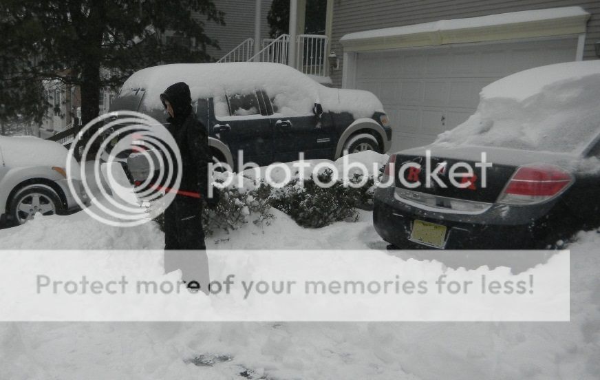
Is... is that a Saturn??
Dude... c'mon.
Literally no snow here in hours. Maybe since 10? Very light whatever coming down for hours and hours now.
Nope, there wasn't a joke in there. Gary Szatkowski was the chief meteorologist at NWS Mt. Holly for a number of years. It was Gary who initially sounded the alarm on Sandy. Great guy. He retired last year.
Gary was very good and Mt. Holly's reputation has certainly taken a bit of a hit in the past 3 years (I think he retired before the Jan-15 debacle). It's not so much that Mt. Holly (and many others) didn't do so well on that storm or today's, it's that they made two compounding errors.
First, they forecasted accumulations that were on the high side of the model guidance in both storms (certainly bac and I and others on the weather boards were questioning that approach for both storms). Forecasting 18-24" isn't necessary, when forecasting 12-18" is more realistic and really sends the same message of, "Whoa! a lot of snow is coming."
Then, they compounded the initial error and went down with the ship, sticking to their guns (to mix cliches), despite strong evidence during the storm that they were going to be quite wrong. Clearly this morning, by 4-5 am, it was becoming obvious that the warm nose at 700 mbar was screaming north faster than modeled and advancing the sleet/mix line north much earlier than expected.
Even if they felt that dynamic cooling would bring the line back to the SE, they knew they were at least going to lose some accumulation, so why not at least reduce snowfall amounts with their 7 am update much more significantly (they just made small tweaks), like NWS-NYC did a little while later.
One last point: Gary got dinged pretty badly, though, for Mt. Holly's weak performance on Sandy, as they were very late with accurate storm surge predictions and their communications were very diffuse, not timely and difficult to decipher for the community. Bryan Norcross didn't criticize him by name, but he excoriated the org in a very well done post-mortem on Sandy.
As a small aside, TWC did pretty well on both of these busted storms - much better than anyone else. However, I still see tons of disparaging remarks about them on the weather boards. They went down the tubes many years ago, but they've hired some top notch talent over the past 5 years and really do a very nice job, especially with their experts and the Wunderground show.
Is Leggets open?
Didn't appear to be around 1 but looking up the street there's cars in front now.
Spent a snow day afternoon there a few years back. Im guessing they will get packed.Didn't appear to be around 1 but looking up the street there's cars in front now.
This is going to be a brutal cleanup for those of us in N NJ. Snow , sleet, and ice, and still going on. ugh.
Was no picnic in Metuchen or maybe I'm just getting old...
Is it also still snowing there? :stuck_out_tongue_winking_eye:Still getting pounded in NW Morris County
What a tool Chris Christie is. Wearing a Notre Dame fleece for his briefing on the storm. He went to Delaware and Seton Hall, so I don't get it.
Was no picnic in Metuchen or maybe I'm just getting old...
streets have already dried out here, LOL. It was brutal picking up a few sticks that blew into my driveway.
Just outside doing a shift of cleanup. Still coming down fairly hard in Western Morris county... Yardstick is reading between 17" and 20 from several of the low spots on the lawn, but that is including the 2" or so that was still on the ground from Fridays storm.Is it also still snowing there? :stuck_out_tongue_winking_eye:
Finished my driveway and the neighbor driveway except at the end of the driveways waiting for the town to plow the street.
One last point: Gary got dinged pretty badly, though, for Mt. Holly's weak performance on Sandy, as they were very late with accurate storm surge predictions and their communications were very diffuse, not timely and difficult to decipher for the community. Bryan Norcross didn't criticize him by name, but he excoriated the org in a very well done post-mortem on Sandy.
Then Bryan Norcross didn't see the PowerPoint advisory that PHI (Gary) distributed via social media 48 hours before the storm that pretty much nailed everything.
One of the things that was previously unsettled was the inter-organizational boundary between NHC and the local NWS offices. Sandy revealed that gap. Everybody looks to Coral Gables for the wisdom of the ages when it comes to hurricanes, but they don't have the local knowledge necessary to accurately detail the effects of storm surge on specific locales. The Shrewsbury River and Sea Bright / Monmouth Beach are a great example. That system doesn't behave "typically", there's a level of experience required to fully understand what it's going to do under any given set of circumstances.
Raritan Bay is another perfect example. Nobody at the NHC thought that the northwestern bayshore was going to see 18' of water - they gave it no special consideration. But if you've lived in the area long enough you know that the Bay is a funnel that thrives on a long easterly fetch and storm surges from roughly Keyport up through Sayreville are typically a multiple of the surge further down the coast.
I believe there's been a better detailing of the RACI for tropical systems that allows local NWS office feedback into the NHC forecasts, and Mt. Holly (for one) now has yearly meetings for local emergency managers to discuss communications procedures and responses. Probably, it took something like a Sandy to make everyone pay attention to the fact that we'd been underthinking tropical systems in this part of the country.
Then, of course, there's the small matter of semantics. Recall that Sandy was, technically, not a hurricane when it rolled up on the Jersey Shore. NHC should have backed off and performed a formal handoff to the local NWS offices - but, as we know, they did not.
Nope, there wasn't a joke in there. Gary Szatkowski was the chief meteorologist at NWS Mt. Holly for a number of years. It was Gary who initially sounded the alarm on Sandy. Great guy. He retired last year.
I thought it was a Gary Waters reference. He retired recently....or was fired.
Looks like a bust for sure:
That's a bust I'll take every day of the week....twice on sunday!!![devil][devil]
Spent a snow day afternoon there a few years back. Im guessing they will get packed.
Years ago after a 25+" snow my son and I went up for dinner. 2-3 deep all around the bars. Don't know where everyone came from.
The layer of slush under the 10" of snow and sleet was a nice touch...clearing it was brutal
Crabs Claw in Lavallette was the same. In the winter Lavallette had about 300 year round residents and it was like everyone was there on big storm days.Years ago after a 25+" snow my son and I went up for dinner. 2-3 deep all around the bars. Don't know where everyone came from.
Just got in from shoveling and snow blowing here in Hamilton. Man that snow/sleet mixture is heavy. Have a two stage Husqvarna and it managed but did struggle through the super heavy parts. Hopefully everyone made it through this storm ok. Im a snow lover like #'s but I think its time for spring!!
I recommend the title of "The Official Next Snow Bust of 2017"Time to look ahead for the weekend. Maybe more snow! Time for a new thread
Reverse psychology might land us a real blizzard.
IMO, this storm did not bust. The forecast track was wrong which resulted in many getting less than predicted. However, the line from far northwest NJ/NE PA through Albany, NY ended up with the jackpot of 18 to 24. So in my view, the storm did not bust...the forecast did. Thank God we only ended up with a foot here.
I recommend the title of "The Official Next Snow Bust of 2017"
Reverse psychology might land us a real blizzard.
I wouldn't call it a bust. Some areas got pounded . Some areas didn't. It's not like the storm didn't show.
Is it also still snowing there? :stuck_out_tongue_winking_eye:
Of course.. I'm at 1200 feet above sea level and the highest point in Morris county 1356 is a mile away. Typical storm for us is rest of the state 3-4 inches with a changeover, that means 12 for us.
Similar threads
- Replies
- 477
- Views
- 12K
- Replies
- 608
- Views
- 17K
- Replies
- 62
- Views
- 2K
- Replies
- 104
- Views
- 2K
- Replies
- 771
- Views
- 20K
ADVERTISEMENT
ADVERTISEMENT