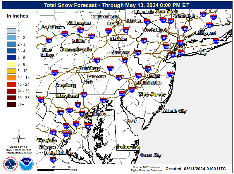
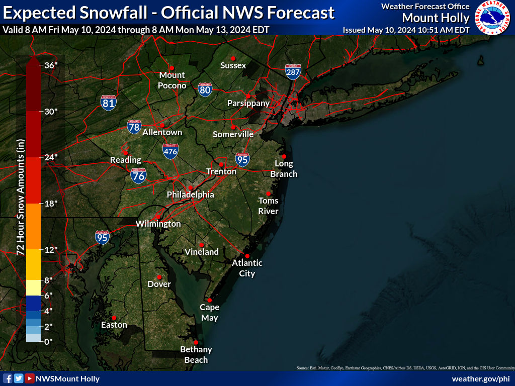
Normally, I might not start a thread for a minor event like this, but since the vast majority of the Philly-NJ-NYC area (outside of parts of NWNJ/NEPA/Hudson Valley, where several inches or more at the higher elevations have fallen) has received nada or just a dusting so far this winter (a miniscule 1/4" here in Metuchen) thought folks would be interested in the possibility of getting the first inch or so of snow this winter.
We have an approaching weak clipper system, which is forecast to interact with a low pressure system well offshore (via an inverted trough feature) bringing precip to the area from late Friday afternoon through Saturday morning, with areas well NW of 95 starting off as light snow, but temps will be above freezing everywhere else, so precip will likely start as light rain for everyone else, likely changing to snow by late Friday night as colder air moves in (except maybe at/near the coast, where the changeover will be hours later).
There isn't that much precip forecast (maybe 0.1-0.2"), so snowfall amounts will likely be in the 0.5-1.0" along/SE of 95 and maybe 1-2" NW of 95, especially N of 78/NW of 287 where there will be less rain; the NBM (National Blend of Models) snowfall forecast is below; the NWS discussion through Friday night (note that for the NWS Friday night means 6 pm Friday through 6 am Saturday) below is similar. Note that temps almost everywhere will be below 32F by late Friday night, so any snow that falls will likely also accumulate on paved surfaces, so driving Saturday morning could be slippery. Also, it's still quite possible that this system fizzles bringing very little precip/snow (as per a few models) and overperforming is also possible, bringing 2-3" for most (as per at least one model).
After this minor event, it's gonna get pretty damn cold with temps generally 10-15F below normal, i.e., with Saturday's highs around freezing and Sunday's highs in the 20s and Monday's highs around 30F, while lows Saturday and Sunday nights will be in the teens (and single digits well NW); wind chills most of this time will be about 10F colder than the air temps.
https://forecast.weather.gov/produc...&format=CI&version=1&glossary=1&highlight=off
Area Forecast Discussion
National Weather Service Mount Holly NJ
632 AM EST Wed Dec 18 2024
SHORT TERM /THURSDAY THROUGH FRIDAY NIGHT/...
Our attention then turns for the Friday through Friday night period
as our next weather system takes aim at the area. A deepening upper
trough will be approaching the area to close the week, which will be
accompanied with several shortwaves embedded in the flow. At the
surface, low pressure originating over the High Plains will traverse
across the southern Great Lakes region and approach our region by
Friday afternoon. Forecast guidance continues to trend a little
deeper with the primary shortwave, so as the low approaches, some
precipitation is expected to overspread the area. At the same time,
a secondary low will be developing a couple hundred miles off the
Mid-Atlantic coast and deepen rapidly as it lifts northeast;
enhanced by speed max rounding base of the upper trough.
With the low offshore remaining in `close enough` proximity to the
area, it is looking more likely that there will be some areas of
light rain and snow across the area on Friday into Friday night as
the initial low transitions its energy to the offshore low. As a
result, PoPs have increased slightly (~40-60%). In addition, some
forecast guidance indicates the development of an inverted /
Norlun trough set-up on the northwest side of the offshore low.
This would enhance precipitation across portions of the area,
however, it is uncertain where or if this feature is to even
develop at this time. For now, the best chance of observing
accumulating snow will be across the Lehigh Valley, northern New
Jersey and in the Poconos where temperatures will be cooler
through the duration of the event. Snow totals in these areas
will range between 1-2", locally up to 3". Light accumulations
of a dusting up to 1" are possible across the remainder of New
Jersey, Pennsylvania and northern Delaware as rain transitions
to snow on Friday night as temperatures cool below/near
freezing.

Last edited:


