
Same with my tulips...looks like they got stunted with the colder weather the past few days. Was very surprised to see them come out already. Never this early.I was walking the dogs on Sunday and had noticed that bulbs were sprouting. Most were already 4-5 inches out of the ground.
I don't think I have ever seen that before in mid Feb...
Colleges
- American Athletic
- Atlantic Coast
- Big 12
- Big East
- Big Ten
- Colonial
- Conference USA
- Independents (FBS)
- Junior College
- Mountain West
- Northeast
- Pac-12
- Patriot League
- Pioneer League
- Southeastern
- Sun Belt
- Army
- Charlotte
- East Carolina
- Florida Atlantic
- Memphis
- Navy
- North Texas
- Rice
- South Florida
- Temple
- Tulane
- Tulsa
- UAB
- UTSA
- Boston College
- California
- Clemson
- Duke
- Florida State
- Georgia Tech
- Louisville
- Miami (FL)
- North Carolina
- North Carolina State
- Pittsburgh
- Southern Methodist
- Stanford
- Syracuse
- Virginia
- Virginia Tech
- Wake Forest
- Arizona
- Arizona State
- Baylor
- Brigham Young
- Cincinnati
- Colorado
- Houston
- Iowa State
- Kansas
- Kansas State
- Oklahoma State
- TCU
- Texas Tech
- UCF
- Utah
- West Virginia
- Illinois
- Indiana
- Iowa
- Maryland
- Michigan
- Michigan State
- Minnesota
- Nebraska
- Northwestern
- Ohio State
- Oregon
- Penn State
- Purdue
- Rutgers
- UCLA
- USC
- Washington
- Wisconsin
High Schools
- Illinois HS Sports
- Indiana HS Sports
- Iowa HS Sports
- Kansas HS Sports
- Michigan HS Sports
- Minnesota HS Sports
- Missouri HS Sports
- Nebraska HS Sports
- Oklahoma HS Sports
- Texas HS Hoops
- Texas HS Sports
- Wisconsin HS Sports
- Cincinnati HS Sports
- Delaware
- Maryland HS Sports
- New Jersey HS Hoops
- New Jersey HS Sports
- NYC HS Hoops
- Ohio HS Sports
- Pennsylvania HS Sports
- Virginia HS Sports
- West Virginia HS Sports
ADVERTISEMENT
You are using an out of date browser. It may not display this or other websites correctly.
You should upgrade or use an alternative browser.
You should upgrade or use an alternative browser.
OT: Will NYC, NB, Philly, Balt, DC (and more) go snowless this winter?
- Thread starter RU848789
- Start date
I was walking the dogs on Sunday and had noticed that bulbs were sprouting. Most were already 4-5 inches out of the ground.
I don't think I have ever seen that before in mid Feb...
It's been since the winter of '72-'73 that it's been like this. But there's still March, and we've had plenty of big storms in that month.

Washington, D.C.'s cherry blossoms might make an early appearance, as mild winter kicks in
Washington D.C. may see an early spring as some cherry blossom trees have already started to bloom.
I am sure someone has this at their fingertips- but what has the median and average temps been this winter and where does it stack up all time. I can only remember a single week all year that was between 15-25 degrees. Seems all other weeks have been more in the 30-40+ range
Newark's are better anyway.Washington, D.C.'s cherry blossoms might make an early appearance, as mild winter kicks in
Washington D.C. may see an early spring as some cherry blossom trees have already started to bloom.abcnews.go.com
A lot more snow to come for CA/OR and the towards the 4 Corners and Rockies, plus there will even be snow down to about 1000' in the CA valleys and even a bit of snow down to the coast in NoCal and OR, which is very unusual.
A prolonged major winter storm will continue to bring widespread heavy snow and blizzard conditions to portions of the West as well as the northern Plains/Great Lakes into Thursday as a series of low pressure waves traverse a front to the south. Heavy snowfall rates of as much as 1 to 2 inches/hour are expected to combine with winds locally as high as 40 to 50 mph to drive significant impacts that will include major disruptions to travel, infrastructure, livestock and recreation. This series of low pressure waves that will make up this coast-to-coast winter storm will bring heavy snow and locally significant ice from the Great Lakes into the Northeast, and many of these areas are expected to see an additional 6 to 12 inches of snow, with some amounts perhaps as high as 18 inches. Power outages and areas of tree damage will be possible across these areas, and especially for the locations seeing a combination of stronger winds and accumulating ice.
On Thursday and Friday, the heavy snowfall threat across the West should become more centered over California as a new storm system developing just off the West Coast drops south and begins to edge into the Southwest for the end of the week. Multiple rounds of new snowfall should accumulate to as much as 3 to 5 feet for the Sierra Nevada, with locally heavier totals for the highest peaks. Lesser amounts of 1 to 2 feet are forecast elsewhere across portions of the Great Basin and into the Four Corners region. Given the depth of cold air that has infiltrated the West, accumulating snow will also be expected over some of the lower foothills and interior valley areas near the Pacific Coast adjacent to the terrain where snowfall is less common. Onshore flow combined with instability related to the cold pool aloft will lead to a heightened risk of flash flooding across southern California Friday morning into Saturday.
https://www.wpc.ncep.noaa.gov/discussions/hpcdiscussions.php?disc=pmdspd
Our Monday night/Tuesday system is looking like it may at least deliver a few inches of snow along and N of 80 (and maybe several inches N of 80) and possibly even down to 78 and maybe to the Raritan (more likely mostly/all rain south of 78 though). If we start to see some model consensus by tomorrow (models are all over the place right now, 4-5 days out), would likely be worth a thread, even if it's all/mostly rain for CNJ as quite a few posters live in NNJ/NEPA/NYC/LI.
Also, keep in mind most of the area might see a coating to 1/2" on Saturday, but there might also be nothing as predicting that little precip accurately (+/- 1/2" means zero for everyone on the minus side) is very difficult.
And 3/4 is looking like the best chance this winter for some decent snow for everyone, but it's 9 days out, so that chance could easily fall apart (but we haven't even been seeing fantasy storms 9 days out in this warm winter, so it's worth watching).

the Cardinal and Blue Jay that live in my yard definitely didn't leave during the winterCardinals stay throughout the winter as well I believe.
A lot more snow to come for CA/OR and the towards the 4 Corners and Rockies, plus there will even be snow down to about 1000' in the CA valleys and even a bit of snow down to the coast in NoCal and OR, which is very unusual.
A prolonged major winter storm will continue to bring widespread heavy snow and blizzard conditions to portions of the West as well as the northern Plains/Great Lakes into Thursday as a series of low pressure waves traverse a front to the south. Heavy snowfall rates of as much as 1 to 2 inches/hour are expected to combine with winds locally as high as 40 to 50 mph to drive significant impacts that will include major disruptions to travel, infrastructure, livestock and recreation. This series of low pressure waves that will make up this coast-to-coast winter storm will bring heavy snow and locally significant ice from the Great Lakes into the Northeast, and many of these areas are expected to see an additional 6 to 12 inches of snow, with some amounts perhaps as high as 18 inches. Power outages and areas of tree damage will be possible across these areas, and especially for the locations seeing a combination of stronger winds and accumulating ice.
On Thursday and Friday, the heavy snowfall threat across the West should become more centered over California as a new storm system developing just off the West Coast drops south and begins to edge into the Southwest for the end of the week. Multiple rounds of new snowfall should accumulate to as much as 3 to 5 feet for the Sierra Nevada, with locally heavier totals for the highest peaks. Lesser amounts of 1 to 2 feet are forecast elsewhere across portions of the Great Basin and into the Four Corners region. Given the depth of cold air that has infiltrated the West, accumulating snow will also be expected over some of the lower foothills and interior valley areas near the Pacific Coast adjacent to the terrain where snowfall is less common. Onshore flow combined with instability related to the cold pool aloft will lead to a heightened risk of flash flooding across southern California Friday morning into Saturday.
https://www.wpc.ncep.noaa.gov/discussions/hpcdiscussions.php?disc=pmdspd
Our Monday night/Tuesday system is looking like it may at least deliver a few inches of snow along and N of 80 (and maybe several inches N of 80) and possibly even down to 78 and maybe to the Raritan (more likely mostly/all rain south of 78 though). If we start to see some model consensus by tomorrow (models are all over the place right now, 4-5 days out), would likely be worth a thread, even if it's all/mostly rain for CNJ as quite a few posters live in NNJ/NEPA/NYC/LI.
Also, keep in mind most of the area might see a coating to 1/2" on Saturday, but there might also be nothing as predicting that little precip accurately (+/- 1/2" means zero for everyone on the minus side) is very difficult.
And 3/4 is looking like the best chance this winter for some decent snow for everyone, but it's 9 days out, so that chance could easily fall apart (but we haven't even been seeing fantasy storms 9 days out in this warm winter, so it's worth watching).
Question is, when all this snow in the Rockies/West melts, how much is going to end up in the Colorado River
Not nearly enough. Lake Mead is disappearing. Sad.Question is, when all this snow in the Rockies/West melts, how much is going to end up in the Colorado River
Well, January was one of the top 2-3 warmest in recorded history for many stations between DC and Boston and for most in NJ, with it being the warmest ever in NYC (10F above normal!), since records started being kept in 1869 and was tied for the mildest ever in NJ (averaged across many stations - see 2nd link). February is on its way to being a top 5-10 warmest ever, while December was around average.I am sure someone has this at their fingertips- but what has the median and average temps been this winter and where does it stack up all time. I can only remember a single week all year that was between 15-25 degrees. Seems all other weeks have been more in the 30-40+ range
https://www.axios.com/2023/02/03/january-record-warm-millions
https://www.njweather.org/
It'll certainly help, although you're right that Lake Mead is just ridiculously low from the long term drought coupled with ever rising water usage...in the desert.Not nearly enough. Lake Mead is disappearing. Sad.
A lot more snow to come for CA/OR and the towards the 4 Corners and Rockies, plus there will even be snow down to about 1000' in the CA valleys and even a bit of snow down to the coast in NoCal and OR, which is very unusual.
A prolonged major winter storm will continue to bring widespread heavy snow and blizzard conditions to portions of the West as well as the northern Plains/Great Lakes into Thursday as a series of low pressure waves traverse a front to the south. Heavy snowfall rates of as much as 1 to 2 inches/hour are expected to combine with winds locally as high as 40 to 50 mph to drive significant impacts that will include major disruptions to travel, infrastructure, livestock and recreation. This series of low pressure waves that will make up this coast-to-coast winter storm will bring heavy snow and locally significant ice from the Great Lakes into the Northeast, and many of these areas are expected to see an additional 6 to 12 inches of snow, with some amounts perhaps as high as 18 inches. Power outages and areas of tree damage will be possible across these areas, and especially for the locations seeing a combination of stronger winds and accumulating ice.
On Thursday and Friday, the heavy snowfall threat across the West should become more centered over California as a new storm system developing just off the West Coast drops south and begins to edge into the Southwest for the end of the week. Multiple rounds of new snowfall should accumulate to as much as 3 to 5 feet for the Sierra Nevada, with locally heavier totals for the highest peaks. Lesser amounts of 1 to 2 feet are forecast elsewhere across portions of the Great Basin and into the Four Corners region. Given the depth of cold air that has infiltrated the West, accumulating snow will also be expected over some of the lower foothills and interior valley areas near the Pacific Coast adjacent to the terrain where snowfall is less common. Onshore flow combined with instability related to the cold pool aloft will lead to a heightened risk of flash flooding across southern California Friday morning into Saturday.
https://www.wpc.ncep.noaa.gov/discussions/hpcdiscussions.php?disc=pmdspd
Our Monday night/Tuesday system is looking like it may at least deliver a few inches of snow along and N of 80 (and maybe several inches N of 80) and possibly even down to 78 and maybe to the Raritan (more likely mostly/all rain south of 78 though). If we start to see some model consensus by tomorrow (models are all over the place right now, 4-5 days out), would likely be worth a thread, even if it's all/mostly rain for CNJ as quite a few posters live in NNJ/NEPA/NYC/LI.
Also, keep in mind most of the area might see a coating to 1/2" on Saturday, but there might also be nothing as predicting that little precip accurately (+/- 1/2" means zero for everyone on the minus side) is very difficult.
And 3/4 is looking like the best chance this winter for some decent snow for everyone, but it's 9 days out, so that chance could easily fall apart (but we haven't even been seeing fantasy storms 9 days out in this warm winter, so it's worth watching).
Yes please.
I was straight choking on white room powder right up to last lift yesterday.
Great Salt Lake drying up also and they're worried about all the chemicals it's going to unleash into the air.
I live north of Boston near New Hampshire border and it's been a very mild winter with little or no measurable snow . But last night we got nearly 6 inches of snow and cold weather is on the way. What's our near term outlook for snow?Well, January was one of the top 2-3 warmest in recorded history for many stations between DC and Boston and for most in NJ, with it being the warmest ever in NYC (10F above normal!), since records started being kept in 1869 and was tied for the mildest ever in NJ (averaged across many stations - see 2nd link). February is on its way to being a top 5-10 warmest ever, while December was around average.
https://www.axios.com/2023/02/03/january-record-warm-millions
https://www.njweather.org/
It'll certainly help, although you're right that Lake Mead is just ridiculously low from the long term drought coupled with ever rising water usage...in the desert.
Article in today's WSJ on the significant buildup of California's reservoirs so far this winter.
Fear not, snowbirds! My daughter is studying abroad in Rome and we are visiting in mid-March. I fully expect a late season blizzard to ruin our plans.
Fear not, snowbirds! My daughter is studying abroad in Rome and we are visiting in mid-March. I fully expect a late season blizzard to ruin our plans.
I went to Dublin for St. Patty's a few years ago and it was the first time it snowed there in around a century. I feel this pain lol.
Just was at Jay Peak. Always great snow. Unfortunately has become so more commercialized than last time here 15 years back. Oh well that was expected I guess.
Bummer. Place seemed the opposite of commercial last time I was there, maybe 17 years ago.
Man I first went there around 2000 I guess. It was so basic and there was just a few local places to go to.Bummer. Place seemed the opposite of commercial last time I was there, maybe 17 years ago.
But busineas is what it is I guess. I was shocked to see the difference all these years later. Still great but not what it was all those years back.
You ever been to A-Basin out your direction ? My buddy used to take us there back in the day all the time . Was curious if that stayed as basic as it used to be. Was so simple and nice when I visited
Man I first went there around 2000 I guess. It was so basic and there was just a few local places to go to.
But busineas is what it is I guess. I was shocked to see the difference all these years later. Still great but not what it was all those years back.
You ever been to A-Basin out your direction ? My buddy used to take us there back in the day all the time . Was curious if that stayed as basic as it used to be. Was so simple and nice when I visited
No, but it's high on my list. Gonna be out that way in a month and hoping to check it out then.
Saw a headline recently, can't remember where, that it's basically thrived by being an "anti resort," just like you describe, so I think it still has the same vibe.
ETA, here it is. Sounds like they got right back to basics after splitting off from the Epic Pass.
How Leaning Into Its Status as an Anti-Resort Made A-Basin More Profitable
Arapahoe Basin is making the experience of skiing more enjoyable—and generating higher profits—by limiting the number of people on the slopes.
 www.5280.com
Last edited:
Yeah it’s worth checking out if you get to that area. My buddy lived in Denver and used to bring me there when I visited. It was as you said a total anti resort local place. Small lodge and a tiny bar after your day on the mountain. I have some old tshirt I have to dig out for A-Basin “the local legend”. They had the claim back then to be open longer than most anyone. Like they opened so early ij the fall and didn’t close until maybe end of April. Don’t quote me on that. It was fun back then.No, but it's high on my list. Gonna be out that way in a month and hoping to check it out then.
Saw a headline recently, can't remember where, that it's basically thrived by being an "anti resort," just like you describe, so I think it still has the same vibe.
ETA, here it is. Sounds like they got right back to basics after splitting off from the Epic Pass.
How Leaning Into Its Status as an Anti-Resort Made A-Basin More Profitable
Arapahoe Basin is making the experience of skiing more enjoyable—and generating higher profits—by limiting the number of people on the slopes.
But yeah that Epic pass I don’t know much about other than my friend had one and he got me discounted into like Keystone,Breckinridge & Vail back then. Arapahoe wasn’t part of it back then. Sorry, long tangent, it’s a fun day there.
Hope you enjoy your season, what’s left still !
Yeah it’s worth checking out if you get to that area. My buddy lived in Denver and used to bring me there when I visited. It was as you said a total anti resort local place. Small lodge and a tiny bar after your day on the mountain. I have some old tshirt I have to dig out for A-Basin “the local legend”. They had the claim back then to be open longer than most anyone. Like they opened so early ij the fall and didn’t close until maybe end of April. Don’t quote me on that. It was fun back then.
But yeah that Epic pass I don’t know much about other than my friend had one and he got me discounted into like Keystone,Breckinridge & Vail back then. Arapahoe wasn’t part of it back then. Sorry, long tangent, it’s a fun day there.
Hope you enjoy your season, what’s left still !
You too!
I intended to hit Jay this year but usually hit Stowe as well and it seems like a hassle to ski there now outside of being off property and using the shuttle (meaning Stowe). How were the crowds at Jay? This past week was Massachusetts week (schools closed for mid-winter break). This week is New Hampshire week but most either stay in NH or go to Florida.Just was at Jay Peak. Always great snow. Unfortunately has become so more commercialized than last time here 15 years back. Oh well that was expected I guess.
Yeah it’s worth checking out if you get to that area. My buddy lived in Denver and used to bring me there when I visited. It was as you said a total anti resort local place. Small lodge and a tiny bar after your day on the mountain. I have some old tshirt I have to dig out for A-Basin “the local legend”. They had the claim back then to be open longer than most anyone. Like they opened so early ij the fall and didn’t close until maybe end of April. Don’t quote me on that. It was fun back then.
But yeah that Epic pass I don’t know much about other than my friend had one and he got me discounted into like Keystone,Breckinridge & Vail back then. Arapahoe wasn’t part of it back then. Sorry, long tangent, it’s a fun day there.
Hope you enjoy your season, what’s left still !
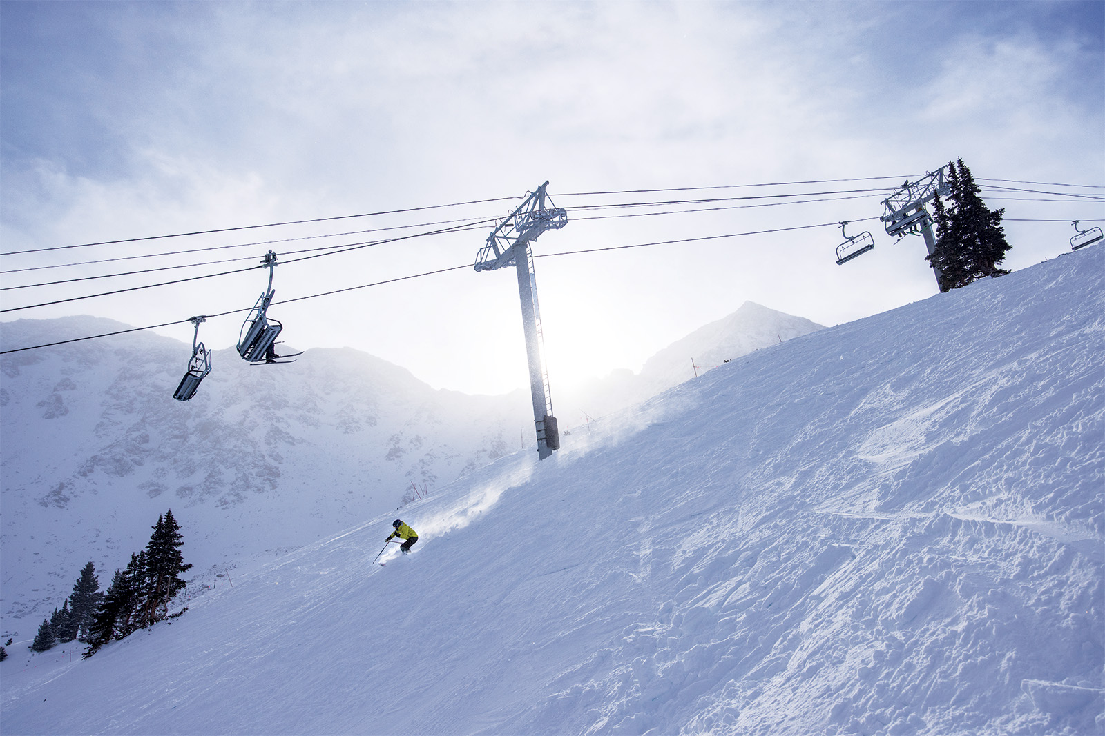
My nephew got married last summer at the facility half way up Arapaho Basin. First time I arrived at a wedding by chair lift.
Haha that’s awesome! Must have been beautiful that time of year. Congrats !My nephew got married last summer at the facility half way up Arapaho Basin. First time I arrived at a wedding by chair lift.
Jay was busier than I recall it being years ago. But still better than the usual places in VT or NH. It’s far enough north I guess that it takes some effort. What’s funny is you mentioned MA & NH weeks. My buddy lives in RI and sent me a video on the mountain this morning because kids are off.I intended to hit Jay this year but usually hit Stowe as well and it seems like a hassle to ski there now outside of being off property and using the shuttle (meaning Stowe). How were the crowds at Jay? This past week was Massachusetts week (schools closed for mid-winter break). This week is New Hampshire week but most either stay in NH or go to Florida.
Haha that’s awesome! Must have been beautiful that time of year. Congrats !
Scattered showers. But the stars on the ride back down after the reception were amazing.
Could easily get 3-5" Mon/Tues and another 6-10" with the Fri/Sat storm (but that's far enough out that uncertainty is huge).I live north of Boston near New Hampshire border and it's been a very mild winter with little or no measurable snow . But last night we got nearly 6 inches of snow and cold weather is on the way. What's our near term outlook for snow?
Cool article from the LA Times on the SoCal snows of 5-7' in the mountains above 4500' and even several inches down to 1000' and the heavy, flooding rains at lower elevations.
https://www.latimes.com/california/...YLhT9PNtol6xAMeyaFBGScT5290V7fu18r_2jYo_bibuw
https://www.latimes.com/california/...YLhT9PNtol6xAMeyaFBGScT5290V7fu18r_2jYo_bibuw
Similar threads
- Replies
- 44
- Views
- 3K
- Replies
- 59
- Views
- 4K
- Replies
- 412
- Views
- 24K
ADVERTISEMENT