ADVERTISEMENT

Snow 1/3-1/4? And continued very cold...

Status
Not open for further replies.
I live in eastern Monmouth county. Inlaws have a generator and are in western Union county. I have a 5 month old. My wife wants to leave tonight to inlaws (who have a generator), She's concerned about wind related power outages and no heat.... what's the move?

I obviously want to stay put...

Hmmm. On one hand warmth, power, food for you and your young family. On the other hand, in-laws. I am not sure how to advise you.
 
18z GFS seems to be very close in line with Mt Holly's current call for NJ with that shot those double digit numbers on the coast
 
I live in eastern Monmouth county. Inlaws have a generator and are in western Union county. I have a 5 month old. My wife wants to leave tonight to inlaws (who have a generator), She's concerned about wind related power outages and no heat.... what's the move?

I obviously want to stay put...


there are definitely power outage risks with the winds which will get worse as the day goes on..remember even when the snow ends, the potential for power outages Thursday night and Friday exist and with 8-12 inches on the ground and temps hovering around 0...that could be a danger with no heat and then trying to get somewhere.

Send your wife and baby to the inlaws and hunker down yourself to protect your cave!
 
I live in eastern Monmouth county. Inlaws have a generator and are in western Union county. I have a 5 month old. My wife wants to leave tonight to inlaws (who have a generator), She's concerned about wind related power outages and no heat.... what's the move?

I obviously want to stay put...
We also live in eastern Monmouth County & I just started up the generator to make sure that it is ready to do its job, just in case, with an infant I would stay at the in laws as a precaution.
 
gfs_tprecip_nyc_8.png.f310a5381e78c65370aa0b1a263f15b8.png
 
What a difference a day makes. Ship, I have over 1000 cases of beer arriving at 8am tomorrow.
 
Store is in Franklin Mills, NE Philly (refuse to call it Philadelphia Mills) On the Bensalem border (Bucks County).
Live in Washington Crossing.


eh..well you could luck out because it might be slow to reach that far west until after 5AM but all bets off after that you will be in the heart of the storm after that
 
there are definitely power outage risks with the winds which will get worse as the day goes on..remember even when the snow ends, the potential for power outages Thursday night and Friday exist and with 8-12 inches on the ground and temps hovering around 0...that could be a danger with no heat and then trying to get somewhere.

Send your wife and baby to the inlaws and hunker down yourself to protect your cave!

My guess is the winds won't be strong enough, except at the coast, for direct wind-driven tree damage and I'm also pretty sure that with temps in the mid/upper 20s at the surface and colder aloft, plus some wind, the snow will not accumulate that much on trees - most of it should just blow off, as opposed to those heavy wet snows that just stick to everything, trees/branches included. So then, when the strongest winds kick in, the trees won't be weighed down by much snow. Pretty sure on this, but not 100%.
 
Lee Goldberg is widespread 3-6 from NYC down to central jersey...thinking more 6 in NYC, 1-3 NW Jersey and 6-12 along jersey shore

has it over in NYC by around 1 and says it will sweep in from the southeast about 3-4AM and be widespread across the entire metro area after 6AM

This does not appear a long duration storm for areas away from the coast. Some places will see heavy rates for a few hours and that will pile up totals quickly
 
Last edited:
Anyones job closed/cancelled for tomorrow. Mine did. Im surprised the State hasnt closed yet for tomorrow
 
My guess is the winds won't be strong enough, except at the coast, for direct wind-driven tree damage and I'm also pretty sure that with temps in the mid/upper 20s at the surface and colder aloft, plus some wind, the snow will not accumulate that much on trees - most of it should just blow off, as opposed to those heavy wet snows that just stick to everything, trees/branches included. So then, when the strongest winds kick in, the trees won't be weighed down by much snow. Pretty sure on this, but not 100%.
You can sneeze near a JCP&L pole and cause a power outage. There will be plenty of outages at the shore.
 
Nope, haven't tried that one yet. What's its age?

Its a NAS they came out with a few months ago. Its supposed to be like the cask stregnth they had a few years back. Its a limited 2017 release 58.4%. It was good not great, personally I like the 12 yo better
 
Gettin' it on...

wv-animated.gif
This is potentially going to be the strongest cold-core, non-tropical cyclone in the Western Atlantic ever - someone posted a list of the top 10 and I think #1 was 949 mbar, which this could make a run at. That's cat 2/3 level from a pressure perspective and if it was the size of a hurricane it would probably hae 120 mph winds instead of 60 mph. Nova Scotia is going to be annihilated.
 
This is potentially going to be the strongest cold-core, non-tropical cyclone in the Western Atlantic ever - someone posted a list of the top 10 and I think #1 was 949 mbar, which this could make a run at. That's cat 2/3 level from a pressure perspective and if it was the size of a hurricane it would probably hae 120 mph winds instead of 60 mph. Nova Scotia is going to be annihilated.

AF recon found 96 kt. flight level winds.
 
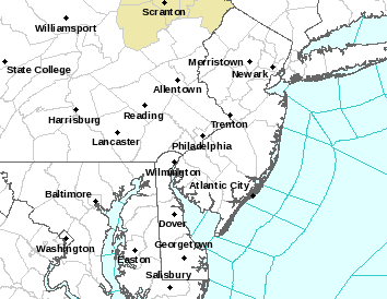
Boom - winter storm warnings (pink) and blizzard warnings (orange) now up for I-95 counties and coastal counties in NJ/LI, respectively, as well as winter weather advisories (blue). And snowfall amounts up again as per maps. Strap in folks.

phi.png


26165164_10212931847124959_1984724540149051885_n.jpg


26168558_10212931853565120_8617278742605053387_n.jpg

A couple of points for anyone interested, which were in my email updates but hadn't posted here yet (as far as I recall).

Snow Will Accumulate: First, with temps generally in the mid/upper 20s during daylight hours, the snow, which will start after midnight towards Philly and after about 3 am towards NYC, will immediately accumulate on all untreated surfaces, making walking and driving treacherous, even on major highways, once the snowfall rate exceeds the melting rate from salt/traffic (which it will, if we get the forecasted amounts) – and the worst of it will likely be from 4 am to 10 am, right around the morning rush hour, so be careful out there and consider putting a snow emergency kit in your car.

Shovel by Evening: Second, while the snow will be high ratio/low density fluffy stuff and should be easy to shovel, any snow that gets mixed with salt from road treatments and ends up at the bottom of your driveway from a plow will have melting going on in that pile during the afternoon tomorrow. Then, when the bottom drops out of the temperature tomorrow night (low of 5-10F) that mix will freeze solid and won't melt until at least Monday. So shovel before 6-7 pm if at all possible.

Uncertainty Still: This is still an extraordinarily complex synoptic setup and while the models have converged somewhat on the solutions upon which this forecast is made, there’s still decent variability in them and uncertainty in how this will play out, i.e, only a few inches of snow is still a potential outcome for I-95, for example (no snow is close to a 0% probability), while up to a foot of snow is also still possible for the I-95 corridor. And similar variabilities exist for other locations. Some of us remember Jan-15 very well when our 18-30” of snow for most of NJ, forecasted right up until the start of the storm, ended up being 3-9” from W to E.

1/25/00 Analog: Also, if this does verify, remember the Jan 25, 2000 “surprise” snowstorm, where little to no snow was forecast up until the night before and most of the area got 8-14”? I do, painfully, as I left for Ireland the night before and didn’t even know it snowed back home until the next night! Well, that storm is the #1 analog to this storm and was called out by many mets when the models were showing not much snow for this one 2 days ago. Several pros highlighted how this could happen, meteorologically, if the northern jet stream energy moved faster than was being modeled, as well as in a more S/SW direction instead of SE (as per my comments Monday evening), such that the leading southern jet stream energy would have to respond to that “action” with an equal and opposite reaction (yes Newton’s 3rd Law still applies) by heading more N or even NNW after formation off of FL, rather than moving more NE out to sea. That’s what’s being modeled by all the models now. DT/WxRisk did a wonderful podcast showing how this might happen - link below.

Coastal Flooding: A coastal flood advisory is up for the NJ Shore for minor flooding Thursday morning; despite the recent lunar high tide, the storm is likely to be far enough away and not sticking around long enough to have a major impact. However, one unusual effect will be that there will be areas of stagnant salt water that will freeze solid, given temps below 20F for the next few days and salt water freezes around 27-28F. Could be locally treacherous.

Record Cold: It's coming for the next 3 days for many locations - will post on this later - worth its own post, if not its own thread, really.

https://www.wxrisk.com/the-wxrisk-com-snowstorm-page/
http://www.raymondcmartinjr.com/weather/2000/25-Jan-00.html
 
Last edited:
slight cut in 0zNAMqpf from the 18z NAM along coastal locations...here is the comparison...pretty consistent that nw of 95 just is not going to get the big amounts at all.


nam_total_precip_nyc_9.png.fc68d4bb0b084b5382059b26926ab41e.png


nam_total_precip_nyc_12.png.6f62b2bd3113c7f60617ad34b69aa8f7.png
 
Thought it would be fun to share the snowfall maps from the entire 00Z model suite tonight, just so people can see the outcomes and variability. These all assume a 10:1, snow to liquid precip ratio, whereas we're likely to have close to 15:1 ratios so you can multiply the numbers in these maps by about 1.5 to get snow depth amounts. This is due to the very cold column (so no liquid water present), the great conditions in the dendritic snow crystal growth region, and the superb vertical velocities, driving supersaturation and crystal growth via vapor phase deposition on nucleated crystals. So here you go; I'll just keep adding these to one post, so it doesn't clutter up the board.

First up is the NAM 12 km lower resolution mesoscale model:

26196355_10212933665010405_8200289005210598133_n.jpg


Next up is the NAM 3 km high resolution mesoscale model:

26229565_10212933730652046_5006573433893594253_n.jpg


Next up is the 00Z RGEM, regional Canadian mesoscale model. Notice that the mesoscale models have toned down there 12" plus snowfall amounts, but are still significant to major snowstorms, especially from 95 east.

26167453_10212934022659346_1185237744934026686_n.jpg


Now for the first of the global models, the 00Z GFS. Looking pretty similar to the mesoscale models now, which is what happens as one gets closer to any event - the models only have to predict out about 20 hours to get to the end of the storm now, so the errors and model to model variability will usually be much smaller at this point. Generally still seeing roughly 4-7" very close to the NJ TPK and 6-10" SE of that line and 2-4" more than 20 miles NW of that line. If it's 10:1 snow as per the model graphics; those numbers translate to about 6-10" for the 95 corridor, 9-15" SE of that line and 3-6" more than 20 miles NW of 95.

26168648_10212934066980454_6661469451850259083_n.jpg


And now for the 00Z Canadian high resolution HRDPS model, the snowiest model so far, although not by a huge amount...

26165458_10212934200503792_5809690299578734079_n.jpg


Next to last one is the UK global model, which is now the snowiest of all the 0Z models tonight. The I-95 corridor from Philly to Trenton to NYC is all in that yellow 20-25 mm of liquid precip band or 2.0-2.5 cm or 0.8-1,0" of liquid or 8-10" of snow at 10:1 ratios or, better yet, 12-15" at 15:1 ratios expected. Time for a nap until maybe 3 am to get up to watch the storm and stuff, as I'm on vacation tomorrow, so I'll really get to enjoy this one.

26170000_10212934489511017_89889129393828198_n.jpg


And finallly the Euro - came in about as snowy as the UK, i.e., close to a foot of snow for I-95, considering 15:1 ratios. Map is smaller, but that's all I have.

26195844_10212934569433015_6947980746032427916_n.jpg
 
Last edited:
  • Like
Reactions: Cabana Man
I am right there with you..this is a pretty substantial cut in qpf and snow if you are I95 and west, becoming clear that while there is going to be some snow, the idea of big snows west of 95 are very low

IMG_1062.GIF.cb8ed314230058deb4edb20db45d4bf8.GIF
 
Looks like total of 4" of snow here in Pinehurst, NC. Snow started around 3:30 pm. Appears to be done. Village and county alerts issued to stay home/off roads for tomorrow, so snow removal can occur. Supposedly cars are abandoned all over, making snow removal difficult. Below freezing temps over next few days. So no melting until Sunday. Hopefully.

On another front, we retreated from the Boone cabin on Tuesday, after experiencing - 4 degrees as overnight low for two consecutive nights, and wind chills at - 11, this at 4600-foot elevation. Well head froze. Sheesh. Forecast was nuts, with wind gusts up to 45 mph. Thawed the water system, drained it, then headed east to warmer temps of 14 as nightly lows.

This cabin you speak of... In the mountains of North Carolina?

Interesting. A place like that would be nice.
 
Status
Not open for further replies.
ADVERTISEMENT
ADVERTISEMENT