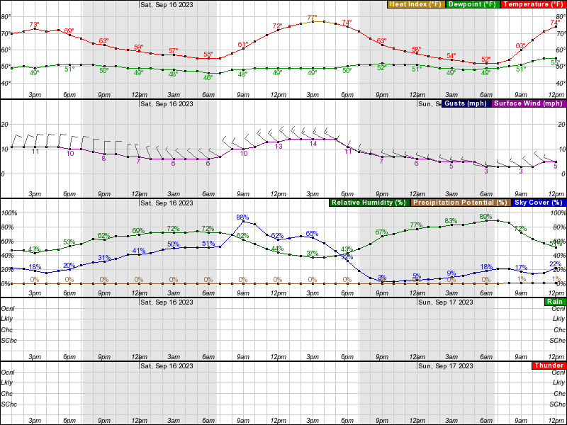
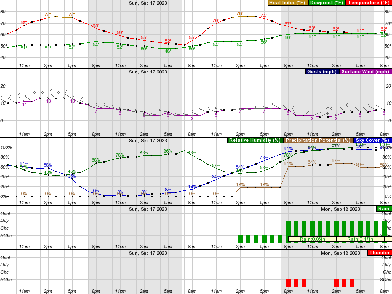
This is similar to the NW game, where 7-8 days out it was almost a lock for very warm and dry conditions. In both setups we had a major front/ trough coming through mid-week, establishing strong high pressure in control of our weather for the next several days, which almost always means fair and dry conditions and this case is no exception, as we can very likely expect highs in the mid/upper 70s, no rain, some sun, and comfortable humidity (dewpoints in the mid-50s). The only potential fly in the ointment is Lee, but I'd say Lee is 99% to not impact our weather other than high surf/erosion. NWS discussion is very encouraging, as are all the models. Let's go 1-0 next week to get to 3-0.
National Weather Service Mount Holly NJ
1244 AM EDT Sun Sep 10 2023
LONG TERM /TUESDAY NIGHT THROUGH SUNDAY/...
A cold front will look to continue to approach the region
Tuesday night and be either on our doorstep or beginning to
cross through the region Wednesday morning. Though the cold
front may slow down some while crossing the region, it will look
to be offshore by Thursday morning. Surface high pressure will
look to build in behind the front and will look to hold
influence over the region thereafter through the end of the long
term.
Last edited: