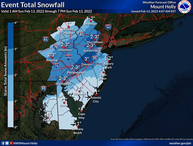
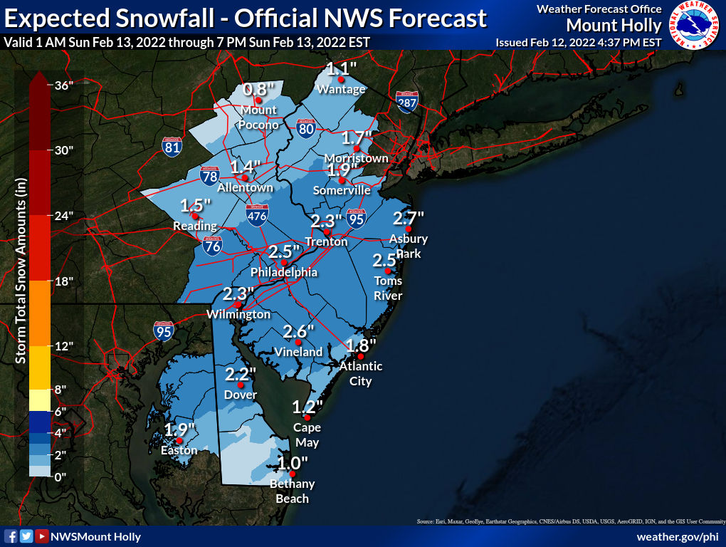
It’s a shame because your threads are useful. Not many people KNEW about this snow front was going through here until you brought it up the other day. But you’re the troll🤦🏻♂️First they claim bust no matter what the outcome was and then they start making political posts to get people arguing, which shuts the thread down usually, just like the first one on this event. The mods and Richie won't do anything on my behalf, but they might if premium members, like you, said something (or they might not).
I’m trying and keep commenting on those unnecessary shenanigans. I’m seen this on the Mets threads and now I’ve seen some of the CE shenanigans creep inside the Rutgers Sports Pay Section, which I’m not paying to see. Hell, I think I would be the one banned if I say that I’ll stop paying if I keep seeing that crap on unrelated threads. Don’t think they’ll miss my $9/month though.