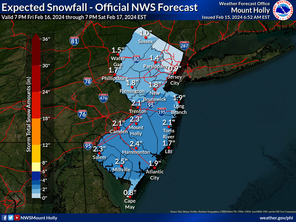
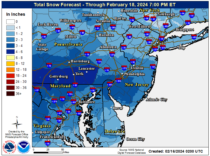
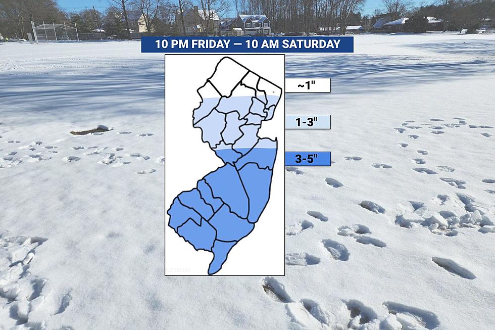
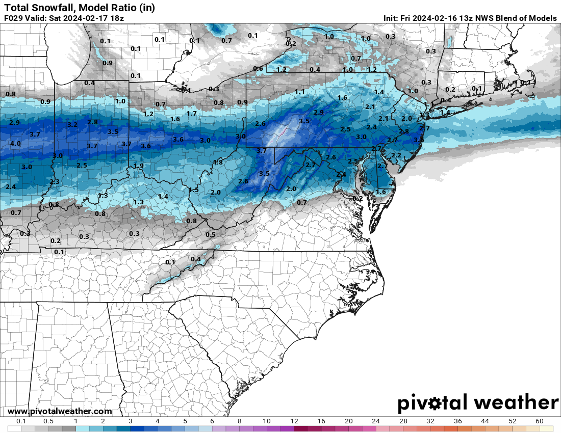
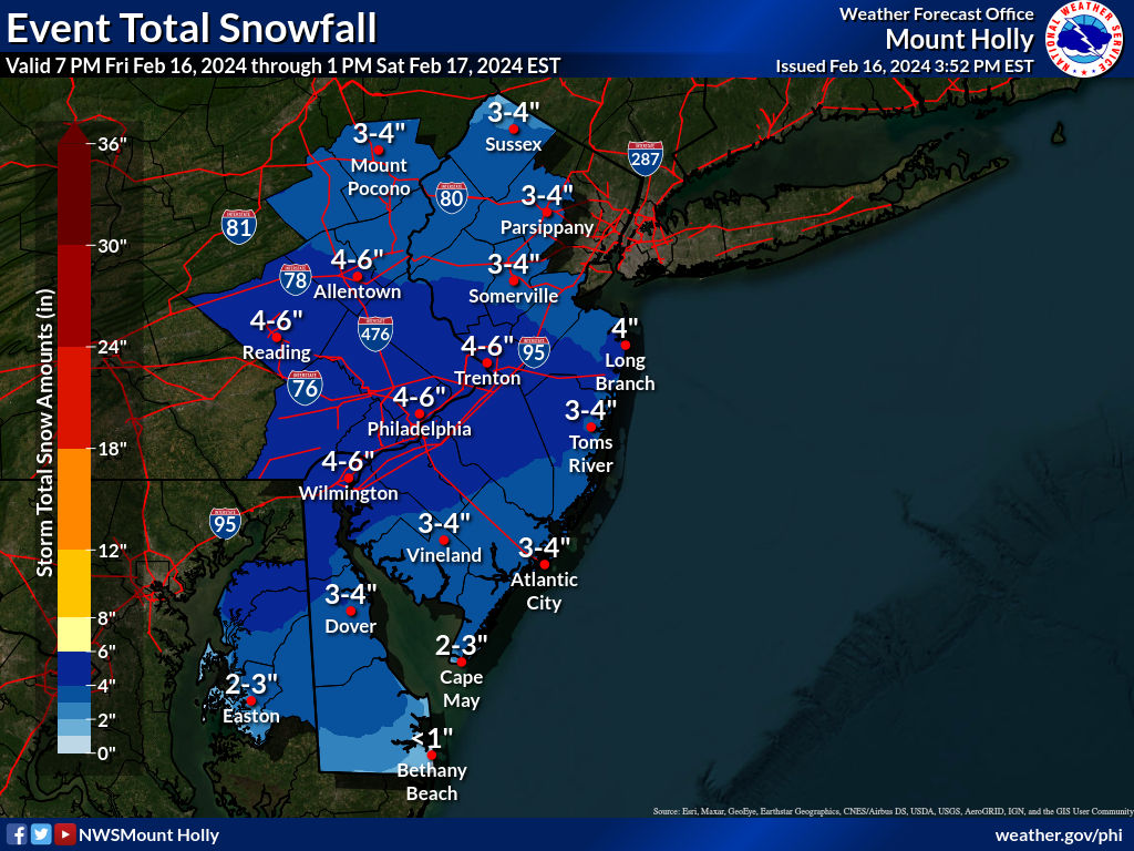
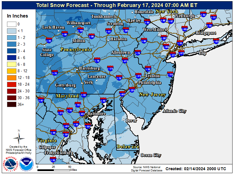
Saturday morning system: It's not a big deal of a storm, but in this paltry winter, I think a 1-3" event is worthy of a thread, especially since it should be below 32F from 1 am to 10 am Sat when any snow is likely to fall. The preliminary NWS map is below (it's only through 7 am, though, so another 1/2" or so could be added to this) and it shows 1-2" for the region, except maybe just an inch or so for NENJ (Union up to Bergen) and SENYNYC/LI as there will likely be less precip N of 80 and east of the TPK, but that's not a given yet. Most of the models are showing up to 3" amounts with isolated 4" amounts being shown. The Euro, NAM, CMC, RGEM, Icon and NBM are all showing a 1-3" event for most, while the GFS/UK have 1" or less generally. Lee Goldberg has a map showing 1-3" for everywhere S of 80 in PA/NJ and an inch of so N of 80, except for maybe only an inch or so for Hudson/Essex/NYC/LI.
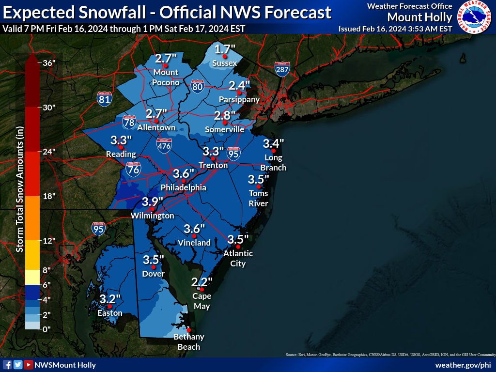
And even just 1-2" with temps below freezing mostly falling at night will lead to slick untreated roads everywhere until things warm up a bit with the indirect sun by the late morning. Probably be mostly gone by sunset, but morning travel could be impacted. At this point, it doesn't look like this storm will be a complete whiff, as we're only 2.5 days out and it's not a complex setup as a low is simply expected to traverse from the TN valley past our area to the south, with a further south track than yesterday, meaning more cold air will be in place and much less chance of rain except for coastal DE/Cape May. In fact, if we had had this cold air mass in place yesterday, everyone would've gotten at least 6" of snow. Anyway, this has nowhere near the energy/precip potential the last storm did, so 3-4" is very likely the storm ceiling, so no need to run out and get milk and, bread.
Thursday Night System: Just a word about the Thursday night clipper, which is likely to be just a nuisance event with a coating to 1/2" being possible for the entire region (although some will see very little snow) and 1-2" being likely for the Poconos/Catskills/Sussex; should have little to no impact on the RU hoops game. After that, ~40 mph wind gusts look likely during the day on Friday.
https://www.weather.gov/phi/
Changed thread title from "OT: Minor to Moderate (1-3"?) Snowfall Likely Sat morning (2/17)" to current title at 10 am on 2/16.
Last edited: