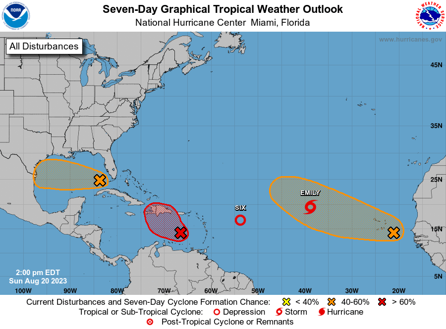
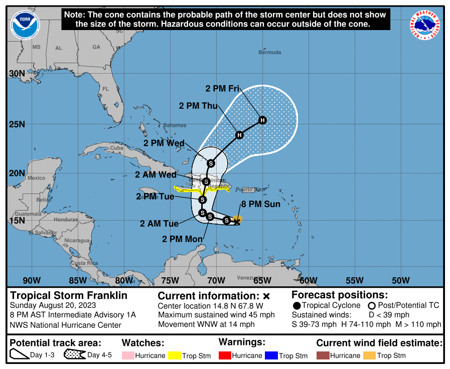
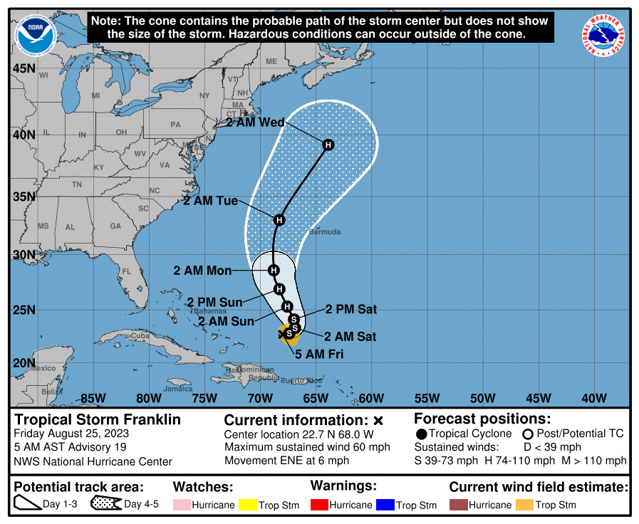
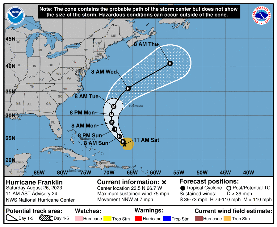
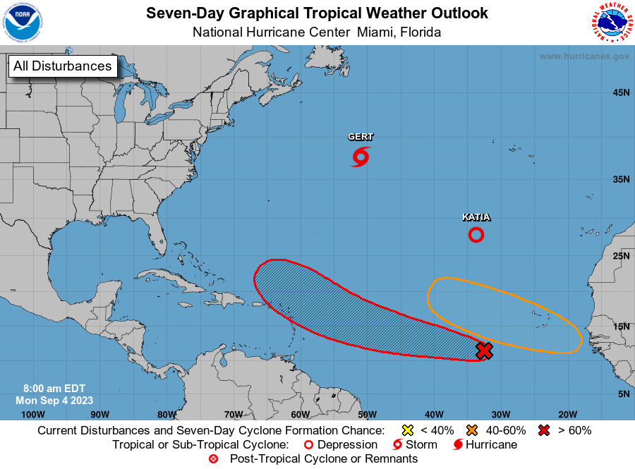
In case people missed it, after Hurricanes Franklin and Idalia (and TS Harold) kind of stole the show, we've had Gert, Jose, and now Katia and as per the graphic below, more tropical systems might be on the way. If anyone is interested in a seasonal summary to date, Wikipedia does a nice job with that.
https://en.wikipedia.org/wiki/2023_Atlantic_hurricane_season
Gert was a TS that formed on 8/21, but was short-lived, becoming just a remnant storm 2 days later; however, its remnants then regenerated into a TS again on 9/1 and has meandered around the central Atlantic for days (never getting above 55 mph) and should dissipate, finally, in the next day or so.
Jose became a TS on 8/31, well SE of Bermuda and topped out at about 60 mph winds before dissipating into nothingness 2 days later in the central Atlantic. And we now have TS Katia, which became a TS on 9/2 in the eastern Atlantic and topped out at about 60 mph as it headed north and is about to dissipate in the next day or so.
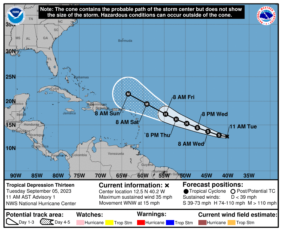
We're also about to head into the peak of the tropical season (9/5-9/15) and it looks like we have a couple of strong tropical waves, including Invest 95L, which is a Cape Verde system coming off the coast of Africa a few days ago, which the NHC puts at a 90% chance of becoming a named storm in the next several days (would likely be named Lee). The models are almost all showing this storm becoming a TS and then hurricane (possibly a major hurricane within 5 days) with some potential to skirt the Lesser Antilles in 5-7 days and then possibly taking aim at the US east coast in 10+ days, although more models show the storm staying well off the coast - but this one needs to be watched very closely, given the huge track uncertainties beyond 6-7 days. The AmericanWx thread, below, is a good one if interested in tracking this system.
https://www.americanwx.com/bb/topic/59538-invest-95l-70-2-day90-5-day-development-odds/page/3/