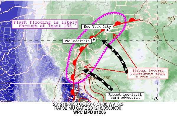
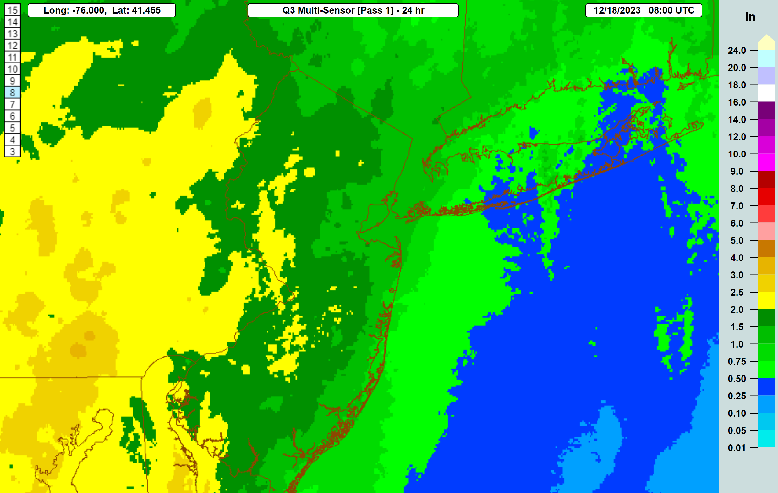
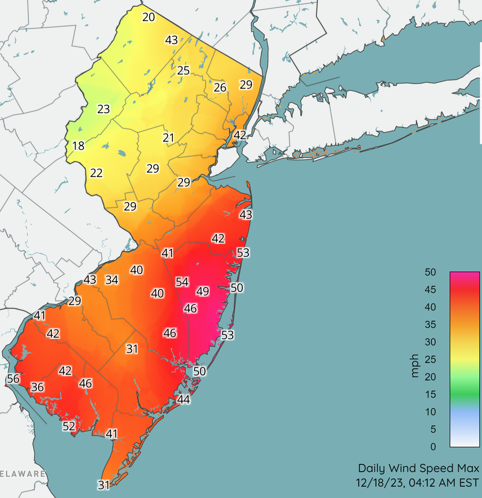
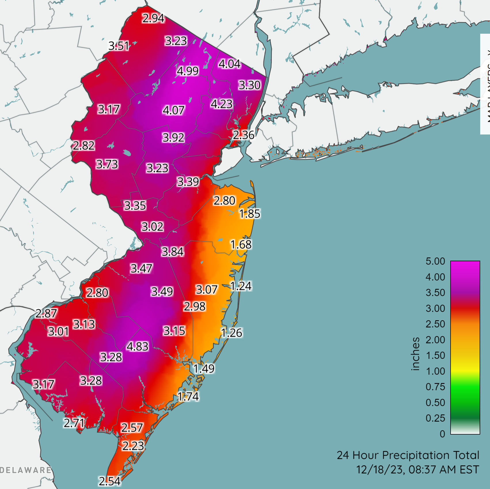
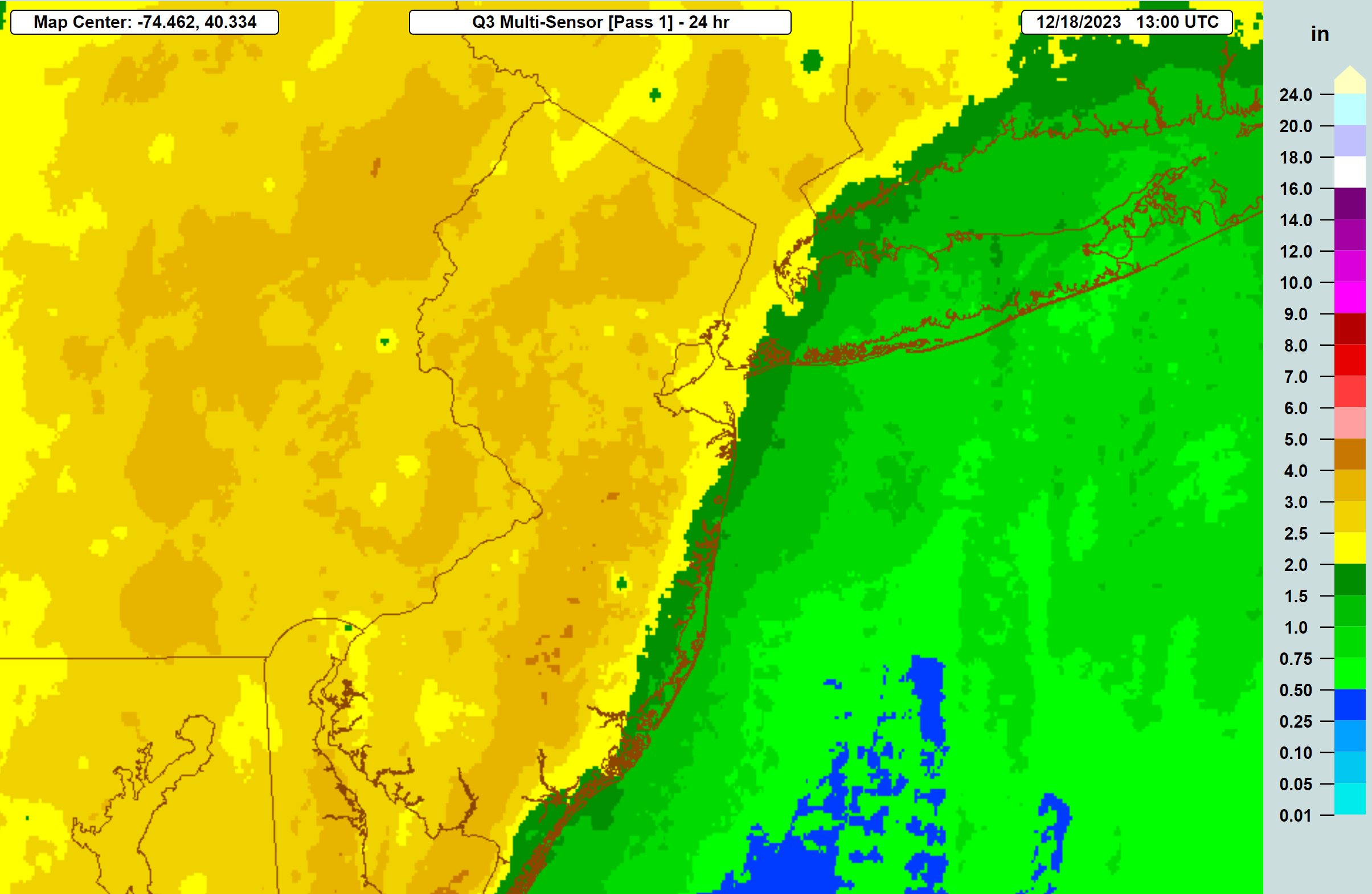
Well, there's not much winter to talk about, so figured I'd give a heads up on a nearly identical forecast for this Sunday into Monday as we had this past weekend, after another very nice Friday/Saturday. Looks like things start to go downhill Sunday afternoon with the worst of it being Sunday night through maybe the Monday morning commute with the mid-range models showing 1.5-3" of rain for the region and wind gusts up to 50+ mph, especially along the DE/NJ/LI coasts. This sounds similar to the 1.5-3.5" of rain most of us got last weekend, but one big difference is that we now have saturated soils from those heavy rains, so the chances of urban and stream/river flooding will be greater (and could be significant).
This being a true nor'easter (last week's wasn't quite), which is actually a Miller A storm, originating in the Gulf of Mexico and then moving towards the Atlantic coast and coming up the coast, soaking everywhere from FL to Maine, the chances of the higher winds verifying are pretty good, plus there's more chance of some minor coastal flooding with this storm. Unfortunately, for snow lovers, with a track inland of the coast, there is zero chance of any frozen precip through Monday morning (not even much chance for the NY/New England ski resorts), although there is the chance for some minor snowfall NW of 95 early on Tuesday with an approaching clipper-style system.
https://forecast.weather.gov/produc...&format=CI&version=1&glossary=1&highlight=off
FYI, there doesn't look like much chance of snow the next two weeks, but there are signs of a possible pattern change to a colder regime in late December, which would increase the likelihood of snow chances. Many analog analysts who compare winter seasons are likening this winter to 2015-2016, which was also an El Nino winter and had very little NE US snowfall through mid-January, but we then had the Jan-2016 blizzard that set the all-time NYC snowfall record of 27.5" (got ~22" in Metuchen) and slightly above average winter snowfall. No idea what's going to happen this year, as nobody seems to have figured out a way to predict seasonal snowfall accurately (unlike seasonal tropical activity forecasts, which have some accuracy). And way too early to predict the weather for the Pinstripe Bowl.
https://www.nytimes.com/2023/12/14/us/rain-storm-forecast-snow.html