After this week's brief warm-up. which will last through Saturday, the cold rushes in Saturday night and we could see some light snow on Sunday morning into the afternoon, with up to an inch possible along the 95 corridor from Philly-NJ-NYC and perhaps up to 2" near the coast (with little to no snow well NW of 95). With temps below 32F, it's likely any snow that falls will accumulate on all surfaces. This is still almost 3 days away (too early for snowfall forecasts) and there is the potential for this to be a bit snowier (2-4" have been seen on the occasional model run), but there's also the potential for little to no snow for everyone. Since this is Super Bowl Sunday, people ought to be aware of the chance of some snow.
https://www.weather.gov/phi/
https://www.americanwx.com/bb/topic/56799-possible-east-coast-storm-213-214/page/3/
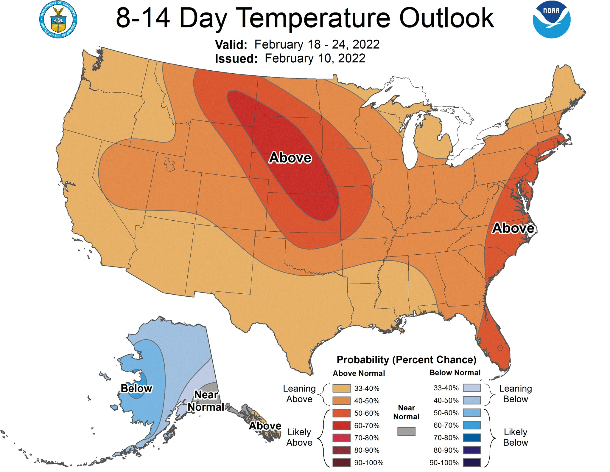
After this threat and a couple of days of cold temps, we warm up by mid-next week and expect warmer than normal conditions from about mid-February through the end of the month (see the CPC graphic below), as a pattern flip is expected. It's expected we'll move from a pattern with jet stream going up and over a strong high over the Pac NW (keeping the west warm) and then diving down through the center of the country, carving out a large trough in the eastern 1/2 of the nation, with colder than normal temps, to a pattern with the trough over the west and a large southeastern ridge (high) over the eastern US, bringing warmth to the east. The long range ensemble forecasts also predict the development of an EPO+/AO+/PNA- pattern by the end of next week and that kind of pattern clearly favors above to well above normal temperatures in much of the eastern 1/3 of the country, including the NE US. None of this means snow can't happen during a pattern like this in February, but it's just a lot less likely.
https://www.33andrain.com/topic/2046-winter-21-22-weather-pattern-storm-threat-discussion/page/553/
https://www.weather.gov/phi/
https://www.americanwx.com/bb/topic/56799-possible-east-coast-storm-213-214/page/3/
After this threat and a couple of days of cold temps, we warm up by mid-next week and expect warmer than normal conditions from about mid-February through the end of the month (see the CPC graphic below), as a pattern flip is expected. It's expected we'll move from a pattern with jet stream going up and over a strong high over the Pac NW (keeping the west warm) and then diving down through the center of the country, carving out a large trough in the eastern 1/2 of the nation, with colder than normal temps, to a pattern with the trough over the west and a large southeastern ridge (high) over the eastern US, bringing warmth to the east. The long range ensemble forecasts also predict the development of an EPO+/AO+/PNA- pattern by the end of next week and that kind of pattern clearly favors above to well above normal temperatures in much of the eastern 1/3 of the country, including the NE US. None of this means snow can't happen during a pattern like this in February, but it's just a lot less likely.
https://www.33andrain.com/topic/2046-winter-21-22-weather-pattern-storm-threat-discussion/page/553/