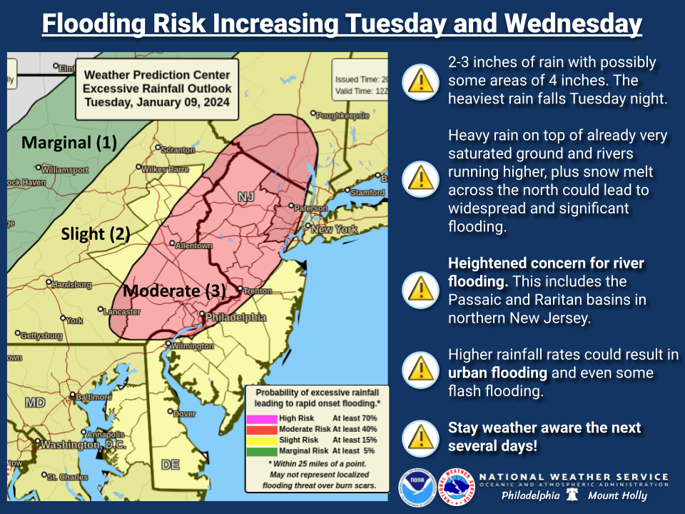
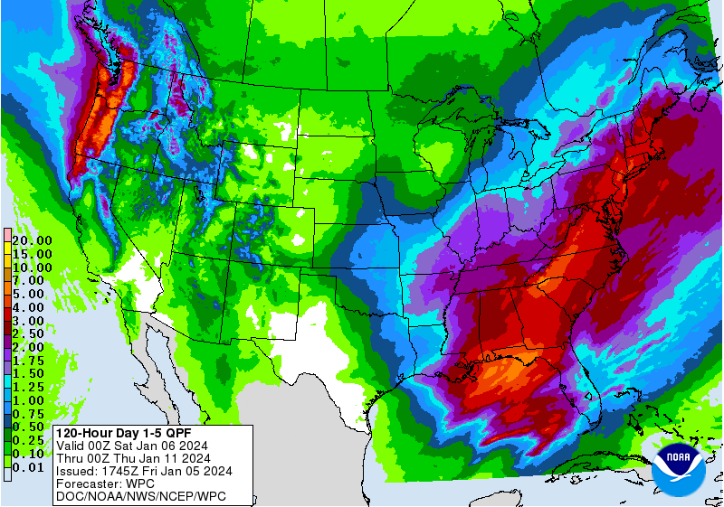
I know we're in the midst of a winter storm thread, which will likely deliver 1" of rain to most of the Philly-NJ-NYC region from the coast up through 95, with significant snows likely N of 78, but regardless of where it snows or rains, we're going to get about 3/4-1" of liquid equivalent precip and next week's storm is likely to add 2-3" on top of that, meaning we're likely to have 3-5" of total liquid precip over the next 5 days, which could lead to significant flooding, given the saturated conditions we already have and the fact that most rivers/streams are still at well above normal levels from recent flooding.
This storm will also likely be more powerful than this weekend's, with higher winds, which could lead to some power outages, and it is much more of a threat for coastal flooding (at least minor). This storm also doesn't have the complexities of trying to figure out precipitation type, so it's just about how much rain/wind we'll get, which are easier to predict. For many of us, this storm will end up being more impactful than this weekend's storm, especially for those who don't get much snow.
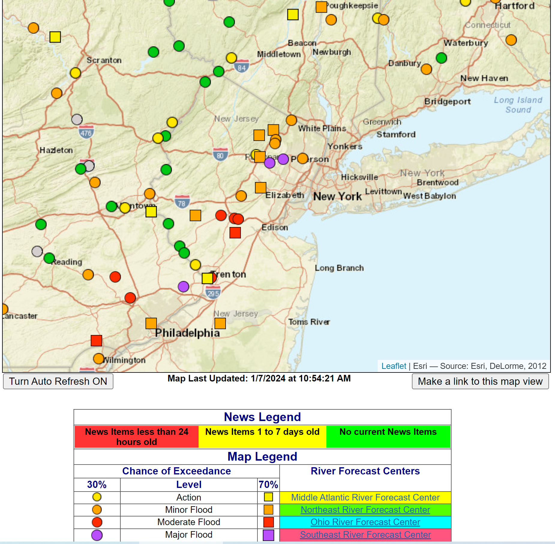
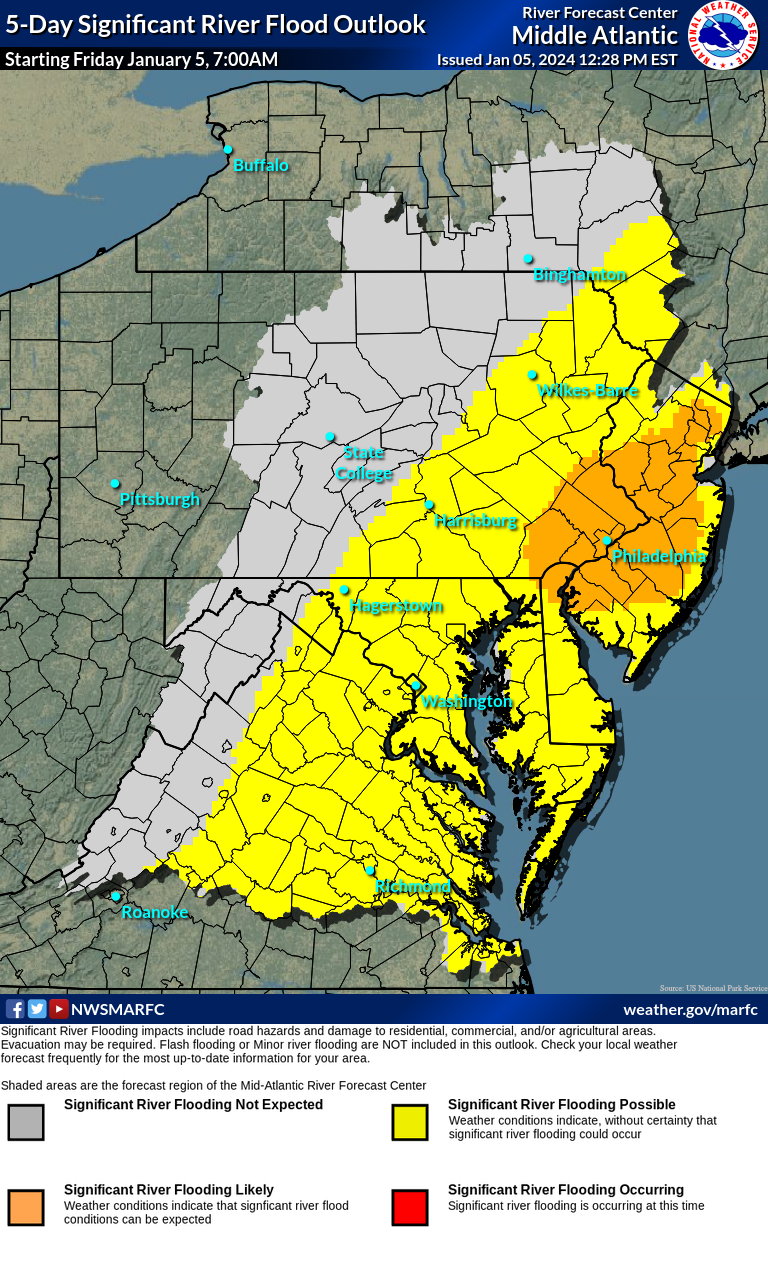
Below are the WPC 5-day QPF (quantitative precip forecast) graphic, a link to the NWS flood page, where one can check on river/stream flooding, should we get to that, and another good graphic from the NWS Mid-Atlantic River Forecast Center, showing they're already considering most of our area to be at a likely risk of flooding from the next storm. It's unusual to have a "likely" this far in advance, meaning they're taking this situation pretty seriously. Stay tuned.
https://water.weather.gov/ahps2/index.php?wfo=PHI


Last edited:


