ADVERTISEMENT

OT (Updated): The Saturday 1/11 Event Now Looking Like <1" with a Whiff Possible on the Low Side and 1-2" Possible on the High Side

found this on the americanwx board of all places

So I'm going to tell a story. When I was a very young lawyer, a partner -- perhaps the most tenacious and successful litigator in our big firm -- and I sketched out a legal theory we would use in a case. He then said, "what is the best counterargument our opponents could make?" I hesitated; he thumped the table and said, "Think like an advocate!" In other words, a lawyer must always think about what does *not* support him in addition to what does. (So too, IMHO, must a scientist, an engineer, and so on.)

Irrelevant sidenote: He later told me he had done the exact same thing with a young woman ( a graduate of Hahvad Law School) who, like me, was new to the firm: "she put her hand to her mouth and I thought, 'I've shattered her1'"
 
Last edited:
  • Like
Reactions: bac2therac
You have any backcountry skiing out your backyard?
Have neighbors who cross country ski and snowshoe on the mountain here, atop snow-covered private roads. Not backcountry, though. Off our mountain, there are a number of resorts that may allow off-trail skiing. Appalachian Ski Mountain. Sugar Mountain. Beech Mountain. ??? The Moses Cone Estate off the Blue Ridge Parkway is popular for x country, as is the parkway itself, as it closes frequently during snows.
 
  • Like
Reactions: fsg2
StormTotalSnowWeb.jpg
 
  • Haha
Reactions: rurichdog
found this on the americanwx board of all places

This is why people watch certain news channels, podcasters, social media influencers, etc. People need to read, watch and listen to people who they don’t agree with to truly learn, grow and think.
 
There has been a small uptick in the snow shown by almost all the models tonight at 0Z, with small being the key word, as I'd guesstimate that we're now seeing a rough average across most models of 0.5-1.0" with some spots getting <0.5" and some getting 1.0-1.5" (and even up to 2" in far SENJ/coastal DE. This is a little more than the NWS forecast and might just be a blip, but I'd say don't be surprised if you wake up with a 1/2" or a bit more with some approaching 1". Also, a whiff is still very possible for many folks, i.e., <1/4" (roughly a coating).

Whatever does fall will accumulate with temps in the 20s from about 2 am to 9 am when the light snow is expected to fall, so there could be some slick spots on untreated roads before about noon, when temps go above 32F eventually reaching the mid-30s. Mainly a nuisance event, but will hopefully at least be a pretty one with little wind. Time to watch the radar and the sky.
 
Last edited:
As of 5:30 am we had 0.3" on the ground at 27F (fell back to sleep after that so didn't get to post it, lol) and as of 6:30 am we have 0.6" of very fine, fluffy pixie dust on pretty much all surfaces, so pavement is slick, but looking at the radar, it looks like that's about it for this "storm" and I'd expect anything on paved surfaces to be gone by 9-10 am for most. Not a complete whiff, but not even an inch when several days ago it looked at least a bit more promising - we are, however, up to 6.5" on the season. Looks like more cold coming up after the next couple of seasonable days and a few snow/mix chances coming up starting next weekend. If you're up early, take a walk - it is very pretty outside with the fresh snow cover.
 
Looks like a general 0.5-1.0" snowfall for much of the area based on social media posts and reports. Elsewhere, the south was hit pretty hard with snow and freezing rain, as Atlanta had 2-4" yesterday morning then freezing rain that knocked out power to over 100,000 customers, Asheville NC area had 2-4", Raleigh-Durham had 1/2-1" and some ice as did Charlotte, while Dallas had 2-4", Little Rock had about 10", Memphis had nearly 8" and a friend in Knoxville had 6"; Baltimore had about 2" overnight.

https://www.cnn.com/2025/01/09/weather/winter-storm-snow-ice-south-texas-climate/index.html
 
not even a half inch here...label it a heavy dusting lol

It will all be gone later

Enjoy the mid 40s coming Sunday and Monday
 
Trying to summon the courage to get out there and begin snow "removal." 18°. 10-12 mph wind with gusts above 20. Sideways snowing, still. Snow depth looks to be at least 8" but really hard to tell at this point, until I get out there.

Edit/Update.... Forecast for "down" the mountain in the town of Boone (elevation 3333) today: "Blustery with snow showers. High near 25F. Winds WNW at 25 to 35 mph. Chance of snow 50%. Winds could occasionally gust over 40 mph." Timeline shows snow ceasing by 2 pm.

Lucky to reach 20° up here, though, at 4600 ft.
 
Last edited:
  • Like
Reactions: bac2therac
accumulations were spotty...some areas got a band of snow and actually overperformed and others didnt...and its really melting away even with temps not that warm


07:00 am EST - 1/11/20251 S Ironia, NJ1.5
07:00 am EST - 1/11/20251 NE Chatham, NJ1.5
08:00 am EST - 1/11/20253 NNW Bridgewater, NJ1.4
07:50 am EST - 1/11/2025Berwyn, PA1.3
07:00 am EST - 1/11/2025Belvidere Bridge, NJ1.3
07:00 am EST - 1/11/20252 NW Bridgewater, NJ1.3
07:00 am EST - 1/11/2025Three Bridges, NJ1.3
09:45 am EST - 1/11/2025Chatham, NJ1.2
08:05 am EST - 1/11/2025Warren, NJ1.2
07:00 am EST - 1/11/2025Randolph, NJ1.1
07:10 am EST - 1/11/2025Millington, NJ1.1
09:00 am EST - 1/11/2025Nazareth, PA1
08:45 am EST - 1/11/2025Bushkill Twp, PA1
07:00 am EST - 1/11/2025Hackettstown, NJ1
09:45 am EST - 1/11/2025Salisbury Twp, PA1
07:00 am EST - 1/11/20251 NW West Conshohocken, PA1
07:30 am EST - 1/11/2025Hellertown, PA0.9
07:43 am EST - 1/11/2025Stewartsville, NJ0.9
08:35 am EST - 1/11/2025Bernardsville, NJ0.8
06:31 am EST - 1/11/20251 W Long Valley, NJ0.8
 
07:18 am EST - 1/11/2025West Chester, PA1
07:00 am EST - 1/11/2025New Hanover Twp, PA1
07:30 am EST - 1/11/2025Hellertown, PA0.9
07:43 am EST - 1/11/2025Stewartsville, NJ0.9
08:35 am EST - 1/11/2025Bernardsville, NJ0.8
06:31 am EST - 1/11/20251 W Long Valley, NJ0.8
08:30 am EST - 1/11/2025Readington Twp, NJ0.8
07:00 am EST - 1/11/20251 SSW Sellersville, PA0.8
07:00 am EST - 1/11/2025Martins Creek, PA0.7
08:35 am EST - 1/11/2025Furlong, PA0.7
07:00 am EST - 1/11/2025Lehigh Valley Internati, PA0.6
09:45 am EST - 1/11/2025Upper Dublin Twp, PA0.6
07:30 am EST - 1/11/2025Eagleville, PA0.6
10:28 am EST - 1/11/20251 NE Parlin, NJ0.5
07:30 am EST - 1/11/20253 S Cloverhill, NJ0.5
08:47 am EST - 1/11/20251 SW Phoenixville, PA0.5
07:00 am EST - 1/11/2025Trenton Mercer Airport, NJ0.5
07:30 am EST - 1/11/2025East Coventry Twp, PA0.5
06:45 am EST - 1/11/2025Mount Laurel, NJ0.5
06:30 am EST - 1/11/20251 SW Long Branch, NJ0.4
 
05:41 am EST - 1/11/2025Butler, NJ1
06:30 am EST - 1/11/20251 SW Long Branch, NJ0.4
06:31 am EST - 1/11/20251 W Long Valley, NJ0.8
07:00 am EST - 1/11/20251 S Ironia, NJ1.5
07:00 am EST - 1/11/20251 NE Chatham, NJ1.5
07:00 am EST - 1/11/2025Belvidere Bridge, NJ1.3
07:00 am EST - 1/11/2025Three Bridges, NJ1.3
07:00 am EST - 1/11/20252 NW Bridgewater, NJ1.3
07:00 am EST - 1/11/2025Randolph, NJ1.1
07:00 am EST - 1/11/20251 SE Boonton, NJ1
07:00 am EST - 1/11/2025Hackettstown, NJ1
07:00 am EST - 1/11/20251 SSW Sellersville, PA0.8
07:00 am EST - 1/11/2025Martins Creek, PA0.7
07:00 am EST - 1/11/2025Lehigh Valley Internati, PA0.6
07:00 am EST - 1/11/2025Trenton Mercer Airport, NJ0.5
07:00 am EST - 1/11/20251 NNE Hamilton Square, NJ0.3
07:05 am EST - 1/11/2025South River, NJ0.3
07:10 am EST - 1/11/2025Millington, NJ1.1
07:15 am EST - 1/11/20251 SSW Lake Mohawk, NJ1.5
07:15 am EST - 1/11/2025Long Branch, NJ0.4
 
A dusting at most in Belmont Hills and Manayunk. Not even measurable. The sun sneaked briefly. This "storm" will be unrecognizable in a few hours.
Philadelphia area official snow count for the season before last night was 2.2 inches. Less then most deep South cities.
 
  • Like
Reactions: Knight Shift
A dusting at most in Belmont Hills and Manayunk. Not even measurable. The sun sneaked briefly. This "storm" will be unrecognizable in a few hours.
Philadelphia area official snow count for the season before last night was 2.2 inches. Less then most deep South cities.
Yeah the snow disappeared quickly even with cold temps...very little moisture in the snow..probably had 20-1 ratio
 
Looks like a general 0.5-1.0" snowfall for much of the area based on social media posts and reports. Elsewhere, the south was hit pretty hard with snow and freezing rain, as Atlanta had 2-4" yesterday morning then freezing rain that knocked out power to over 100,000 customers, Asheville NC area had 2-4", Raleigh-Durham had 1/2-1" and some ice as did Charlotte, while Dallas had 2-4", Little Rock had about 10", Memphis had nearly 8" and a friend in Knoxville had 6"; Baltimore had about 2" overnight.

https://www.cnn.com/2025/01/09/weather/winter-storm-snow-ice-south-texas-climate/index.html
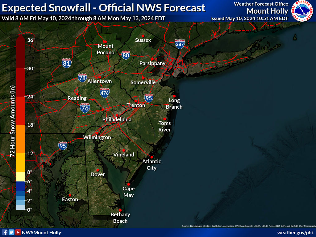
Actually, turns out it was more of a general 0.5-1.5" snowfall looking at the NWS accumulation map and reports, below, with a few places <0.5" and a few places more than 1.5", including Cape May once again being the winner with 2.2"...so certainly not a whiff and even made it to minor territory (1-2") for many, which is a bit of a surprise. All gone from sunny spots, but still some in the shade, where we also still had some snow left over from Monday's event. No NWS-NYC reports yet, other than 0.5" at Central Park.

473077788_1007978448021586_6320677023805466641_n.jpg


Public Information Statement
National Weather Service Mount Holly NJ
1104 AM EST Sat Jan 11 2025

...JANUARY 11TH SNOWFALL REPORTS AS OF 11 AM...

...New Jersey...

...Atlantic County...
Somers Point 0.4 N 1.1 in 0700 AM 01/11 COCORAHS
Estell Manor 1.0 in 0800 AM 01/11 COOP
Somers Point 0.2 NW 1.0 in 0630 AM 01/11 COCORAHS
Brigantine 0.9 ESE 1.0 in 0700 AM 01/11 COCORAHS
Somers Point 1.0 in 0450 AM 01/11 Public
Estell Manor 4.0 WNW 0.7 in 0800 AM 01/11 COCORAHS
Hammonton 0.6 in 1002 AM 01/11 Broadcast Media
Atlantic City International 0.5 in 0700 AM 01/11 ASOS
Buena Vista Twp 2.6 NNE 0.5 in 0700 AM 01/11 COCORAHS
Galloway Twp 2.9 SW 0.5 in 0700 AM 01/11 COCORAHS
Egg Harbor City 3.5 SW 0.5 in 0800 AM 01/11 COCORAHS
0.7 N Hammonton 0.4 in 0800 AM 01/11 COOP
Egg Harbor City 3.6 SW 0.4 in 0845 AM 01/11 COCORAHS

...Burlington County...
Mount Laurel 0.5 in 0700 AM 01/11 COCORAHS
Medford Twp 1.5 WSW 0.4 in 0640 AM 01/11 COCORAHS
Willingboro Twp 1.3 ESE 0.4 in 0700 AM 01/11 COCORAHS
Cinnaminson Twp 1.4 SSE 0.4 in 0944 AM 01/11 COCORAHS
2 NW South Jersey Regional A 0.4 in 0645 AM 01/11 NWS Employee
1 NNE Rancocas 0.4 in 0714 AM 01/11 NWS Employee
Riverside Twp 0.6 S 0.3 in 0700 AM 01/11 COCORAHS
Moorestown 0.3 in 0823 AM 01/11 COCORAHS
Medford Lakes 0.3 in 0830 AM 01/11 COCORAHS
1 SSE Rancocas 0.3 in 0753 AM 01/11 NWS Employee
Westampton 0.2 in 0700 AM 01/11 COOP
Mount Holly WFO 0.2 in 0659 AM 01/11 Official NWS Obs

...Camden County...
1 E Somerdale 0.6 in 0730 AM 01/11 NWS Employee
Barrington 0.8 NE 0.4 in 0700 AM 01/11 COCORAHS
Mount Ephraim 0.4 in 0700 AM 01/11 COCORAHS
Cherry Hill Twp 1.6 WNW 0.3 in 0700 AM 01/11 COCORAHS
Pennsauken 1 N 0.2 in 0700 AM 01/11 COOP

...Cape May County...
Rio Grande 2.2 in 0852 AM 01/11 Trained Spotter
Cape May Court House 2.0 in 0858 AM 01/11 Broadcast Media
Lower Twp. 2.4 W 2.0 in 0700 AM 01/11 COCORAHS
Middle Twp. 4.2 NNW 2.0 in 1000 AM 01/11 COCORAHS
Villas 1.6 in 0955 AM 01/11 Broadcast Media
2 NW Cape May 1.6 in 0740 AM 01/11 CO-OP Observer
Dennis Twp. 2.5 S 1.5 in 0700 AM 01/11 COCORAHS
Lower Twp 1.3 ENE 1.5 in 0700 AM 01/11 COCORAHS
Woodbine 0.8 NNW 1.2 in 0700 AM 01/11 COCORAHS
Woodbine 0.8 NW 1.0 in 0700 AM 01/11 COCORAHS
Ocean City 1.6 SW 1.0 in 0700 AM 01/11 COCORAHS

...Cumberland County...
Deerfield Twp 2.0 E 0.5 in 0715 AM 01/11 COCORAHS

...Gloucester County...
Deptford Twp 0.6 in 0600 AM 01/11 Public
Franklin Twp 2.7 W 0.5 in 0700 AM 01/11 COCORAHS
Pitman 0.1 W 0.5 in 0700 AM 01/11 COCORAHS
Pitman 0.7 ENE 0.4 in 1200 AM 01/11 COCORAHS
Greenwich Twp 2.2 ESE 0.3 in 0800 AM 01/11 COCORAHS
Monroe Twp. 1.8 SE 0.3 in 0800 AM 01/11 COCORAHS
Washington Twp 0.3 in 0730 AM 01/11 Trained Spotter

...Hunterdon County...
Three Bridges 1.3 in 0700 AM 01/11 Public
Readington Twp 1.8 ENE 1.2 in 0700 AM 01/11 COCORAHS
Lebanon 2.8 N 1.0 in 0630 AM 01/11 COCORAHS
Lebanon 0.5 E 1.0 in 0700 AM 01/11 COCORAHS
Clinton Twp. 4 N 1.0 in 0800 AM 01/11 COCORAHS
Franklin Twp 0.4 W 1.0 in 0830 AM 01/11 COCORAHS
Holland Twp 2.6 NNE 0.9 in 0600 AM 01/11 COCORAHS
Flemington 2.3 E 0.9 in 0800 AM 01/11 COCORAHS
Flemington 1.9 SE 0.8 in 0700 AM 01/11 COCORAHS
Frenchtown 0.5 N 0.8 in 0700 AM 01/11 COCORAHS
Readington Twp 0.8 in 0830 AM 01/11 Trained Spotter
2.5 S Cloverhill 0.5 in 0730 AM 01/11 COOP

...Mercer County...
Trenton Mercer Airport 0.5 in 0700 AM 01/11 ASOS
Hopewell 0.5 in 0700 AM 01/11 COCORAHS
Hopewell Twp. 2.4 NW 0.5 in 0700 AM 01/11 COCORAHS
Ewing Twp. 0.5 in 0715 AM 01/11 COCORAHS
West Windsor Twp 2.6 N 0.5 in 0900 AM 01/11 COCORAHS
West Windsor Twp 2.6 N 0.4 in 0524 AM 01/11 COCORAHS
Pennington 1.7 SE 0.4 in 0630 AM 01/11 COCORAHS
Hamilton Twp 2.6 NNE 0.3 in 0700 AM 01/11 COCORAHS
1 NNE Hamilton Square 0.3 in 0700 AM 01/11 Trained Spotter

...Middlesex County...
North Brunswick Twp 1.5 W 0.6 in 0700 AM 01/11 COCORAHS
New Brunswick 3 SE 0.5 in 0800 AM 01/11 COOP
East Brunswick Twp 0.5 in 0600 AM 01/11 COCORAHS
Old Bridge Twp. 5 NE 0.5 in 0700 AM 01/11 COCORAHS
Middlesex 0.1 ENE 0.5 in 0800 AM 01/11 COCORAHS
1 NE Parlin 0.5 in 1028 AM 01/11 Trained Spotter
Woodbridge 1 ESE 0.4 in 0700 AM 01/11 COCORAHS
Monroe Twp 1.3 NW 0.3 in 0830 AM 01/11 COCORAHS
South River 0.3 in 0705 AM 01/11 Trained Spotter

...Monmouth County...
Howell Twp 3.7 SSW 0.6 in 0704 AM 01/11 COCORAHS
0.7 SW Long Branch 0.4 in 0630 AM 01/11 COOP
Marlboro 0.4 in 0800 AM 01/11 COOP
Long Branch 0.5 W 0.4 in 0630 AM 01/11 COCORAHS
Neptune City 0.1 E 0.4 in 0700 AM 01/11 COCORAHS
Long Branch 0.4 in 0715 AM 01/11 Public
Red Bank 1.9 NNW 0.3 in 0614 AM 01/11 COCORAHS

...Morris County...
Lake Hopatcong 1.7 in 0835 AM 01/11 Trained Spotter
Green Pond 1.6 in 0825 AM 01/11 Trained Spotter
Chatham 0.6 NE 1.5 in 0700 AM 01/11 COCORAHS
Mendham 3.2 NNW 1.5 in 0700 AM 01/11 COCORAHS
Mount Arlington 1.5 in 0800 AM 01/11 COCORAHS
Rockaway 2.5 N 1.5 in 0840 AM 01/11 COCORAHS
Madison 0.8 WSW 1.3 in 0700 AM 01/11 COCORAHS
Mine Hill Twp. 1.3 in 0700 AM 01/11 COCORAHS
Oak Ridge 1.3 in 0728 AM 01/11 Public
Budd Lake 1.3 in 0827 AM 01/11 Public
Jefferson Twp 3.1 WSW 1.2 in 0700 AM 01/11 COCORAHS
Chatham 1.2 in 0945 AM 01/11 Public
Randolph Twp 2.2 SE 1.1 in 0700 AM 01/11 COCORAHS
Denville Twp 1.5 ESE 1.1 in 0700 AM 01/11 COCORAHS
Randolph Twp. 2 E 1.1 in 0800 AM 01/11 COCORAHS
Rockaway 1.1 in 0800 AM 01/11 COCORAHS
Randolph Twp 2.1 ESE 1.1 in 0900 AM 01/11 COCORAHS
Millington 1.1 in 0710 AM 01/11 Public
Randolph 1.1 in 0700 AM 01/11 Trained Spotter
1 SE Boonton 1.0 in 0700 AM 01/11 CO-OP Observer
Butler 0.5 NE 1.0 in 0800 AM 01/11 COCORAHS
Montville Twp 0.4 E 1.0 in 0830 AM 01/11 COCORAHS
Kinnelon 1.4 SE 1.0 in 0845 AM 01/11 COCORAHS
Butler 1.0 in 0541 AM 01/11 Public
Mendham 1.5 W 0.8 in 0845 AM 01/11 COCORAHS
1 W Long Valley 0.8 in 0631 AM 01/11 Public

...Ocean County...
Brick Twp. 1.5 NNE 1.0 in 0800 AM 01/11 COCORAHS
2 W Tuckerton 1.0 in 0705 AM 01/11 Public
Toms River Twp 3.1 SSE 0.5 in 0700 AM 01/11 COCORAHS
Jackson Twp 3.7 NNE 0.5 in 0700 AM 01/11 COCORAHS
Brick Twp. 1.5 NNE 0.5 in 0800 AM 01/11 COCORAHS
Manchester Twp 5.6 NE 0.4 in 0630 AM 01/11 COCORAHS
Point Pleasant Beach 0.4 in 0700 AM 01/11 COCORAHS
Beachwood 0.7 S 0.4 in 0730 AM 01/11 COCORAHS
Berkeley Twp. 2.7 SSE 0.3 in 0700 AM 01/11 COCORAHS
Barnegat Twp 0.3 in 0630 AM 01/11 Trained Spotter
Waretown 0.3 in 0735 AM 01/11 Trained Spotter

...Salem County...
Pennsville 1.0 in 0715 AM 01/11 Public
Pittsgrove Twp 1.9 NNE 0.7 in 0700 AM 01/11 COCORAHS

...Somerset County...
Bridgewater Twp 1.7 NW 1.5 in 0700 AM 01/11 COCORAHS
Bridgewater Twp 3.3 NW 1.4 in 0700 AM 01/11 COCORAHS
3 NNW Bridgewater 1.4 in 0800 AM 01/11 Trained Spotter
Bernards Twp. 1.3 in 0800 AM 01/11 COCORAHS
Bridgewater Twp 0.9 NE 1.3 in 0800 AM 01/11 COCORAHS
2 NW Bridgewater 1.3 in 0700 AM 01/11 Trained Spotter
Watchung 1.4 WNW 1.2 in 0800 AM 01/11 COCORAHS
Branchburg Twp 2.0 NE 1.2 in 0800 AM 01/11 COCORAHS
Warren 1.2 in 0805 AM 01/11 Trained Spotter
Bernards Twp 0.9 ENE 1.0 in 0700 AM 01/11 COCORAHS
Bridgewater Twp 3.7 WSW 1.0 in 0753 AM 01/11 COCORAHS
Peapack-Gladstone 1.2 NW 0.8 in 0635 AM 01/11 COCORAHS
Bernardsville 0.8 in 0835 AM 01/11 Trained Spotter
Manville 0.6 in 0600 AM 01/11 COCORAHS
Hillsborough Twp. 3.5 SE 0.5 in 0800 AM 01/11 COCORAHS
Franklin Twp. 4 NNW 0.3 in 0700 AM 01/11 COCORAHS

...Sussex County...
Sparta Twp 3.6 SSW 1.5 in 0715 AM 01/11 COCORAHS
Sparta Twp 3.3 NW 1.2 in 0800 AM 01/11 COCORAHS
Sparta 1.2 in 0800 AM 01/11 Trained Spotter
Sussex 1.1 in 0757 AM 01/11 Trained Spotter
Newton 0.3 W 1.0 in 0700 AM 01/11 COCORAHS
3 N Pellettown 0.9 in 0825 AM 01/11 Public

...Warren County...
0.5 W Belvidere 1.3 in 0700 AM 01/11 COOP
Belvidere Bridge 1.3 in 0700 AM 01/11 CO-OP Observer
Blairstown Twp 2.4 E 1.2 in 0815 AM 01/11 COCORAHS
Blairstown 1.2 in 0910 AM 01/11 Trained Spotter
Hackettstown 1.0 in 0700 AM 01/11 COCORAHS
Blairstown Twp 2.2 ESE 1.0 in 0700 AM 01/11 COCORAHS
Greenwich Twp 1.6 S 0.9 in 0700 AM 01/11 COCORAHS
Stewartsville 0.9 in 0743 AM 01/11 Trained Spotter
2 SE Mt. Bethel 0.8 in 0700 AM 01/11 COCORAHS
Washington Twp. 1.8 SE 0.8 in 0700 AM 01/11 COCORAHS
Washington Twp 2.4 ESE 0.5 in 0700 AM 01/11 COCORAHS

...Pennsylvania...

...Berks County...
Elverson 2.1 NE 1.0 in 0845 AM 01/11 COCORAHS
Huffs Church 1.0 in 1000 AM 01/11 Trained Spotter
Mertztown 1.0 in 1030 AM 01/11 Trained Spotter
Fleetwood 2 ESE 0.9 in 0700 AM 01/11 COCORAHS
Mohrsville 0.9 in 0700 AM 01/11 Trained Spotter
Bernville 1.3 SW 0.8 in 0700 AM 01/11 COCORAHS
Fleetwood 4.8 ESE 0.8 in 0700 AM 01/11 COCORAHS
Oley 0.9 SSW 0.8 in 0800 AM 01/11 COCORAHS
Mohrsville 2.2 SW 0.8 in 0800 AM 01/11 COCORAHS
Union Twp 0.8 in 0545 AM 01/11 Trained Spotter
Hamburg 0.7 in 0700 AM 01/11 COCORAHS
Reading Regional Airport 0.5 in 0700 AM 01/11 ASOS
Strausstown 1.5 N 0.5 in 0700 AM 01/11 COCORAHS
Reading 3.5 SW 0.5 in 0700 AM 01/11 COCORAHS
Shillington 0.5 E 0.5 in 0800 AM 01/11 COCORAHS

...Bucks County...
Souderton 1.4 ENE 1.0 in 0700 AM 01/11 COCORAHS
Sellersville 0.8 in 0700 AM 01/11 COOP
Furlong 0.8 in 0700 AM 01/11 COCORAHS
Fricks 0.7 in 0700 AM 01/11 COCORAHS
Furlong 0.7 in 0835 AM 01/11 Trained Spotter
Langhorne 3.4 NNE 0.5 in 0630 AM 01/11 COCORAHS
Doylestown 3.4 SW 0.5 in 0800 AM 01/11 COCORAHS

...Carbon County...
Hudsondale 2.0 in 0820 AM 01/11 Public
Lake Harmony 2.4 WNW 1.8 in 0700 AM 01/11 COCORAHS
Lehighton 1 SSW 1.0 in 0800 AM 01/11 COOP

...Chester County...
West Grove 2.6 W 1.6 in 0700 AM 01/11 COCORAHS
Atglen 0.2 W 1.3 in 0559 AM 01/11 COCORAHS
Berwyn 1.3 in 0750 AM 01/11 Public
East Nantmeal Twp 1.3 in 0545 AM 01/11 Trained Spotter
2 WSW West Sadsbury Twp 1.3 in 0600 AM 01/11 Trained Spotter
Atglen 1.3 in 0608 AM 01/11 Trained Spotter
West Caln Twp 1.3 in 0623 AM 01/11 Trained Spotter
Spring City 4.9 W 1.0 in 0800 AM 01/11 COCORAHS
Oxford 2.1 ENE 1.0 in 0900 AM 01/11 COCORAHS
West Chester 1.0 in 0718 AM 01/11 Public
Phoenixville 2.9 W 0.5 in 0700 AM 01/11 COCORAHS
West Chester 2.4 SSE 0.5 in 0700 AM 01/11 COCORAHS
Pottstown 3.0 SSE 0.5 in 0700 AM 01/11 COCORAHS
East Coventry Twp 0.5 in 0730 AM 01/11 Trained Spotter
1 SW Phoenixville 0.5 in 0847 AM 01/11 Trained Spotter
Chads Ford 3 SW 0.4 in 0700 AM 01/11 COCORAHS

...Delaware County...
Swarthmore 0.4 in 0930 AM 01/11 Trained Spotter

...Lehigh County...
Washington Twp 1.5 in 0820 AM 01/11 Trained Spotter
Slatington 2.3 SE 1.1 in 0730 AM 01/11 COCORAHS
1 SE North Whitehall Twp 1.0 in 0827 AM 01/11 Trained Spotter
Salisbury Twp 1.0 in 0945 AM 01/11 Trained Spotter
Lehigh Valley International 0.6 in 0700 AM 01/11 ASOS

...Monroe County...
Saylorsburg 2.7 ENE 2.5 in 0800 AM 01/11 COCORAHS
Mount Pocono 0.7 N 1.2 in 0900 AM 01/11 COCORAHS
Canadensis 0.9 in 0700 AM 01/11 COOP

...Montgomery County...
Pennsburg 0.5 E 1.3 in 0800 AM 01/11 COCORAHS
1 SSE Trappe 1.2 in 0715 AM 01/11 Trained Spotter
0.5 NW West Conshohocken 1.0 in 0700 AM 01/11 COOP
New Hanover Twp 1.0 in 0700 AM 01/11 Trained Spotter
Hatfield 0.1 SSW 0.8 in 0600 AM 01/11 COCORAHS
Pennsburg 2.4 SSW 0.8 in 0700 AM 01/11 COCORAHS
Pennsburg 1.6 SSW 0.8 in 0730 AM 01/11 COCORAHS
Conshohocken 0.5 N 0.7 in 0800 AM 01/11 COCORAHS
Willow Grove 0.6 SW 0.6 in 0600 AM 01/11 COCORAHS
Fort Washington 0.8 NW 0.6 in 0800 AM 01/11 COCORAHS
Eagleville 0.6 in 0730 AM 01/11 Trained Spotter
Upper Dublin Twp 0.6 in 0945 AM 01/11 Trained Spotter
Willow Grove 0.9 ESE 0.5 in 0700 AM 01/11 COCORAHS
Glenside 1.1 NW 0.5 in 0730 AM 01/11 COCORAHS
North Wales 1.3 WSW 0.5 in 0800 AM 01/11 COCORAHS

...Northampton County...
Portland 2.7 WNW 1.0 in 0700 AM 01/11 COCORAHS
Nazareth 1.0 in 0900 AM 01/11 Public
Bushkill Twp 1.0 in 0845 AM 01/11 Trained Spotter
Hellertown 0.9 in 0730 AM 01/11 Trained Spotter
Martins Creek 0.7 in 0700 AM 01/11 COCORAHS
Martins Creek 0.7 in 0700 AM 01/11 Trained Spotter

...Philadelphia County...
Shawmont - Philadelphia 0.4 in 0912 AM 01/11 Public
1 SSE Center City 0.3 in 0720 AM 01/11 Public
Philadelphia 0.2 in 0900 AM 01/11 COCORAHS
Philadelphia Internati 0.1 in 0700 AM 01/11 ASOS
 
Last edited:
Just like the 1/6 storm - cold air isn't the issue, precip is.
I evidently didn't make my point well. Even when the amount of precip is high, it often falls at the shore as rain, freezing rain, or sleet rather than as snow because the ocean's influence raises the air temperature above freezing. So it was a little surprising to me that the precip in the Cape May area apparently was almost all snow.
 
I evidently didn't make my point well. Even when the amount of precip is high, it often falls at the shore as rain, freezing rain, or sleet rather than as snow because the ocean's influence raises the air temperature above freezing. So it was a little surprising to me that the precip in the Cape May area apparently was almost all snow.
Me either, lol. What I was trying to convey is that you're correct when there's a big snowstorm for the 95 corridor, often the coast, being closer to the storm's center over the ocean, sees more WAA (warm air advection), especially aloft, which changes the precip there to non-snow, holding down accumulations often significantly. But when the track of the storm is so far south that the 95 corridor and NW areas aren't getting much precip at all and there's plenty of cold air in place at the coast - and the storm is further offshore, so the WAA doesn't penetrate as far NW from the storm - then the coast gets all snow and sometimes a lot of it, like on 1/6. It was all snow as far south southern DE and there wasn't significant mixing until one got to Salisbury MD and points south of there.

So for NE winter storms, it's usually the track which is most important, assuming there's enough cold air for snow at least somewhere NW of the track. A track well off the coast often gives heavy snow to the coast, light to moderate snow for 95 and light, if any snow, well NW of 95, while a track a bit off the coast towards the 40N/70W "benchmark" often gives heavy snow for 95 and NW of 95 (although less well NW), but gives initial heavy snow to the coast, which changes over to sleet/rain, and a track just off the coast to even inland will usually give heavy snow well NW of 95, heavy snow to mix/rain along 95 (and maybe just NW), and mostly rain to the coast.
 
  • Like
Reactions: retired711
We had less than an inch here in Wayne. Any MILF's visiting our delis would have been bitterly disappointed.
 
  • Like
Reactions: RocktheRac
Me either, lol. What I was trying to convey is that you're correct when there's a big snowstorm for the 95 corridor, often the coast, being closer to the storm's center over the ocean, sees more WAA (warm air advection), especially aloft, which changes the precip there to non-snow, holding down accumulations often significantly. But when the track of the storm is so far south that the 95 corridor and NW areas aren't getting much precip at all and there's plenty of cold air in place at the coast - and the storm is further offshore, so the WAA doesn't penetrate as far NW from the storm - then the coast gets all snow and sometimes a lot of it, like on 1/6. It was all snow as far south southern DE and there wasn't significant mixing until one got to Salisbury MD and points south of there.

So for NE winter storms, it's usually the track which is most important, assuming there's enough cold air for snow at least somewhere NW of the track. A track well off the coast often gives heavy snow to the coast, light to moderate snow for 95 and light, if any snow, well NW of 95, while a track a bit off the coast towards the 40N/70W "benchmark" often gives heavy snow for 95 and NW of 95 (although less well NW), but gives initial heavy snow to the coast, which changes over to sleet/rain, and a track just off the coast to even inland will usually give heavy snow well NW of 95, heavy snow to mix/rain along 95 (and maybe just NW), and mostly rain to the coast.
Thanks! I always assumed that the ocean's relative warmth would always keep snow down along the shore, but I can now see that will not always be the case depending on the track of the storm. Here in Cherry Hill we often have to keep a careful eye on the snow/freezing rain and sleet line.
 
Last edited:
  • Like
Reactions: RU848789
Thanks! I always assumed that the ocean's relative warmth would always keep snow down along the shore, but I can now see that will not always be the case depending on the track of the storm. Here in Cherry Hill we often have to keep a careful eye on the snow/freezing rain and sleet line.

Biggest NJ snowfall ever was in Cape May in 1899 with 34" (from what I recall there were never confirmed reports of more in Whitehouse during Jan-1996), so clearly it can really snow there. But on average, Cape May gets the least snow in NJ and low snowfall totals generally move up the coast from there and, generally speaking, snowfall goes up slowly from SW to NE in all areas, but goes up much more quickly per mile from SE to NW, as one can see from the snowfall graphic below. I grew up a few miles from CH in Washington Twp and in the 70s it seemed like we rarely got more than the NW folks, due to mixing/rain.

Philly gets about 23" per year, NB gets about 27" and Central Park gets about 29", moving about 90 miles from SW to NE along the 95 corridor, whereas just heading 40 miles NW from NYC or Newark, snowfall goes up much faster from 29" to over 50" in Sussex County. The 95 corridor generally isn't that far from the coast and is at low elevation, whereas areas NW of 95 are obviously further away from the warming effects of the ocean, but they also are usually at much greater elevations and temps go down about 5F for every 1000 feet increase in elevation, so that is why those areas get snow very often when 95 or the coast gets rain.

NJ-Avg-Snow3.png
 
ADVERTISEMENT
ADVERTISEMENT