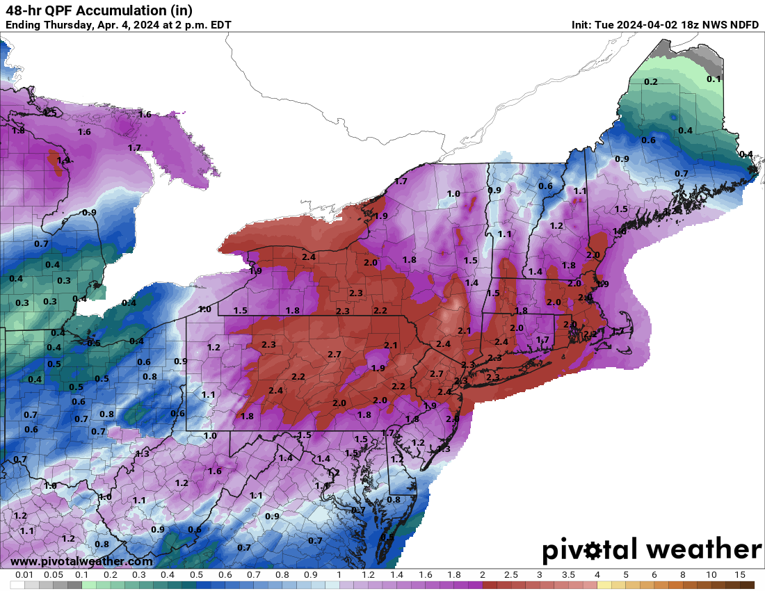
People seemed disappointed I didn't do a thread for the last rainstorm, so here you go. For our area, this rainstorm will be somewhat similar to the one a week and a half ago with 2-3" of rain (locally up to 4") being likely for most of the region over the next 2+ days - the long time duration should prevent major flooding, although some minor (and isolated moderate) urban/stream flooding is likely. In addition, some minor coastal flooding is likely the next 2 days for the Jersey Shore and a wind advisory is up for coastal Middlesex/Monmouth/Ocean for gusts up to 50 mph. Gonna be a couple of raw days out there. The NWS page summarizes the various impacts from the rain well and the NWS 48 hr total precip and snowfall forecast maps are below.
https://www.weather.gov/phi/
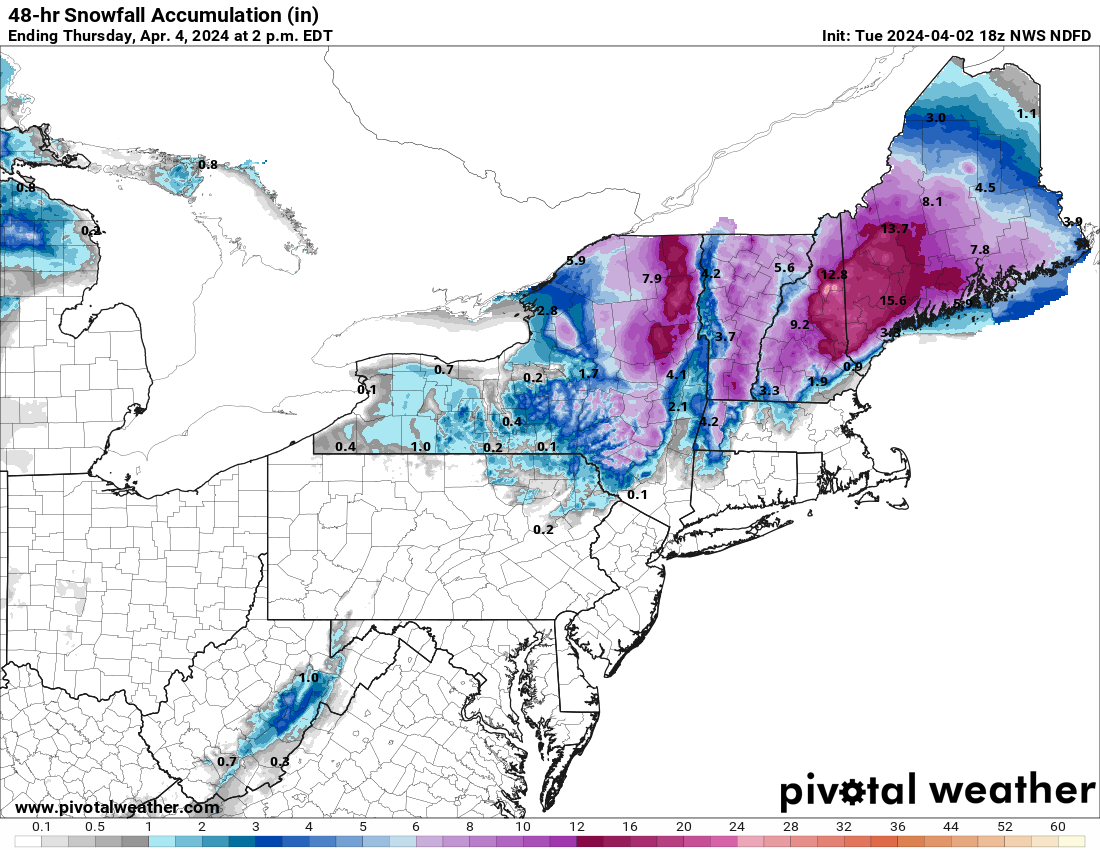
With regard to the cold side, the chances of measurable snow Weds night/Thursday morning for the 95 corridor have dwindled to about nil (at best, some snow showers with no accumulation maybe early Thursday, but unlikely). However, the models are currently split on NW areas with some showing a few to maybe several inches of snow for the Poconos and NWNJ (Sussex/NW Warren/NW Passaic) and even up to 1" along 80 (W of 287), but with some showing only an inch or so of snow for the highest elevations in the Poconos/NW Sussex and no snow anywhere else. This could've been an epic snowstorm for many if there was a bit more cold air to work with and if the track was further SE. Stay tuned if in a NW area.
But for the Catskills and much of interior NY and New England, particularly at higher elevations, it's looking like another snowstorm with watches up for 6" or more of snow and some sleet/freezing rain for the Catskills and ski resorts in central New England and 12-18" or so for the far northern ski areas in the Adirondacks and New England. Spring skiing has turned out to be pretty good for many. And by the way, they're getting hammered with a foot or more of snow in much of WI and northern MI.
https://www.weather.gov/phi/
With regard to the cold side, the chances of measurable snow Weds night/Thursday morning for the 95 corridor have dwindled to about nil (at best, some snow showers with no accumulation maybe early Thursday, but unlikely). However, the models are currently split on NW areas with some showing a few to maybe several inches of snow for the Poconos and NWNJ (Sussex/NW Warren/NW Passaic) and even up to 1" along 80 (W of 287), but with some showing only an inch or so of snow for the highest elevations in the Poconos/NW Sussex and no snow anywhere else. This could've been an epic snowstorm for many if there was a bit more cold air to work with and if the track was further SE. Stay tuned if in a NW area.
But for the Catskills and much of interior NY and New England, particularly at higher elevations, it's looking like another snowstorm with watches up for 6" or more of snow and some sleet/freezing rain for the Catskills and ski resorts in central New England and 12-18" or so for the far northern ski areas in the Adirondacks and New England. Spring skiing has turned out to be pretty good for many. And by the way, they're getting hammered with a foot or more of snow in much of WI and northern MI.