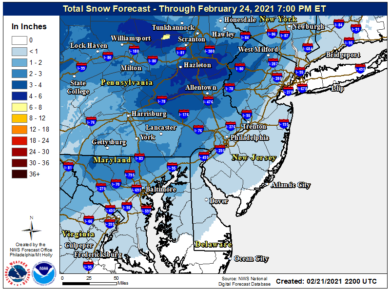
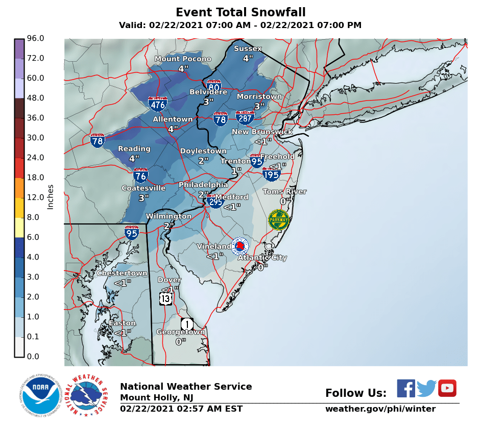
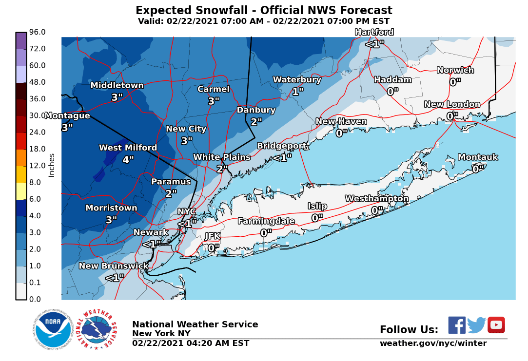
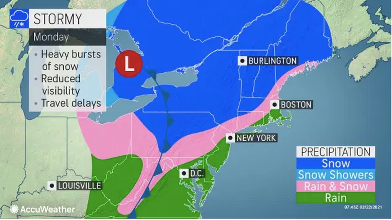
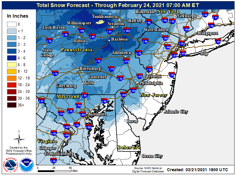
This is not a big deal, but thought folks in the areas listed might not know they likely have a few inches of snow coming tomorrow, starting mid-morning and going into the afternoon. Not a huge storm (0.3-0.4" liquid equivalent), but where it falls as mostly/all snow could produce 2-4" of snow. That's most likely for places like the Poconos, Sussex/Warren/NW Morris/NW Passaic, but even 1-2" of snow could fall down to 78 and not far NW of 95. Might even see a coating to an inch on colder surfaces (like the snow on the ground) along 95 and some models are even showing 1-2", but that's not the forecast.
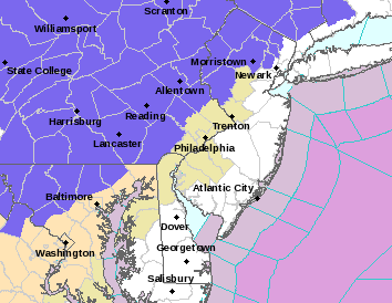
While the models are almost all showing more snow than the NWS is forecasting, the model bust potential is high for seeing those amounts, given borderline temps and the indirect late Feb sun. This is also one of those rare events where Philly is forecast to get more than NB to NYC, since the precip is coming from the west and will reach the Philly area first, while it's a little colder and more likely to snow. We'll see if that verifies.
https://www.weather.gov/phi/