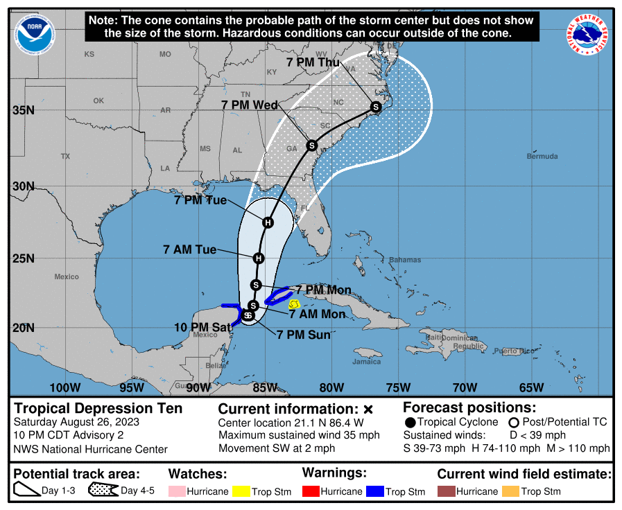
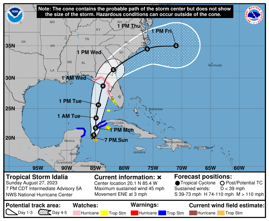
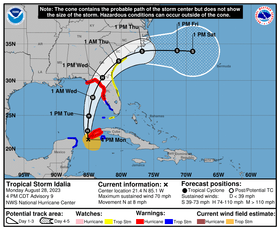
Been talking about this area of concern for a couple of days in the tropical season thread, but now it's nearly certain that this area of disturbed weather with broad low pressure and convection, which is looking more organized, will become TS Idalia in the next few days (90% chance from the NHC), as per every major model, so figured a thread was warranted given the potential US impact. Most of the models show eventual Idalia likely making landfall somewhere from the FL panhandle to the Big Bend area of FL mid/late this coming week (after meandering near the Yucatan Strait for the next day or two), but areas from about Mobile to Tampa need to be watching this storm, as storms that are just forming are notoriously difficult to forecast accurately.
Most of the global/hurricane models show the storm only reaching strong TS status (70 mph or less), but a couple show it becoming a Cat 1 hurricane and given the record warm GOM temps, one has to be concerned that the storm could strengthen more than forecast (shear from an approaching trough is why the models are not showing higher intensity). It's also worth noting that "I" named storms are the most retired storm names in history (the worst storms). Of course, there's always a chance Idalia doesn't form, but that's a low probability. The NHC discussion is below, as well as links to the NHC page, the AmericanWx discussion on this potential storm, and the Tropical Tidbits page with model graphics.
This storm is very unlikely to impact our area. And as a sneak preview, the weather is looking seasonably warm and dry for the NW game (higher confidence than normal 8 days out given the pattern); will start a thread on that tomorrow....
https://www.nhc.noaa.gov/gtwo.php?basin=atlc&fdays=7
https://www.americanwx.com/bb/topic/59459-93l/page/3/#comments
https://www.tropicaltidbits.com/storminfo/#93L
Tropical Weather Outlook
NWS National Hurricane Center Miami FL
800 AM EDT Sat Aug 26 2023
1. Northwestern Caribbean Sea and Eastern Gulf of Mexico (AL93):
Shower and thunderstorm activity continues to show signs of
organization in association with an area of low pressure located
near the Yucatan Channel. Environmental conditions appear conducive
for further development of this system, and a tropical depression is
likely to form within the next day or two while it moves generally
northward over the southeastern Gulf of Mexico. Interests in the
Yucatan Peninsula of Mexico, western Cuba, and Florida should
monitor the progress of this system.
* Formation chance through 48 hours...high...70 percent.
* Formation chance through 7 days...high...90 percent.
Last edited: