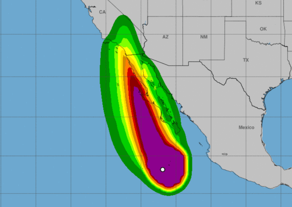
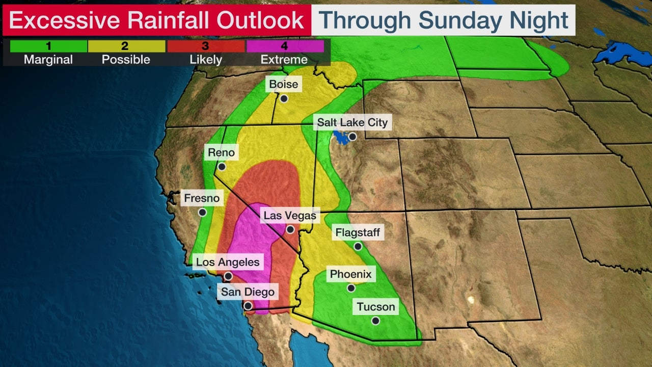
So, Hilary just made landfall on the Baja Peninsula as a strong TS with 65 mph winds and torrential rains, with catastrophic flooding looking likely for that area and parts of SoCal and Nevada, where 3-6" of rain are still forecast and heavy rains have begun falling. This is more rain than some areas in the desert get in a year and most of this area gets zero rain in August, so this is unprecedented. We could even see a few inches of rain as far north as Utah and western Oregon.
Wind gusts of 78 mph have already been recorded in the mountans east of San Diego - most areas won't see winds over 50 mph, but we could see plenty of hurricane force wind gusts in the mountains (less frictional effects). The mountainous areas that get torrential rains could definitely see mudslides, too. See the graphic below detailing the flooding threat and the NHC bulletin below and the links to the Wunderground article and NHC webpage on the storm. This is a serious and life-threatening storm for this area.
https://www.wunderground.com/articl...hern-california-flood-tropical-storm-forecast
https://www.nhc.noaa.gov/graphics_ep4.shtml?start#contents
BULLETIN
Tropical Storm Hilary Intermediate Advisory Number 17A
NWS National Hurricane Center Miami FL EP092023
1100 AM PDT Sun Aug 20 2023
...HILARY MAKES LANDFALL OVER THE NORTHERN BAJA CALIFORNIA
PENINSULA...
...CATASTROPHIC AND LIFE-THREATENING FLOODING LIKELY OVER BAJA
CALIFORNIA AND PORTIONS OF THE SOUTHWESTERN U.S. THROUGH MONDAY...
SUMMARY OF 1100 AM PDT...1800 UTC...INFORMATION
-----------------------------------------------
LOCATION...29.9N 115.6W
ABOUT 215 MI...340 KM SSE OF SAN DIEGO CALIFORNIA
MAXIMUM SUSTAINED WINDS...65 MPH...100 KM/H
PRESENT MOVEMENT...NNW OR 345 DEGREES AT 25 MPH...41 KM/H
MINIMUM CENTRAL PRESSURE...988 MB...29.18 INCHES

deadline.com
