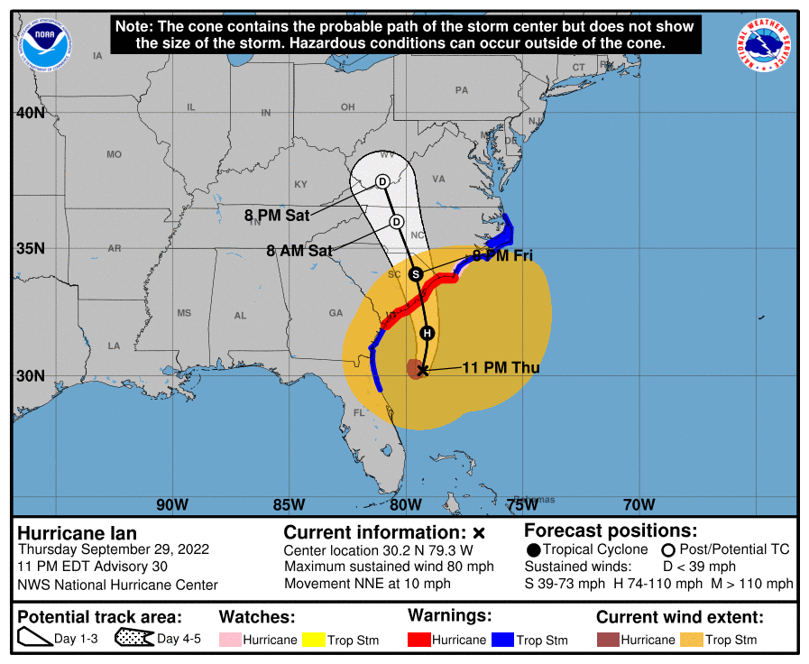
Ian regained hurricane status at 5 pm with 75 mph winds and they're now up to 85 mph, as the storm is moving towards landfall along the SC coast in about 18 hours, when the forecast calls for an 85 mph hurricane (it's not expected to strengthen much at all due to shear). As we've seen all along for Ian, the actual track keeps being a bit south or east of the forecast track and that is continuing, as landfall is now forecast to be about 50 miles NE of Charleston, as opposed to being very close to Charleston 12 hours ago.
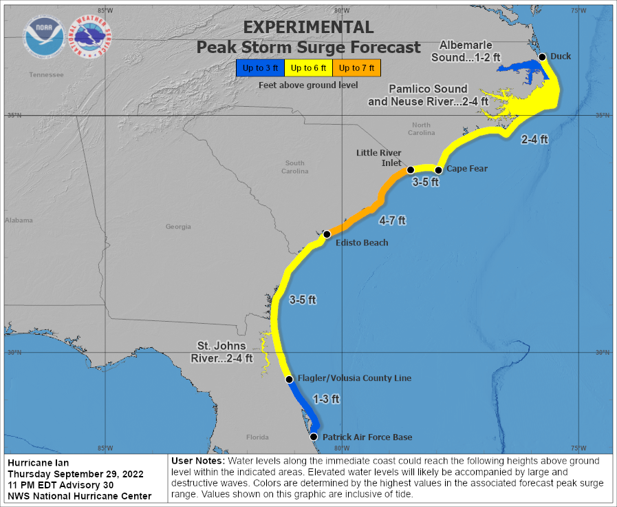
That is a significant relief for Charleston, if it verifies, as it now ought to mostly experience offshore winds as Ian approaches, which should limit surge. However, the surge forecasts weren't decreased yet, as I'm guessing the NHC doesn't want to have people there let their guard down, since the track could shift back closer to Charleston. But surges in NE SC and SW NC could easily be in the 4-7' predicted - likely not catastrophic, except for low-lying areas.
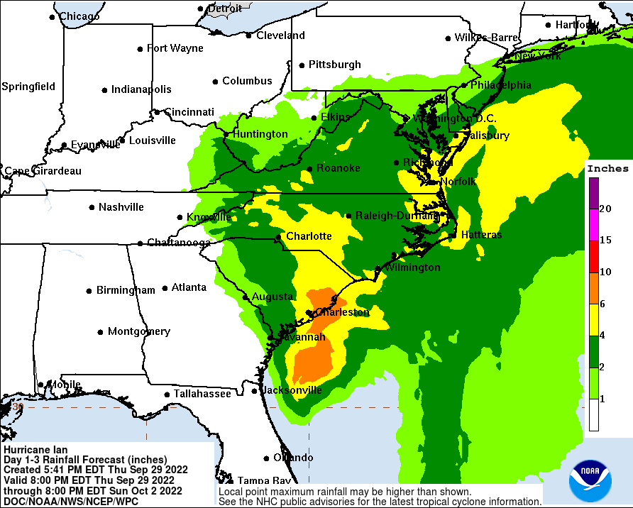
As Ian moves inland, the winds will not die down that quickly, partly because Ian has become a bit of a hybrid storm based on interactions with the stalled frontal system in the SE US (which runs up to our area), so it's not deriving all of its energy from ocean water evaporation (getting some from baroclinic sources, i.e., the gradient from warm to cold air masses, as we see with most lows in our area, including nor'easters). Hence TS force winds are expected a couple of hundred miles inland in SC and NC, as well as heavy rains with 4-8" forecast.
For our area, the main issue is just the rain from a combination of Ian's remnants (which will dissipate in western VA) and that stalled front which extends up to our area. We could get 2-4" along the coast and in SNJ/DE and 1-2" along the 95 corridor, but much less well NW - and we can use the rain, which will mostly fall on Saturday into Sunday.
https://www.nhc.noaa.gov/graphics_at4.shtml?start#contents

 explore.org
