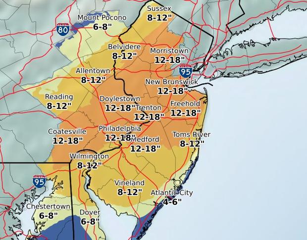
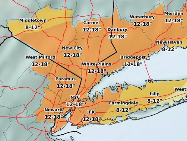
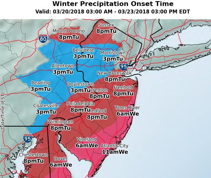
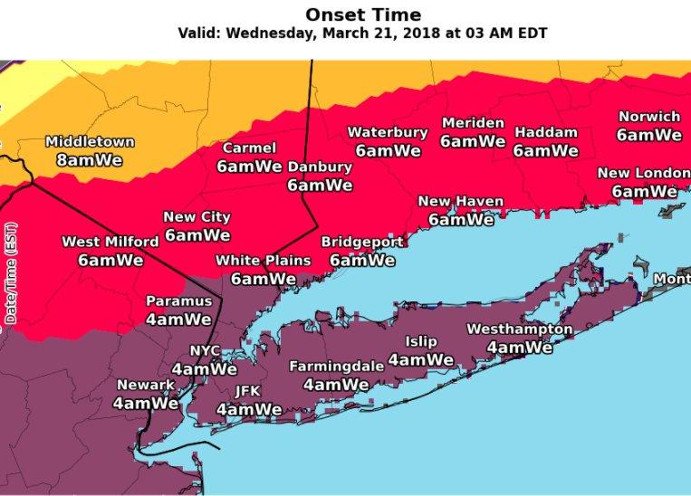
Just woke up for a bit and saw the NWS snowfall maps, posted below. Warnings are up for basically the whole Philly-NYC region for a general 8-14" of snow for most starting early Weds around dawn and going through Weds evening. The high end amounts will likely be where the best frontogenetic forcing and mesoscale banding is, which is impossible to predict in advance, as we've seen multiple times this winter.
Accumulations may be 6-9" well N/W (Poconos), due to less precip (and the 6Z NAM just came out and shows a fair amount less snow NW of about 20 miles NW of 95) and along the SE NJ coastal areas, due to sleet/rain mixing in, especially early Weds. Sleet could mix in for awhile as far inland as I-95 for a bit. Could be some heavy snowfall rates of 1-2" per hour, which wlll mean accumulation on all surfaces, even in late March during the day. For today and tonight expect some occasional light snow/sleet or maybe freezing rain, with little or no accumulation. Gotta get some more sleep, lol...
Still 24 hours from the main event, so there could easily be some modest to even significant shifts in the storm track and impacts, so stay tuned - in fact, the 6Z NAM just came out and shifted the track SE about 25 miles such that areas NW of about a line 20 miles NW of 95 would get only 3-6" or so - could be a blip or could be a trend. Once the main low forms this evening and starts to strengthen, we'll have a much better handle on final snowfall amounts for the region.
Edit - it's never easy, lol - just look at the new 6Z NAM which went east a fair amount and the 6Z RDPS/RGEM, which came west a bit and is snowier. Going back to sleep for a bit - you guys figure it out, lol...
8 am edit: the rest of the 6Z models generally held serve overall, with the HRDPS and CMC getting a bit snowier vs. 00Z and the GFS getting somewhat less snowy (not sure why on any of these - could just be natural run to run variability - only the 6Z NAMs made a significant shift in track). Here they are. Wouldn't expect any changes in the forecast based on the 6Z suite of models - perhaps a small decrease at most - if the NAM continues the eastward shift at 12Z, then forecasts may change). 12Z up next...