

Colleges
- AAC
- ACC
- Big 12
- Big East
- Big Ten
- Pac-12
- SEC
- Atlantic 10
- Conference USA
- Independents
- Junior College
- Mountain West
- Sun Belt
- MAC
- More
- Navy
- UAB
- Tulsa
- UTSA
- Charlotte
- Florida Atlantic
- Temple
- Rice
- East Carolina
- USF
- SMU
- North Texas
- Tulane
- Memphis
- Miami
- Louisville
- Virginia
- Syracuse
- Wake Forest
- Duke
- Boston College
- Virginia Tech
- Georgia Tech
- Pittsburgh
- North Carolina
- North Carolina State
- Clemson
- Florida State
- Cincinnati
- BYU
- Houston
- Iowa State
- Kansas State
- Kansas
- Texas
- Oklahoma State
- TCU
- Texas Tech
- Baylor
- Oklahoma
- UCF
- West Virginia
- Wisconsin
- Penn State
- Ohio State
- Purdue
- Minnesota
- Iowa
- Nebraska
- Illinois
- Indiana
- Rutgers
- Michigan State
- Maryland
- Michigan
- Northwestern
- Arizona State
- Oregon State
- UCLA
- Colorado
- Stanford
- Oregon
- Arizona
- California
- Washington
- USC
- Utah
- Washington State
- Texas A&M
- Auburn
- Mississippi State
- Kentucky
- South Carolina
- Arkansas
- Florida
- Missouri
- Ole Miss
- Alabama
- LSU
- Georgia
- Vanderbilt
- Tennessee
- Louisiana Tech
- New Mexico State
- Middle Tennessee
- Western Kentucky
- UTEP
- Florida International University
High School
- West
- Midwest
- Northeast
- Southeast
- Other
- Alaska
- Arizona
- California
- Colorado
- Nevada
- New Mexico
- Northern California
- Oregon
- Southern California Preps
- Washington
- Edgy Tim
- Indiana
- Kansas
- Nebraska
- Iowa
- Michigan
- Minnesota
- Missouri
- Oklahoma Varsity
- Texas Basketball
- Texas
- Wisconsin
- Delaware
- Maryland
- New Jersey Basketball
- New Jersey
- New York City Basketball
- Ohio
- Pennsylvania
- Greater Cincinnati
- Virginia
- West Virginia Preps
ADVERTISEMENT
Install the app
How to install the app on iOS
Follow along with the video below to see how to install our site as a web app on your home screen.
Note: This feature may not be available in some browsers.
You are using an out of date browser. It may not display this or other websites correctly.
You should upgrade or use an alternative browser.
You should upgrade or use an alternative browser.
OT: Major winter storm 3/20-21?
- Thread starter RU848789
- Start date
So are we looking at heavy, wet snow once again?
That's what the National Weather Service has been saying for the last few days -- maybe they've changed now, but I haven't heard that.
So are we looking at heavy, wet snow once again?
Just looked at the most recent NWS briefing (4 p.m. Tuesday), and the answer is "yes."
Looks like 3K NAM came in with more widespread snow. Which had been the opposite up until now I believe. Interesting
but its not as ridiculous as the regular NAM..it has more reasonable amounts. I think the 12K was way overdone...3k is way to go.


I know most of you are probably tired of this weather and forecast, but c'mon, THUNDERSNOW!!
im not thinking this will go over well...no one should rooting for this shit that can potentially cause a lot of issues beyond just not being able to get out for a day.
TONE DEAF


Drive from Woodbridge to Wall sucked for the last 10 miles. People need to learn how to drive.
Car in ditch near Allaire State Park. Jeep off the road on Ramshorn.
Car in ditch near Allaire State Park. Jeep off the road on Ramshorn.
im not thinking this will go over well...no one should rooting for this shit that can potentially cause a lot of issues beyond just not being able to get out for a day.
TONE DEAF
its called passion.... he's not rooting for death and destruction. I like looking at tsunamis but I don't root for them to cause death and destruction. when we physician see novel forms of cancer we use the word "impressive" but we don't root for cancer.
Very heavy wet 1-2 inch base of snow/sleet already down in Cherry Hill area.
A foot plus of wet snow over this will not be good for trees and power lines.
A foot plus of wet snow over this will not be good for trees and power lines.

509 PM EDT Tue Mar 20 2018
.SYNOPSIS...
A pair of low pressure systems to our south today will consolidate
into an intense nor`easter just east of the mid-Atlantic coast on
Wednesday, then pass southeast of Nantucket Island Wednesday night.
A blustery cold northwest flow follows in its wake Thursday and
Friday. Canadian high pressure builds in to start the weekend.
Another low pressure system may pass to our south early next week.
&&
.NEAR TERM /UNTIL 6 PM THIS EVENING/...
A mixed bag of precipitation is encompassing much of the area
this afternoon, with combination of snow/sleet/freezing rain
beginning to accumulate on paved and non-paved surfaces west of
the Delaware River and at least on elevated surfaces in
central/southern New Jersey. Plain rain dominates south of Kent
County MD/DE and in Cape May County, NJ. Travel impacts are
beginning to occur. As such, feel that ramping up the start time
of the winter storm warning to the present is a good idea,
generally between I-80 and New Castle/Queen Anne`s Counties.
However, I delayed the start time of the warning until 6 am for
far northern New Jersey and for the rest of Delmarva, where
precipitation will either be sparse (north) or mostly liquid
(with temps above freezing; south).
The evening commute may be difficult, especially near/west of
Philly, where quick bursts of snow/sleet/freezing rain have
already caused some problems. Several reports of 0.5-2 inches of
snow/sleet accumulation have been received, and several ASOS
sites are reporting freezing rain mixing in with the snow/sleet
(including ILG and PHL). Worried that some roads will become
quite hazardous during rush hour.
Updated grids expanded freezing rain mention along the
I-76/I-95/I-295 corridors. Also lowered temperatures a little
bit, since wet bulbing was still keeping temps lower than what
models are insisting upon.
Meanwhile, wind gusts 40-50 mph are ongoing in Sussex County in
Delaware and Cape May/Atlantic Counties in NJ. Wind advisory
looks good. Based on delaying the winter storm watch here, may
end up extending the wind advisory through the night to account
for the continued wind threat. So far, though, have kept the
advisory through 6 pm.
&&
.SHORT TERM /6 PM THIS EVENING THROUGH 6 AM WEDNESDAY/...
Potent vort max moving through the Ohio/Tennessee Valleys this
afternoon will pivot into more of a negative tilt overnight,
with considerable large-scale ascent downstream in much of the
Mid-Atlantic. Downstream surface low off the coast will be
absorbed/overtaken by a strengthening/kicker vort max late
tonight. Long-duration onshore flow and low-level isentropic
lift will occur north of the low in the northern Mid-Atlantic.
This should permit continued precipitation in much of the area
tonight, though some gradual lessening of rates will occur as
the strongest/deepest lift with the predecessor vort max moves
out of the area. However, another ramp-up will likely begin by
the end of the night in the region as considerable differential
cyclonic vorticity advection begins, aided by left-exit region
upper-level divergence as a cyclonic jet streak reaches the
Southeast coast.
As mentioned above, precipitation during the late evening and
early overnight hours will become somewhat lighter and
potentially even drizzly. This is concerning, because this may
permit liquid precipitation to expand northward/westward as the
precipitation intensity lightens. With temperatures near or even
below freezing, freezing drizzle/rain may become more
widespread between the I-195 and I-76 corridors this evening and
in northern/central Delmarva through much of the overnight. I
expanded icing potential considerably during the evening/early
overnight hours, with potential for up to tenth-of-an-inch
accumulations, especially in far southern New Jersey and
northeast MD/northern DE. Just how far south this threat expands
is a tough question, as temperatures should stay marginal in
the Dover/Stevensville areas southward. This may require
frequent grid edits overnight, based on nowcasting.
The precipitation will ramp up again late, and dynamic cooling
aided by considerable large-scale lift should get the snow
machine cranking from west to east late in the night. The main
show will begin tomorrow.
For temps/dew points, used a blend of 2-m NAM/ECMWF with only
some weighting to the previous forecast, given these models`
generally superior performance during the past 12 hours.
Winds at the coast may stay elevated overnight, which may
require extension of the wind advisory. Winds will likely stay
elevated tonight -- I kept gusts 25 to 30 mph through much of
the area, and they may actually remain higher than this in the
higher terrain, especially late.
&&
.LONG TERM /WEDNESDAY THROUGH TUESDAY/...
The following is stated with a request to please check back on
our 4 AM products tomorrow morning. But as of this writing...we
continue to need to sound the siren for major or extreme impact
for the I95 corridor to I80 Wednesday afternoon and night.
Major and dangerous probable record breaking March winter snow
storm (pasting!) for both the 2 day total and the month of
March for parts of our area (NNJ for the month, PHL the storm)
with impassable roads expected and possibly the greatest number
of power outages from any storm so far in March. This continues
to look HUGE and potential extreme impact I95 corridor up to
I80.
Take this storm seriously and prepare for changing your daily
plans, especially Wednesday. Unnecessary travel is not recommended
Wednesday in eastern PA and the northwest two thirds of NJ. It
could be life threatening if disabled in rural areas. If you
have to travel, plan for much much longer commutes. Potential
exists widespread cancellations in eastern PA and much of nw NJ.
This forecast today was split between myself Wednesday through
Friday, and Lance, Friday night through the weekend.
Growing 12z/20 model consensus (exception the seemingly lagging
op 12z/20 ECMWF?) with heavy reliance on the NAM 12 and 3KM as
well as the bountiful model qpf from the RGEM/GGEM, UKMET.
We expect widespread 1 to 3 inches of qpf from this, heaviest se
PA thru northern and central NJ, Banding will be a huge
contributor. The northwest fringe of our area from KMPO to High
Point may escape with only 6 to 10 inches of snow but it is now
expected that widespread storm totals 10-20" will occur I95
corridor nwwd with isolated 25 inch amounts possible some where
between I95 and and I80...probably best chance hilly areas of
northern NJ where some 30 inches has already occurred this
month.
The forecast snow total map includes todays sleet/snow mix and
the anticipated much greater snowfall on Wednesday. Please
realize that pavement amounts will be considerably less but we
expect at least 7 inches on all pavements in NJ/e PA from this
storm as a minimum and at least 3" pavements elsewhere to the se
of I95. We forecast for the traditional accumulating surfaces
including homes/trees/wires and that is what will cause the
power outages...ie 6" or more of wet snow (32-33F) should
trigger a sharp increase in power outages Wednesday afternoon.
Also wind driven wet snow or freezing rain clinging to branches
and wires will be part of the power outage problem. Our forecast
amounts are presented on our winter wx page and social media
briefing packages serves as a good start! Have been
uncomfortable forecasting these amounts the past two days in our
area, late season and what not, but the recent advances in
modeling and snow forecasting science tells us these amounts
are probable including running qpf from snow ratios.
Wednesday and Wednesday night through 2 am Thursday...By 00z/22
(Wednesday evening), our forecast area will have been in
constant 3 to 4 standard deviation 850MB easterly flow with
pretty high values of moisture flux for 24hours!!, beginning
late this afternoon and continuing through Wednesday afternoon.
This less extreme easterly flow inflow might normally mean less
qpf, but the unusually long duration has to make up for the
normally faster newd movement of the 850MB ely inflow. I think
this justifies the NAM and GGEM QPF and resultant excessive late
season snowfall.
As the 500 mb associated heights lower, whatever remains of the
remaining above freezing 880-800MB layer is cooled to freezing
around 12z/Wednesday along and nw of I95, and any mixed
precipitation will change to snow. (We think the NAM warm nose
is a bit overdone but respect it becoming more pronounced this
evening before cooling tomorrow morning).
Bands of cirrus will increase the seeding potential (potential
thunder snow) and there is considerable agreement that FGEN
banding will develop on the northwest periphery of the deepening
mid Atlc coast cyclone. That will mean 1-3"/hr accumulations at
times Wednesday afternoon and evening, especially I95 westward.
This with snow water ratios of 11 or 12 to 1 e PA and nNJ (near
9 or 10 to 1 I95 should result in record breaking (see climate
section). If thunderstorms occur (we saw lightning in clouds in
nw VA and around 11z and recently se of DC around 1320z), then
we may have a repeat of 3-4" hr snowfall rates. There is still
uncertainty on whether thunder will occur.
Strong winds, with gusts around 45 mph, primarily along the coast,
and primarily during the morning. This will could cause power
problems, especially if there is already a snow load on trees
and power lines. The strongest winds may occur before the heaviest
snow, although that is still somewhat uncertain. I also don`t
think these strong winds will contribute too much to blowing
snow prior to the evening commute. This will be a very heavy
wet snow which should limit the blowing snow threat until
sundown Wednesday. For now consider this heart attack - power
outage snow, pasted street signs.
Late Wednesday night after 2 am Thursday...snow tapering off
late with gusty northwest winds to 25 MPH.
its called passion.... he's not rooting for death and destruction. I like looking at tsunamis but I don't root for them to cause death and destruction. when we physician see novel forms of cancer we use the word "impressive" but we don't root for cancer.
Of course you don't root for death and destruction but you know these types of severe weather events cause catastrophic consequences. Sure its an awe sight to see a tornado but you know damn well that's gonna cause destruction.
One saving grace in terms of people having to plow, shovel, or snowblow....this blurb from the Mt Holly disco
The forecast snow total map includes todays sleet/snow mix and
the anticipated much greater snowfall on Wednesday. Please
realize that pavement amounts will be considerably less but we
expect at least 7 inches on all pavements in NJ/e PA from this
storm as a minimum and at least 3" pavements elsewhere to the se
of I95. We forecast for the traditional accumulating surfaces
including homes/trees/wires and that is what will cause the
power outages...ie 6" or more of wet snow (32-33F) should
trigger a sharp increase in power outages Wednesday afternoon.
Also wind driven wet snow or freezing rain clinging to branches
and wires will be part of the power outage problem. Our forecast
amounts are presented on our winter wx page and social media
briefing packages serves as a good start! Have been
uncomfortable forecasting these amounts the past two days in our
area, late season and what not, but the recent advances in
modeling and snow forecasting science tells us these amounts
are probable including running qpf from snow ratios.
its called passion.... he's not rooting for death and destruction. I like looking at tsunamis but I don't root for them to cause death and destruction. when we physician see novel forms of cancer we use the word "impressive" but we don't root for cancer.
I know he isnt rooting for destruction but he needs to realize that pretty much no one wants especially late in the season and especially because of the potential damage this particular storm can cause. This is not the weather board where they root for the most amount of snow...I have no idea what that is about.
so sorry I dont like overexuberance that will cost alot of monetary damages and then some when we have weakened trees and facing a potential foot of snow that will have power outages again.. when we working I saw all the downed trees and power lines last time and believe me its a dangerous situation
and how can you be in a awe of snow...it snows, it happens, its snowed for years, we have had big storms..wow so
I dig it.I know he isnt rooting for destruction but he needs to realize that pretty much no one wants especially late in the season and especially because of the potential damage this particular storm can cause. This is not the weather board where they root for the most amount of snow...I have no idea what that is about.
so sorry I dont like overexuberance that will cost alot of monetary damages and then some when we have weakened trees and facing a potential foot of snow that will have power outages again.. when we working I saw all the downed trees and power lines last time and believe me its a dangerous situation
and how can you be in a awe of snow...it snows, it happens, its snowed for years, we have had big storms..wow so
NYC public schools are officially closed. Waiting to get an email from my kids school to follow suit.
Such a snowflakeI know he isnt rooting for destruction but he needs to realize that pretty much no one wants especially late in the season and especially because of the potential damage this particular storm can cause. This is not the weather board where they root for the most amount of snow...I have no idea what that is about.
so sorry I dont like overexuberance that will cost alot of monetary damages and then some when we have weakened trees and facing a potential foot of snow that will have power outages again.. when we working I saw all the downed trees and power lines last time and believe me its a dangerous situation
and how can you be in a awe of snow...it snows, it happens, its snowed for years, we have had big storms..wow so
Who cares. If you don't want to see people cheering on snow, don't open the thread. It's an easy solution.
Thank you to all for taking the time to post your info here. It's become a go to source for me. And I enjoy the banter bet bac and numbers. I legit have no clue what you're arguing over 90% of the time, which makes it funnier.
Thank you to all for taking the time to post your info here. It's become a go to source for me. And I enjoy the banter bet bac and numbers. I legit have no clue what you're arguing over 90% of the time, which makes it funnier.
Or this:if you root for snow, expect pushback, thats all fair game,
I know he isnt rooting for destruction but he needs to realize that pretty much no one wants especially late in the season and especially because of the potential damage this particular storm can cause. This is not the weather board where they root for the most amount of snow...I have no idea what that is about.
so sorry I dont like overexuberance that will cost alot of monetary damages and then some when we have weakened trees and facing a potential foot of snow that will have power outages again.. when we working I saw all the downed trees and power lines last time and believe me its a dangerous situation
and how can you be in a awe of snow...it snows, it happens, its snowed for years, we have had big storms..wow so
this is easy to defend but since it's numbers passion I'll let him defend that. Everybody has their passions. Some people love guns, some people love fires, some people really like seeing terrible diseases ... you and I might not get it, but I don't think they necessarily Root 4 death and destruction.
and him rooting for it or any of the weenies doesn't equate it to much of anything.
Stop now. Most people have had it.I know most of you are probably tired of this weather and forecast, but c'mon, THUNDERSNOW!!
Im with bac but I get numbers obsession and really appreciate that both put a lot of thought and helpfulness into the weather threads.
I have a very different way of looking at it, and at similar things. I happen to share #s love of snow and intense weather. But even when it's not a something I share a passion for with someone, I get a lot of joy from observing another person's unbridled joy and passion for a thing. I sometimes find such things even more emotionally satisfying than doing things I love to do.I know he isnt rooting for destruction but he needs to realize that pretty much no one wants especially late in the season and especially because of the potential damage this particular storm can cause. This is not the weather board where they root for the most amount of snow...I have no idea what that is about.
so sorry I dont like overexuberance that will cost alot of monetary damages and then some when we have weakened trees and facing a potential foot of snow that will have power outages again.. when we working I saw all the downed trees and power lines last time and believe me its a dangerous situation
and how can you be in a awe of snow...it snows, it happens, its snowed for years, we have had big storms..wow so
As an example I suspect will surprise you, while I mock the hell out of you on the CE board for your enthusiasm for certain political things, I actually am made happy for the obvious pleasure you take in it all. I think it's awesome how into it you get.
This is something I've realized later in life than I wish I had discovered a lot sooner.
I have a very different way of looking at it, and at similar things. I happen to share #s love of snow and intense weather. But even when it's not a something I share a passion for with someone, I get a lot of joy from observing another person's unbridled joy and passion for a thing. I sometimes find such things even more emotionally satisfying than doing things I love to do.
As an example I suspect will surprise you, while I mock the hell out of you on the CE board for your enthusiasm for certain political things, I actually am made happy for the obvious pleasure you take in it all. I think it's awesome how into it you get.
This is something I've realized later in life than I wish I had discovered a lot sooner.
midone.. you are a person who "gets it",
one of the true joys in life. taking Delight in others Delight. that being said, I hope before I die that I get to see a huge asteroid crash into Earth. I've always loved asteroids and Science and Space. But of course I would want it to happen without anyone getting hurt :pray::smiley::chairshot:
While you guys argue, I’m not worried about snow, I’m worried about physical injuries from falling limbs and trees, emergency response and property damage.
Those are all byproducts of spring blizzards.
If you could guarantee me no falling trees, I don’t care how much it snows at this point
Those are all byproducts of spring blizzards.
If you could guarantee me no falling trees, I don’t care how much it snows at this point
I remember, as a young kid, being able to look up at night, and see stars -- lots of them. I vaguely remember seeing "the Milky Way" band of stars that nowadays, unless you're maybe Skillet, in New Zealand, you never see anymore, unless it's in photos. There was, and still is, a sense of wonder. It's never left me, I'm just a grown-up, now, that basically knows that we live on a planet, and planets do what they want, and it really doesn't matter whether we want it to or not. The day-to-day frustrations of crappy weather, or the impact of the weather on us, is more apparent to us, as adults, but the wonder will always be there.
Anonymous
2018
Anonymous
2018
as an adult I dislike snow. I dislike the work and the inconvenience, the destruction and lost office time Etc.
but I do also take Delight in the enthusiasm and the science behind all the weenies craziness.
there's also a sense of nostalgia and childhood memories of building forts with my brothers and friends and snowball fights and staying home and listening on the radio for closings. so the meaning of snow has many layers to a lot of people. I feel bad for the younger Generations who never will have developed a neighborhood sense of that kind of nostalgia and wonderment.
as an adult I dislike snow. I dislike the work and the inconvenience, the destruction and lost office time Etc.
but I do also take Delight in the enthusiasm and the science behind all the weenies craziness.
there's also a sense of nostalgia and childhood memories of building forts with my brothers and friends and snowball fights and staying home and listening on the radio for closings. so the meaning of snow has many layers to a lot of people. I feel bad for the younger Generations who never will have developed a neighborhood sense of that kind of nostalgia and wonderment.
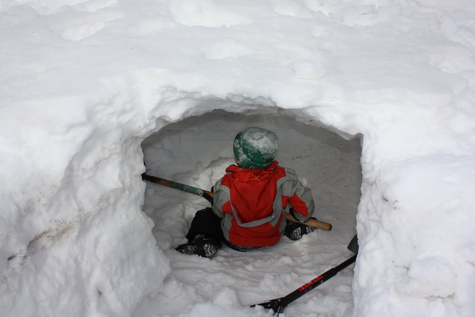
This was me, my brother and sister, and all the neighborhood kids. Every winter.
What time will it get bad in south jersey? Is it feasible to get a half day in at the office and head home around 1 without getting stuck?
doesn't seem like a good bet, but if I were you, I wouldn't decide until you're about to start for work in the morning. We'll have a better idea then of whether roads are passable and whether they are likely to stay that right. If you have to decide right now, I'd advise you to decide "no." With 12-18 inches of snow forecast, there is too high a chance that the roads will be impassable by 1.
The farmer prays for rain. The pottery maker prays for sun. Numbers prays for snow. Que sera sera.
ALALALALALALALALALALALALALALALALALA!!
Similar threads
- Replies
- 608
- Views
- 17K
- Replies
- 62
- Views
- 2K
- Replies
- 160
- Views
- 3K
- Replies
- 771
- Views
- 20K
ADVERTISEMENT
Latest posts
-
-

-
***Ask The Experts Presented by American Financial Network’s Greg Ginn***
- Latest: rutgersspeak95
-
ADVERTISEMENT