ADVERTISEMENT

OT: Nor'easter (rain then snow?) 3/1-2, then wintry pattern for next week?

Aside from snow/rain debate, when is the precipitation supposed to start in South Monmouth, when will be the peak precipitation, and when is it supposed to end?

I just glanced at the NWS web site, they're saying scattered showers after 4:00, steady rain through the overnight with 1-2" possible, then showers through most of tomorrow with maybe another 1/2" to 3/4".
 
  • Like
Reactions: Knight Shift
Aside from snow/rain debate, when is the precipitation supposed to start in South Monmouth, when will be the peak precipitation, and when is it supposed to end?
It's in the post you quoted - it applies to the whole area really, plus or minus an hour or so on the front and back. Gets going tonight, heavy rain overnight and heavy precip at times through early Saturday morning. Long duration event.
 
The real question. Can I practice outside Friday afternoon/ Saturday morning for the opening of lacrosse season in Hunterdon County?
 
United Airlines issued travel waivers out of Newark and the other local airports, so I changed my Friday morning flight from 10am to 6:30am for free.

Made the change online and then it necessitated a phone call last night after to "reissue the ticket" and another LONG one this morning after an email saying the ticket "had no value". What a mess. Finally got it worked out with some supervisor, have my boarding passes and am hoping the plane gets up in the air at 6:30am, and will be having some cold beers by noon!
 
  • Like
Reactions: Knight Shift
the mets around the area and NWS do not seem to be too bullish on accumulating snows being a big factor south of 78 despite some hysteria on 33andrain boards. Probably going to be a nowcasting type thing to see if the heavier rates bring a change to snow and where banding sets up and subsidence in between that is just light rain. Obviously those in the NW sections should be prepared for some Colgate paste.
 
My daughter has a flight to Europe Saturday evening out of Kennedy and Delta sent a travel warning offering her the same ability to switch to a different flight. They are on a tight schedule with connections and really don't want to change unless necessary. Seems like this weather should be done by then but I wonder if the issue is the inbound flight.
 
the mets around the area and NWS do not seem to be too bullish on accumulating snows being a big factor south of 78....
That's an understatement. Even the 1-in-10 chance map only shows 1 inch or less south of 78.
 
My daughter has a flight to Europe Saturday evening out of Kennedy and Delta sent a travel warning offering her the same ability to switch to a different flight. They are on a tight schedule with connections and really don't want to change unless necessary. Seems like this weather should be done by then but I wonder if the issue is the inbound flight.

Flights inbound to international connections are given priority.
 
Insanely difficult forecast, due to insanely complex system. Model outputs for the 95 corridor range from 6+" of snow to a couple of inches to all rain (with more models showing little or no snow); similarly for areas well to the N/W the range is from a few inches to well over a foot of snow. So, the NWS has responded with the snowmaps below, but has hedged in their discussion with the below comment, which is why people still need to pay attention to the snow threat: Note that the heavy rain should start this evening and moderate to heavy precip will likely continue through early Saturday morning. The changeover to snow well inland will likely be early Friday and would be later Friday for the 95 corridor if it does change over.

However, confidence on the thermal profiles and the resultant
extent of snow and total accumulations is very low outside of
the winter storm watch. Large changes to the forecast Friday and
Friday night are possible in the next 24 hours as a result.


As I said yesterday, no matter what, this going to be a powerful nor'easter with potential for 2-3" of rain (if all rain), which could cause some urban/stream flooding, minor to moderate coastal flooding Friday/Saturday (but NOT Sandy kind of flooding, which was catastrophic), and high winds (25-35 mph with gusts to 40-50 mph, especially near the coast). Also, anywhere that gets 6" or more of heavy wet snow, will potentially have issues with downed trees and power lines and power outages (this might even occur if it's all rain, especially with the wind and saturated soil). All kinds of watches are up for flooding/winds.

One more thing: given the high wind watch in place for the entire area (gusts over 50 mph possible for the event), anywhere that it does snow will likely experience very low visibility conditions at times due to heavy falling snow and high winds, i.e., blizzard conditions - might even see blizzard warnings going up for NW areas. And even in areas like 95 and the coast where there might only be a little to some snow, when that snow does fall, there could be local blizzard conditions.

28576094_10213352561042544_5904464641878130688_n.jpg


28377475_10213352563642609_666398552892637184_n.jpg

Same discrepancy in models we've had for awhile now. NAM is a decent hit for 95/coast (4-8") and a huge hit inland, Euro and HRDPS are a modest hit for the 95/coast (1-3"/2-4") and a good hit inland (4-8" or more), and GFS/CMC are whiffs for 95/coast with a modest hit well inland (Poconos, Sussex, Catskills - 1-3/2-4").

So what will happen? No friggin' clue. If I had to forecast for 95/coast, I'd go with 1-3" as it's reasonable and alerts people to the risk of snow (whereas the NWS forecast does not at all) and if we got a 3-6" overperforming storm, it wouldn't be a total surprise.

All the other impacts are a given: big rains, minor to moderate urban, stream and coastal flooding, high winds for an extended period, potential power issues, especially where heavy snow falls and possible blizzard conditions with high winds and snow. The kitchen sink, lol.

Gotta go back to work, but then have an event in JC for chem eng'g alums tonight, then going to the Garden for the RU game, so I might not have much more to say on this before late tonight.

Hopefully you'll be commenting on the impact to a Friday night game of RU vs. purdue.
 
  • Like
Reactions: ATIOH
Same discrepancy in models we've had for awhile now. NAM is a decent hit for 95/coast (4-8") and a huge hit inland, Euro and HRDPS are a modest hit for the 95/coast (1-3"/2-4") and a good hit inland (4-8" or more), and GFS/CMC are whiffs for 95/coast with a modest hit well inland (Poconos, Sussex, Catskills - 1-3/2-4").

So what will happen? No friggin' clue. If I had to forecast for 95/coast, I'd go with 1-3" as it's reasonable and alerts people to the risk of snow (whereas the NWS forecast does not at all) and if we got a 3-6" overperforming storm, it wouldn't be a total surprise.

All the other impacts are a given: big rains, minor to moderate urban, stream and coastal flooding, high winds for an extended period, potential power issues, especially where heavy snow falls and possible blizzard conditions with high winds and snow. The kitchen sink, lol.

Gotta go back to work, but then have an event in JC for chem eng'g alums tonight, then going to the Garden for the RU game, so I might not have much more to say on this before late tonight.

This is a serious storm folks and long duration, starting tonight and going into Saturday morning, with 2-3" rain likely where it's all rain and heavy wet snow, where it changes over (won't change over until at least early afternoon anywhere near 95, if it changes over at all; could change over early morning to the NW; everyone is going to get at least an inch of rain before any changeover). The hard part is models are still in poor agreement with ranges from 0" to 8" just along I-95 - kind of makes it hard to have confidence in a forecast, but forecasts were just updated by the NWS.

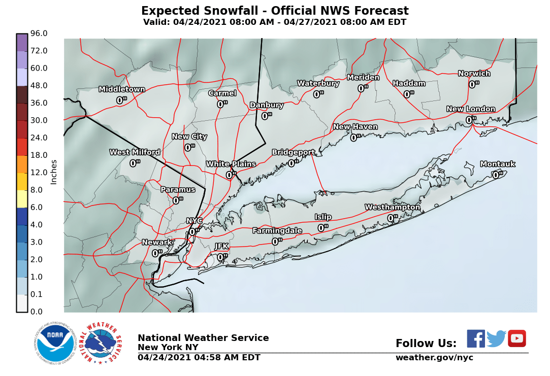
NWS just put up warnings are up for Poconos/Sussex and parts of the Hudson Valley and advisories for Warren/Morris/Passaic, as the NWS increased snowfall amounts significantly for areas to the N/W of NYC (especially N/W of 80/287). NWS still calling for little or no snow accumulation for the 95 corridor to Woodbridge (and the Shore) and 1" or less towards NYC. Snowfall maps are below. FYI, the 18Z NAM continues with the idea of 6+" of snow for most of NJ (and 10" or more for NWNJ/NE PA/Hudson Valley), while the GFS still has no 95 snow, but now it's much closer than it was and there's more snow N/W now.

However, they acknowledge the potential (~10% or so) for 3-5" of snow for much of NJ. As I said above, I would've gone with a general 1-3" for the Philly-NYC corridor. We'll see who's right soon, I guess - I also included DT's (WxRisk.com) map, since that's more like what I'm thinking . And all the other risks are a given with this, as for most major nor'easters: urban, stream and coastal flooding (but nowhere near Sandy - need to keep repeating that - minor to moderate at most), heavy rain, high winds, blizzard conditions where it snows, downed trees and power lines, etc.).

Gotta run - Go RU!!

https://www.weather.gov/phi/
https://www.33andrain.com/topic/815...e-a-lion-32-coastal-storm-discussion/?page=70


28378235_10213356372217821_2638970516756496384_n.jpg


StormTotalSnowWeb1.png


28468339_10213356406618681_1869677642806984704_n.jpg
 
Did this thing slow down (not overall, just for the time being)? At 3'ish it said "rain begins 37 minutes" in JC but nothing yet and now not until 8
 
  • Like
Reactions: mikemarc1
This is a serious storm folks and long duration, starting tonight and going into Saturday morning, with 2-3" rain likely where it's all rain and heavy wet snow, where it changes over (won't change over until at least early afternoon anywhere near 95, if it changes over at all; could change over early morning to the NW; everyone is going to get at least an inch of rain before any changeover). The hard part is models are still in poor agreement with ranges from 0" to 8" just along I-95 - kind of makes it hard to have confidence in a forecast, but forecasts were just updated by the NWS.

NWS just put up warnings are up for Poconos/Sussex and parts of the Hudson Valley and advisories for Warren/Morris/Passaic, as the NWS increased snowfall amounts significantly for areas to the N/W of NYC (especially N/W of 80/287). NWS still calling for little or no snow accumulation for the 95 corridor to Woodbridge (and the Shore) and 1" or less towards NYC. Snowfall maps are below. FYI, the 18Z NAM continues with the idea of 6+" of snow for most of NJ (and 10" or more for NWNJ/NE PA/Hudson Valley), while the GFS still has no 95 snow, but now it's much closer than it was and there's more snow N/W now.

However, they acknowledge the potential (~10% or so) for 3-5" of snow for much of NJ. As I said above, I would've gone with a general 1-3" for the Philly-NYC corridor. We'll see who's right soon, I guess - I also included DT's (WxRisk.com) map, since that's more like what I'm thinking . And all the other risks are a given with this, as for most major nor'easters: urban, stream and coastal flooding (but nowhere near Sandy - need to keep repeating that - minor to moderate at most), heavy rain, high winds, blizzard conditions where it snows, downed trees and power lines, etc.).

Gotta run - Go RU!!

https://www.weather.gov/phi/
https://www.33andrain.com/topic/815...e-a-lion-32-coastal-storm-discussion/?page=70


28378235_10213356372217821_2638970516756496384_n.jpg


StormTotalSnowWeb1.png


28468339_10213356406618681_1869677642806984704_n.jpg

Just got back from a nice evening in Jersey City (Liberty House restaurant for an RU chem eng'g alumni party - gorgeous views of the Manhattan skyline and great food), then figured why not go to the Garden and catch the RU game simply a huge win over Indiana - #3 Purdue tomorrow night, yikes.

Anyway, I've been completely away from all weather info since 6 pm and it was a nice surprise to come home to the Euro moving very much towards the consistently fairly snowy NAM (and pretty snowy HRDPS) for the I-95 corridor (all of them are showing 5-10" for Philly to NYC. And for what seems like days now, the GFS and CMC continue to show no snow for the 95 corridor or the coast.

As I've mentioned several times most of the pros on 33andrain think the GFS and CMC are wrong, since they're lower resolution, which usually means they don't handle dynamic, highly convective systems like this well (and their thermal fields have been way off so far). Would love to get 6" or more, although not counting on it, per se, since so much can go wrong with this fragile setup. I'm still thinking 1-3: for Philly to NYC and places near/along 95 and the coast, but am becoming more optimistic we might get the 3-6" that News12NJ, who are usually pretty conservative are calling for. I'll also be amazed if the NWS doesn't at least put the 95 corridor down for 1-3" in their 4 am update, instead of the zilch they have now.

One more thing that really should be stressed is the likelihood of blizzard conditions wherever it ends up snowing. With the wind warnings and advisories up, all it will take is heavy snow with <1/4 mile visibility, which this storm will certainly have the power to generate, to get blizzard conditions. Even if many places only get a few hours and maybe an inch or two of snow, they will likely have blizzard conditions for much of that time On a Friday afternoon, that is a recipe for disaster, especially when I think most people will go to work assuming it's just a big rainstorm. We'll find out soon.

4:30 am edit: Very surprised NWS didn't up totals for 95 and the coast - only significant snow well NW, as per the maps. They did acknowledge how far off they could end up being though, in the discussion below which makes me wonder even more why they didn't hedge their bets a bit and at least go with an inch or two. Multiple pros on the weather boards criticizing the NWS (which is pretty unusual) for completely discounting the Euro and the high res models like the NAM and HRDPS, which all show 5-10" for the 95 corridor and even towards the coast (and much more inland).

If they're right everyone will owe them an apology, but if they're wrong, they'll have really dropped the ball when they could at least be showing some snow. Anyway, the maps are up below. Here's the thing - if the NWS is wrong and we get even a modest 2-4" snowfall for the 95 corridor from Philly to NYC and most of NJ (not even the 5-10" amounts we're seeing on the Euro, NAM and HRDPS), that snow is going to fall in the afternoon and produce blizzard or near blizzard conditions smack dab in the middle of a rush hour that people thought would be just rainy and windy. That's a recipe for disaster on the roads. Even if they don't think a few inches will fall they should show it, just in case they're wrong, so that people are aware of the risk - it's only a minor issue to predict 1-3" and get none, whereas from a public risk perspective, it's a major miss to predict nothing and get several or even a few inches of snow. I just don't get the logic.

National Weather Service New York NY
429 AM EST Fri Mar 2 20
While the cooling airmass associated with the upr low evidenced
by decreasing wet bulb zero heights remains a crucial component,
the wwd trend brings warmer air aloft in as well. Because of
these two factors, snowfall totals have been lowered from
roughly the Hudson River ewd, and increased elsewhere. Over a
foot of snow is now expected for some of the higher elevations
in Orange county.

Significant changes in snow amounts for the entire area are
possible with such little room for error thermally. The time
period thru noon will be critical for getting a handle of how
the rain/snow line is progressing.

28378343_10213359508856235_8635142283886329856_n.jpg


28576381_10213359509816259_5806636883286949888_n.jpg
 
Last edited:
Just got back from a nice evening in Jersey City (Liberty House restaurant for an RU chem eng'g alumni party - gorgeous views of the Manhattan skyline and great food), then figured why not go to the Garden and catch the RU game simply a huge win over Indiana - #3 Purdue tomorrow night, yikes.

Anyway, I've been completely away from all weather info since 6 pm and it was a nice surprise to come home to the Euro moving very much towards the consistently fairly snowy NAM (and pretty snowy HRDPS) for the I-95 corridor (all of them are showing 5-10" for Philly to NYC. And for what seems like days now, the GFS and CMC continue to show no snow for the 95 corridor or the coast.

As I've mentioned several times most of the pros on 33andrain think the GFS and CMC are wrong, since they're lower resolution, which usually means they don't handle dynamic, highly convective systems like this well (and their thermal fields have been way off so far). Would love to get 6" or more, although not counting on it, per se, since so much can go wrong with this fragile setup. I'm still thinking 1-3: for Philly to NYC and places near/along 95 and the coast, but am becoming more optimistic we might get the 3-6" that News12NJ, who are usually pretty conservative are calling for. I'll also be amazed if the NWS doesn't at least put the 95 corridor down for 1-3" in their 4 am update, instead of the zilch they have now.

One more thing that really should be stressed is the likelihood of blizzard conditions wherever it ends up snowing. With the wind warnings and advisories up, all it will take is heavy snow with <1/4 mile visibility, which this storm will certainly have the power to generate, to get blizzard conditions. Even if many places only get a few hours and maybe an inch or two of snow, they will likely have blizzard conditions for much of that time On a Friday afternoon, that is a recipe for disaster, especially when I think most people will go to work assuming it's just a big rainstorm. We'll find out soon.

4:30 am edit: Very surprised NWS didn't up totals for 95 and the coast - only significant snow well NW, as per the maps. They did acknowledge how far off they could end up being though, in the discussion below which makes me wonder even more why they didn't hedge their bets a bit and at least go with an inch or two. Multiple pros on the weather boards criticizing the NWS (which is pretty unusual) for completely discounting the Euro and the high res models like the NAM and HRDPS, which all show 5-10" for the 95 corridor and even towards the coast (and much more inland).

If they're right everyone will owe them an apology, but if they're wrong, they'll have really dropped the ball when they could at least be showing some snow. Anyway, the maps are up below. Here's the thing - if the NWS is wrong and we get even a modest 2-4" snowfall for the 95 corridor from Philly to NYC and most of NJ (not even the 5-10" amounts we're seeing on the Euro, NAM and HRDPS), that snow is going to fall in the afternoon and produce blizzard or near blizzard conditions smack dab in the middle of a rush hour that people thought would be just rainy and windy. That's a recipe for disaster on the roads. Even if they don't think a few inches will fall they should show it, just in case they're wrong, so that people are aware of the risk - it's only a minor issue to predict 1-3" and get none, whereas from a public risk perspective, it's a major miss to predict nothing and get several or even a few inches of snow. I just don't get the logic.

National Weather Service New York NY
429 AM EST Fri Mar 2 20
While the cooling airmass associated with the upr low evidenced
by decreasing wet bulb zero heights remains a crucial component,
the wwd trend brings warmer air aloft in as well. Because of
these two factors, snowfall totals have been lowered from
roughly the Hudson River ewd, and increased elsewhere. Over a
foot of snow is now expected for some of the higher elevations
in Orange county.

Significant changes in snow amounts for the entire area are
possible with such little room for error thermally. The time
period thru noon will be critical for getting a handle of how
the rain/snow line is progressing.

28378343_10213359508856235_8635142283886329856_n.jpg


28576381_10213359509816259_5806636883286949888_n.jpg

when do you sleep ?
 
  • Like
Reactions: Knight Shift
Let's ask the most important question: how does this affect those who will be relying on mass transit to come home from another big bball loss tonight?
 
Last edited:
6:40 - just changed over to snow where we are in Wayne.
 
Let's ask the most important question: how does this affect those who will be relying on mass transit to come home from another big bball loss tonight?
Please edit. We don't need any SN jinx tonight.
 
It's fluctuating between rain, sleet and snow now. Can't make up its mind.
 
Snowing here in Ogdensburg
Huh looked outside half hour ago was still raining
 
Rain and wind in Cranford. Got some big trees and that ground is pretty soft right now.
 
ADVERTISEMENT
ADVERTISEMENT