
Colleges
- American Athletic
- Atlantic Coast
- Big 12
- Big East
- Big Ten
- Colonial
- Conference USA
- Independents (FBS)
- Junior College
- Mountain West
- Northeast
- Pac-12
- Patriot League
- Pioneer League
- Southeastern
- Sun Belt
- Army
- Charlotte
- East Carolina
- Florida Atlantic
- Memphis
- Navy
- North Texas
- Rice
- South Florida
- Temple
- Tulane
- Tulsa
- UAB
- UTSA
- Boston College
- California
- Clemson
- Duke
- Florida State
- Georgia Tech
- Louisville
- Miami (FL)
- North Carolina
- North Carolina State
- Pittsburgh
- Southern Methodist
- Stanford
- Syracuse
- Virginia
- Virginia Tech
- Wake Forest
- Arizona
- Arizona State
- Baylor
- Brigham Young
- Cincinnati
- Colorado
- Houston
- Iowa State
- Kansas
- Kansas State
- Oklahoma State
- TCU
- Texas Tech
- UCF
- Utah
- West Virginia
- Illinois
- Indiana
- Iowa
- Maryland
- Michigan
- Michigan State
- Minnesota
- Nebraska
- Northwestern
- Ohio State
- Oregon
- Penn State
- Purdue
- Rutgers
- UCLA
- USC
- Washington
- Wisconsin
High Schools
- Illinois HS Sports
- Indiana HS Sports
- Iowa HS Sports
- Kansas HS Sports
- Michigan HS Sports
- Minnesota HS Sports
- Missouri HS Sports
- Nebraska HS Sports
- Oklahoma HS Sports
- Texas HS Hoops
- Texas HS Sports
- Wisconsin HS Sports
- Cincinnati HS Sports
- Delaware
- Maryland HS Sports
- New Jersey HS Hoops
- New Jersey HS Sports
- NYC HS Hoops
- Ohio HS Sports
- Pennsylvania HS Sports
- Virginia HS Sports
- West Virginia HS Sports
ADVERTISEMENT
You are using an out of date browser. It may not display this or other websites correctly.
You should upgrade or use an alternative browser.
You should upgrade or use an alternative browser.
OT: Significant Winter Storm 2/27-28 (esp along/N of 78); and update on Fri storm (p. 6)
- Thread starter RU848789
- Start date
Right after that met explained why we were seeing sleet and that it should move to snow with intensity, all the rain/sleet to our west flipped to all snow as intensity jumped. Great insight by that guy (DualJet on 33andrain).A couple of mets said the sleet was likely due to lighter precip and poor snow growth up at ~15K feet and should flip to snow, as precip intensity increases and snow crystals grow better up around 15K feet, as it has over the last 15 minutes in most of EPA. All snow here now and falling decently with a coating on the ground.
Was light snow (and some sleet) here in Metuchen from 6-8 pm with little accumulation and temps in the 36-37F range, but in the last 20-30 minutes, snow rate has picked up (moderate snow now) and we've now doubled our seasonal snowfall of 1/4", as we have a 1/4" on the ground now lol. Snow is accumulating on colder surfaces (not pavement yet, but soon, I think) with temps down to 35F. Would love to make my pre-storm prediction of 2.5" for my house (or more obviously). It's going to get slippery out there tonight, especially along/N of 78, so be careful.

He's wishcasting again. LOL!id be shocked if newark gets 4-6
Can we please melt it all before my plane lands at 11 ish?sticking now on pavement would call it a dusting thus far
Change over to rain around midnight?sticking now on pavement would call it a dusting thus far
Last Saturday I saw a lot of snowflakes in Philadelphia but that was just some of the people walking around South Street. As for real snow flakes nothing. This storm will bring no snow to Philadelphia.
Thursday will be 65 degrees.
Thursday will be 65 degrees.
He's wishcasting again. LOL!
The official furecast from NWS says 3-5 for newark. I wouldn’t say it’s wishcasting
neighborhood kids are running around in snow having fun. love it!
Holy crap, snowing close to heavily now, as we got 3/4" in the last 30 min (1.5"/hr rate) and have 1" OTG. As expected snowfall rates are now overcoming melting rates and driveways/sidewalks are covered and the street is partially covered (modest traffic on it). Down to 34F. 1-2 more hours of this and we'll have 3-4". Mix line still SE of the Monmouth/Middlesex border, so folks in NE Monmouth should be getting snow. Those areas were supposed to get <1".Right after that met explained why we were seeing sleet and that it should move to snow with intensity, all the rain/sleet to our west flipped to all snow as intensity jumped. Great insight by that guy (DualJet on 33andrain).
Was light snow (and some sleet) here in Metuchen from 6-8 pm with little accumulation and temps in the 36-37F range, but in the last 20-30 minutes, snow rate has picked up (moderate snow now) and we've now doubled our seasonal snowfall of 1/4", as we have a 1/4" on the ground now lol. Snow is accumulating on colder surfaces (not pavement yet, but soon, I think) with temps down to 35F. Would love to make my pre-storm prediction of 2.5" for my house (or more obviously). It's going to get slippery out there tonight, especially along/N of 78, so be careful.
I think we're done in our neck of the woods.Snow has lessened in intensity here and it shows on the pavement as its starting to melt somewhat
A bit of a lull coming into western NJ, unless it can fill in. Looks like another large batch in central PA, which should be here in an hour or so - if that is snow, many places south of 78 could overperform. Hard to say.
A bit of a lull coming into western NJ, unless it can fill in. Looks like another large batch in central PA, which should be here in an hour or so - if that is snow, many places south of 78 could overperform. Hard to say.
If its not heavy that wont happen..more pavement melt in last 10 minutes
Yeah east wind, warm ocean, low vv's, unsaturated column, I think that's it for routes 1/202If its not heavy that wont happen..more pavement melt in last 10 minutes
As of 9:30 pm we have 1.5" OTG (1/2" the last 1/2 hr), which is 6X our seasonal snowfall before this, lol. Still coming down moderately, but about to hit a lull in the next 15 min - hoping that lull fills in and/or that the next batch in east/central PA brings snow (jury is out on the weather boards on that, for areas S of 78). Streets totally covered now and temp is down to 33F.Holy crap, snowing close to heavily now, as we got 3/4" in the last 30 min (1.5"/hr rate) and have 1" OTG. As expected snowfall rates are now overcoming melting rates and driveways/sidewalks are covered and the street is partially covered (modest traffic on it). Down to 34F. 1-2 more hours of this and we'll have 3-4". Mix line still SE of the Monmouth/Middlesex border, so folks in NE Monmouth should be getting snow. Those areas were supposed to get <1".
YesJust a question. So let’s say we have an inch on the ground..it melts….and then an hour later another inch.
Even though it never accumulated on the ground as two inches….woukd the storm total technically be two inches of snow?
When you say 1 and 202, how far north do you think it's "over" for? First batch clearly overperformed with regard to the southern extent of snow.Yeah east wind, warm ocean, low vv's, unsaturated column, I think that's it for routes 1/202
Done here. Barely stuck to anything. Is this a dusting or just nuisance snow?Snow has lessened in intensity here and it shows on the pavement as its starting to melt somewhat
Massive bust!
Come on Numbers you're a smart guy. Your guess is as good as mine. Does it really matter if another inch falls on pavement in Metuchen or Readington or Flemington between now and 2am before it all melts off anyway? I'd say another inch or so on the grass south of 78 that you won't really notice by the time the sun comes up.When you say 1 and 202, how far north do you think it's "over" for? First batch clearly overperformed with regard to the southern extent of snow.
Oh stop you dingusDone here. Barely stuck to anything. Is this a dusting or just nuisance snow?
Massive bust!
Dont forget compaction, and the snow equivalent ratio. According to some, the answer would be 17 inches of snow fell.Just a question. So let’s say we have an inch on the ground..it melts….and then an hour later another inch.
Even though it never accumulated on the ground as two inches….woukd the storm total technically be two inches of snow?
I usually am with you numbers on the wish for snow. With my travel, not tonight..As of 9:30 pm we have 1.5" OTG (1/2" the last 1/2 hr), which is 6X our seasonal snowfall before this, lol. Still coming down moderately, but about to hit a lull in the next 15 min - hoping that lull fills in and/or that the next batch in east/central PA brings snow (jury is out on the weather boards on that, for areas S of 78). Streets totally covered now and temp is down to 33F.
As of 10 pm, we have 1.7" OTG, as the snow let up a fair amount since about 9:45 pm; snowing lightly now and we have what looks to be an hour or so lull coming up before the next slug could hit and then another lull before the next big batch in EPA hits, unless the radar fills in as some think might happen. Lots of disagreement among the pros on the boards on whether we get much more snow S of 78 - lots of talk of a mixed bag for awhile with snow only falling when intensity picks up.As of 9:30 pm we have 1.5" OTG (1/2" the last 1/2 hr), which is 6X our seasonal snowfall before this, lol. Still coming down moderately, but about to hit a lull in the next 15 min - hoping that lull fills in and/or that the next batch in east/central PA brings snow (jury is out on the weather boards on that, for areas S of 78). Streets totally covered now and temp is down to 33F.
Yeah east wind, warm ocean, low vv's, unsaturated column, I think that's it for routes 1/202
Pavement and parking lot completely melted now
Done here. Barely stuck to anything. Is this a dusting or just nuisance snow?
Massive bust!
Not plowable
Can we please melt it all before my plane lands at 11 ish?
Don't know about melting, but Newark should be able to handle it. Probably more snow up in Mahwah, but my part of Bergen has 1 - 1 1/2 on the ground with light mix falling temp at 34.
Well, it matters to me, as I simply love tracking and observing storms and I enjoy seeing how the various forecasters did, especially the NWS. I'll also notice another inch, lol. Secondary roads are completely covered here, by the way, so it's not just the grass - and as you know, once there's a 32F layer of snow on a road, snow will accumulate even if the air temp is 33-34F.Come on Numbers you're a smart guy. Your guess is as good as mine. Does it really matter if another inch falls on pavement in Metuchen or Readington or Flemington between now and 2am before it all melts off anyway? I'd say another inch or so on the grass south of 78 that you won't really notice by the time the sun comes up.
Next batch hammering Hunterdon and starting to hit Somerset - reports of snow and snow/sleet depending on where one is.
Edit - just started back up here as a mix of snow and sleet and posters are reporting snow in Clinton and Basking Ridge and a mix of snow/sleet in Plainfield. Radar is filling in nicely - areas N of 78 are going to get another 1-2" out of this, but not sure we will here or in other places S of 78. Will still take sleet though.
Edit - just started back up here as a mix of snow and sleet and posters are reporting snow in Clinton and Basking Ridge and a mix of snow/sleet in Plainfield. Radar is filling in nicely - areas N of 78 are going to get another 1-2" out of this, but not sure we will here or in other places S of 78. Will still take sleet though.
Last edited:
+1Not plowable
Likely more of an ice/mix issue until it completely changes to rain.
At least in my neck of the woods you can not call this "significant"! You really can't call it a storm. Light rain on a chilly day. However, I did capture a great picture of City Hall with the low clouds and the lights reflecting off them. Makes it looks much more scary then goes inside that building! 😉
+1
Likely more of an ice/mix issue until it completely changes to rain.
+1
Likely more of an ice/mix issue until it completely changes to rain.
Yep and despite what Numbers posted its not doing anything here
Hard to imagine this not giving you something with that radar presentation. Maybe sleet or rain?Yep and despite what Numbers posted its not doing anything here
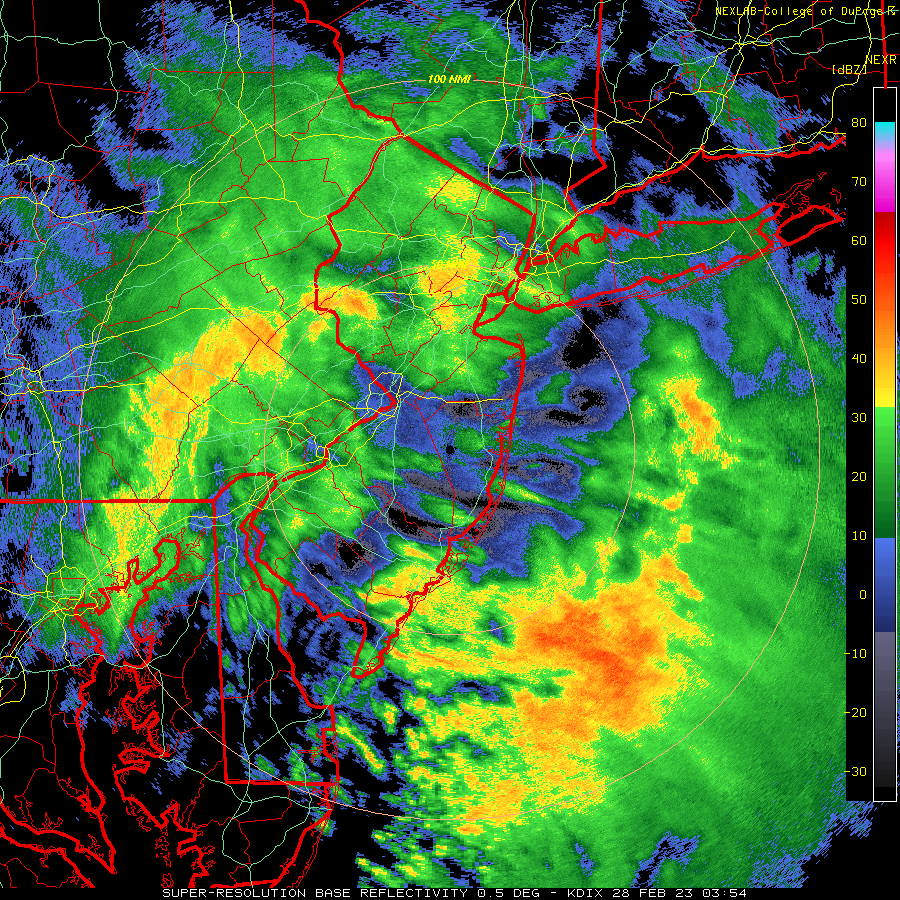
We've had a decent rate of mostly sleet falling since about 10:45 pm, with about 0.2" sleet accumulation, bringing our total snow/sleet accumulation to 1.9" (yes, sleet counts). Looks like the snow might be over as it's raining south of the Driscoll Bridge just about 5 miles SE from here, although if we get more intensity, it could flip back to snow as snow is only about 5 miles N of me, lol. It's 34F.Next batch hammering Hunterdon and starting to hit Somerset - reports of snow and snow/sleet depending on where one is.
Edit - just started back up here as a mix of snow and sleet and posters are reporting snow in Clinton and Basking Ridge and a mix of snow/sleet in Plainfield. Radar is filling in nicely - areas N of 78 are going to get another 1-2" out of this, but not sure we will here or in other places S of 78. Will still take sleet though.
Similar threads
- Replies
- 472
- Views
- 18K
- Replies
- 131
- Views
- 5K
- Replies
- 74
- Views
- 2K
ADVERTISEMENT
ADVERTISEMENT