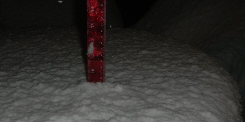
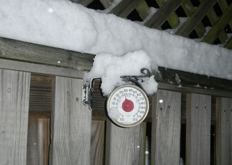
NWS did pretty well on this one...
Public Information Statement
Spotter Reports
National Weather Service Mount Holly NJ
645 AM EST Sun Feb 18 2018
********************STORM TOTAL SNOWFALL********************
NEW JERSEY
...Atlantic County...
Estell Manor 2.0 958 PM 2/17 Rain at 955PM.
Hammonton 0.5 943 PM 2/17 Co-Op Observer
Atlantic City Intl A T 706 PM 2/17 ASOS
...Burlington County...
Florence 3.0 924 PM 2/17 Trained Spotter
Hainesport 2.2 903 PM 2/17 Meteorologist
Bordentown 2.0 510 AM 2/18 Social Media
Marlton 2.0 850 PM 2/17 Meteorologist
Delran 2.0 1005 PM 2/17 NWS Employee
Westampton 2.0 851 PM 2/17 Meteorologist
Mount Laurel 2.0 946 PM 2/17 Meteorologist
Mount Holly WFO 1.9 851 PM 2/17 NWS Office
Cinnaminson 1.8 1136 PM 2/17 Trained Spotter
Lumberton 1.8 843 PM 2/17 Social Media
2 SW Burlington Twp 1.8 916 PM 2/17 NWS Employee
Medford 1.5 841 PM 2/17 Social Media
Eastampton Twp 1.2 835 PM 2/17 NWS Employee
...Camden County...
Cherry Hill 2.5 832 PM 2/17 Trained Spotter
Lindenwold 1.5 906 PM 2/17 Trained Spotter
...Cumberland County...
Bridgeton 2.0 914 PM 2/17 Social Media
Millville 1.5 702 PM 2/17 Social Media
...Gloucester County...
Mantua 2.0 904 PM 2/17 Social Media
...Hunterdon County...
Lebanon 8.8 1116 PM 2/17 Trained Spotter
Ringoes 6.5 956 PM 2/17 Social Media
Glen Gardner 6.0 718 PM 2/17 Social Media
Readington Twp 4.8 642 AM 2/18 Trained Spotter
Kingwood 4.7 1119 PM 2/17 Trained Spotter
Flemington 4.7 1010 PM 2/17 Trained Spotter
...Mercer County...
Princeton 5.1 1118 PM 2/17 Social Media
Ewing Twp 3.0 1024 PM 2/17 Trained Spotter
Ewing 2.9 1101 PM 2/17 Social Media
...Middlesex County...
Port Reading 4.3 1114 PM 2/17 Trained Spotter
Edison 4.2 455 AM 2/18 S Edison near US1.
South Plainfield 4.0 941 PM 2/17 Trained Spotter
Cheesequake 3.7 1031 PM 2/17 Trained Spotter
New Brunswick 3.5 1021 PM 2/17 Trained Spotter
East Brunswick 3.5 1034 PM 2/17 Social Media
1 WSW Carteret 2.5 846 PM 2/17 CoCoRaHS
...Monmouth County...
Freehold 3.2 1039 PM 2/17 Social Media
Colts Neck 3.0 936 PM 2/17 Trained Spotter
Middletown 2.0 928 PM 2/17 Social Media
Howell 1.8 1020 PM 2/17 Social Media
ENE Howell Twp 1.7 1151 PM 2/17 CoCoRaHS
Neptune City 1.5 947 PM 2/17 Social Media
Rumson 1.3 453 AM 2/18 Trained Spotter
Allentown 1.0 808 PM 2/17 Social Media
...Morris County...
Schooleys Mountain 9.5 1139 PM 2/17 Social Media
Randolph Twp 9.2 1102 PM 2/17 Social Media
Rockaway 9.0 1022 PM 2/17 Social Media
Mine Hill 9.0 1126 PM 2/17 Social Media
Succasunna 9.0 1138 PM 2/17 Social Media
Budd Lake 8.5 503 AM 2/18 Social Media
Roxbury Twp 8.5 1103 PM 2/17 Social Media
Morristown 8.3 459 AM 2/18 Trained Spotter
Denville 8.2 451 AM 2/18 Trained Spotter
Green Pond 8.1 1121 PM 2/17 Trained Spotter
Butler 8.1 1101 PM 2/17 Trained Spotter
Mount Arlington 8.0 631 AM 2/18 Trained Spotter
Marcella 8.0 1213 AM 2/18 Trained Spotter
Wharton 8.0 926 PM 2/17 Social Media
2 E Randolph Twp 8.0 912 PM 2/17 CoCoRaHS
Morris Twp 8.0 1137 PM 2/17 Trained Spotter
Lake Hopatcong 7.5 931 PM 2/17 Trained Spotter
1 ESE Franklin 6.8 853 PM 2/17 Trained Spotter
Millington 6.8 1105 PM 2/17 Trained Spotter
Parsippany 6.0 844 PM 2/17 Social Media
Springtown 5.8 842 PM 2/17 Trained Spotter
...Ocean County...
Brick Twp 1.5 858 PM 2/17 Trained Spotter
Forked River 0.2 513 AM 2/18 Social Media
Waretown 0.2 1205 AM 2/18 Social Media
6 E Lacey Twp T 514 AM 2/18 CoCoRaHS
...Somerset County...
Basking Ridge 7.0 1113 PM 2/17 Social Media
2 S Bernards Twp 7.0 1056 PM 2/17 CoCoRaHS
Warren Twp 6.0 1115 PM 2/17 Meteorologist
Bernardsville 5.5 1118 PM 2/17 Trained Spotter
Bridgewater Twp 5.2 1120 PM 2/17 Trained Spotter
Somerville 4.5 1210 AM 2/18 Trained Spotter
NW Bridgewater Twp 3.3 812 PM 2/17 Trained Spotter
...Sussex County...
Newton 5.5 856 PM 2/17 Social Media
Highland Lake 5.3 630 AM 2/18 Trained Spotter
Highland Lakes 4.2 1036 PM 2/17 Trained Spotter
Sussex 3.9 1113 PM 2/17 Social Media
3 N Wantage 2.7 859 PM 2/17 Trained Spotter
...Warren County...
1 ENE Washington 9.3 1159 PM 2/17 CoCoRaHS
Washington 8.3 1012 PM 2/17 Trained Spotter
Harmony Twp 8.0 836 PM 2/17 Social Media
2 S Greenwich Twp 7.6 1047 PM 2/17 CoCoRaHS
Stewartsville 7.6 1035 PM 2/17 Trained Spotter
Oxford 7.5 500 AM 2/18 Trained Spotter
Hackettstown 7.0 1157 PM 2/17 Trained Spotter
Allamuchy 6.3 629 AM 2/18 Trained Spotter
Blairstown 6.0 948 PM 2/17 CoCoRaHS
2 W Blairstown 5.8 1018 PM 2/17 CoCoRaHS
Phillipsburg 5.7 828 PM 2/17 Trained Spotter
Marksboro 5.5 837 PM 2/17 Social Media
Columbia 5.5 857 PM 2/17 Social Media
PENNSYLVANIA
...Berks County...
Huffs Church 7.4 501 AM 2/18 Trained Spotter
Boyertown 7.0 1101 PM 2/17 Trained Spotter
Hamburg 7.0 857 PM 2/17 Social Media
Spring Twp 6.8 1205 AM 2/18 Social Media
Exeter Twp 6.5 954 PM 2/17 Social Media
4 SW Reading 6.4 1225 AM 2/18 Trained Spotter
Douglassville 6.0 843 PM 2/17 Social Media
West Wyomissing 6.0 842 PM 2/17 Social Media
...Bucks County...
Bedminster 5.0 1133 PM 2/17 Social Media
Pipersville 5.0 1014 PM 2/17 Social Media
Sellersville 5.0 458 AM 2/18 Social Media
Doylestown 4.8 1010 PM 2/17 Trained Spotter
Furlong 3.8 1058 PM 2/17 Trained Spotter
Richboro 3.0 946 PM 2/17 Social Media
Perkasie 3.0 808 PM 2/17 Social Media
3 NNE Langhorne 2.8 632 AM 2/18 Meteorologist
Langhorne 2.5 926 PM 2/17 Trained Spotter
Trevose 2.4 1022 PM 2/17 Trained Spotter
Bensalem 1.0 1019 PM 2/17 Social Media
...Carbon County...
Lower Towamensing Tw 6.0 935 PM 2/17 Social Media
Lehighton 5.5 934 PM 2/17 Social Media
...Chester County...
North Coventry Twp 5.0 1121 PM 2/17 Trained Spotter
East Coventry Twp 4.7 1012 PM 2/17 Trained Spotter
Warwick 4.5 1008 PM 2/17 Mesonet
Chester Springs 3.8 1009 PM 2/17 Mesonet
Glenmoore 3.6 1009 PM 2/17 Mesonet
West Caln Twp 3.0 807 PM 2/17 Social Media
West Chester 2.1 1122 PM 2/17 Trained Spotter
Atglen 1.9 1007 PM 2/17 Mesonet
Devault 1.7 1005 PM 2/17 Mesonet
Nottingham 1.6 1006 PM 2/17 Mesonet
...Delaware County...
Wayne 3.2 1106 PM 2/17 Trained Spotter
Lansdowne 2.9 927 PM 2/17 Social Media
Chadds Ford 2.7 951 PM 2/17 Trained Spotter
Norwood 2.0 948 PM 2/17 Trained Spotter
Broomall 2.0 1052 PM 2/17 Trained Spotter
...Lehigh County...
Allentown 8.3 832 PM 2/17 Trained Spotter
Germansville 7.9 1136 PM 2/17 Trained Spotter
Salisbury Twp 7.6 1116 PM 2/17 Trained Spotter
S Allentown 7.4 907 PM 2/17 Trained Spotter
Emmaus 7.0 1038 PM 2/17 Social Media
Center Valley 7.0 949 PM 2/17 Trained Spotter
Laurys Station 6.8 809 PM 2/17 Social Media
New Tripoli 6.6 908 PM 2/17 Trained Spotter
Alburtis 6.5 1036 PM 2/17 Trained Spotter
Upper Macungie Twp 6.5 1143 PM 2/17 Social Media
Lehigh Valley Intl A 6.5 1200 AM 2/18 ASOS
Neffs 6.1 952 PM 2/17 Trained Spotter
East Texas 6.0 813 PM 2/17 Trained Spotter
...Monroe County...
Marshalls Creek 3.5 841 PM 2/17 Social Media
Tannersville 3.5 927 PM 2/17 Social Media
...Montgomery County...
Gilbertsville 6.1 1107 PM 2/17 Trained Spotter
Green Lane 5.5 809 PM 2/17 Trained Spotter
Pottstown 5.2 1059 PM 2/17 Social Media
Vernfield 4.5 947 PM 2/17 Social Media
Graterford 4.3 925 PM 2/17 Trained Spotter
Skippack 3.8 923 PM 2/17 Social Media
Royersford 3.5 756 PM 2/17 Trained Spotter
1 W Ambler 2.5 842 PM 2/17 Trained Spotter
Wynnewood 2.3 1032 PM 2/17 Trained Spotter
...Northampton County...
Walnutport 8.0 1059 PM 2/17 Social Media
Danielsville 7.5 502 AM 2/18 Social Media
Cherry Hill 7.5 505 AM 2/18 Trained Spotter
Bushkill Twp 7.5 504 AM 2/18 Trained Spotter
Martins Creek 7.3 1013 PM 2/17 Trained Spotter
North Catasauqua 6.8 1206 AM 2/18 Social Media
Pen Argyl 6.7 917 PM 2/17 Social Media
Hellertown 6.5 1035 PM 2/17 Social Media
Easton 6.2 916 PM 2/17 Social Media
1 WSW Allen Twp 6.0 1011 PM 2/17 Trained Spotter
Upper Nazareth Twp 5.9 848 PM 2/17 Trained Spotter
...Philadelphia County...
Fox Chase 1.6 1025 PM 2/17 Trained Spotter
Philadelphia 1.5 1028 PM 2/17 engine 55
Somerton 1.2 1117 PM 2/17 Trained Spotter
Philadelphia Intl Ai 1.2 104 AM 2/18 ASOS
NEW JERSEY
...Bergen County...
Westwood 9.2 1159 PM 2/17 Trained Spotter
Allendale 9.0 1111 PM 2/17 Public
Franklin Lakes 8.7 1150 PM 2/17 Public
Ridgewood 8.0 1200 AM 2/18 Trained Spotter
Oradell 7.5 930 PM 2/17 Social Media
Rivervale 7.4 1015 PM 2/17 Trained Spotter
Paramus 5.5 1037 PM 2/17 Trained Spotter
Mahwah 5.2 930 PM 2/17 Trained Spotter
East Rutherford 3.6 1054 PM 2/17 Trained Spotter
Teterboro Airport 3.0 800 PM 2/17
ASOS
...Essex County...
Cedar Grove 8.2 1256 AM 2/18 Trained Spotter
West Orange 6.0 857 PM 2/17 Social Media
South Orange 5.0 1147 PM 2/17 Social Media
...Hudson County...
Harrison 3.5 850 PM 2/17 Co-Op Observer
...Passaic County...
Woodland Park 7.6 1002 PM 2/17 Social Media
Ringwood 7.5 1030 PM 2/17 Amateur Radio
Wayne 7.4 912 PM 2/17 Social Media
Totowa 7.3 921 PM 2/17 Social Media
West Milford 7.3 1045 PM 2/17 Trained Spotter
Bloomingdale 6.3 1000 PM 2/17 Trained Spotter
Hawthorne 6.0 900 PM 2/17 Trained Spotter
...Union County...
Plainfield 5.2 1053 PM 2/17 Social Media
Newark Airport 3.1 100 AM 2/18
FAA Contract Observer
NEW YORK
...Bronx County...
1 NE Riverdale 5.0 1130 PM 2/17 CoCoRaHS
...Kings County...
Williamsburg 3.5 1036 PM 2/17 Social Media
Sheepshead Bay 2.5 1100 PM 2/17 Trained Spotter
Fort Hamilton 1.0 900 PM 2/17 CoCoRaHS
...Nassau County...
Levittown 4.2 1135 PM 2/17 Public
North Massapequa 3.8 1120 PM 2/17 Social Media
Thomaston 3.8 1036 PM 2/17 Social Media
Seaford 3.3 600 PM 2/17 Public
Wantagh 2.6 1130 PM 2/17 Trained Spotter
1 S Merrick 1.8 1230 AM 2/18 Trained Spotter
New Hyde Park 1.0 750 PM 2/17 Trained Spotter
...New York County...
Yorkville 5.0 950 PM 2/17 Public
Central Park 4.4 1200 AM 2/18 Park Conservancy
Harlem River Houses 2.6 1045 PM 2/17 CoCoRaHS
Upper West Side 2.5 840 PM 2/17 Trained Spotter
...Orange County...
Vails
Gate 4.0 1100 PM 2/17 Trained Spotter
1 NNW Berea 3.6 1055 PM 2/17 CoCoRaHS
Mount Hope 3.0 1010 PM 2/17 Trained Spotter
Monroe 2.5 815 PM 2/17 Trained Spotter
...Putnam County...
Putnam Valley 5.8 1210 AM 2/18 Newspaper
Mahopac 4.5 458 AM 2/18 Public
Brewster 4.4 1012 PM 2/17 Social Media
Baldwin Place 4.0 900 PM 2/17 Social Media
...Queens County...
Whitestone 5.0 1100 PM 2/17 Public
Bayside 4.8 1047 PM 2/17 Social Media
NYC/LaGuardia Airpor 4.3 100 AM 2/18
FAA Contract Observer
Little Neck 3.3 1030 PM 2/17 Trained Spotter
Elmhurst 3.2 1200 AM 2/18 Trained Spotter
Rego Park 3.0 1040 PM 2/17 Trained Spotter
NYC/JFK Airport 2.3 100 AM 2/18
FAA Contract Observer
Howard Beach 2.0 1130 PM 2/17 Broadcast Media
Middle Village 1.3 847 PM 2/17 Social Media
...Richmond County...
Sunnyside 2.1 820 PM 2/17 Social Media
...Rockland County...
New City 7.5 1030 PM 2/17 Trained Spotter
Nyack 7.0 1215 AM 2/18 Public
Stony Point 7.0 1150 PM 2/17 Trained Spotter
Congers 6.3 1135 PM 2/17 Fire Dept/Rescue
Spring Valley 5.9 1024 PM 2/17 Social Media
...Suffolk County...
Commack 3.2 1130 PM 2/17 Public
North Babylon 3.2 1230 AM 2/18
NWS Employee
St. James 2.9 1200 AM 2/18 Trained Spotter
Babylon 2.5 1136 PM 2/17 Social Media
Smithtown 2.1 1200 AM 2/18 Trained Spotter
Lake Ronkonkoma 2.0 129 AM 2/18 Trained Spotter
Brentwood 1.5 923 PM 2/17 Social Media
Kings Park 1.3 840 PM 2/17 Social Media
Yaphank 1.3 1159 PM 2/17 Public
Islip Airport 1.2 100 AM 2/18
FAA Contract Observer
Upton 1.2 100 AM 2/18
NWS Office
Orient 1.0 856 PM 2/17 Trained Spotter
Miller Place 0.9 733 PM 2/17 Social Media
Medford 0.2 1015 PM 2/17 Public
...Westchester County...
Croton-on-Hudson 7.7 1100 PM 2/17 Social Media
White Plains 7.5 1100 PM 2/17 Public
Harrison 7.4 300 AM 2/18 Public
Mount Kisco 7.2 300 AM 2/18 Public
Armonk 7.2 1140 PM 2/17 Public
Mamaroneck 7.1 320 AM 2/18 Public
Valhalla 6.5 937 PM 2/17 Social Media
Yonkers 6.5 1245 AM 2/18 Trained Spotter
Irvington 6.5 1013 PM 2/17 Social Media