ADVERTISEMENT

OT: Updated Thread: Stormy Monday evening (8/7), including tornado watch for some

I was going to say the same. We may have had rain predicted most weekends but up until today the weekends have been pretty nice for the beach. Last weekend was one of the best ever if you factor in water quality and yesterday was great weather and waves
There's been a lot less rain/storms at the Shore than along and NW of 95 over the past few weeks, as the t-storms often are sparked by fronts which approach from the W/NW and these often die out by the time they reach the coast, as per below.

https://climate.rutgers.edu/stateclim_v1/njclimoverview.html

"5) Most areas receive 25 to 30 thunderstorms per year, with fewer storms near the coast than farther inland....During the warm season, thunderstorms are responsible for most of the rainfall. Cyclones and frontal passages are less frequent during this time. Thunderstorms spawned in Pennsylvania and New York State often move into Northern New Jersey, where they often reach maximum development in the evening. This region has about twice as many thunderstorms as the coastal zone, where the nearby ocean helps stabilize the atmosphere."
 
  • Like
Reactions: newell138
Good luck - that sucks - say hi to my niece and nephew, lol (they live in Charlotte)...
Just landed in Trenton
Co worker flying to Jax had her flight cancelled
Moral of the story - always get the early fight if possible!
 
Flash Flooding claimed the lives of 4 people and another 4 are missing in my old neck of the woods near Washington Crossing PA.
Now tornado and flood warnings.

Terrible tragedy. Sadly, the raging floodwaters swept several cars away on a rural road (532) next to tributary creeks to the Delaware River; at this point there are 5 confirmed deaths with 2 children still missing. The water simply came up so fast that people on the road at that location next to the swollen stream didn't have time to respond - this wasn't a case of people trying to go through floodwaters. The details are in the link below.

A friend of mine messaged me earlier today about how he was traveling through the area (from the New Hope area down to Philly, where he lives) and was trying to head down 532, but was diverted - turns out he had gotten there about 20-30 minutes after the major flooding, but said even the residual high levels on the stream he saw were pretty scary.

https://www.phillyburbs.com/.../upper.../70417523007/
 
Had some big storms along/SE of 95 today; we got hammered here, but was even worse in NB/HP and SE of there towards the coast and on SI/LI. There was a water rescue in NB early this afternoon at Welton/Drift as they got 1.4" in 30 minutes and dozens of cars were flooded. Supposedly there was a funnel cloud spotted in Seaside Park about an hour ago.

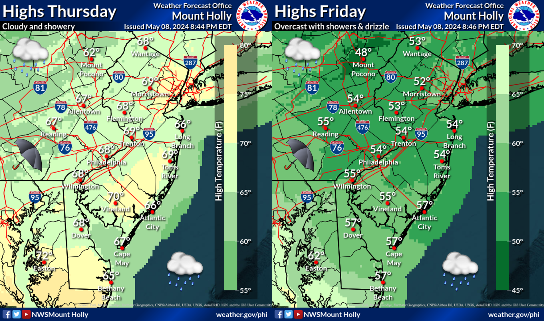
Things should quiet down from here on and Weds/Thurs look mostly dry for a change, but another big round of storms looks likely late Thursday night into Friday morning. And after that? Looks like an almost completely dry, seasonable, less humid weekend.
 
Last edited:
Absolutely blasted in Tom’s River. Downtown is significantly flooded, just in time for poor workers to commute home. Hopefully clear in 1 hour
 
  • Like
Reactions: RU848789
Lather, rinse, repeat. Big storms, possibly even severe with damaging winds in spots late tonight (after midnight) through Friday afternoon, plus torrential rains in some locations likely producing urban/stream flooding where they hit (1-2" of rain likely with more locally, most likely along/NW of 95, but can't rule any location out, given the instability/energy we'll have).

After that, a great 3-4 day stretch with no rain in the forecast and seasonable temps and reasonable humidity levels/dew points.

https://www.weather.gov/phi/

362260469_664433462376088_1634180278902979271_n.jpg
Ugh.. more Airport delays at Newark
 
Lather, rinse, repeat. Big storms, possibly even severe with damaging winds in spots late tonight (after midnight) through Friday afternoon, plus torrential rains in some locations likely producing urban/stream flooding where they hit (1-2" of rain likely with more locally, most likely along/NW of 95, but can't rule any location out, given the instability/energy we'll have).

After that, a great 3-4 day stretch with no rain in the forecast and seasonable temps and reasonable humidity levels/dew points.

https://www.weather.gov/phi/

362260469_664433462376088_1634180278902979271_n.jpg

Busting badly with this Friday forecast
Am I missing something? Radar shows as of 9 a.m. the green/red/orange blob out in the ocean and gone. Yet NWS forecast for Belmar says:

Today
Showers and thunderstorms. Some storms could be severe, with damaging winds, gusty winds, and heavy rain. Patchy fog before 9am. High near 84. South wind 10 to 15 mph. Chance of precipitation is 80%. New rainfall amounts between three quarters and one inch possible.

There could be some pop up storms for the coast per simulated radar but for the most part it was a dud
 
  • Love
Reactions: Knight Shift
Probably one of the most gorgeous days of summer

Finally real blue skies and lower humidity

So much for improved forecasting by mets given Wednesdays busted forecast
 
  • Like
Reactions: T2Kplus20
Probably one of the most gorgeous days of summer

Finally real blue skies and lower humidity

So much for improved forecasting by mets given Wednesdays busted forecast
Half bust today. This morning's line of storms put down 1/4-1/2" for most locations in NJ/EPA/SENY (and up to an inch in SENJ and parts of NNJ) and there were a few severe storms with high winds. But since storms after about 8 am never materialized, the forecast for some storms the rest of the day clearly busted - we enjoyed today greatly.

Thursday's forecast was perfect 3 days out (I know, since the decision on whether to have an outdoor picnic for 100+ people in my old work dept had to be made Monday morning and I advised them to have it, so they did and the weather was great). And Wednesday was bad south of about the Raritan, but great north of there, with little rain, as forecast. Also, the forecast was for a great weekend as early as a week out and that's definitely going to verify.
 
  • Like
Reactions: Knight Shift
That was a nasty line this morning but it moved through fast around 5 am so many people probably missed it.
 
  • Like
Reactions: RU205
Half bust today. This morning's line of storms put down 1/4-1/2" for most locations in NJ/EPA/SENY (and up to an inch in SENJ and parts of NNJ) and there were a few severe storms with high winds. But since storms after about 8 am never materialized, the forecast for some storms the rest of the day clearly busted - we enjoyed today greatly.

Thursday's forecast was perfect 3 days out (I know, since the decision on whether to have an outdoor picnic for 100+ people in my old work dept had to be made Monday morning and I advised them to have it, so they did and the weather was great). And Wednesday was bad south of about the Raritan, but great north of there, with little rain, as forecast. Also, the forecast was for a great weekend as early as a week out and that's definitely going to verify.
Just hoping the long summer dry slot down the shore persists through next March!
 
Severe t-storm watches up for the whole area and a new warning was just issued for much of CNJ. Looks like a pretty stormy afternoon...

Severe Thunderstorm Warning
National Weather Service Mount Holly NJ
208 PM EDT Tue Jul 25 2023

The National Weather Service in Mount Holly NJ has issued a

* Severe Thunderstorm Warning for...
Southeastern Hunterdon County in northwestern New Jersey...
Northwestern Mercer County in central New Jersey...
Somerset County in northern New Jersey...
Central Middlesex County in northern New Jersey...

* Until 300 PM EDT.

* At 207 PM EDT, a severe thunderstorm was located over Belle Mead,
or 7 miles southwest of Somerville, moving east at 25 mph.

HAZARD...60 mph wind gusts and nickel size hail.

SOURCE...Radar indicated.

IMPACT...Damage to roofs, siding, trees, and power lines is
possible.

* Locations impacted include...
New Brunswick, Somerville, Somerset, Edison, Old Bridge, East
Brunswick, Bridgewater, South Brunswick, North Brunswick,
Middlesex, Princeton, Bound Brook, Manville, Jamesburg, Pennington,
Hopewell, Rocky Hill, Millstone, Skillman and Flagtown.

This includes the following highways...
New Jersey Turnpike near exit 10.
Interstate 287 in New Jersey between mile markers 1 and 18.
 
And it's gonna be pretty hot the next 4 days with highs in the 90s and uncomfortable humidities. Fortunately, the heat wave will break Saturday afternoon/evening with a cold front sparking what could be severe weather, but which will be followed by some nice, seasonable weather for Sunday and most of next week.
 
Nasty storm right now in my area. Sheets of ran and plenty of lightning bolts. Water quickly pooling on roads but worst looks to skirt just to the northeest in Hinterdon and northern somerset

Another underforecasted bust given what they were saying 36 hours ago

Tens of thousands will be caught off guard on the roads today and situations will be dangerous. Came in quick as an hour ago there were no storm clouds on the horizon
 
  • Like
Reactions: Proud NJ Sports Fan
Nasty storm right now in my area. Sheets of ran and plenty of lightning bolts. Water quickly pooling on roads but worst looks to skirt just to the northeest in Hinterdon and northern somerset

Another underforecasted bust given what they were saying 36 hours ago

Tens of thousands will be caught off guard on the roads today and situations will be dangerous. Came in quick as an hour ago there were no storm clouds on the horizon
You're becoming insufferable with your uneducated criticisms of weather forecasts. The potential for severe storms has been highlighted for at least a couple of days now and the NWS put out a severe t-storm watch for the region this morning.

weatherstory.png
 
Big thunder storm hitting Linden now, pouring, sheets of rain.

Streets flooding already.
 
You're becoming insufferable with your uneducated criticisms of weather forecasts. The potential for severe storms has been highlighted for at least a couple of days now and the NWS put out a severe t-storm watch for the region this morning.

weatherstory.png

Not like this..24 hours ago..it was for late scattered t storms..so great you post a meme from this morning...too late people generally are going off what they heard on Monday

Not a mega severe line dropping 3 inches
 
Also the severe thunderstorm warnings were very late in being issued..in some cases when the storm was already passing.. see americanwx posts
 
Not like this..24 hours ago..it was for late scattered t storms..so great you post a meme from this morning...too late people generally are going off what they heard on Monday

Not a mega severe line dropping 3 inches
Yesterday afternoon's AFD mentioned low risk of severe weather, but predicting such events more than 24 hours out is difficult, which is why you're whining about a 36-hour forecast being "wrong" is irrelevant to me and anyone who knows anything about mesoscale convective events like these. They at least got the elevated risks out to the public very early this morning. Also, that graphic is not a "meme" as you should know.

On Tuesday, the upper H5 trough will start to push through the
area, reaching wrn PA during the morning and arriving over ern
PA by evening. More shortwaves and good daytime heating will
create showers/tstms by afternoon. A line of activity could
develop and move W to E thru the afternoon and evening. The most
recent Day2 outlook has increased the Delmarva areas into the
Slight risk category while other areas remain in Marginal risk.
Wind and hail are the primary threats for Tuesday.
 
Got pounded again in Hunterdon, lost power for about 2 hours which never happens here according to neighbors. Just plain brutal cloud to ground lightning. Widowmaker strikes that sound like artillery shelling.
 
  • Like
Reactions: RU848789
Had some downed trees in North Plainfield but no power loss thankfully. Had a car wash come down in New Brunswick around 2 or 3 but no big issues.
 
Got pounded again in Hunterdon, lost power for about 2 hours which never happens here according to neighbors. Just plain brutal cloud to ground lightning. Widowmaker strikes that sound like artillery shelling.
You’ve had some bad luck with these things this year.
 
And it's gonna be pretty hot the next 4 days with highs in the 90s and uncomfortable humidities. Fortunately, the heat wave will break Saturday afternoon/evening with a cold front sparking what could be severe weather, but which will be followed by some nice, seasonable weather for Sunday and most of next week.
Was driving south on the turnpike around 3pm. Traffic came to a crawl because of the rain, luckily only lasted a few minutes. Looking forward to more normal/seasonal temps hopefully next week. Another note was in Lowes on Centennial Ave yesterday they had some Halloween stuff out already, crazy. I like the cooler fall weather but not yet. Only got 0.30" in Hamilton today so far
 
ADVERTISEMENT
ADVERTISEMENT