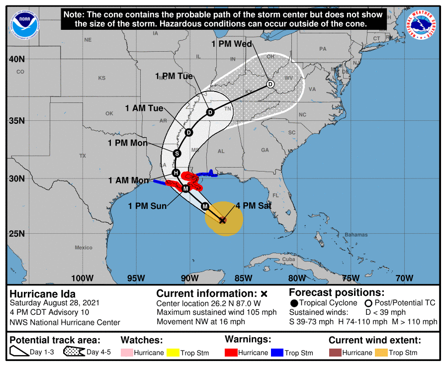
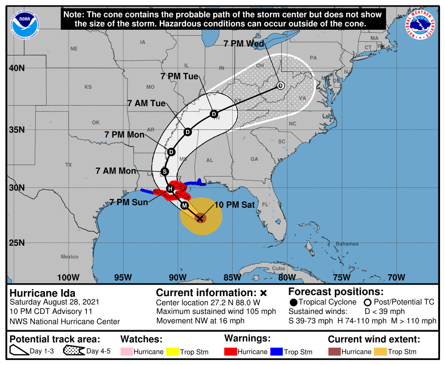
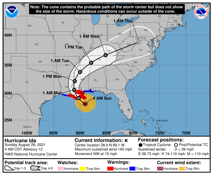
Ida is looking very impressive right now, with a closed eye finally forming in the last hour, strong convection wrapped around the entire storm and an impressive vertical structure, with winds up to 105 mph (almost Cat 3, which is 111-129 mph) and pressure down to 976 mbar, so rapid intensification is underway with winds expected to be up to 125 mph by late tonight and up to at least 130 mph by tomorrow afternoon before landfall, which is expected sometime tomorrow afternoon or perhaps early evening.
Unfortunately, the forecast track was moved about 20-25 miles east of where it has been, putting landfall in the marshes and bayous just south of Houma (heading NNW towards Baton Rouge), with the track taking the storm only about 40-45 miles west of New Orleans, which means we'd only need about another 25 mile shift east to put NOLA in the eastern eyewall of Ida. Hurricane-force winds extend outward up to 30 miles from the center and tropical-storm-force winds extend outward up to 125 miles out, as the wind field has expanded considerably.
If Ida makes a direct hit on NOLA and there wasn't a mandatory evacuation because "there wasn't enough time" for contraflow (all lanes of I10 and other roads going in one direction to speed evacuations) to be set up, as the mayor has said, that will be a significant emergency planning failure, IMO, as the experts have known since at least Thursday night that Ida was going to likely be a major hurricane which could possibly strike NOLA directly. Let's hope it's not a direct hit.
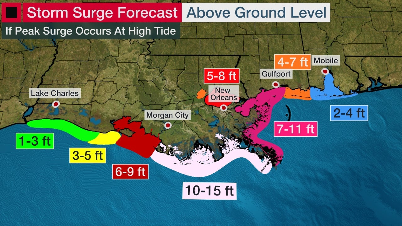
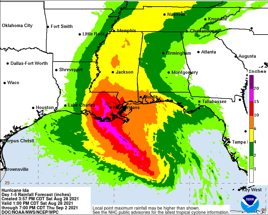
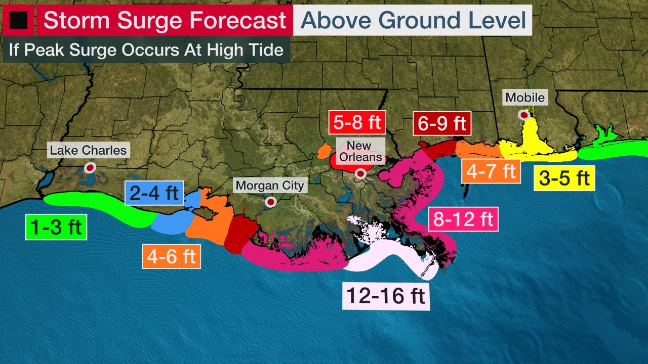
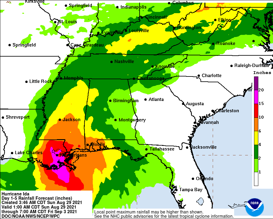
The usual links and graphics are below, showing the likely catastrophic storm surge for much of the LA coast, the likely catastrophic flooding resulting from incredible rainfall of 10-15" or more in areas that are well above average in rainfall this year, and of course, the likely catastrophic wind damage near the storm's track, including inland at least 50-75 miles. And small tornadoes are likely, especially east of the storm's track, including well inland eventually. Power outages will obviously be widespread. This is a life-threatening storm and hopefully people are well-prepared.
Impacts to our area are still fairly uncertain with regard to how much rain we get from Ida's remnants and when. Best guess now is showery rains to perhaps heavy rains from early Wednesday morning through early Thursday morning (given how much rain we've had, some flooding is quite possible), but we're seeing a pretty good chance that any rain will be over by around noon on Thursday and hopefully we'll actually have a pleasant Thursday afternoon/evening with highs near 80F and lower humidity. That would be great for obvious reasons.
https://www.nhc.noaa.gov/graphics_at4.shtml?start#contents
https://www.americanwx.com/bb/topic/55251-hurricane-ida/page/23/
https://www.wunderground.com/articl...cast-louisiana-mississippi-alabama-gulf-coast
FORECAST POSITIONS AND MAX WINDS
INIT 28/2100Z 26.2N 87.0W 90 KT 105 MPH
12H 29/0600Z 27.5N 88.6W 110 KT 125 MPH
24H 29/1800Z 29.1N 90.4W 115 KT 130 MPH
36H 30/0600Z 30.5N 91.3W 65 KT 75 MPH...INLAND
48H 30/1800Z 32.2N 91.2W 35 KT 40 MPH...INLAND
60H 31/0600Z 34.0N 90.1W 25 KT 30 MPH...INLAND
72H 31/1800Z 35.7N 88.1W 20 KT 25 MPH...INLAND
96H 01/1800Z 38.0N 82.5W 20 KT 25 MPH...POST-TROP/INLAND
120H 02/1800Z...DISSIPATED