
I had the exact reaction as I was being permanently banned from the Arkansas Razorback message board!Thank you, but being here is bad for my temper.
Colleges
- American Athletic
- Atlantic Coast
- Big 12
- Big East
- Big Ten
- Colonial
- Conference USA
- Independents (FBS)
- Junior College
- Mountain West
- Northeast
- Pac-12
- Patriot League
- Pioneer League
- Southeastern
- Sun Belt
- Army
- Charlotte
- East Carolina
- Florida Atlantic
- Memphis
- Navy
- North Texas
- Rice
- South Florida
- Temple
- Tulane
- Tulsa
- UAB
- UTSA
- Boston College
- California
- Clemson
- Duke
- Florida State
- Georgia Tech
- Louisville
- Miami (FL)
- North Carolina
- North Carolina State
- Pittsburgh
- Southern Methodist
- Stanford
- Syracuse
- Virginia
- Virginia Tech
- Wake Forest
- Arizona
- Arizona State
- Baylor
- Brigham Young
- Cincinnati
- Colorado
- Houston
- Iowa State
- Kansas
- Kansas State
- Oklahoma State
- TCU
- Texas Tech
- UCF
- Utah
- West Virginia
- Illinois
- Indiana
- Iowa
- Maryland
- Michigan
- Michigan State
- Minnesota
- Nebraska
- Northwestern
- Ohio State
- Oregon
- Penn State
- Purdue
- Rutgers
- UCLA
- USC
- Washington
- Wisconsin
High Schools
- Illinois HS Sports
- Indiana HS Sports
- Iowa HS Sports
- Kansas HS Sports
- Michigan HS Sports
- Minnesota HS Sports
- Missouri HS Sports
- Nebraska HS Sports
- Oklahoma HS Sports
- Texas HS Hoops
- Texas HS Sports
- Wisconsin HS Sports
- Cincinnati HS Sports
- Delaware
- Maryland HS Sports
- New Jersey HS Hoops
- New Jersey HS Sports
- NYC HS Hoops
- Ohio HS Sports
- Pennsylvania HS Sports
- Virginia HS Sports
- West Virginia HS Sports
ADVERTISEMENT
You are using an out of date browser. It may not display this or other websites correctly.
You should upgrade or use an alternative browser.
You should upgrade or use an alternative browser.
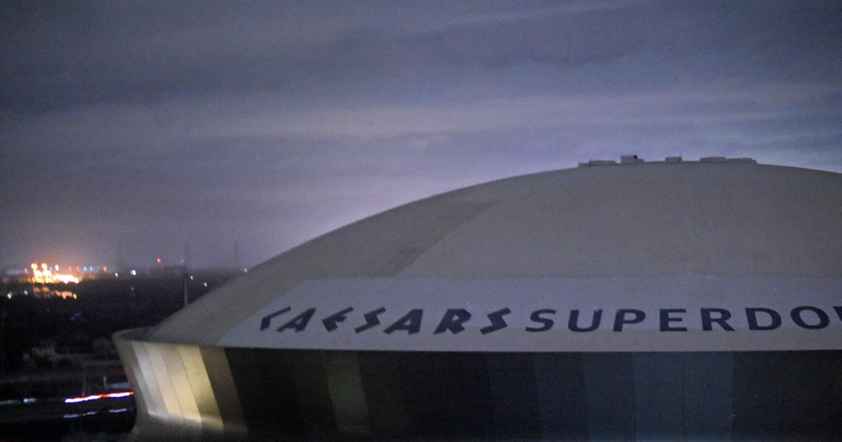
OT: Hurricane Ida taking aim at Louisiana and more as a likely major hurricane Sunday (8/29)
- Thread starter RU848789
- Start date

They are big but not as big as other storms. Numbers have changed as storm path shifted towards more populous areas. 28,000 repair, 28000 replace and 10000 total loss.How do those projections compare to other major hurricanes? They sound big but I don't know how big.
Kind of a hurricanes in general question here but it does pertain to this one.
Is there any significance to this storm strengthening so quickly just before landfall?
Is there a momentum consideration or anything like that? Perhaps it stays together longer then a storm that is trending towards weaken just before landfall?
Is there any significance to this storm strengthening so quickly just before landfall?
Is there a momentum consideration or anything like that? Perhaps it stays together longer then a storm that is trending towards weaken just before landfall?
NHC now doing hourly updates and based on the latest hurricane hunter report, Ida is now up to 150 mph winds at 935 mbar, representing a 45 mph increase and a pressure drop of 29 mbar from 11 pm to 7 am, which is nearly unprecedented. Cat 5 (157 mph or more) is possible before landfall.
Hurricane Ida Tropical Cyclone Update
NWS National Hurricane Center Miami FL AL092021
600 AM CDT Sun Aug 29 2021
...NOAA PLANE FINDS IDA STRONGER...
...EXTREMELY DANGEROUS CATEGORY 4 HURRICANE IDA EXPECTED TO MAKE
LANDFALL IN SOUTHEASTERN LOUISIANA LATER TODAY...
Reports from a NOAA Hurricane Hunter aircraft indicate that maximum
sustained winds have increased to near 150 mph (240 km/h) with
higher gusts. The latest minimum central pressure estimated from
reconnaissance aircraft data is 935 mb (27.61 in).
An elevated NOAA C-MAN station at Pilot's Station East near
Southwest Pass, Louisiana, recently reported a sustained wind of 82
mph (131 km/h) and a gust to 107 mph (172 km/h). Another NOAA
elevated C-MAN station at Southwest Pass recently reported a
sustained wind of 77 mph (124 km/h) and a wind gust of 93 mph (150
km/h).
SUMMARY OF 600 AM CDT...1100 UTC...INFORMATION
----------------------------------------------
LOCATION...28.3N 89.4W
ABOUT 75 MI...120 KM SSE OF GRAND ISLE LOUISIANA
ABOUT 60 MI...95 KM SSW OF THE MOUTH OF THE MISSISSIPPI RIVER
MAXIMUM SUSTAINED WINDS...150 MPH...240 KM/H
PRESENT MOVEMENT...NW OR 315 DEGREES AT 15 MPH...24 KM/H
MINIMUM CENTRAL PRESSURE...935 MB...27.61 INCHES
The northern eyewall of Ida is now moving ashore in SE LA in the Grand isle/Port Fourchon area, so we should have landfall in the next hour or so. Winds still at 150 mph and pressure is down to 933 mbar. Wind gusts well over 100 mph all over the place with the highest reported being 146 mph on Grand Isle. It's getting very bad in SE LA right now and about to get worse. Supposedly 28 people stayed on Grand Isle.
Hurricane Ida Tropical Cyclone Update
NWS National Hurricane Center Miami FL AL092021
1100 AM CDT Sun Aug 29 2021
...1100 AM CDT POSITION UPDATE...
...NORTHERN EYEWALL OF IDA MOVING ONSHORE ALONG THE COAST OF
SOUTHEASTERN LOUISIANA...
An elevated NOAA C-MAN station at Southwest Pass, Louisiana,
recently reported a sustained wind of 89 mph (143 km/h) and a wind
gust of 104 mph (167 km/h).
Within the past hour, sustained winds of 44 mph (70 km/h) and a
gust to 60 mph (96 km/h) was reported at Lakefront Airport in New
Orleans.
A NOAA National Ocean Service tide gauge in Shell Beach, Louisiana,
recently reported a water level of 6.0 feet above mean higher high
water, which is an approximation of inundation in that area.
A NOAA National Ocean Service tide gauge at Bay Waveland Yatcht
Club, Mississippi, recently reported a water level of 5.4 feet
above mean higher high water, which is an approximation of
inundation in that area.
SUMMARY OF 1100 AM CDT...1600 UTC...INFORMATION
-----------------------------------------------
LOCATION...28.9N 90.1W
ABOUT 25 MI...40 KM SSW OF GRAND ISLE LOUISIANA
ABOUT 60 MI...95 KM SE OF HOUMA LOUISIANA
MAXIMUM SUSTAINED WINDS...150 MPH...240 KM/H
PRESENT MOVEMENT...NW OR 320 DEGREES AT 13 MPH...20 KM/H
MINIMUM CENTRAL PRESSURE...933 MB...27.55 INCHES
Grand Isle police chief was just on TWC and he said their wind meter read 148.....before breaking.The northern eyewall of Ida is now moving ashore in SE LA in the Grand isle/Port Fourchon area, so we should have landfall in the next hour or so. Winds still at 150 mph and pressure is down to 933 mbar. Wind gusts well over 100 mph all over the place with the highest reported being 146 mph on Grand Isle. It's getting very bad in SE LA right now and about to get worse. Supposedly 28 people stayed on Grand Isle.
Hurricane Ida Tropical Cyclone Update
NWS National Hurricane Center Miami FL AL092021
1100 AM CDT Sun Aug 29 2021
...1100 AM CDT POSITION UPDATE...
...NORTHERN EYEWALL OF IDA MOVING ONSHORE ALONG THE COAST OF
SOUTHEASTERN LOUISIANA...
An elevated NOAA C-MAN station at Southwest Pass, Louisiana,
recently reported a sustained wind of 89 mph (143 km/h) and a wind
gust of 104 mph (167 km/h).
Within the past hour, sustained winds of 44 mph (70 km/h) and a
gust to 60 mph (96 km/h) was reported at Lakefront Airport in New
Orleans.
A NOAA National Ocean Service tide gauge in Shell Beach, Louisiana,
recently reported a water level of 6.0 feet above mean higher high
water, which is an approximation of inundation in that area.
A NOAA National Ocean Service tide gauge at Bay Waveland Yatcht
Club, Mississippi, recently reported a water level of 5.4 feet
above mean higher high water, which is an approximation of
inundation in that area.
SUMMARY OF 1100 AM CDT...1600 UTC...INFORMATION
-----------------------------------------------
LOCATION...28.9N 90.1W
ABOUT 25 MI...40 KM SSW OF GRAND ISLE LOUISIANA
ABOUT 60 MI...95 KM SE OF HOUMA LOUISIANA
MAXIMUM SUSTAINED WINDS...150 MPH...240 KM/H
PRESENT MOVEMENT...NW OR 320 DEGREES AT 13 MPH...20 KM/H
MINIMUM CENTRAL PRESSURE...933 MB...27.55 INCHES
He was saying they had never seen anything like what they are seeing now.
The Gulf water temperatures are VERY high at the moment. 80-90 degree water temps will allow the hurricanes to intensify quickly And grow in size as well.Kind of a hurricanes in general question here but it does pertain to this one.
Is there any significance to this storm strengthening so quickly just before landfall?
Is there a momentum consideration or anything like that? Perhaps it stays together longer then a storm that is trending towards weaken just before landfall?
If you have not been to that part of Louisiana, I will tell you that the land is very flat, and has many canals/ bayous that will do next to nothing to contain the surge of seawater headed their way. Most homes are built on stilts 10-15 above the ground. The stilts will remain after the storm, but 150 mph relentless and sustained winds will destroy damn near everything in the storm’s path.
I love going fishing out of Grand Isle, Cocodrie, and other places around there.
New Orleans expected to be getting 100 mph winds around 9pm tonight.
The towns south of New Orleans, including Grand Isle, which are along the track of that northeastern-eastern eyewall are in for it.
Not sure what level of storm surge is expected along that corridor. Feel like the worst of that is expected on the other side of that peninsula.
The towns south of New Orleans, including Grand Isle, which are along the track of that northeastern-eastern eyewall are in for it.
Not sure what level of storm surge is expected along that corridor. Feel like the worst of that is expected on the other side of that peninsula.
So it made it to strong category 4, pretty damn impressive day of intensification. I stayed up last night for one final recon pass, didn't post about it but the pressure fell from 955 to 945 in less than 2 hours...told me all I needed to know. Hoping for the best for those in the path.
Postell was talking about the pressure drop over the previous 9 hours I think, said he couldn't remember such a drop.So it made it to strong category 4, pretty damn impressive day of intensification. I stayed up last night for one final recon pass, didn't post about it but the pressure fell from 955 to 945 in less than 2 hours...told me all I needed to know. Hoping for the best for those in the path.
Tried to google the specifics on that but found this.
"Wind speeds are holding on to 150 mph with gusts up to 185 mph as it slams into the southeastern coast of Louisiana."
MSN
www.msn.com
And the heavy rain during my 68 mile bike ride to AC from Philly charity ride. And is it too much to ask to include wind in your TV forecast??Probably to save the local mets save face for blowing the call of 1-5 inches of rain for our area this weekend
We have landfall at Port Fourchon as of about 1 pm, with 150 mph winds (at the water's surface - those never verify over land, due to frictional effects) and a pressure of 930 mbar, which I believe makes this one of the top 5-10 storms to ever make landfall in the US. That police station in Grand Isle reported a wind gust of 148 mph before the gauge broke (not sure that's official, but, yeah it's windy) and gusts well over 100 mph have been reported throughout the area. Reported storm surges right now are in the 7-10 foot range from what I've seen. Damage is going to be catastrophic in places.The northern eyewall of Ida is now moving ashore in SE LA in the Grand isle/Port Fourchon area, so we should have landfall in the next hour or so. Winds still at 150 mph and pressure is down to 933 mbar. Wind gusts well over 100 mph all over the place with the highest reported being 146 mph on Grand Isle. It's getting very bad in SE LA right now and about to get worse. Supposedly 28 people stayed on Grand Isle.
Hurricane Ida Tropical Cyclone Update
NWS National Hurricane Center Miami FL AL092021
1100 AM CDT Sun Aug 29 2021
...1100 AM CDT POSITION UPDATE...
...NORTHERN EYEWALL OF IDA MOVING ONSHORE ALONG THE COAST OF
SOUTHEASTERN LOUISIANA...
An elevated NOAA C-MAN station at Southwest Pass, Louisiana,
recently reported a sustained wind of 89 mph (143 km/h) and a wind
gust of 104 mph (167 km/h).
Within the past hour, sustained winds of 44 mph (70 km/h) and a
gust to 60 mph (96 km/h) was reported at Lakefront Airport in New
Orleans.
A NOAA National Ocean Service tide gauge in Shell Beach, Louisiana,
recently reported a water level of 6.0 feet above mean higher high
water, which is an approximation of inundation in that area.
A NOAA National Ocean Service tide gauge at Bay Waveland Yatcht
Club, Mississippi, recently reported a water level of 5.4 feet
above mean higher high water, which is an approximation of
inundation in that area.
SUMMARY OF 1100 AM CDT...1600 UTC...INFORMATION
-----------------------------------------------
LOCATION...28.9N 90.1W
ABOUT 25 MI...40 KM SSW OF GRAND ISLE LOUISIANA
ABOUT 60 MI...95 KM SE OF HOUMA LOUISIANA
MAXIMUM SUSTAINED WINDS...150 MPH...240 KM/H
PRESENT MOVEMENT...NW OR 320 DEGREES AT 13 MPH...20 KM/H
MINIMUM CENTRAL PRESSURE...933 MB...27.55 INCHES
Hurricane Ida Tropical Cyclone Update
NWS National Hurricane Center Miami FL AL092021
1155 AM CDT Sun Aug 29 2021
...EXTREMELY DANGEROUS CATEGORY 4 HURRICANE IDA MAKES LANDFALL NEAR
PORT FOURCHON LOUISIANA...
NOAA Doppler radar imagery indicates that the eye of Ida made
landfall along the southeastern coast of Louisiana near Port
Fourchon around 1155 AM CDT (1655 UTC). Data from an Air Force
Reserve reconnaissance aircraft and Doppler radar data indicate that
Ida's maximum sustained winds at landfall were estimated to be 150
mph (240 km/h). The latest minimum central pressure estimated from
reconnaissance aircraft data is 930 mb (27.46 in).
Within the past hour, sustained winds of 43 mph (69 km/h) and a
gust to 67 mph (107 km/h) were reported at Lakefront Airport in New
Orleans.
A NOAA National Ocean Service tide gauge in Shell Beach, Louisiana,
recently reported a water level of 6.4 feet above mean higher high
water, which is an approximation of inundation in that area.
A NOAA National Ocean Service tide gauge at Bay Waveland Yacht Club,
Mississippi, recently reported a water level of 5.5 feet above mean
higher high water, which is an approximation of inundation in that
area.
SUMMARY OF 1155 AM CDT...1655 UTC...INFORMATION
-----------------------------------------------
LOCATION...29.1N 90.2W
ABOUT 15 MI...25 KM SW OF GRAND ISLE LOUISIANA
ABOUT 45 MI...75 KM SE OF HOUMA LOUISIANA
MAXIMUM SUSTAINED WINDS...150 MPH...240 KM/H
PRESENT MOVEMENT...NW OR 320 DEGREES AT 13 MPH...20 KM/H
MINIMUM CENTRAL PRESSURE...930 MB...27.46 INCHES
He also said to Paul Goodloe, TWC met, "we can't take 3-4 more hours of this - you need to make it stop!" I nearly fell out of my chair. I feel bad for those folks, but they should've evacuated.Grand Isle police chief was just on TWC and he said their wind meter read 148.....before breaking.
He was saying they had never seen anything like what they are seeing now.
Port Fourchon handles 20-30% of nations oil in one form or another. Here we go...
"Port Fourchon is Louisiana’s southernmost port, located on the southern tip of Lafourche Parish, on the Gulf of Mexico. It is a seaport, with significant petroleum industry traffic from offshore Gulf oil platforms and drilling rigs as well as the Louisiana Offshore Oil Port pipeline. Fourchon's primary service markets are domestic deepwater oil and gas exploration, drilling, and production in the Gulf. Port Fourchon currently services over 90% of the Gulf of Mexico's deepwater oil production."
"Port Fourchon is Louisiana’s southernmost port, located on the southern tip of Lafourche Parish, on the Gulf of Mexico. It is a seaport, with significant petroleum industry traffic from offshore Gulf oil platforms and drilling rigs as well as the Louisiana Offshore Oil Port pipeline. Fourchon's primary service markets are domestic deepwater oil and gas exploration, drilling, and production in the Gulf. Port Fourchon currently services over 90% of the Gulf of Mexico's deepwater oil production."
I heard billions of dollars pumped into the levee and pump system down there . Three pumps l were not working as of yesterday ? Well, why the hell not ! Pathetic. My prediction/forecast is that the system fails or gets breached during Ida . Seems like a waste of billions . I hope I am wrong….
Last edited:
I've never seen a hurricane retain such perfect structure and intensity 5+ hours after landfall, with Ida only having gone from 150 mph to 130 mph winds as of the 5 pm advisory. Clearly the slow movement and near zero elevation with plenty of surface water have helped, but much of this is due to the storm, itself being so well formed when it came ashore. Here's a video showing a roof being blown off a building. Tons of wild videos on this guy's feed.Looking at the radar and it looks like the structure of the storm has actually become more defined after it made land fall.
Does look the winds have stepped back at bit from 140 mph down to 130.
And the link from Wunderground also has some amazing footage and meteorological details of the ongoing storm. Catastrophic surge flooding and wind damage are ongoing and inland rain flooding will come soon as the rainfall piles up. There have also been a few tornadoes well east of the storm, as expected. Going to be a long night for many.
https://www.wunderground.com/articl...ne-ida-forecast-landfall-louisiana-gulf-coast
Last edited:
Do you think my prediction/forecast of the billions wasted and levees failing comes true ? I hope I am wrongI've never seen a hurricane retain such perfect structure and intensity 5+ hours after landfall, with Ida only having gone from 150 mph to 130 mph winds as of the 5 pm advisory. Clearly the slow movement and near zero elevation with plenty of surface water have helped, but much of this is due to the storm, itself being so well formed when it came ashore. Here's a video showing a roof being blown off a building. Tons of wild videos on this guy's feed.
And the link from Wunderground also has some amazing footage and meteorological details of the ongoing storm. Catastrophic surge flooding and wind damage are ongoing and inland rain flooding will come soon as the rainfall piles up. There have also been a few tornadoes well east of the storm, as expected. Going to be a long night for many.
https://www.wunderground.com/articl...ne-ida-forecast-landfall-louisiana-gulf-coast
Levees should hold, based on what I've read - had a good test with last year's storms, although these weren't Ida. Biggest issue might be whether the pumps can keep up with the rainfall that falls inside the levees in NO, as that needs to be pumped out and the pumps can only keep up with some of that, so some flooding will be likely in lower spots (being below sea level, pumping is the only way to "empty the bowl").Do you think my prediction/forecast of the billions wasted and levees failing comes true ? I hope I am wrong
Looks like fun to me - spend some time on the weather threads I post links to - those guys post to those threads (or others post links to their stuff).Who are these people driving around taking video of the storm to post on social media?
That roof that blew off right next to the car from which the one guy was videoing could’ve brought power lines down on top of the car. Roof coulda landed on the car.Looks like fun to me - spend some time on the weather threads I post links to - those guys post to those threads (or others post links to their stuff).
You know I’m a thrill seeker. But that is a little below my threshold for lack of control where risk vs reward makes it enjoyable.
Southern numbers peopleWho are these people driving around taking video of the storm to post on social media?
All of New Orleans without power after Hurricane Ida leaves 'catastrophic transmission damage'
A slow-moving Hurricane Ida has left all of Orleans Parish customers without power due to "catastrophic transmission damage," according to Entergy New Orleans.
Things are gonna be really bad down there. Sucks.All of New Orleans without power after Hurricane Ida leaves 'catastrophic transmission damage'
A slow-moving Hurricane Ida has left all of Orleans Parish customers without power due to "catastrophic transmission damage," according to Entergy New Orleans.www.nola.com
Yeah just saw that on TWC, where they've simply been fantastic all through this storm, from run-up to now. I would assume they have backup generators for those water pumps in order to keep the bowl from flooding too badly...All of New Orleans without power after Hurricane Ida leaves 'catastrophic transmission damage'
A slow-moving Hurricane Ida has left all of Orleans Parish customers without power due to "catastrophic transmission damage," according to Entergy New Orleans.
While I sort of realized it previously, but now fully realize it--YouTubeTV does not carry the TWC or any channel for the weather, which kind of sucks during hurricane season. Keep that in mind if you ever consider cutting the cord! We are otherwise happy with YouTubeTV, which is much easier to watch in our vacation home.Yeah just saw that on TWC, where they've simply been fantastic all through this storm, from run-up to now. I would assume they have backup generators for those water pumps in order to keep the bowl from flooding too badly...
The cable news channels have done an OK job carrying the storm with live coverage.
Will be in the Yellow Lot by around 4 p.m. (maybe earlier) Thursday near the very front.
Last edited:
Big post game party?Will be in the Yellow Lot by around 4 p.m. (maybe earlier) Friday near the very front.
Sleeping over and celebrating the victory.Big post game party?
decent youtube search for "Delacroix, Ida, security cam"
decent youtube search for "Delacroix, Ida, security cam"
I heard billions of dollars pumped into the levee system down there . Six of them were not working as of yesterday ? Well, why the hell not ! Pathetic. My prediction/forecast is that many of the levees fail or get breached during Ida . Seems like a waste of billions . I hope I am wrong….
Is there a link on this. Not sure what levees no working before the storm hit even means. Levees are walls.
Edit: Perhaps you meant pumping stations not working?
Last edited:
Yes you’re right . I meant pumping stations .Is there a link on this. Not sure what levees no working before the storm hit even means. Levees are walls.
Edit: Perhaps you meant pumping stations not working?
3 Major S&WB Pumps In New Orleans Down Before Arrival Of Soon-To-Be Hurricane Ida
As Tropical Storm Ida gains speed and churns towards the Louisiana coast, where it’s expected to land as a hurricane, the New Orleans Sewerage and Water Board (S&WB) says their infrastructure is ready to handle the storm despite three major pumps being down.
 www.google.com
Similar threads
- Replies
- 553
- Views
- 33K
- Replies
- 265
- Views
- 11K
ADVERTISEMENT
ADVERTISEMENT