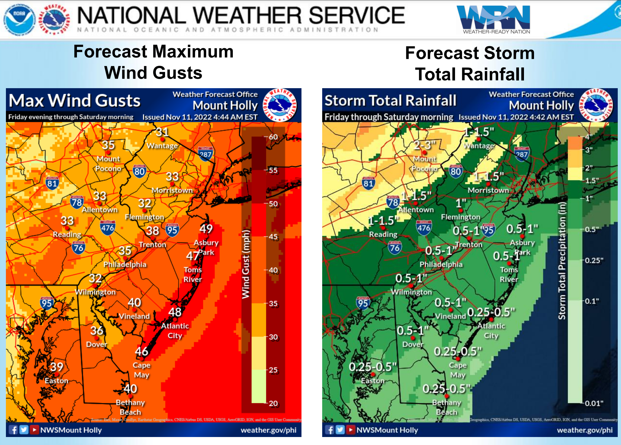
I disagree for the most part, although I can see why people would think the briefing is concerning. Rainfall forecasts have come down markedly since 2-3 days ago, greatly reducing flooding potential, which was the biggest risk to most with this storm. Wind forecasts increased a bit for the coast, but we have at least a dozen wind advisories per year along the coast from various storms, so the winds that are forecast should not be damaging, except for very isolated cases of weakened trees coming down.
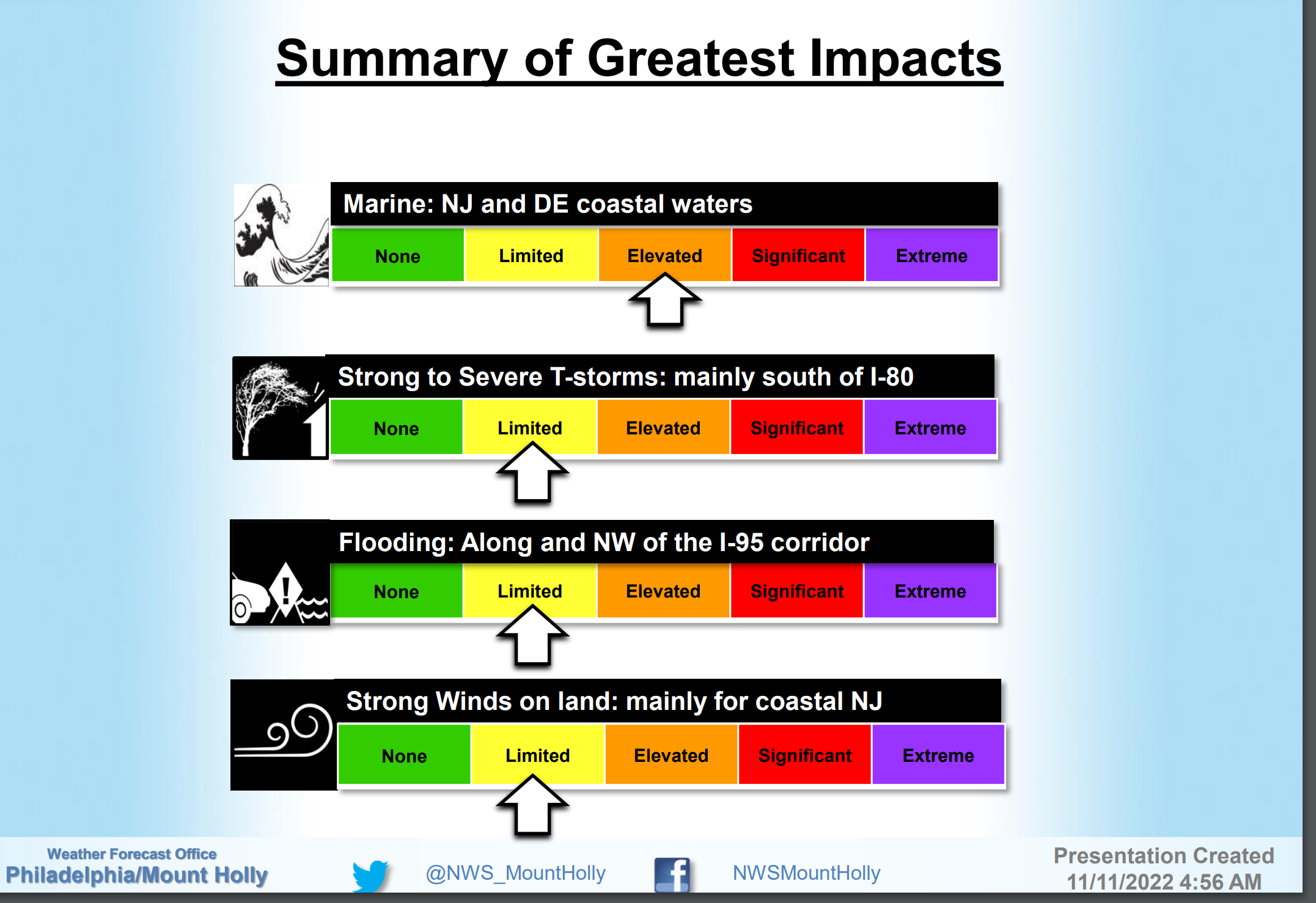
And the severe weather risk hasn't changed much, as severe storms are very likely to be quite isolated and limited to areas south of 276/195 for the most part and are significantly less than the risks we regularly get from summertime mesoscale convective events. It doesn't mean there won't be any severe storms or localized flooding, especially NW of 95 or isolated power outages from wind (especially along the coast), but the likelihood of these events is pretty low, as per the 2nd graphic from the NWS briefing.