Pouring sheets of rain in Mt. Olive right now. Lights starting to flicker a we bit.
It's coming down in buckets further up 206


Follow along with the video below to see how to install our site as a web app on your home screen.
Note: This feature may not be available in some browsers.
Pouring sheets of rain in Mt. Olive right now. Lights starting to flicker a we bit.
+1Total rain bust for most of the State

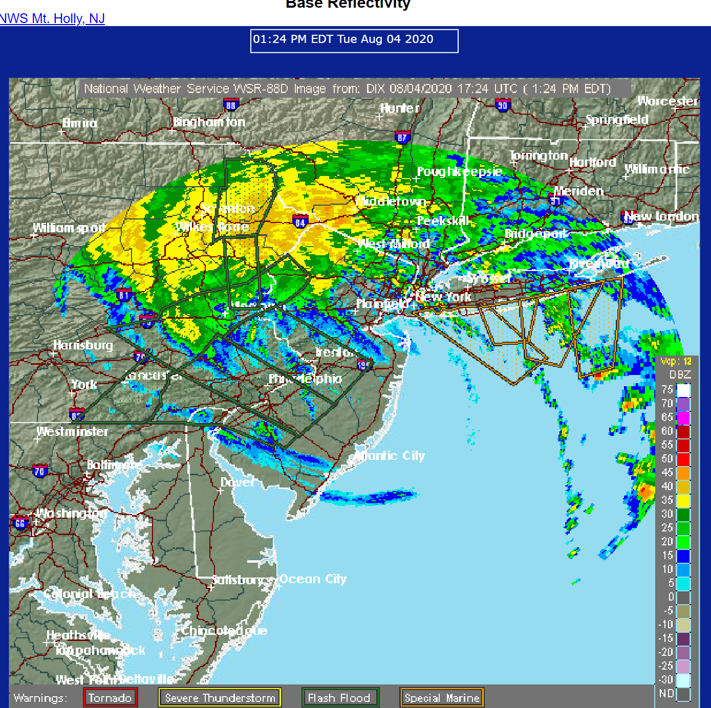
You have 2-3" of rain as per the radar map.+1
Heavy rain well to the west of us.
+1You have 2-3" of rain as per the radar map.
I'm stuck on a fire rig chasing 7,000 wire down calls. Mrs Shift said our generator is running
So..... tell me about this "generator" thing everyone speaks about.....
Power out in New Prov.
Not sure how much longer I can talk the wife out of getting one.
So..... tell me about this "generator" thing everyone speaks about.....
Power out in New Prov.
Not sure how much longer I can talk the wife out of getting one.
Confirmed tornado through Strathmere and South of Somers Point.
I've still got power. which side of rt 1 are you on?Lost power in So. Brunswick around noon.
Rainfall so far...that last band brought us up to about 1.5" in Metuchen. Lights flickering here, so power loss is looking pretty likely. Amazing how much more rain just west of the Turnpike and especially west of the Delaware. We really dodged a bullet in most of NJ, with regard to rain. Winds really cranking up though.
@bac2therac - Is everything done already? No rain and haven't heard any wind in at least 20 mins.
+1Thanks to all particularly @RU848789 for keeping us informed.
@bac2therac - Is everything done already? No rain and haven't heard any wind in at least 20 mins.
Ocean looks a lot worse off of Spring Lake and Belmar.60mph gusts in SSH